THREAD. Today @GrewalBaani and I released a short interactive report looking to explain and update the situation on the Doklam Plateau. It remains a flashpoint with underlying tension. For this project we built a 3D model & mapped positions on both sides. pageflow.aspi.org.au/mappingdoklam
@GrewalBaani What jumps out looking at Doklam today, four years after the stand-off, is that none of the tensions that caused that conflict have been addressed, there is still an inherent competition for the strategic position in Sikkim. /2
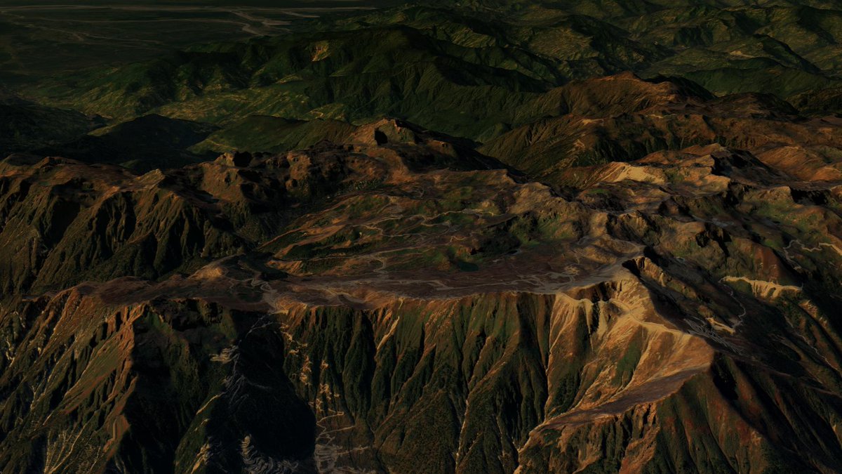
@GrewalBaani To help orient people to the issue and explain the strategic importance of Doklam we produced two 3D models that can be explored here: skfb.ly/o78y8 skfb.ly/o78AV
These allow you to explore the terrain and positions on both sides yourself.
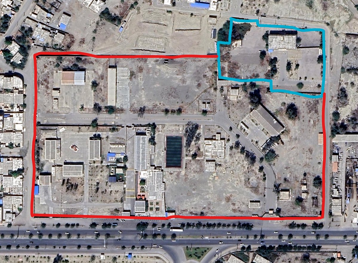
@GrewalBaani The models are annotated with key positions and points that explain some of this tension. /4
@GrewalBaani In short it comes down to the Jampheri Ridge. A strategic position in Doklam that allows complete overwatch of India's Siliguri Corridor. The 'Chicken-Neck".
Control this & you can observe the small strip of Indian land that connects the North-East with the rest of the country.
It was Chinese road-building towards this ridge that prompted India to step into Bhutanese territory and prevent construction in 2017.
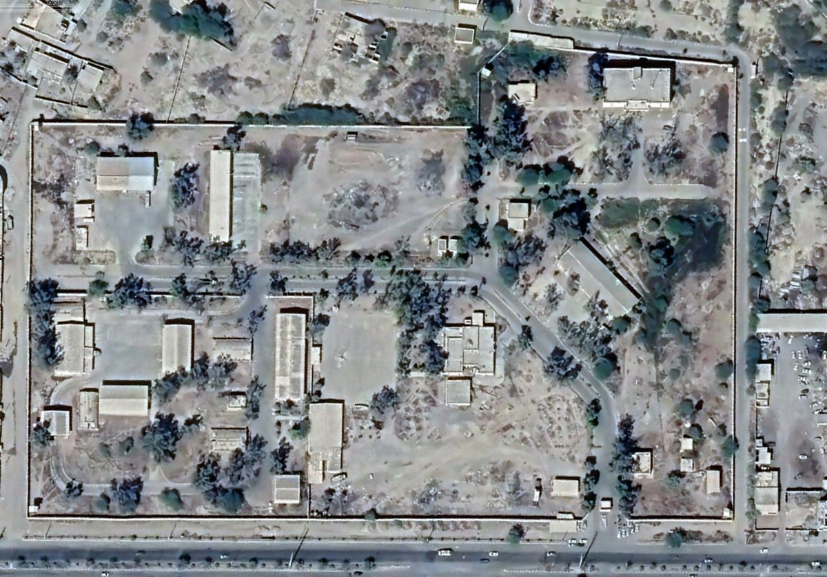
After that was stopped, China continued to build a road towards the ridge, just further back from the border.
/6
This shows China's committment to their strategic goal of control of the Jampheri Ridge. Although the construction has stalled with recent moves towards deconfliction around the border, the road can be continued at any time.
As it stands, India controls the strategic ridgelines along the border, with multiple layers of defense and considerable overwatch over the disputed Bhutanese territory. China has mostly been restricted to building in valleys and on slopes hidden from the Indian border.
Mostly.
These images show the viewshed of both Indian (teal) and Chinese (red) positions. It clearly shows how China has very few eyes into Indian territory, while India's control of the ridges also gives it visibility into Doklam. /9
But despite this, all it would take to turn the current situation on i ts head is a road. And we all know how quickly China can bulid a road, should it see the strategic imperative in continuing this rear road to the ridgeline.
• • •
Missing some Tweet in this thread? You can try to
force a refresh
Unilaterally withdrawing from the world's largest detention site for ISIS members without coordinating with either Washington or Damascus to take over guard duty is probably not the way to make the US come to your aid.
This isnt to undercut the failure of policy, especially in Western capitals, that allowed al-Hawl to sit there while the SDF was trying to establish procedures and mechanisms. But withdrawing more-or-less out of spite that the US isn't providing you with armed support ain't it.
A lot of people seeing this tweet are acting like the two options were either be round up and executed while jihadists release all their ISIS buddies or to flee. Which is so tremendously detached from reality that I worry for them. And exactly the delusions that got the YPG in this mess.
As the man who disarmed a terrorist shooter in Bondi is named as Ahmed El Ahmad, a Muslim name, there is already AI-generated disinformation falsely claiming the hero was a Sydney-born local called "Edward Crabtree", with an entire AI-generated backstory. archive.is/K5eSI
The entire website is built around this disinformation (try clicking any of the related articles) and falsely attributes quotes to the NSW Police Commissioner, the Australian Prime Minister, the made-up Crabtree and several others.
Meanwhile, people are already trying to 'community note' posts about al-Ahmad. The person who wrote this community note has only previously written in Brazilian Portuguese, generally forwarding right-wing talking points.
A 🧵(ongoing) of geolocations from recent escalations on the Thai-Cambodia border.
Firstly, Thailand has claimed it has launched a ground operation into Sa Kaeo, near Chouk Cheay / Ban Nong Chan. Smoke rounds are around 1km beyond the previous forward deployment of Thai troops.
13.766103, 102.702367
These screengrabs (geolocated first by @RoadtoMars9 ) show Thai infantry fighting vehicles advancing past the de-facto barbed wire border, presumably at least towards the Thai interpretation of the border (purple line)
13.8174, 102.7369
🧵A detailed timeline on escalations in the lead-up to yesterday's clashes between Thailand and Cambodia.
Much of the escalation seems to stem from Cambodia, with their troops fortifying many sectors before the May 28 clashes and surging strategic assets immediately after.
🗺️ - heatmap of Cambodian military developments prior to July 24th.
2025-02-13. The immediate tensions seem to originate from an incident on February 13, when a group of Cambodian soldiers escorted civilians to visit an ancient temple. The group reportedly sang the Cambodian national anthem and was later stopped by Thai security officials.
2025-02-17. Defence Minister Phumtham Wechayachai expressed concern over the recent provocative incident involving Cambodian troops in Ta Muen Thom, stating that he does not want the incident to escalate into a conflict.
The craziest thing is that the LA protests are remarkably normal, dare I say pedestrian. Theres no significant or widespread destruction, barely any meaningful resistance to law enforcement.
It's so transparently obvious that the Trump admin wants to fabricate a crisis.
There is absolutely zero tactical or strategic need for any federal support to control what we've seen this weekend. Yet the admin has been able to completely dominate and distort the conversation with barely any pushback from the democratic establishment or even the media.
By the way, when I say 'barely any meaningful resistance' I don't mean no skirmishes, I mean that at NO point have the police not been able to quickly and effectively perform whatever crowd control action they deem necessary.
Which is absolutely credit to the protesters.
🧵Geolocations of ALL sites that the Indian Army has claimed to have hit in Pakistan and Kashmir. 1. Masjid Syedna Bilal/Hazrat Bilal
34.385846°N 73.456974°E
It appears to have been a direct hit, according to after-strike ground photos. google.com/maps/place/34%…
2. Reported training camp in Gulpur, Kotli
33.402328°N 73.876957°E
No post-strike imagery yet. google.com/maps/place/33%…
3. Masjid Ahl-e-Hadis in Barnala, Bhimber.
32.867802°N 74.256469°E
Quadcopter-dropped munition appear to miss the target building and strike a courtyard around 50m away. google.com/maps/place/32%…