
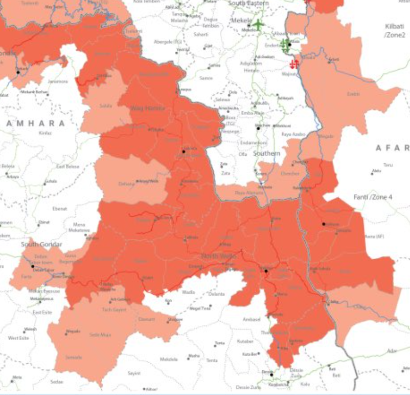
This is a very interesting map.
https://twitter.com/bulgashewa/status/1442743216688623620
Published on 17th September, it purports to show the picture as of 31st August, and is clearly the view of OCHA_Ethiopia which is the coordinator for Aid.
There are several striking features to it.
There are several striking features to it.
Firstly. There are quite a lot of areas inside Tigray which are designated Partially accessible. Presumably because these areas are militarised. On the Western front, and northern front and also in the border area around May Temsre where TPLF Army 1 attacked from. 

On the Western Front there is a very large inaccessible area on both the Ethiopian and Tigrayan side of the Tekeze. But there is corridor through North Gondar which is accessible which takes you very close to the Sudan border.

In the east, the Afar Region area where the TPLF mounted its most recent offensive at Berhale is marked as inaccessible and you can see that the highway is also marked very inaccessible through that area.


But once you get to the area of Afar which is not subject to TPLF attacks the road is marked as accessible in green.

There are numerous reports of a current Afar offensive in this area, which presumably is pushing TPLF forces back towards Mekelle.
In South Gondar you can see the size of the miltarised area where the confrontation of TPLF Army 2 is underway is still huge.
The other two images here are from today's Zehabesha News TV report, which unfortunately I cannot understand. [Src: ]
The other two images here are from today's Zehabesha News TV report, which unfortunately I cannot understand. [Src: ]
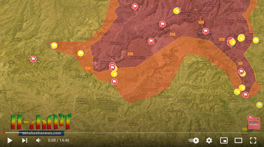

The TPLF have spent a lot of hot air talking about how they are about to invade Dessie, a city where around 300k IDPs are currently sheltering after escaping from North Wollo. On the left you see what the map looked like on August 31 and on the right what it looks like today.


It would be good if someone who can understand the TV reports could explain what the reports say are happening in this area and on the Afar front, where it seems most of the military confrontation is presently taking place.
• • •
Missing some Tweet in this thread? You can try to
force a refresh


