Following on from last weeks look at the 12 SS Panzer Divisions defensive positions around Galmanche and the impact on the British 59th Inf Div during Op Charnwood, today I wanted to look at the ridge leading up to Lebisey that the British 3rd Inf Div would attack...
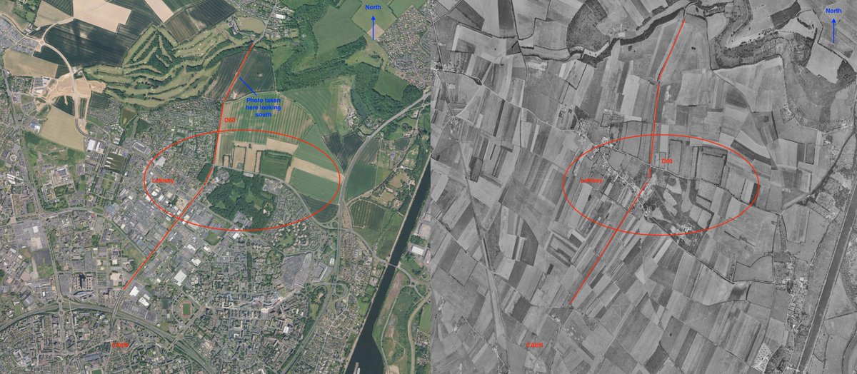
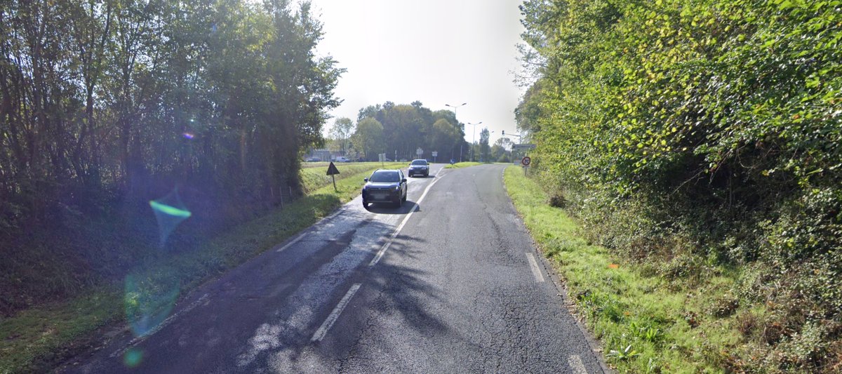
This photo is the D60 looking south, the road leads into Caen and would be a main axis of advance for the British on the 8 July '44. Behind me, 1km away is the village of Bieville. The British frontline had formed around this area since the 6 June. We will come back to here later
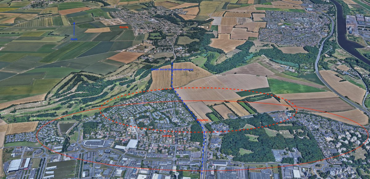
Here's the overview map of where we are just north of Caen. The landscape has changed a lot with urban and industrial sprawl since 1944. The map on the right is from 1950-65. Source- remonterletemps
To focus in closer the area of German defences we will look at is roughly around the area's circled in red. Source- remonterletemps
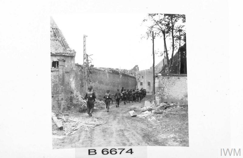
The German's defending this area were the badly mauled men of the 716. Infanterie-Division and supported by elements of the 16. Luftwaffe Felddivision. IWM image B 6664, taken in the area of Lebisey on 8 July '44 during Op Charnwood.
Allied intelligence prior to the operation had began to build up a picture of what defences lay in wait. This was also added to be interrogation of POW's. In some war diaries, infantry units had questioned who the soldiers in blue uniforms were until POW's had been taken.
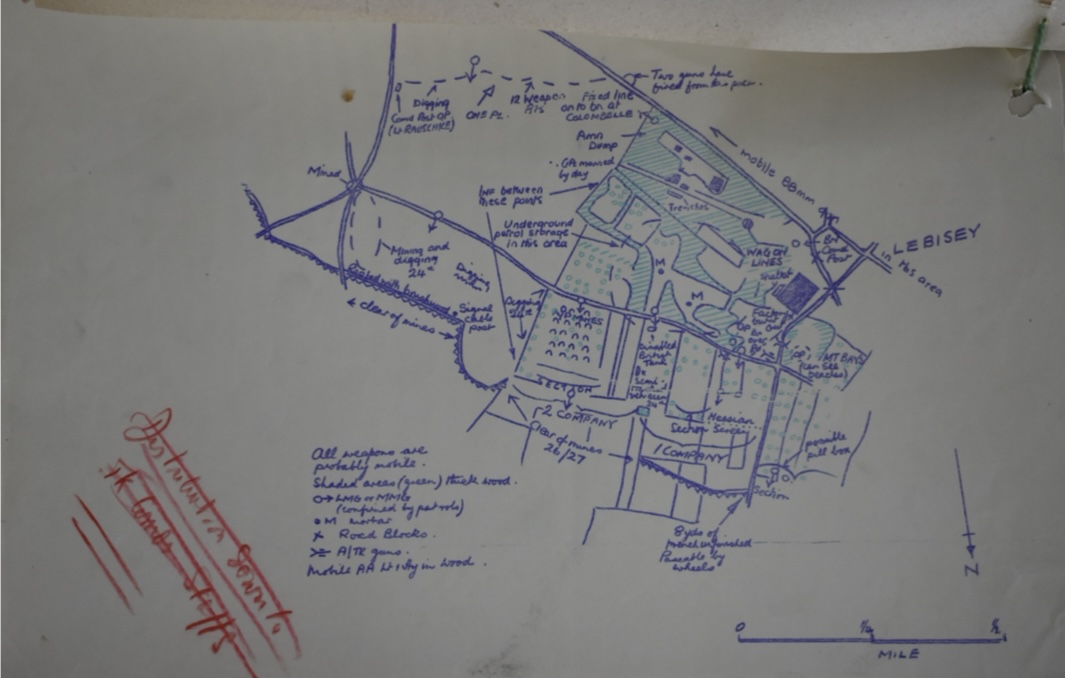
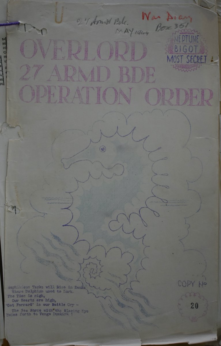
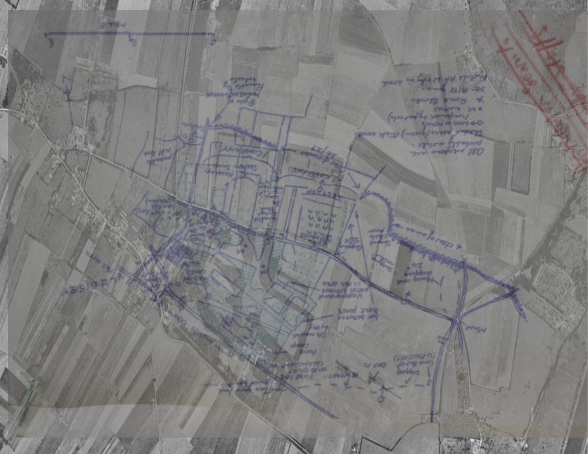
I have tried to best overlay the archive intelligence map from the 27th Army Bde HQ Diary over the map. The northern part matches up well and shows roughly the area of minefields, wire, defences.
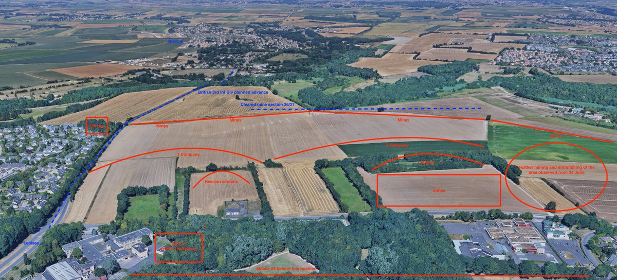
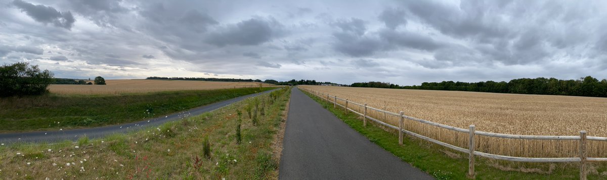
From these maps the terrain is not given justice, the British 3rd Inf Div advance would be on the upslope in open terrain. The incline of around 60-100ft from the now golf club roundabout up to the traffic lights at Lebisey. This is exactly 3.4km in distance.
This would have been the perspective from the German positions looking towards the area and ground the British would slowly come up from and into view.
Now from the British view, the men of the infantry brigades would push along this axis towards Caen. Note, there were further defences to the right as you look. This included hull down Mk iv Panzers of the 21st Panzer Division.
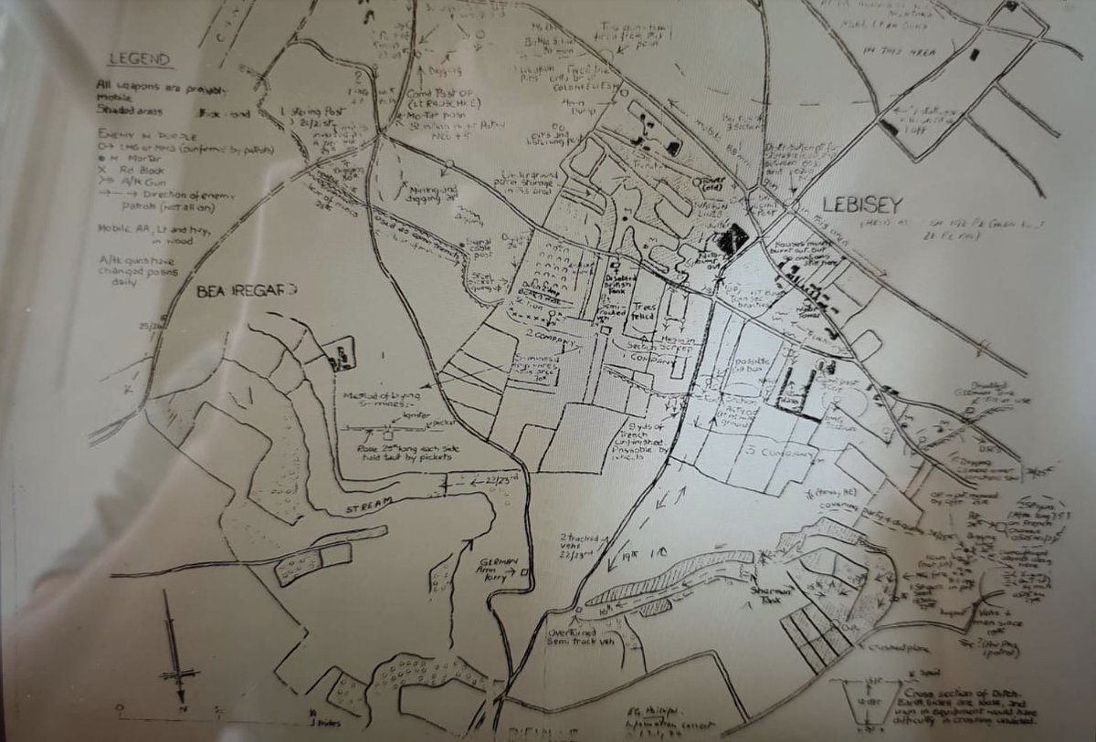
Here is a more in-depth intelligence map from the KSLI, kindly provided by @ShaunColdicutt. You can see further to the west more defensive positions to where the KSLI would advance and take from the area of Square Wood.
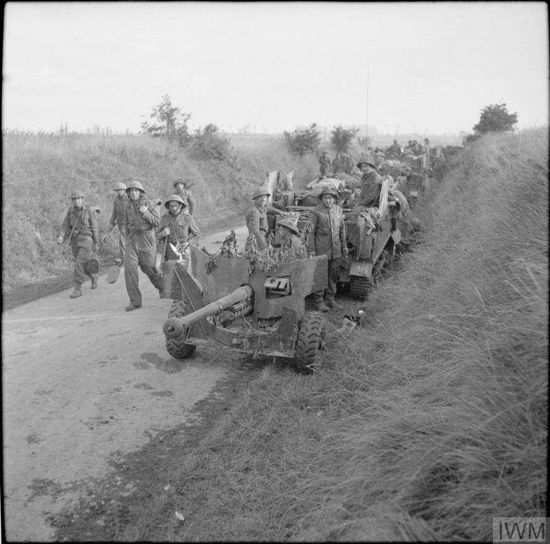
They would be supported by the Staffordshire Yeomanry, 27th Armd Bde. Here a Sherman firefly, mostly likely of the Staff Yeo races towards Lebisey on the 9 July '44. IWM B 6751
A then and now from the 8 July '44, here Shermans of the 33rd Armd Bde advance towards the junction at Lebisey. IWM Image
The British Infantry quickly moved through this area, here they advance into Lebisey on the 8 July. IWM image.
The reality of these defences were that although placed in positions with good fields of fire and using the terrain to their advantage, they were quickly overcome by the British.
Pre bombardment from the air also from artillery and naval had a big effect. The German troop that was positioned here was also not of the quality further west, the example of the 12 SS at Galmanche.
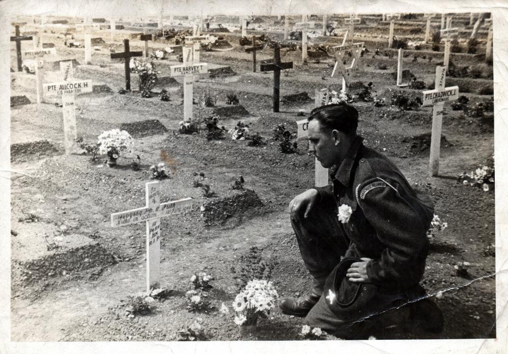
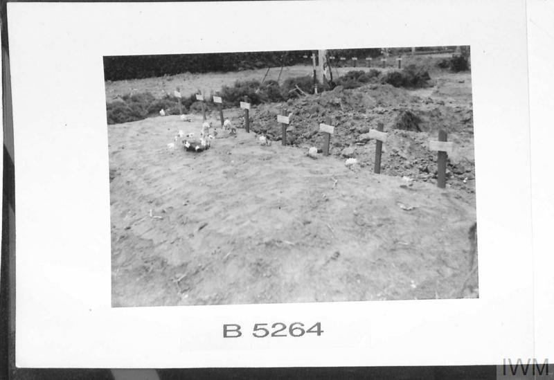
Casualties for the British were lighter here than in the area of Galmanche for the 59th Inf Div. A quick look at the 2RWR diary recorded 25 killed in action and the 1 R Norfolks with 109 casualties. The Brit 3rd Inf Div took a large number of prisoners. IWM image- B 6641
By the 9 July the British were consolidating the positions on the north bank of the Orne river and Caen Canal. The northern half of Caen had been liberated after nearly 5 weeks. IWM Image- B 6779
The impact of Op Charnwood on the French civilian public cannot be underestimated. A large number of civilians killed from the pre bombardment and many left homeless, the city left in ruins. This point should never be forgotten. IWM image B 7101. in the Caen Cathedral
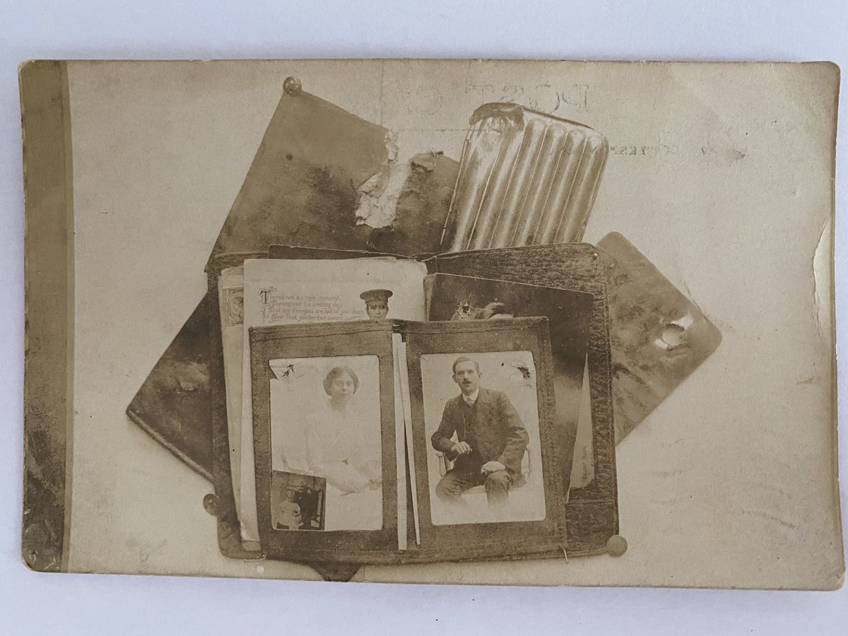
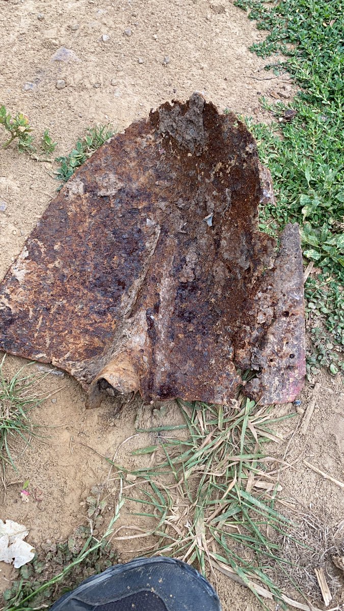
To walk the Op Charnwood battlefield today, the frontline of four weeks from D-Day to 8 July, there is so much still to be seen of the scars of war. This, just one item I found sitting on a soil heap near building works at Lebisey in August '20.
The German defences along that front were well planned, sighted and prepared. In this case comparing the two locations of Lebisey and Galmanche, the difference was down to the quality of German troop defending that position.
The reality though was that the advance of Op Charnwood was not going to be stopped. The pressure of the allies strength and resources would come through on the 8 July '44.

ko-fi.com/battlefieldben

• • •

Missing some Tweet in this thread? You can try to force a refresh
 

Keep Current with Ben Mayne

Ben Mayne Profile picture

Stay in touch and get notified when new unrolls are available from this author!

Read all threads

This Thread may be Removed Anytime!

PDF

Twitter may remove this content at anytime! Save it as PDF for later use!

Try unrolling a thread yourself!

how to unroll video
  1. Follow @ThreadReaderApp to mention us!

  2. From a Twitter thread mention us with a keyword "unroll"
@threadreaderapp unroll

Practice here first or read more on our help page!

More from @BattlefieldBen

16 Nov
Back to Operation Charnwood, this time to look at the defensive positions standing in the way of the 59th Staffordshire Division. In particular the well planned, placed and sighted positions at Galmanche. This position could be classed as a classic hedgehog defence.
Within days of the landings, the Germans looked to bolster their units and defence around Caen. The 12. SS-Panzerdivision "Hitlerjugend" began to move into the villages north of Caen from the 7 June '44. Map- Panzerdivision Hitlerjugend Volume II, Stephen Cazenave
They would hold these positions for nearly four weeks before the British and Canadians launched Op Charnwood on the 8 July '44. Map- The 12th SS Volume one, Hubert Meyer
Read 31 tweets
4 Feb
Yesterday I mentioned the Naval Operational Orders for the invasion of Normandy, it did not post some of my snippets I extracted on the detail of the planning, a few things that stood out to me contained within were..
Many of you will have seen this detail, but here is the breakdown of each beach area and task force including the beach area names and grid co ordinates. Not ground breaking information but very important to makes sure you head for the correct area.
It wasn't just as simple as sailing over, the convoys were prescribed exact details of formations down to yardage and even angles.
Read 5 tweets
30 Dec 20
11. La Breche, Queen Red/White sector of Sword Beach.

To be hit at H-30 to H-15 (or H-10).

RAF heavy day bombing, Priority 1.
12. East of La Breche, WN18

To be hit at H-45 by one fleet destroyer.

Remarks- At Call of FOsB when landed.
12. East of La Breche, WN18 also known as Casino.

To be hit at H-45 by one fleet destroyer.

Once the men of the 1 Special Service Brigade were ashore, Commander Kieffer and his Fusiliers Marins Commandos of No.10 (IA) Commando would assault this position.
Read 25 tweets
30 Dec 20
So after the @WeHaveWaysPod on Gold Beach, a question relating to the Sanatorium came up. It got me thinking so I decided to look at the targets designated to Force D, Sword to see exactly what was in the plan for the most eastern landing beach.

Video- IWM ADM 1258
With the use of the 27th Armoured Brigade HQ Diary '44, I had documents of the proposed targets and timings on Force D and how the pre bombardment would go. Its worth remembering Force S could also have their own plan on targets and timings. There is also evidently an overlap.
So which vessels formed Force D and what were there main armaments?

HMS Danae and Dragon both with five 6-inch guns and a 4-inch gun.

Photographs from naval-historynet.org
Read 25 tweets
22 Dec 20
After a visit to the archives last week I came across an interesting order in relation to 'Burials'. Issued to the 27th Armoured Brigade ahead of Operation Overlord, section 29 lists the conditions for the burial of the dead. Photograph from https://www.paradata.org.uk/media/10005  Pri
1. Burial site for those killed on beaches and in assembly areas will be reserved by Beach Sub area immediately inland of beaches. B 5264 The graves of commandos of 48 (M) Commando at St Aubi
Two examples of these areas that spring to mind is one a hundred yards to the east of Montgomery's statue on Rue de la Mer, Colleville-Montgomery. The other close to Canada House in Bernieres. The men buried there would be moved at a later date during grave concentrations.
Read 25 tweets
29 Jul 20
So I returned home from Normandy to find my uncle had dropped off a box containing items in relation to his Grandfather, Percy, who served in the FWW. Percy told the family he had been shot this one time...
Serving in the Royal Fusiliers he survived the war. I sat down and began to work my way through the box and quickly see what I could ascertain before starting archive work. I photographed the items as I went...
One of the first photographs on top of the pile was this. It soon became apparent that he had been shot and he knew that he had been very lucky indeed. I believe this was taken in 1917, so 103 years later I recreated the photo.
Read 20 tweets

Did Thread Reader help you today?

Support us! We are indie developers!


This site is made by just two indie developers on a laptop doing marketing, support and development! Read more about the story.

Become a Premium Member ($3/month or $30/year) and get exclusive features!

Become Premium

Too expensive? Make a small donation by buying us coffee ($5) or help with server cost ($10)

Donate via Paypal

Thank you for your support!

Follow Us on Twitter!

:(