
U.S. #Drought Monitor 12-9-21: For the seventh consecutive week, drought coverage across the Lower 48 increased. It's now at 55.5%, up from 53.4% last week.
Across all 50 states and Puerto Rico, drought covers 46.5% of the area, up from 44.8%
Across all 50 states and Puerto Rico, drought covers 46.5% of the area, up from 44.8%
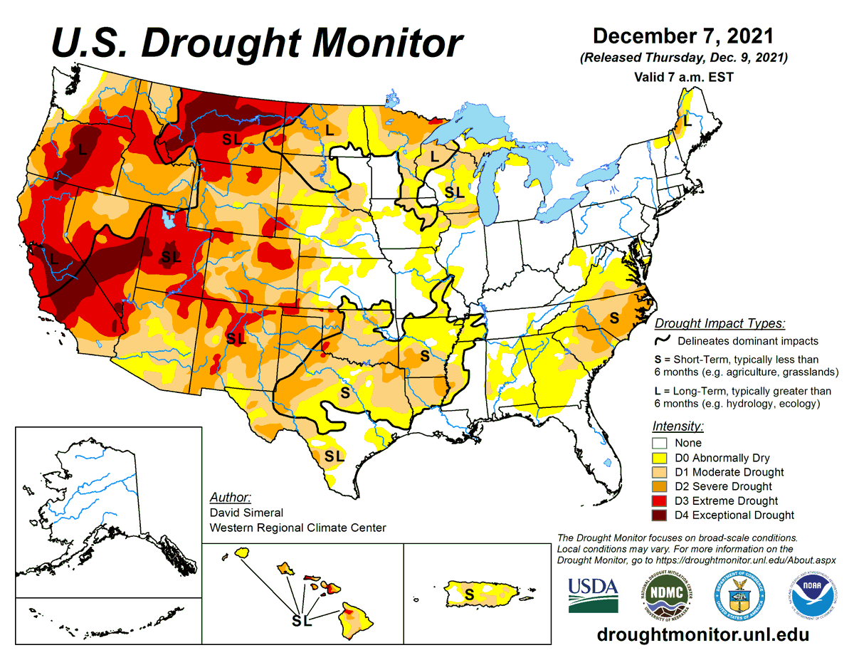
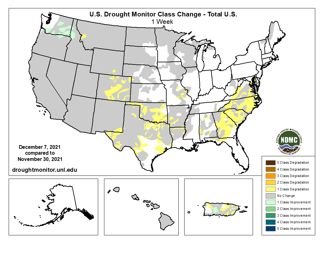
This week's USDM change map shows drought coverage increased or intensified across much of the South and Southeast.
Warm and dry conditions have prevailed in parts of the South for months, and parts of the Southeast have experienced below-normal 30- to 90-day precip totals.
Warm and dry conditions have prevailed in parts of the South for months, and parts of the Southeast have experienced below-normal 30- to 90-day precip totals.
This week is the first time since Jan. 2013 that over 70% of the area across the Lower 48 has experienced abnormal dryness (D0-meaning an area could soon experience drought or is recovering from recent drought) or worse. Currently, 72% of the Lower 48 is experiencing D0 or worse.
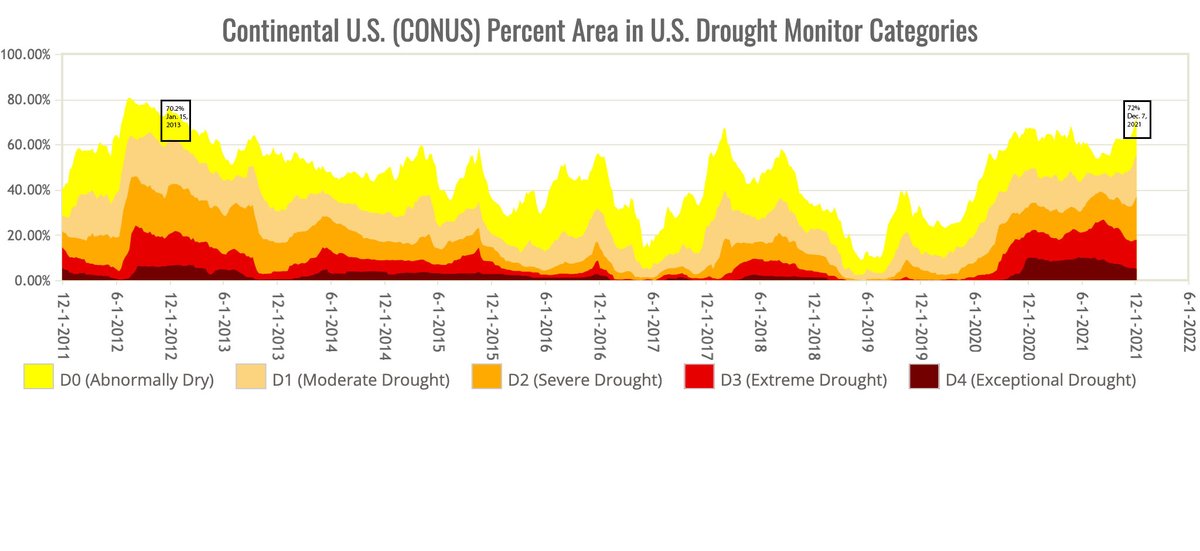
The current streak of consecutive weeks with over 40% of the Lower 48 in drought now stands at 63, third-longest in U.S. Drought Monitor History.
68 weeks - June 19, 2012 - Oct. 1, 2013
65 weeks - March 12, 2002 - June 3, 2003
63 weeks - Sept. 29, 2020 - present
68 weeks - June 19, 2012 - Oct. 1, 2013
65 weeks - March 12, 2002 - June 3, 2003
63 weeks - Sept. 29, 2020 - present
Drought now affects areas across the U.S. and Puerto Rico where nearly 98.3 million people live, up from 90.9 million last week. Keep track of #drought coverage where you live with U.S. Drought Monitor resources available at droughtmonitor.unl.edu.
• • •
Missing some Tweet in this thread? You can try to
force a refresh


