#OSINT tutoriel:
Je vais vous expliquer dans ce petit thread comment utiliser Open Street Map (OSM) pour retrouver des infrastructures militaires et automatiser le travail.
Je vais vous expliquer dans ce petit thread comment utiliser Open Street Map (OSM) pour retrouver des infrastructures militaires et automatiser le travail.
OSM est une carte du monde open source, ce qui signifie que les données peuvent être modifiées par tout le monde. Il faut donc utiliser cet outil avec précaution.
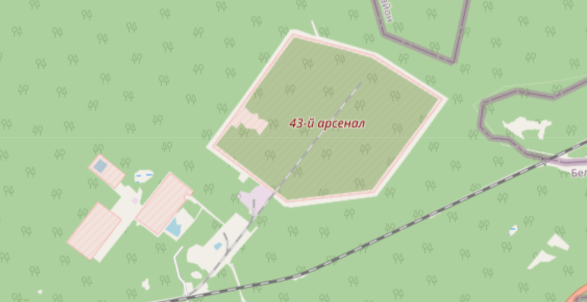
OSM montre toutes sortes d'infrastructures, mais nous allons nous concentrer sur les objets militaires. Ces zones militaires sont représentées sur la carte par une hachure rouge :
Nous allons utiliser Overpass Turbo pour automatiser le travail de recherche. Overpass recherchera tous les objets militaires dans une région donnée. Au moment où j'écris ces lignes, les tensions entre l'Ukraine et la Russie sont en cours, nous choisirons donc la Russie.
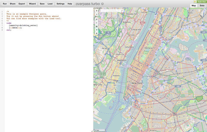
Ouvrez overpass-turbo.eu.
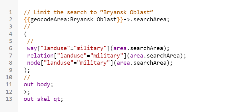
Nous allons demander à Overpass d'aller chercher dans la base de données OSM le "tag" qui correspond aux objets militaires, "landuse=military".
Tapez le code que vous trouvez en suivant ce lien :
textup.fr/605546QvVous
Nous allons demander à Overpass d'aller chercher dans la base de données OSM le "tag" qui correspond aux objets militaires, "landuse=military".
Tapez le code que vous trouvez en suivant ce lien :
textup.fr/605546QvVous
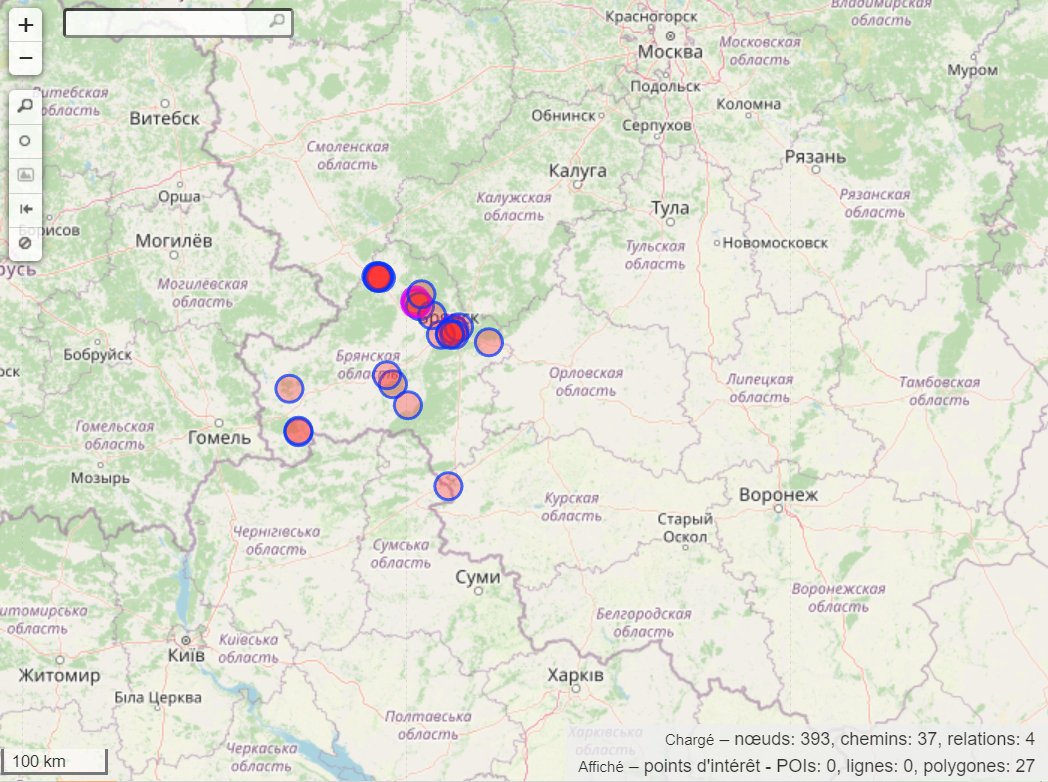
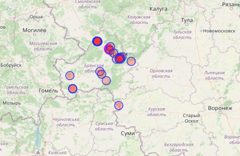
L'Oblast de Bryansk devrait désormais ressembler à ceci. Chaque point rouge représente une zone militaire selon la base de données d'Open Street Map.
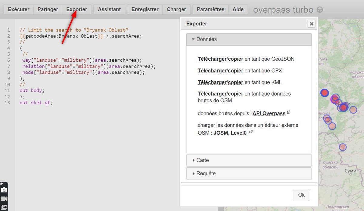
On va maintenant extraire ces données.
On va maintenant extraire ces données.
Cliquez sur exporter, puis choisissiez le format d'export.
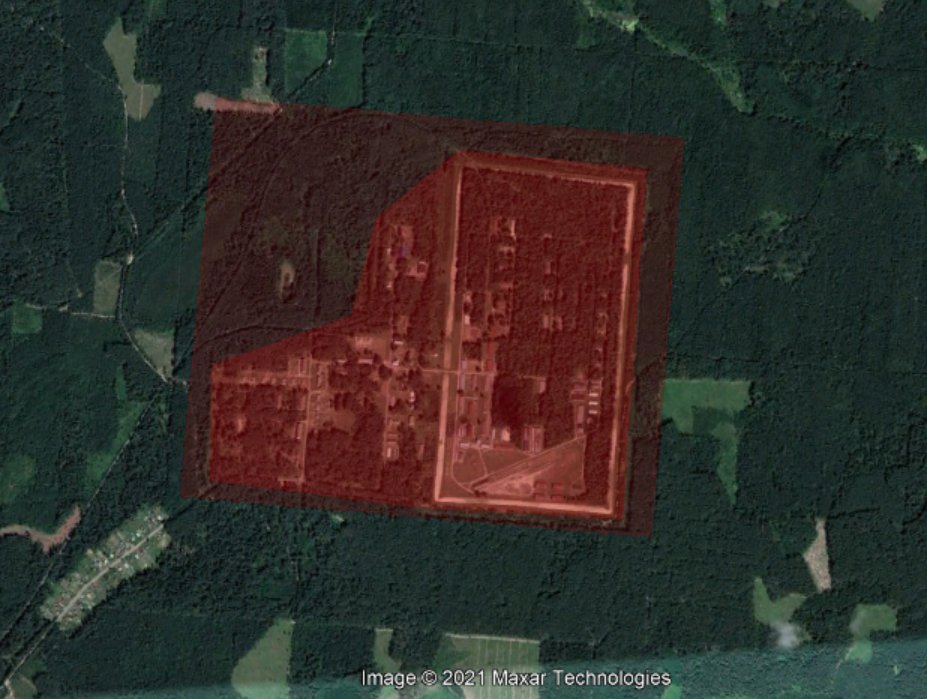
Image 2: Résultat de l'export KML sur Google Earth
Image 2: Résultat de l'export KML sur Google Earth
Si vous avez apprécié ce tutoriel, vous pouvez m'offrir un café ici : ko-fi.com/intelcoupsure
Merci !
Merci !
Petit problème avec le lien textup. C'est ma faute ! Je vais essayer de trouver un autre hébergeur de textup.
https://twitter.com/COUPSURE/status/1477706420183351305
• • •
Missing some Tweet in this thread? You can try to
force a refresh