
#twitterstorians - quick 🧵for beginners on how to access and use historic OS maps (Britain):
But why?, I hear you ask
1. compare & contrast urban/rural landscape change
2. record linkage with census data
3. add some depth and material representation to accounts of places
But why?, I hear you ask
1. compare & contrast urban/rural landscape change
2. record linkage with census data
3. add some depth and material representation to accounts of places
Step 1. Decide whether you want to:
a) use image files of old OS maps and draw on them in Paint or another image editor (the simplest way), or
b) use geo-references files and draw on them using GIS.
a) use image files of old OS maps and draw on them in Paint or another image editor (the simplest way), or
b) use geo-references files and draw on them using GIS.
Step 2. for both 1a) and 1b), go to your institution's library access to Edina Digimap Historic. You may need to register an individual account.

Step 3. If you just want image files, click on Historic Roam. Search for the place you want, then select what decade you want.

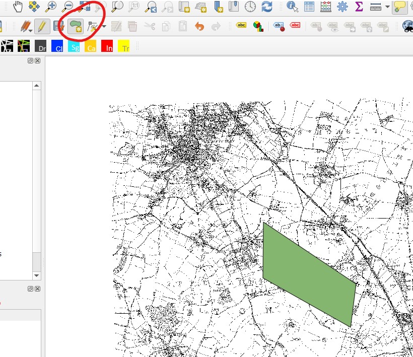
Step 4. For simple drawing, you can edit and draw lines, polygons and shapes on the maps on the website using the 'Drawing Tools' option.
(I've just added a random polygon on a 1880s map of Stevenage here)
Then you can save and export the image using 'save screen image as'.
(I've just added a random polygon on a 1880s map of Stevenage here)
Then you can save and export the image using 'save screen image as'.


Step 5. If you want to use GIS to draw your own maps, I recommend downloading QGIS from qgis.org/en/site/

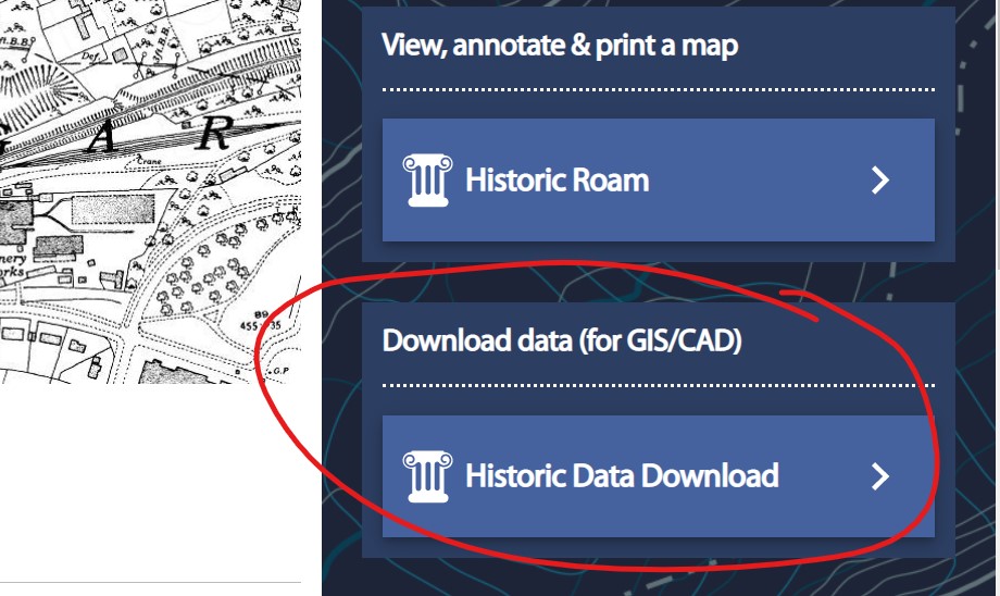
Step 6. Now you need to download some geo-referenced raster files (images of the OS maps). Go to Digimap Historic and click on Data Download.
Find the place you want.
This takes you to a list of all the different types of OS maps available to download.
Find the place you want.
This takes you to a list of all the different types of OS maps available to download.
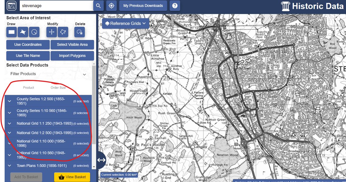
Step 7. Select what area of the map you want, using 'select area of interest' and drawing the shape.
So here for example I've drawn a rectangle of one part of Stevenage.
So here for example I've drawn a rectangle of one part of Stevenage.

Step 8. Now decide what map you want. Clicking on the list on the left hand side shows what historic OS maps cover that area, and how many 'tiles' are available.
So here I've chosen the 1st edition of the county series 1:10,560 (1846-1899). There is 1 tile covering that area.
So here I've chosen the 1st edition of the county series 1:10,560 (1846-1899). There is 1 tile covering that area.

Step 9: 'add to basket'. It takes you to this form, which you then click, and it will email you the files.
Open your email.
Open your email.

Step 10 (regretting saying this was 'quick' now...)
Open QGIS. Click on the blank page icon to start a new document.
Then go to the tab 'Layer' > 'Add Layer' > 'Add Raster Layer'
It should pop up with this:
Open QGIS. Click on the blank page icon to start a new document.
Then go to the tab 'Layer' > 'Add Layer' > 'Add Raster Layer'
It should pop up with this:

Step 11 (nearly there)
If you haven't already saved your Digimap files from your email, then save them in a folder on your computer
On QGIS, click on the three dots next to 'Raster Dataset'. Open your files from your saved folder.
You may need to click through the internal files
If you haven't already saved your Digimap files from your email, then save them in a folder on your computer
On QGIS, click on the three dots next to 'Raster Dataset'. Open your files from your saved folder.
You may need to click through the internal files


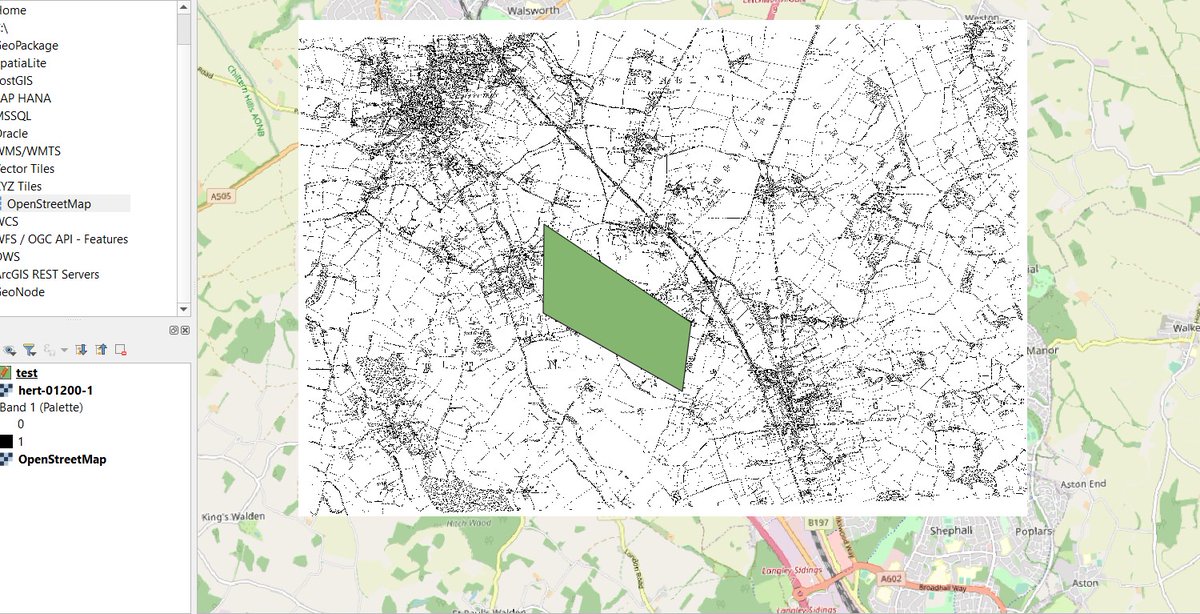
Step 12: Click on 'Add'. It should then load your OS image files on the screen, and as a layer on the left hand side index, which you can turn on and off.

Step 13. To draw on this, click on 'Layer'> 'Create Layer' > 'New Shapefile Layer'.
It comes up with this option: under 'geometry type' click on point, line or polygon.
Also click on the three points next to 'file name' to give the layer a name and save location
It comes up with this option: under 'geometry type' click on point, line or polygon.
Also click on the three points next to 'file name' to give the layer a name and save location

Step 14. Click OK and it should add your new layer.
To edit, click on the pencil symbol near the top of the screen, and then click on the shape symbol.
Draw your shape on the main map.
To edit, click on the pencil symbol near the top of the screen, and then click on the shape symbol.
Draw your shape on the main map.

Final steps. You can add more map layers by repeating the process. You can add open street map by double clicking on the layers on the left hand side menu.
You can layer one on top of the other and change the order by dragging the file names in the lefthand menu
You can layer one on top of the other and change the order by dragging the file names in the lefthand menu
You can change the transparency of the layers, and the colour and style of your drawings, by left-clicking on them in the lefthand menu, go to 'properties', and then 'symbology'.
Here for example I've changed the opacity to 70% and the polygon from green to black stripes
Here for example I've changed the opacity to 70% and the polygon from green to black stripes

TL: DR - Edina Digimap Historic is great for downloading maps, either to colour in manually using their website, or as geo-referenced files that you can use in a GIS.
@threadreaderapp unroll
want to learn more? I recommend @ProgHist 's tutorials on how to use QGIS
e.g. programminghistorian.org/en/lessons/qgi…
e.g. programminghistorian.org/en/lessons/qgi…
• • •
Missing some Tweet in this thread? You can try to
force a refresh


