NWS Chicago Profile picture
Mar 1 4 tweets 3 min read
(1/5) This hour of tornado safety for Illinois #SeverePrep Week: Know the difference between a watch and a warning and what to do during a watch #ilwx
(2/5) Do you know the difference between severe weather WATCHES and WARNINGS? A WATCH means severe storms or tornadoes might form and affect your area. A WARNING means it’s time to take action! A severe storm or tornado is expected in your area. #SeverePrep #ILwx Image
(3/5) Specific terminology for tornadoes
• Note that a Tornado Emergency is an exceedingly rare situation (such as the Kentucky tornadoes back on Dec 10, 2021) with a confirmed violent tornado posing a severe threat to life & catastrophic damage
#SeverePrep #ilwx Image
(4/5) Ever noticed the wording "THIS IS A PARTICULARLY DANGEROUS SITUATION" in some watches issued by @NWSSPC? Used in rare cases when an outbreak of long-lived & intense tornadoes are likely & may accompany Severe T-storm Watches (think Aug 10, 2020 derecho) #SeverePrep #ilwx Image

• • •

Missing some Tweet in this thread? You can try to force a refresh
 

Keep Current with NWS Chicago

NWS Chicago Profile picture

Stay in touch and get notified when new unrolls are available from this author!

Read all threads

This Thread may be Removed Anytime!

PDF

Twitter may remove this content at anytime! Save it as PDF for later use!

Try unrolling a thread yourself!

how to unroll video
  1. Follow @ThreadReaderApp to mention us!

  2. From a Twitter thread mention us with a keyword "unroll"
@threadreaderapp unroll

Practice here first or read more on our help page!

More from @NWSChicago

Mar 1
(1/4) Continuing the theme of this morning's Twitter tornado drill, we'll continue with tornado safety on day 2 of Illinois #SeverePrep Week. This hour, what to do BEFORE a tornado. #ilwx
(2/4) Some people are especially vulnerable to the dangers of tornadoes.
Those with a lower level of mobility, such as the elderly or disabled, or those who live in mobile homes, may need your help to prepare & stay safe & #WeatherReady. #SeverePrep #ilwx weather.gov/safety/tornado
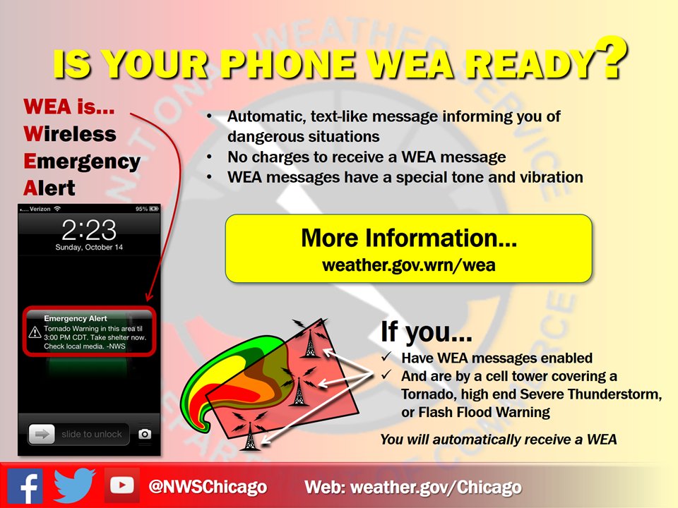
(3/4) Keep Wireless Emergency Alerts for tornado and flash flood warnings enabled on your cell phone. They can save your life! Find out more at ready.gov/alerts & weather.gov/wrn/wea #SeverePrep #ilwx
Read 4 tweets
Aug 11, 2020
Good morning!☀️ Let's talk Monday's storms.

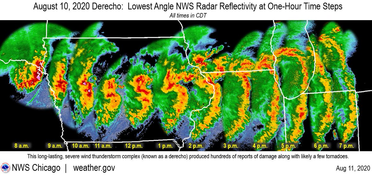
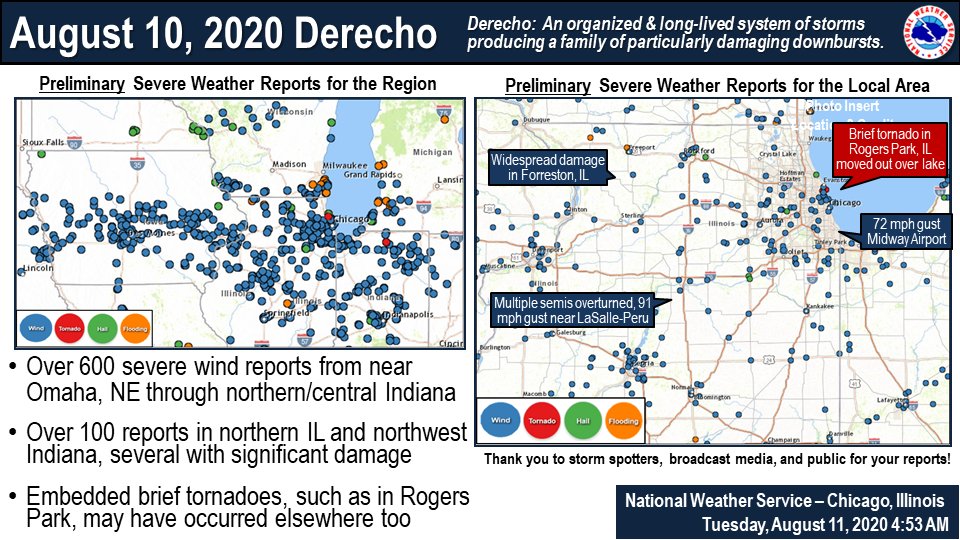
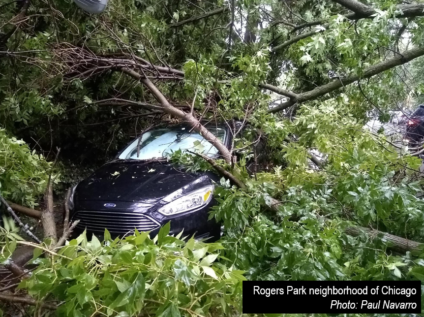
A long-lived, large storm complex tracked from the NE/IA border, across IA, northern IL, & northern IN. This produced widespread damage to trees, toppled several semis, & caused some structure damage.

Recap: weather.gov/lot/2020aug10 Image
The peak gusts (measured & estimated) were frequently 70-90 mph & persisted for 15+ minutes with some locations experiencing even higher. These wind speeds are equivalent to EF-0 to EF-1 tornadoes but over a vastly larger area than a tornado would impact. #ILwx Image
While much of the wind damage was straight-line wind, a few tornadoes were likely embedded within the storm complex across the region, and one has been confirmed in Rogers Park, IL. This did move out over Lake MI becoming a waterspout. #ILwx Image
Read 5 tweets

Did Thread Reader help you today?

Support us! We are indie developers!


This site is made by just two indie developers on a laptop doing marketing, support and development! Read more about the story.

Become a Premium Member ($3/month or $30/year) and get exclusive features!

Become Premium

Don't want to be a Premium member but still want to support us?

Make a small donation by buying us coffee ($5) or help with server cost ($10)

Donate via Paypal

Or Donate anonymously using crypto!

Ethereum

0xfe58350B80634f60Fa6Dc149a72b4DFbc17D341E copy

Bitcoin

3ATGMxNzCUFzxpMCHL5sWSt4DVtS8UqXpi copy

Thank you for your support!

Follow Us on Twitter!

:(