Official Twitter account for the National Weather Service Chicago. Details: https://t.co/2ue76eqLqh
 1) A band of moderate to locally very heavy snow blasting ashore later this eve. Band is expected to surge well inland across northeast IL and portions of northwest IN, gradually weakening as it gets farther inland from the lake.
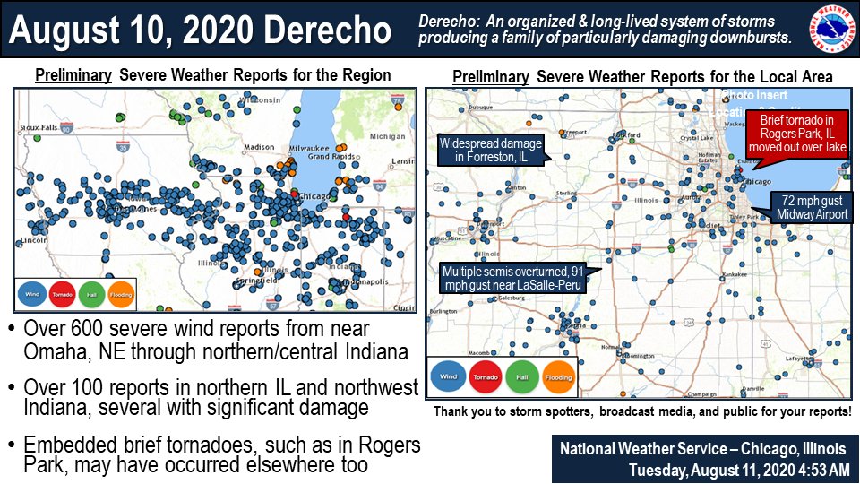
 We have confirmed an additional 3 tornadoes, bringing the event total to 27. The new tornado


 Although snow will taper from west to east overnight, increasingly gusty winds will lead to areas of blowing snow reducing visibility especially in open and rural areas. North to south-oriented roadways will be most susceptible to blowing snow. #ILwx #INwx
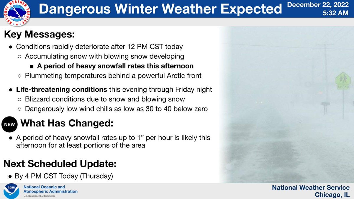 .Arrival time of hazardous travel conditions today: Arctic front will sweep across the area from late AM thru early aftn from west to east, with accumulating snow, plummeting temps & gusty winds. A flash freeze may cause ice covered roads, topped by the snow. #ILwx #INwx (2/6)
 .2) Timeline graphic showing our latest thoughts on the upcoming dangerous winter weather. Travel conditions will likely rapidly deteriorate on Thursday AM through the afternoon from west to east. A flash freeze may cause icy roads during the accumulating snow! #ILwx #INwx (2/5)
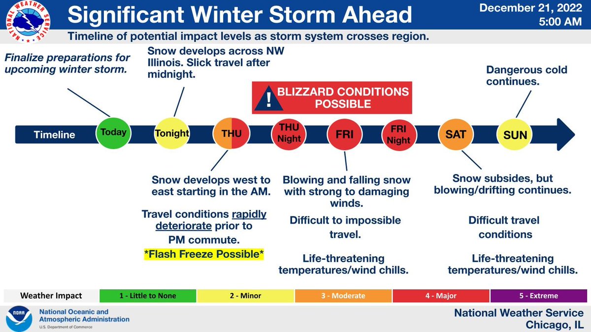
 This is an updated timeline graphic showing our latest thoughts on the upcoming major winter storm. Travel conditions will likely rapidly deteriorate Thursday afternoon and evening. #ILwx #INwx.
 This is a look at impacts over space and time for the expected winter storm. Note the large footprint of this system, so travel will be impacted over much of the Upper Midwest and Great Lakes.


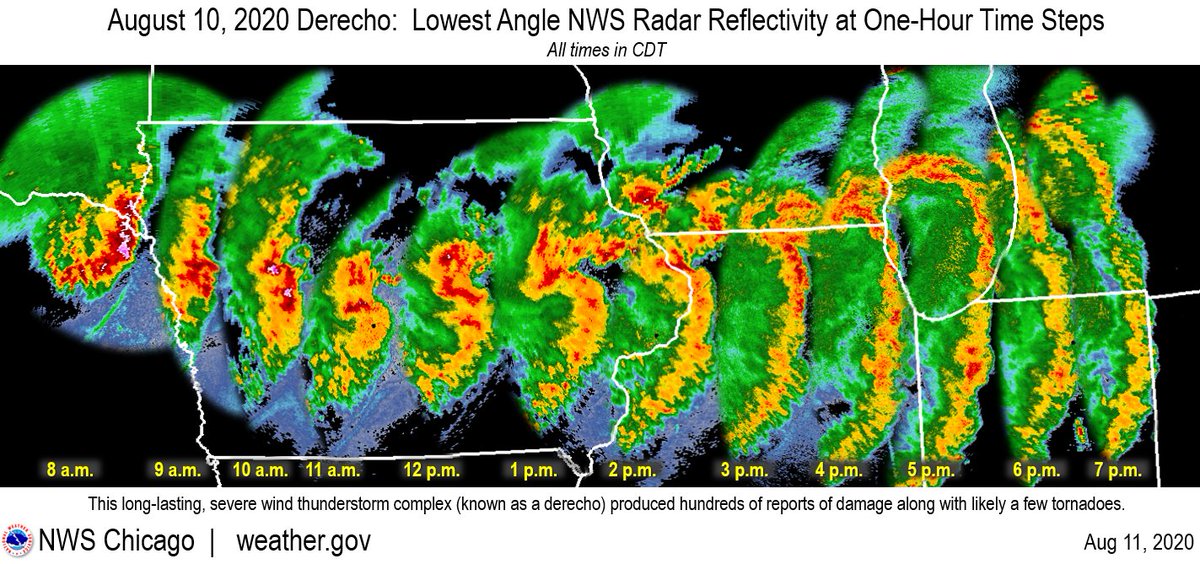 The peak gusts (measured & estimated) were frequently 70-90 mph & persisted for 15+ minutes with some locations experiencing even higher. These wind speeds are equivalent to EF-0 to EF-1 tornadoes but over a vastly larger area than a tornado would impact. #ILwx