JSLINT "While I was sleeping" version. This will be a detailed thread based on the last 24-hour observable ISR traffic. Here is the master map, broken down in this thread. This is my punishment for actually getting sleep. #OSINT #flightpaths 

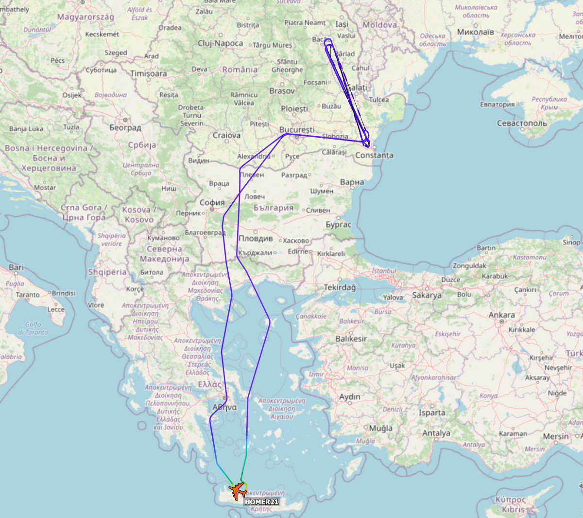
Before I slept, HOMER21 and BRIO68 were traversing the southern border corridor. HOMER may have been diverted to Constanta around 06:00Z when a Typhoon (likely QFR) sortied into that area. Its ISR 'racetrack' is shortened. As BRIO was already on task, this is unusual. 

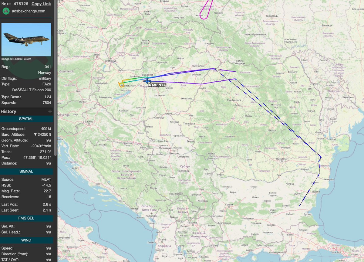
At some point, RAVEN17, A Dassault Falcon with ECM (jamming) capability availed itself to the southern corridor. It did not show up on FR24, just ads-bx. Speculation: its jamming capacity obscures its actual path, so while ECM is on the ability to triangulate location suffers. 

This is a 24-hour mashup of the southern ISR corridor. You can see BRIO68 and HOMER21's racetracks, and NATO01, but RAVEN17's dashed line indicates that only distant ads-b receivers caught its ping, but not enough to triangulate position. Effective jamming. 

Now.. to the north. When I woke up, I kicked myself for missing this.... E-8, G4 ISR, RC-135, P3, E-3. Let's review.... 

This is not a standard 135 flight path. The mission objective was surveillance of St. Petersburg and Kaliningrad. Kaliningrad Oblast remained an unattached Russian sovereign territory after the dissolution of the USSR. To get there, its a domestic flight from St.Petersburg. 

Sweden's G4 ISR platform did most of the heavy lifting on the northern corridor. This is a routine track for her, but also peers into Kaliningrad. 

One of NATO's weak spots is the 40-mile border between Lithuania and Poland, which is pinched between Belarus and Kaliningrad. There is HEAVY ISR presence around the Oblast today: the YANKs (BE20s), our RAF RC-135, and the Swedish G4... and... 

GNY4508, A German P3 doing ASW off Kaliningrad. The strategic importance of Kaliningrad cannot be underestimated. Once Russia's northern retreat began, domestic traffic between Kaliningrad and St. P increased 5-fold. As a domestic route, we have no idea what was on those planes. 

and all the while, Forte kept chugging along. I think we should nominate the FORTEs as "employees of the month." 

• • •
Missing some Tweet in this thread? You can try to
force a refresh


