I was surprised this thread actually proved popular! The original part covers Northland, Wellington, and the Wairarapa. I'll start a new thread here for the Manawatū to Taranaki
Blue = trunk routes
Green = other main lines
Black = branch railways
Orange = tramway/light rail
Blue = trunk routes
Green = other main lines
Black = branch railways
Orange = tramway/light rail
https://twitter.com/DrDreHistorian/status/1530840011528372225
When we were last on the western coast, we got as far as Waikanae. North of there, the NIMT follows its real-life route to Levin... but Horowhenua gets an additional coastal line (in black). It fulfils two purposes: first, I wanted to serve some coastal Horowhenua communities 

Second, I reinstated the Foxton Branch. I was tempted to make this a light rail route from Palmy, but within the bounds of the counterfactual it makes more sense to go with the old railway (albeit on a different alignment) and link it to my Horowhenua Coastal Line
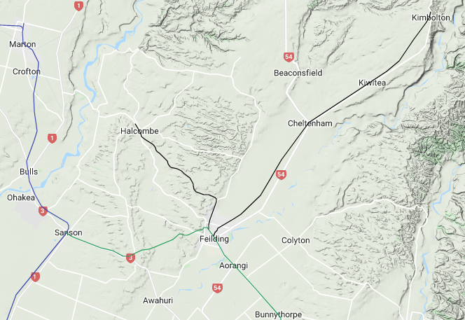
Now, you might have noticed that I have two trunk routes branching north of Levin. In my counterfactual, the NIMT runs more direct across the Manawatū Plains to Marton, with Palmy on the East Coast Main Trunk
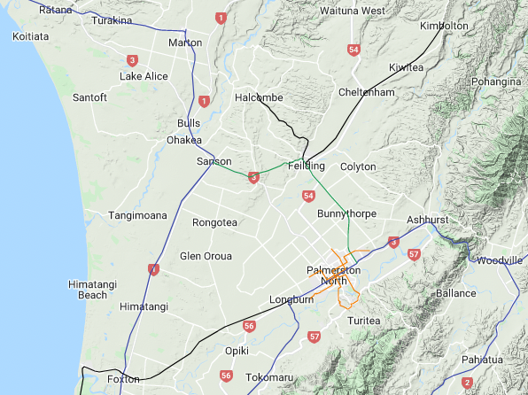
A Feilding Secondary Main Line links Palmy with the NIMT northwards. I was going to use the original NIMT alignment to Marton, but this line is now for local/regional travel: I figured it more plausible to meet the NIMT at Sanson to string together main towns Palmy to Marton
I also chucked in a couple of rural branch lines, as in this counterfactual there would have been justification to build lines to Halcombe (part of the actual NIMT route) and Kimbolton
(as the stub pointing north in Marton might indicate, I'm yet to plot the NIMT onwards)
(as the stub pointing north in Marton might indicate, I'm yet to plot the NIMT onwards)
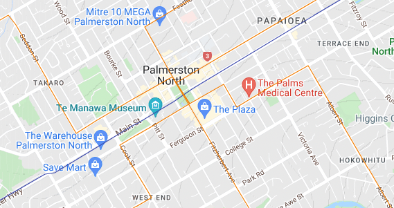
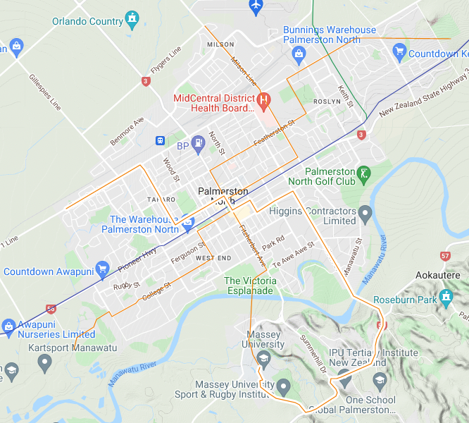
I've kept the original rail route through central Palmy for accessibility—no Milson Deviation for me! (Maybe a goods branch?) It is complemented with an extensive tram network, which I envision evolved from a first-gen network established in the 1930s as Palmy grew large
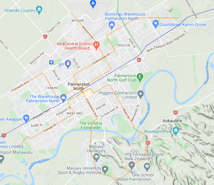
This is clearly the hub of the network, with routes converging on The Square. They share a line through the Square to reduce tramways crossing the railway on the level, although in this counterfactual the railway would be grade-separated by now
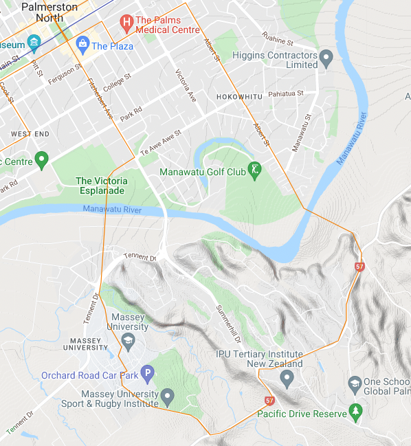
On Palmy's south side, the tramway has a more modern light rail character, with two routes to Massey Uni: an original one extending a line from Victoria Esplanade, and a second extending a Hokowhitu line into new developments around Aokautere, the two meeting on the Massey campus
Back to the overall network and I've highlighted how the routes are designed for through-running
Awapuni line goes all the way to the racecourse. Kelvin Grove line uses the route earmarked in real life for a railway shortcut, hence the odd diagonal boundary of the cemetery
Awapuni line goes all the way to the racecourse. Kelvin Grove line uses the route earmarked in real life for a railway shortcut, hence the odd diagonal boundary of the cemetery
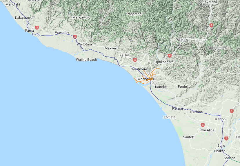
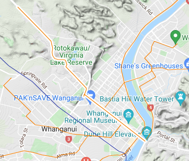
What is in reality known as the Marton–New Plymouth Line is in my counterfactual the South Taranaki Main Line. It sorta follows the same route, but I realigned it from Waitōtara to Turakina so that it actually runs through central Whanganui
I didn't draw a Castlecliff railway—it'd probably be freight sidings, with trams handling all passengers. So, here's the tram network. It's based on the first-gen system, which ran from Aramoho to Castlecliff with two routes via Gonville. It is, however, substantially expanded
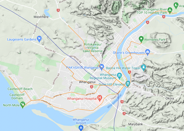
Here are the routes highlighted for through-running:
- Castlecliff Beach–Easttown
- Castlecliff–Aramoho
- Springvale–Wembley Park
- St John's Hill–City (terminating at the Durie Hill Elevator)
I might end up modifying Aramoho/Easttown if I do a railway directly north
- Castlecliff Beach–Easttown
- Castlecliff–Aramoho
- Springvale–Wembley Park
- St John's Hill–City (terminating at the Durie Hill Elevator)
I might end up modifying Aramoho/Easttown if I do a railway directly north
Here's the rest of the South Taranaki Main Line from Pātea to New Plymouth—it's mostly the real-life route. There is also a Taranaki Coastal Line for coastal towns. Instead of just reviving the Ōpunake Branch from south of Eltham, I made a line from Stratford via Kaponga
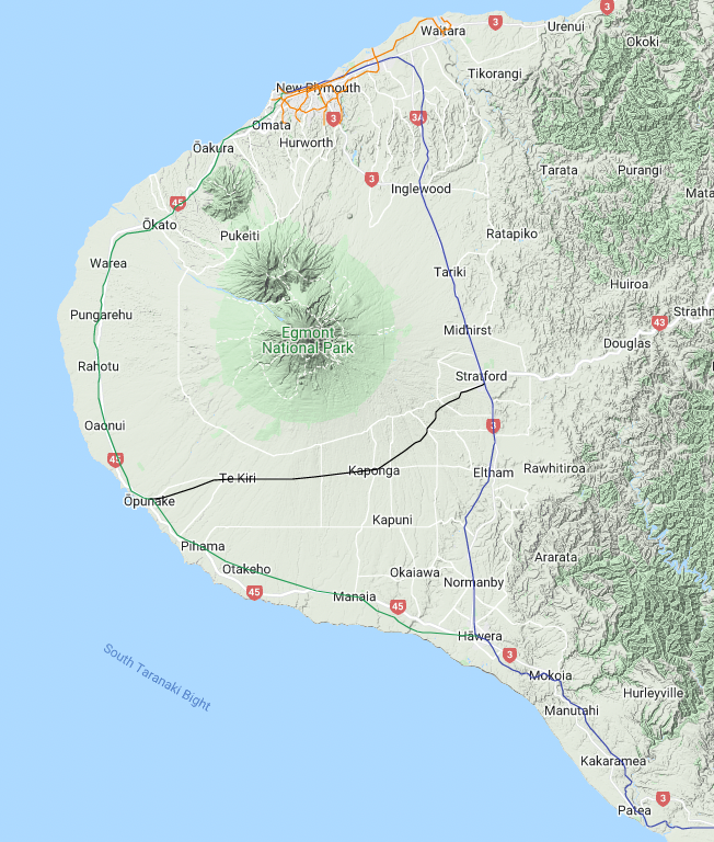
My Taranaki plan picks up on actual proposals by a 1912 commission for a coastal loop line and a branch across the plains south of Taranaki Maunga. If you have Can't Get There from Here, this is mapped on p.61–62. I simplified it a bit and avoided putting Manaia on a branch
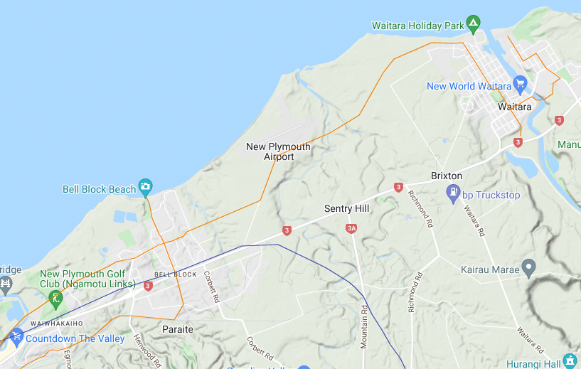
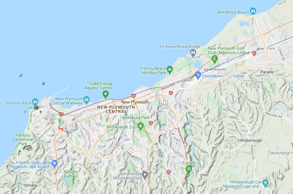
New Plymouth had a first-gen tramway. It forms the basis of this network that links main suburbs and takes on local passenger duties to Waitara. There will be a main line railway to Auckland, not yet drawn: the Waitara station will be south side of town, southern tip of tram line
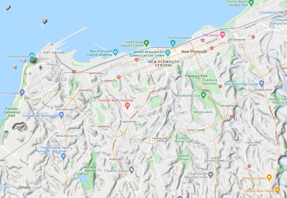
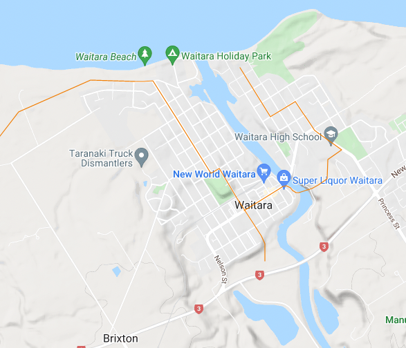
I won't highlight all the tram routes (there isn't as much through-running either, some terminate in central NP), but I wanted to highlight one: a cross-suburban link from Bell Block that winds its way over to Spotswood. Also, yes, the railway is realigned on the east side of NP
There you have it, my counterfactual Manawatū/Taranaki network as it stands. I'm contemplating what routes to take north. Seriously thinking of Marton–Taupō–Hamilton for the NIMT and a separate Whanganui–Taumarunui–Hamilton line. Also contemplating the exact route north from NP
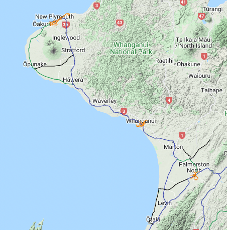
The challenge is keeping to "reverse a century of rail-vs-road funding and attitudes" rather than "railways to everywhere!!!" But given how heartily NZ funds road, I think this is a fair reversal:
- Marton–Taupō–Ham
- Whanganui–Taumarunui–Ham
- NP–Te Kuiti
- Stratford–Taumarunui
- Marton–Taupō–Ham
- Whanganui–Taumarunui–Ham
- NP–Te Kuiti
- Stratford–Taumarunui
• • •
Missing some Tweet in this thread? You can try to
force a refresh