
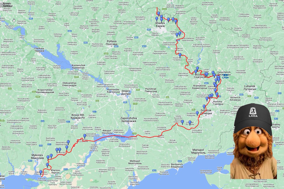
Update 🧵July 24h. Visit the interactive map for more details and explanations. This thread will get updated later today.
Ladarov is sponsoring today again.
Interactive map: scribblemaps.com/maps/view/2022…
Ladarov is sponsoring today again.
Interactive map: scribblemaps.com/maps/view/2022…

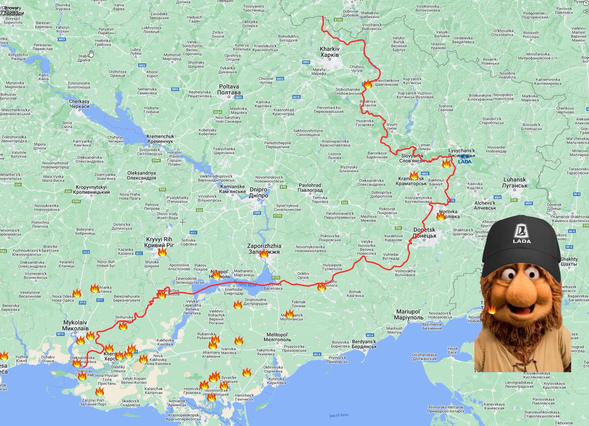
40Shelling locations reported toyday.
FIRMS: To early to give any indication.
Not much movement reported, there was only one mentioned by the GSUA.
Lada aspirants from Russia assaulted the Vuhlehirsʹka Thermal power plant from multiple directions. The AFU pushed them back again. -GSUA
Lada aspirants from Russia assaulted the Vuhlehirsʹka Thermal power plant from multiple directions. The AFU pushed them back again. -GSUA

This one is interesting.
https://twitter.com/bayraktar_1love/status/1551109418082861058
I have previously suggested that location as a good goal/target for the AFU in case of an offensive in the area.
https://twitter.com/DefMon3/status/1547600197101817859
Novobohdanivka is one of possibly two key locations for the railway supply to the entire Kherson/Zaporizhzhia area.
Even if HIMARS are pushing the RU supplies further back, they still utilize the railway, so these locations are still important.
Even if HIMARS are pushing the RU supplies further back, they still utilize the railway, so these locations are still important.

If you are American, make sure you lean on your let your congress man/woman know you want them to send more weapons to Ukraine.
https://twitter.com/shashj/status/1551134643272949760
Here is how to find your local representative.
I tested this with the only zip code I know in the united states. 90210
ziplook.house.gov/htbin/findrep_…
I tested this with the only zip code I know in the united states. 90210
ziplook.house.gov/htbin/findrep_…
Shellings updated, 84.

FIRMS Data: 2022-07-24_17:45
Added 329 locations to kml
Filtered 682 locations by proximity to other fires
Removed 99 false positives
Added 329 locations to kml
Filtered 682 locations by proximity to other fires
Removed 99 false positives

GSUA only reported an attack on Bohorodychne in the Izium area. This part of the frontline has calmed down a lot. A few weeks ago RuAF tried to attack in 3-4 directions every day.

I'm almost thinking they are moving assets away from the Izum area, perhaps the railroad supply line is too vulnerable with the arrival of GMLRS. Just speculation from my part.
Participants in the Ukrainian Lada Rally (RuAF) are trying to advance on Verkhn'okam'yans'ke and Bakhmuts'ke. Mothers morale very high.
Marked Bilohorivka as RU controlled. Based on attacks from that direction.
Marked Bilohorivka as RU controlled. Based on attacks from that direction.

Fighting is still ongoing in the area of Vuhlehirsʹka however the RuAF were repulsed by Ukrainian Mutated Bats in the Novoluhans'ke area.

The last thing reported by GSUA today was the failures of the VDV (RU) in the Kherson region. (Don't worry, they are used to it)
The VDV stood no chance in the direction of Andriivka and Bilohirka, suffered losses and retreated chaotically according to GSUA.
The VDV stood no chance in the direction of Andriivka and Bilohirka, suffered losses and retreated chaotically according to GSUA.

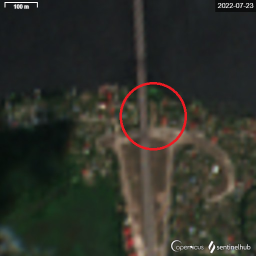
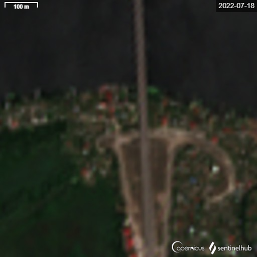
I have spent most of the day trying to figure out the whole pontoon bridge thing found by @CovertShores yesterday. I looked at SAR images, and it looks like two pontoon sections of about 60m each are remaining in place after 24hours.
Source:
Source:
https://twitter.com/CovertShores/status/1550870774923333632


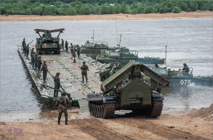
I'm going to call the pontoon sections barges from now on.
I do not think the barges have been deployed at the location they were spotted. The reason is the area around the water looks undisturbed. I think this is a parking place
I do not think the barges have been deployed at the location they were spotted. The reason is the area around the water looks undisturbed. I think this is a parking place
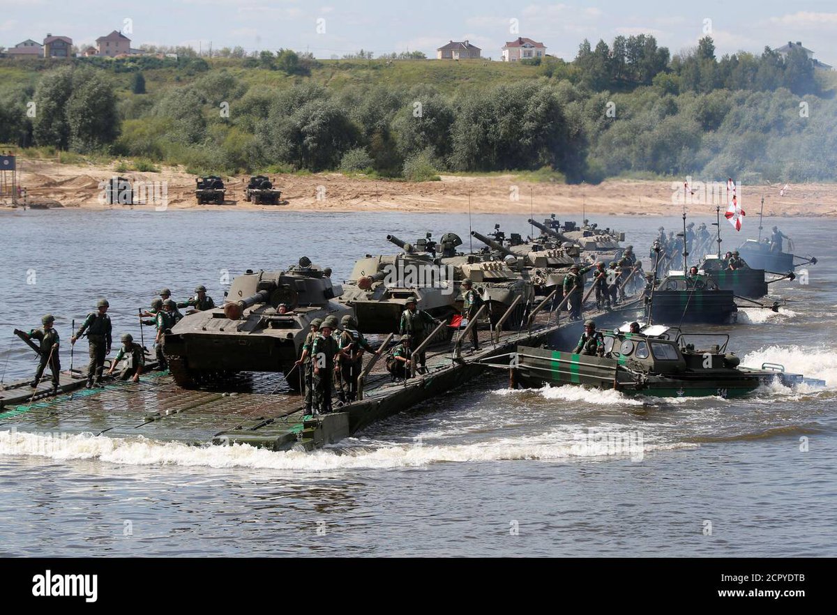
Here are examples of how the pontoon ridges can be used as barges. This way you can quickly transport heavy equipment without the risk of having a stationary bridge.
I believe the barges in question have been used for this purpose already, and have been parked/hidden in that small canal.
I am still unsure of when, how much, where and in what direction. (satellite tells us after 20th, morning, before 23rd morning)
I am still unsure of when, how much, where and in what direction. (satellite tells us after 20th, morning, before 23rd morning)
One possibility is they are using these barges to transport fuel and ammo that is too heavy/risky to transport on the bridge. In to Kherson.
Another possibility is they are using it to evacuate valuable equipment like radars, tanks and washing machines.
Another possibility is they are using it to evacuate valuable equipment like radars, tanks and washing machines.
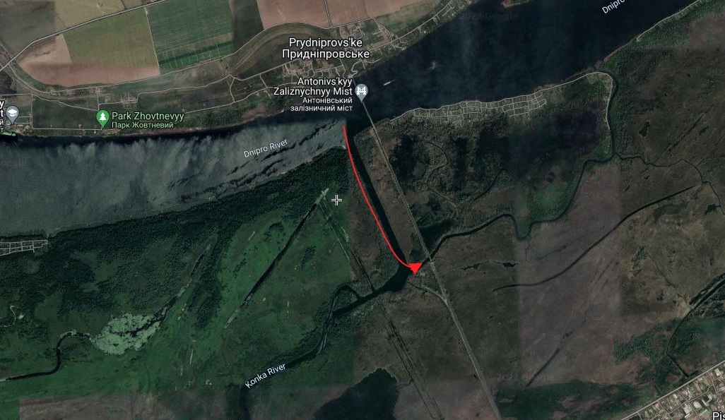
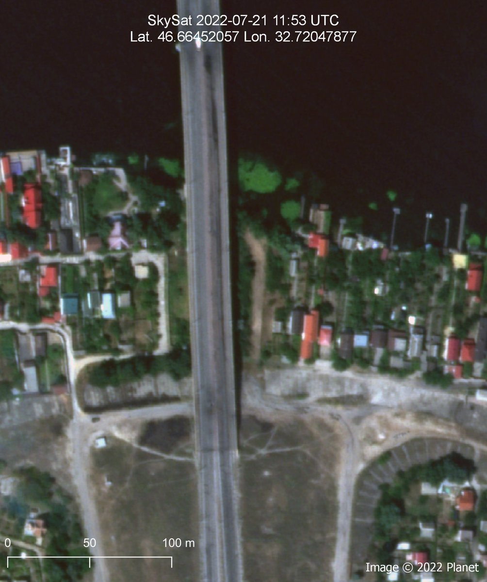
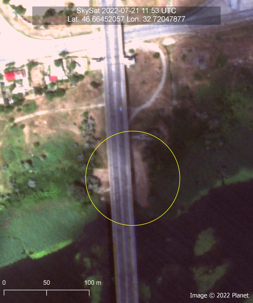
One possible location for docking on the south side of the Dnipro is next to the Antonovskiy Bridge. It looks to me like they have pushed around some dirt to possibly make a ramp down to the river.
This is more or less the only place close with road access on both sides.
This is more or less the only place close with road access on both sides.

All three of these locations looks good for docking on the north side.

I would like to thank everyone who has helped me out with this and provided info and idea. (I don't do this enough)
Amazing images of the N/S end of the Antonovskiy Bridge provided by h/t @sakkesarjakoski. Both sides seems to have fresh marks of "ground disturbance". The one of the south side definitely looks man made.
Also h/t @secretsqrl123 for always providing useful insights.
Also h/t @secretsqrl123 for always providing useful insights.
The main question now is if these in conjunction with the barge is for repair work, or for transportation.
For now I'm thinking they are using the barge for repair work.
For now I'm thinking they are using the barge for repair work.
So let's all cross our fingers and toes and hope Arestovych has improved his accuracy.
https://twitter.com/SamRamani2/status/1551275131422625794
• • •
Missing some Tweet in this thread? You can try to
force a refresh


