
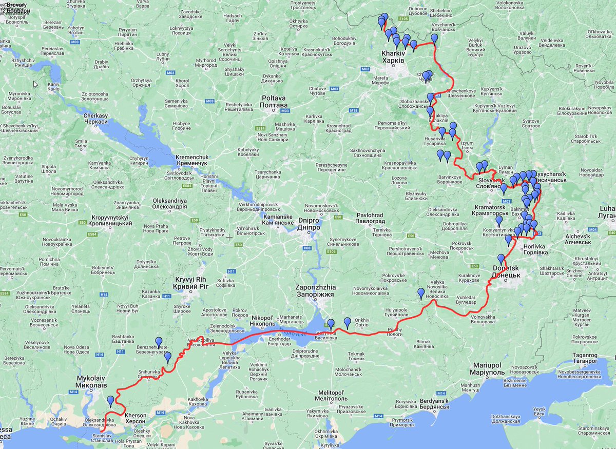
Update 🧵July 26h. Visit the interactive map for more details and explanations.
Todays map is presented by an unnamed dental catastrophe, or in Swedish, Fäbodjäntan.
Interactive map: scribblemaps.com/maps/view/2022…
Todays map is presented by an unnamed dental catastrophe, or in Swedish, Fäbodjäntan.
Interactive map: scribblemaps.com/maps/view/2022…

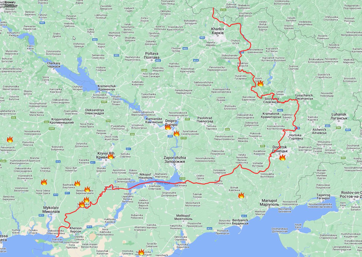
GSUA reported 54 shellings this morning, no anomalies.
FIRMS Data: 2022-07-26_10:48
Added 42 locations to kml
Filtered 0 locations by proximity to other fires
Removed 50 false positives
Added 42 locations to kml
Filtered 0 locations by proximity to other fires
Removed 50 false positives
Kharkiv city area, south side.
RU forces are reported to "conducting combat operations with the aim of holding the occupied lines and preventing the advance of our troops" by GSUA.
This is an indication of AFU operations in the area.
Yesterday I wrote:
RU forces are reported to "conducting combat operations with the aim of holding the occupied lines and preventing the advance of our troops" by GSUA.
This is an indication of AFU operations in the area.
Yesterday I wrote:
https://twitter.com/DefMon3/status/1551536626605735937

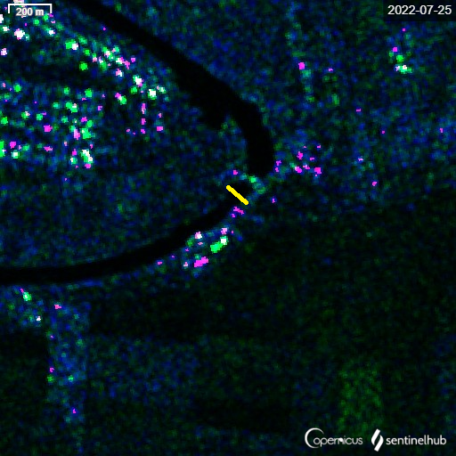
Looking at the Izium-Balakliya area, we can see a possible smoking accident in Izium. I extended the RU area of control to Bairak just south of Balakliya , they seem to do ground assaults on Husarivka from time to time so they most likely have some kind of access.

Area of the smoking accident in Izium. Firms is not exact, so it's possibly that large storage building burning

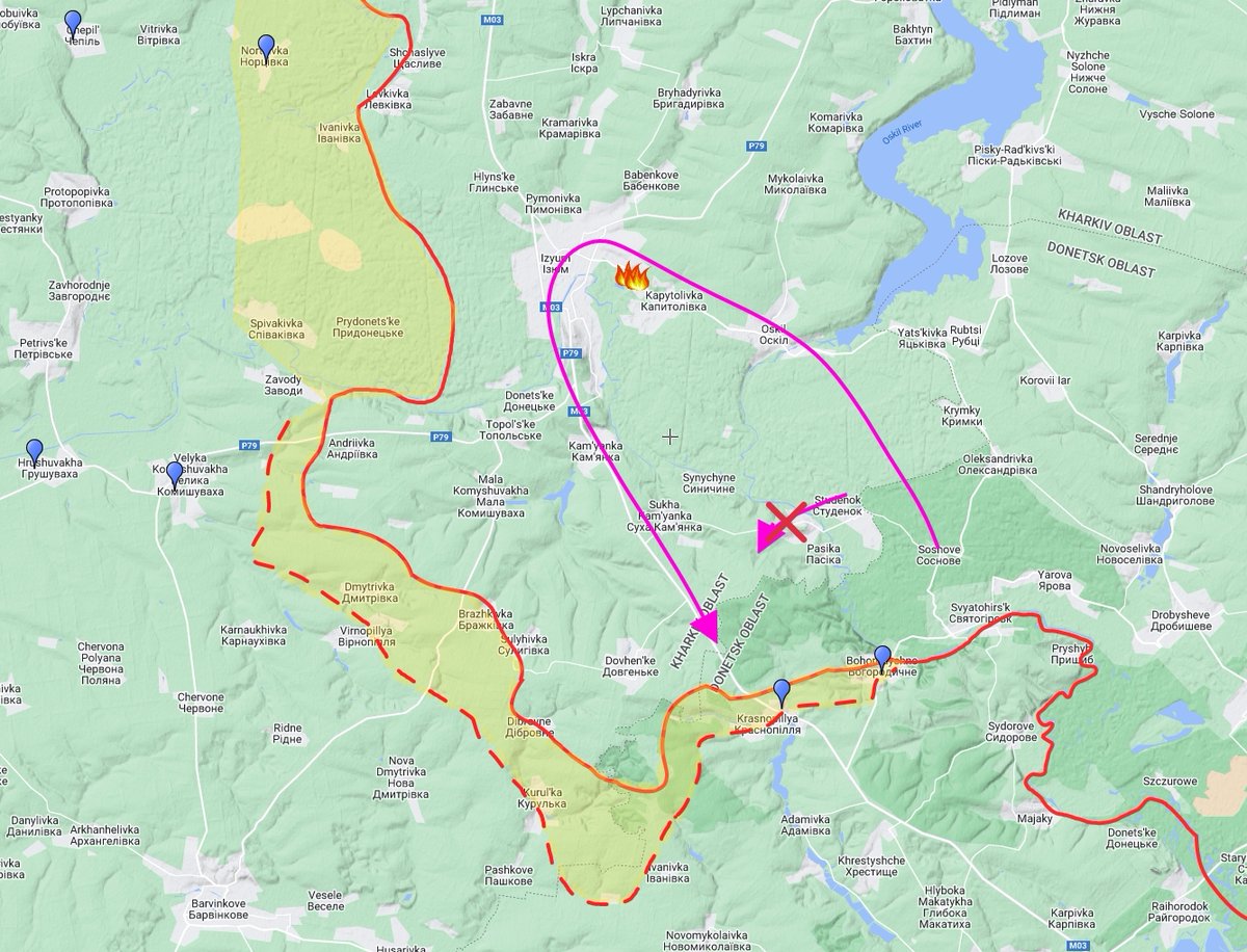
GSUA reported "Our soldiers successfully repelled enemy assaults in the areas of Spirny and the National Nature Park "Svyati Hora"
The National Park is spread out, I deiced to place the red arrow around Bohorodychne.
The National Park is spread out, I deiced to place the red arrow around Bohorodychne.


RU forces attacked in the direction of Berestove, suffered losses and had to retreat according to GSUA.
I believe no one is in control of Berestove, RU sources stated it was captured a while back, but they could not stay in the village because of intense AFU artillery.
I believe no one is in control of Berestove, RU sources stated it was captured a while back, but they could not stay in the village because of intense AFU artillery.
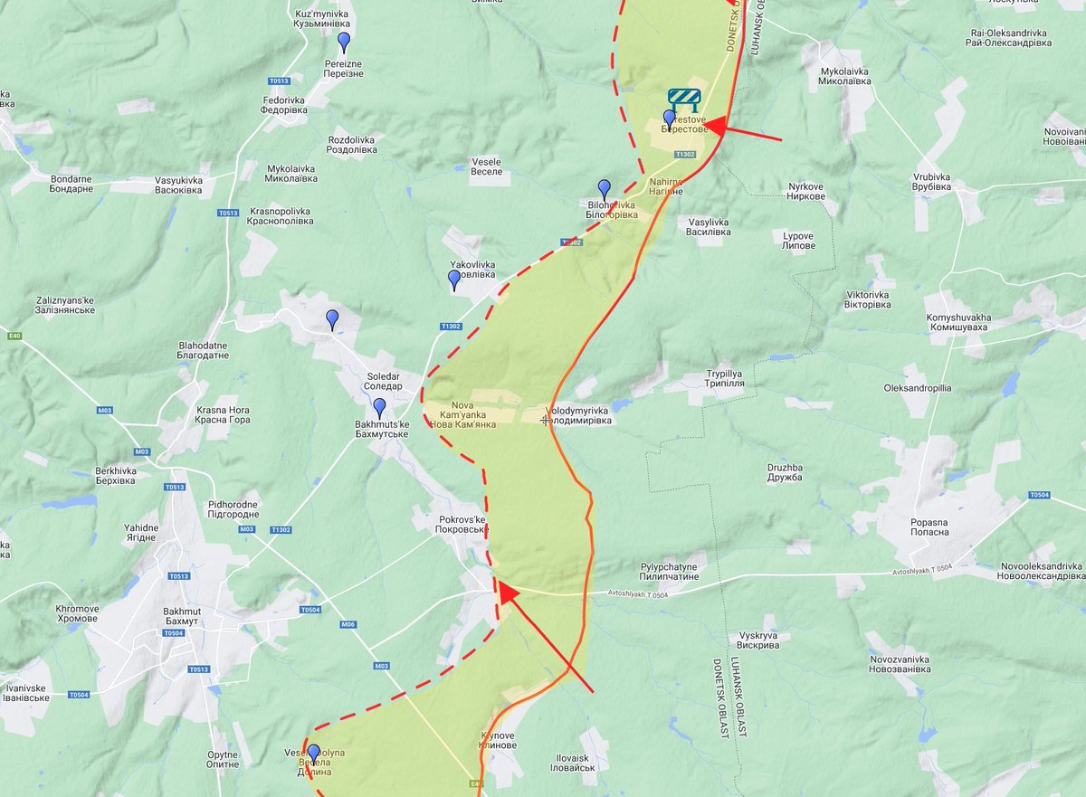
The RuAF attack on Semyhirja was stopped while fighting is ongoing in the Pokrovs'ke area.

Looking at SAR from Sentinel 1, it would appear the pontoon bridge over the Inhulets river had been removed by 15:45 UTC (18:45 local)
Mentioned yesterday:
Mentioned yesterday:
https://twitter.com/DefMon3/status/1551584131556966400
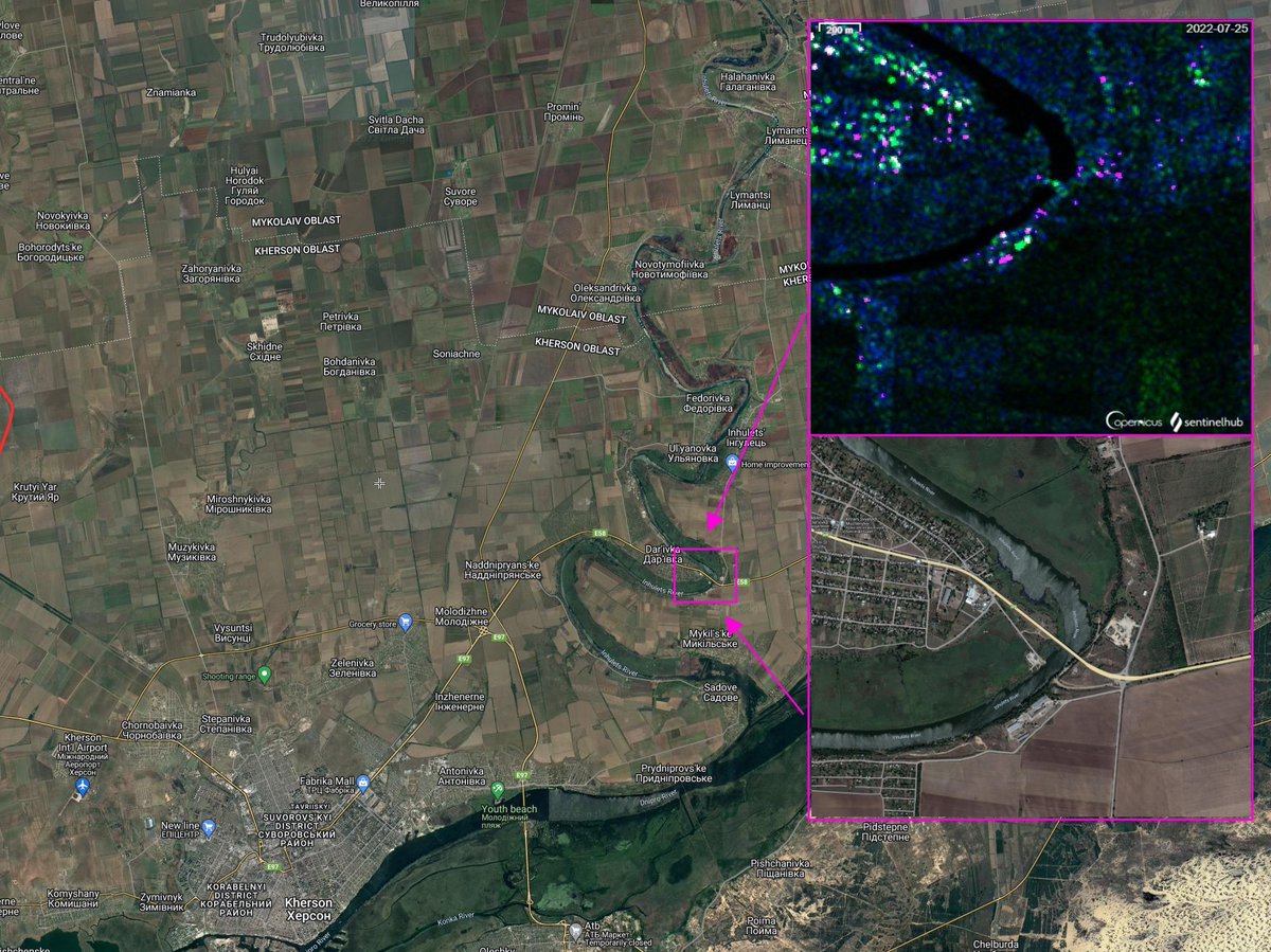
A pontoon bridge should have shown an echo by the yellow mark.
This is an example of what a known pontoon bridge looks like on SAR, taken from another location.

However, a larger radar reflection could be spotted close to the old parking place for the pontoons. This is possibly the pontoons being transported somewhere. My guess is back in to hiding.

While looking at that, I found out that the pontoon bridge by Yaremivka has been removed/destroyed recently.

This will force the Russians to go around like this instead, assuming the railway to Sosnove is still intact.
Borova Township Council: "According to aerial reconnaissance, the number of Russian occupation troops on the territory of the community has recently decreased significantly."

"After targeting the concentration points of the occupiers with targeted fire, the latter withdrew the main part of the surviving equipment in the direction of Kup'yans'k."
"The Russian military, which remained, show more aggression towards the local population and express dissatisfaction with the situation."
More:
pastebin.com/qfMqFe0D
t.me/borova_gromada…
More:
pastebin.com/qfMqFe0D
t.me/borova_gromada…
@TuiteroMartin is on top of things as usual. It looks like the RuAF presence in the Studenok and Yaremivka area has been greatly reduced.
https://twitter.com/TuiteroMartin/status/1551194973592330241

The removal of the pontoon bridge, the report of RU troops getting hit and moving towards Kup'yans'k, and the report about Studenok and Yaremivka indicates to me RuAF are shifting focus.
We have also seen increased activity south of Kharkiv city lately.
We have also seen increased activity south of Kharkiv city lately.
What this means? I think it means Slovyansk, Kramatorsk and Bakhmut will not ever fall in to RU control.
A month ago I thought that there was a decent chance for RuAF to capture them.
A month ago I thought that there was a decent chance for RuAF to capture them.
12 Lucky mothers will be looking to buy new Ladas.
There was a smoking accident in Lysychansk.
facebook.com/sergey.gaidai.…
There was a smoking accident in Lysychansk.
facebook.com/sergey.gaidai.…
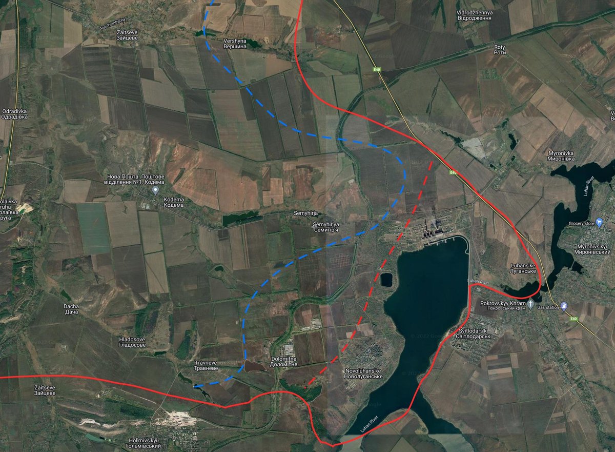
So it seems there is some photo confirmation about Vuhlehirsʹka TPP.
https://twitter.com/J_JHelin/status/1551941282091646977
I think it's likely the AFU has retreated from the salient and possibly taken positions further back. This blue line is the best I could come up with right now, consider it illustrative.
And video confirming the date and time.
t.me/grey_zone/14433
t.me/grey_zone/14433
76 Shellings and 182 Fires added
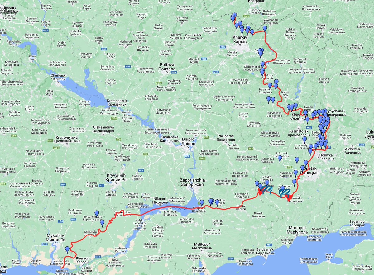
RuAF tried to recon in the direction of Chepil, they were neutralized.

AFU successfully defended Sprine, Soledar, Ivano-Dar'ivka, Berestove and Semyhirja. Vuhlehirsʹka and Novoluhans'ke possibly captured RU Wagner and 1st Army Corps (covered earlier in thread)

RuAF attacks in the areas of Pavlivka and Blahodatne failed. I think this is the correct Blahodatne, there is another one but this makes more sense.

Possible smoking accident yesterday in the Borova Area. Location and link to Borova telegram further up in thread.

• • •
Missing some Tweet in this thread? You can try to
force a refresh


