[MEGA-THREAD] The 4.2 ka BP event and the Aegean (Part 1) : The effect of climatic disturbance in Mesopotamia and Anatolia.
#Aegean #drought #WesternAnatolia #KhaburPlains #Mesopotamia #SyroPalestine #AkkadianEmpire
#Aegean #drought #WesternAnatolia #KhaburPlains #Mesopotamia #SyroPalestine #AkkadianEmpire

1. One of the most interesting issues of modern archaeological research is the climate change which was caused by the 4.2 ka BP event in various regions of the Northern Hemisphere, ➡️

➡️ with the main characteristic being the appearance of a prolonged and persistent drought lasting 200-300 years (2200-1900 BC) and the effects it had on the cultures of the time.

2. Environmental and palaeoclimatic studies demonstrate a clear climatic disturbance, which adversely affected the monsoon season in India and southern China, while contributed to the southward shift of the Intertropical Convergence Zone in the equatorial region of Venezuela.
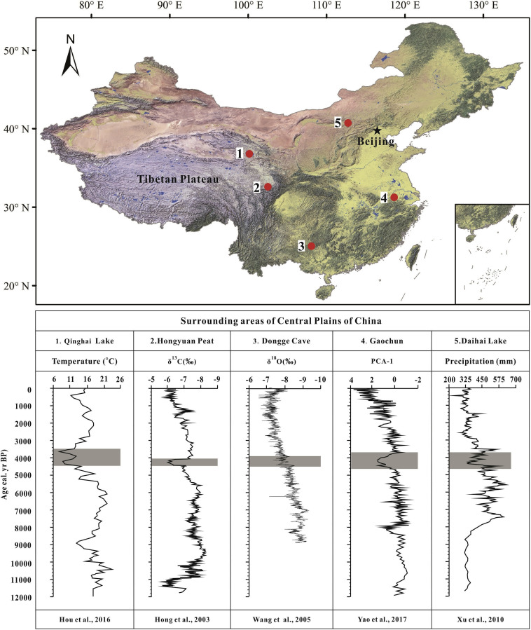
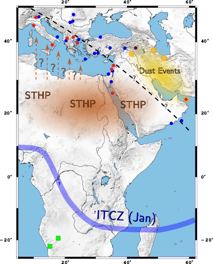
3. In the wider region of the Mediterranean and the Near East it mainly affected SE Anatolia and Northern Mesopotamia. Studies have shown a local decrease in rainfall of 30-50% that brought about dramatic political, social and economic rearrangements.
4. Nevertheless, the phenomenon seems to have had a local impact, affecting areas between the tropics of the equator and the northern mid-latitudes, leaving other areas, such as NW Europe and the Black Sea region, unaffected by the phenomenon.

5. The Mediterranean Basin is subject to a strong climate seasonality and local variability influenced both by the moist westerly winds of the Atlantic and by the displacement of the Intertropical Convergence Zone, a fact that suggests some climatic influence.
6. However, before 2200 BC, the climatic conditions were completely different with the prevalence of a period of high rainfall, which had led the populations of the wider Near East, Anatolia and the Aegean to exploit arid lands through dry farming, ➡️

➡️ creating the appropriate conditions for the population expansion, the adoption of new political-social models and the appearance of a dynamic economic development whose main characteristics were the creation of primary sector surpluses, ➡️

➡️ the development of metallurgy and textiles and the circulation of goods and raw materials through long-distance trade.

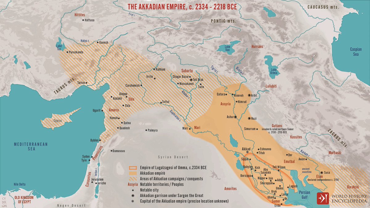
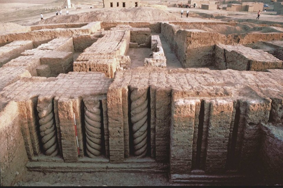
7. In Mesopotamia, it is the period dominated by the Akkadian Empire, whose territory led by the famous Sargon the Great reached as far as Syro-Palestine and Anatolia, while Egypt is dominated by the early pharaohs of the Old Kingdom, exploiting the life-giving floods of the Nile
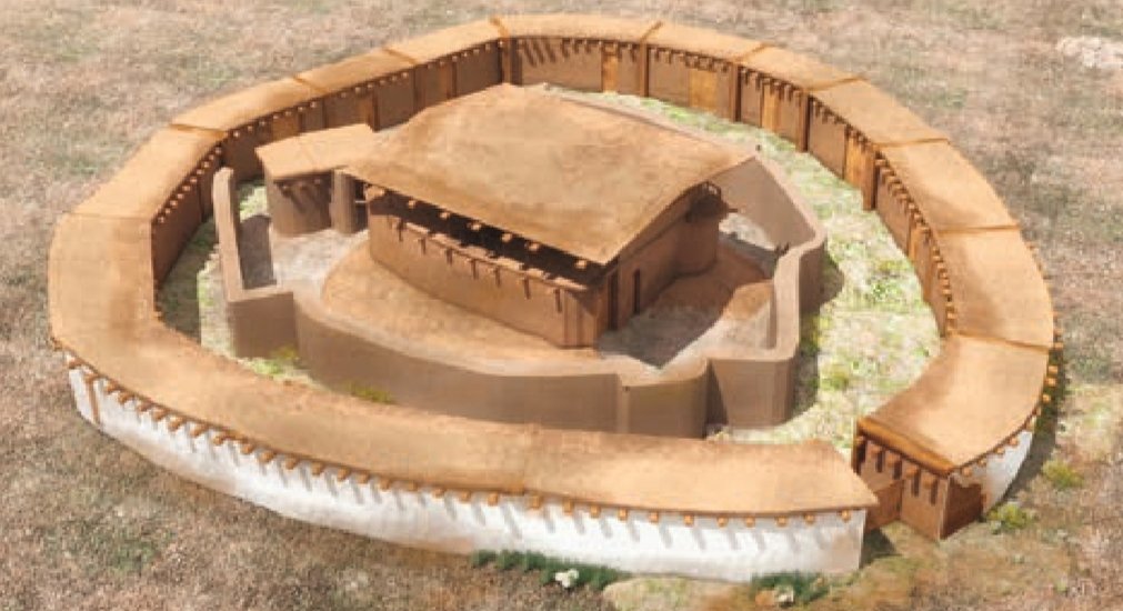
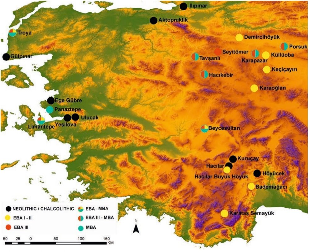
8. In Western and Central Anatolia before 2200 BC the conditions were ripe for the establishment of strong regional centers, which were surrounded by monumental fortifications, ➡️

➡️ while they had public buildings, places of worship and spaces for community feasts, testifying to the existence of a political leadership and a social stratification.
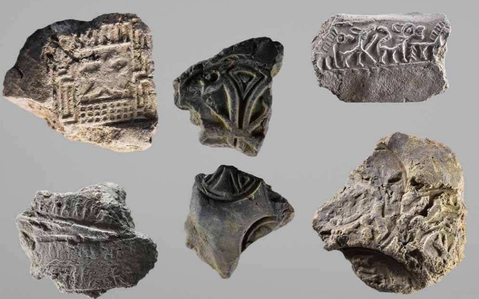
9. The Anatolian communities had adopted the concept of the seal and a common system of weights, participating in the international trade of the time, while the accumulation of prestige items such as ornaments and weapons was of particular importance to members of local elites.

10. Regarding their participation in international trade we must emphasize that between 2500-2200 BC the Anatolian communities were overactive members of the much expanded long-distance trade network of the Near East ➡️

➡️ that stretched from the Aegean to India and through which they circulated - apart from goods and raw materials - ideas, innovations, new technology and know-how, cultural attitudes.

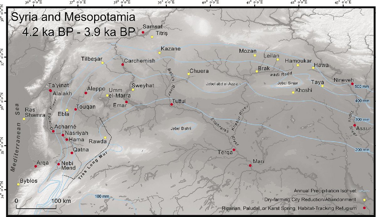
11. This whole cosmopolitan world collapsed after 2200 BC. and there followed a prolonged period of contraction and adaptation to the new conditions. In Mesopotamia, the sharp decrease in rainfall led to the abandonment of large dry farming land (e.g. Khabur Plains), ➡️

➡️in the steep decline in grain production and finally in the abrupt and fast collapse of the AkkadianEmpire with the simultaneous migration of the largest part of its population from its hearths. In fact,the Akkadian collapse is presented in a limited number of texts of the time

12. The local communities unable to manage drought conditions in any other way, mainly because they did not have the appropriate technology and crisis management culture, ➡️

➡️ turned to abandonment, migration, nomadism and especially settling in riparian refugias next to large rivers or other water entity.

13. The end of the drought led during the 19th and 18th centuries BC in the resettlement of the formerly arid and abandoned lands of Northern Mesopotamia, SE Anatolia ➡️
➡️ and Syro-Palestine with the re-sedentary living of various nomadic groups and the intense disputes over the control of the new arable lands.

14. In Western Anatolia, the climatic instability led to the abandonment of the proto-urban process in a context of extensive destructions of settlements and population mobility, ➡️

➡️ while a shift towards less organized forms of social life (pastoral communities) and a fragmentation of social units is attempted.
15. The concentration of the population in large proto-urban centers was particularly vulnerable in conditions of climatic instability as the feeding of large community groups required the finding / production of large quantities of food ➡️

➡️ and consequently the cultivation of marginal lands which were only available in ideal rainfall conditions. The subsequent dispersal of the population into small villages was a much better way of managing the problem.
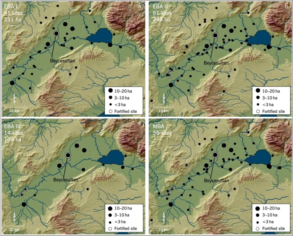
16. The most important impact and at the same time the main cause of the collapse in Western Anatolia was not so much the effect of the climate disturbance itself, ➡️

➡️ but the intense participation of local communities in the extensive interregional trade networks and the heavy dependence on their existence.

17. The collapse in Mesopotamia, Syro-Palestine and SE Anatolia drastically affected these internationalized trade networks and severely affected the communities of Western Anatolia, creating conditions of instability and social unrest.

18. The Aegean was similarly exposed to international trade networks and the exploitation of important vulnerable dry farming lands. So to what extent was the Aegean affected by the climate disturbance event and in what way?
• • •
Missing some Tweet in this thread? You can try to
force a refresh