
#ExtremeWeather Update Thread.
The current "Biblical" rain event over Pakistan - which has destroyed 145 bridges and has one third of the country under water began on August 10th - and has the form of a cyclone over land. 17 days of torrential rains. (image: last 24 hours)
The current "Biblical" rain event over Pakistan - which has destroyed 145 bridges and has one third of the country under water began on August 10th - and has the form of a cyclone over land. 17 days of torrential rains. (image: last 24 hours)
https://twitter.com/althecat/status/1560611124864634887
This image, also today, shows the scale of the outflows from the cyclonic storm which remains centered around 300kms from the sea and which is fed by atmospheric water coming off the North Arabian Sea. The outflows from the storm are causing devastating flooding further north. 

This thread will now look at what happened since the last thread which ended on August 19th. The set up for this catastrophic event involves two cyclones, both of which have remained largely intact over land. Here on the left you can see #Invest04B 2022 (unnamed) making landfall.

These images show #Invest04B crossing India over 4 days - 19-22 August - heading towards the storm over South East Pakistan and Rajastan India.


On the 22nd of August the Storm from the Bay Bengal started to drag the smaller storm over Pakistan into its orbit.

This 22/8 animation shows 24 hours when the storms started to interact - it also shows how the huge storm over the center of India is being fed by streams of water from both the Bay of Bengal and the Arabian Sea.
And the following day, the two storms effectively became one.
In the animation it is obvioys that the storm is strengthening over land. And the area affected by it - over India and Pakistan is colossal 1.3 million km2. Roughly 1% of Earth's landmass - an area larger than Peru, and a little smaller than Mongolia.


On 23-24 August the combined India Pakistan rain storm continued to move west - with the outflow rain bands flowing NNE covering an even larger area.
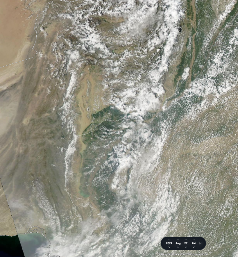
On the 25th the storm was once again centered over the same area in South East Pakistan where it formed 15 days earlier on the 10th August from a depression which travelled inland from the Arabian Sea.
The intensity of the outflows here is astonishing.
The intensity of the outflows here is astonishing.
25-26th August.
Yesterday.
And the storm appears to be finally weakening. The circulation appears to be disintegrating.
Yesterday.
And the storm appears to be finally weakening. The circulation appears to be disintegrating.
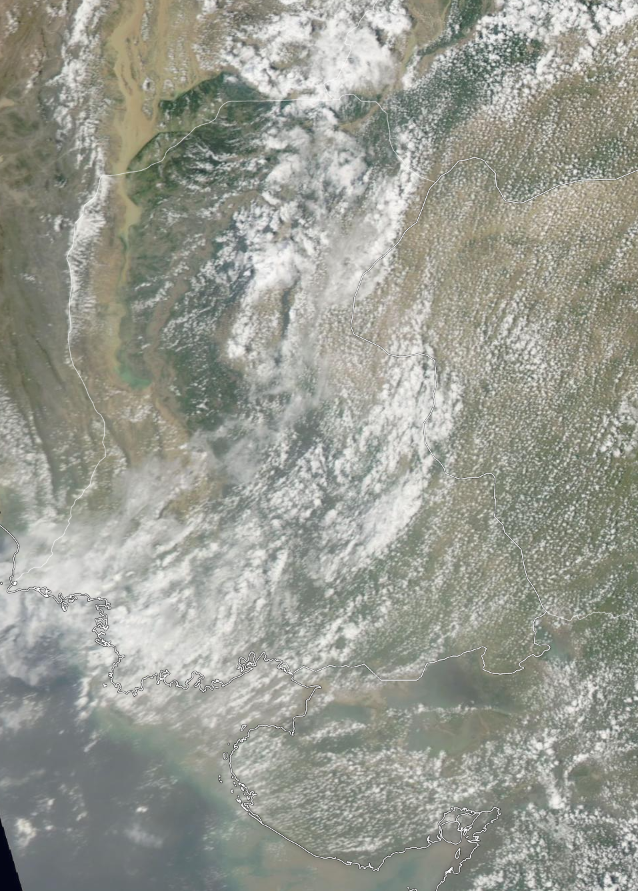
And 26th-27th August getting us up to date.
The storm has finally gone. Some streams of atmospheric water are still coming north over Pakistan. but this may be finally over tomorrow
The storm has finally gone. Some streams of atmospheric water are still coming north over Pakistan. but this may be finally over tomorrow
As the clouds finally clear it is possible to see what look like the flooded areas from satellite, which are huge. First image is an initial effort to show the obviously flooded areas. 2nd shows it without the measuring boxes.


Here's two high resolution NASA Worldview images for comparison
Left. Satellite image from October 6 2021 for comparison.
Right. Satellite image for today.
Left. Satellite image from October 6 2021 for comparison.
Right. Satellite image for today.

A larger image allows you to see more clearly the floodwaters in yellow brown on the LHS of this image.
This area in particular is full of big cities.


I think the worst flooding however will be further south in the South East around Karachi and Hyderabad - where it has been raining very heavily continuously for 17 days.
This area in North West India also appears to be extremely flooded. It has also had heavy rain continuously over the 17 day period.


/ENDS
@Threadreaderapp unroll
@Threadreaderapp unroll
• • •
Missing some Tweet in this thread? You can try to
force a refresh


