Why are 50M Pakistanis suffering historic floods while China suffers a historic drought?
Because of humans and tectonic plates:
Because of humans and tectonic plates:
When the minister says a third of the country is submerged, it's literal. 

1. The human factor is clear: global warming causes higher average temperatures
And this summer the entire Northern Hemisphere is going through one massive heatwave

Why is a small increase of 1.2°C in global temperatures causing so many dramatic heatwaves? Because a small shift in the average can cause a huge shift in extreme events.

But why does it translate into a drought in China but a flood in Pakistan?
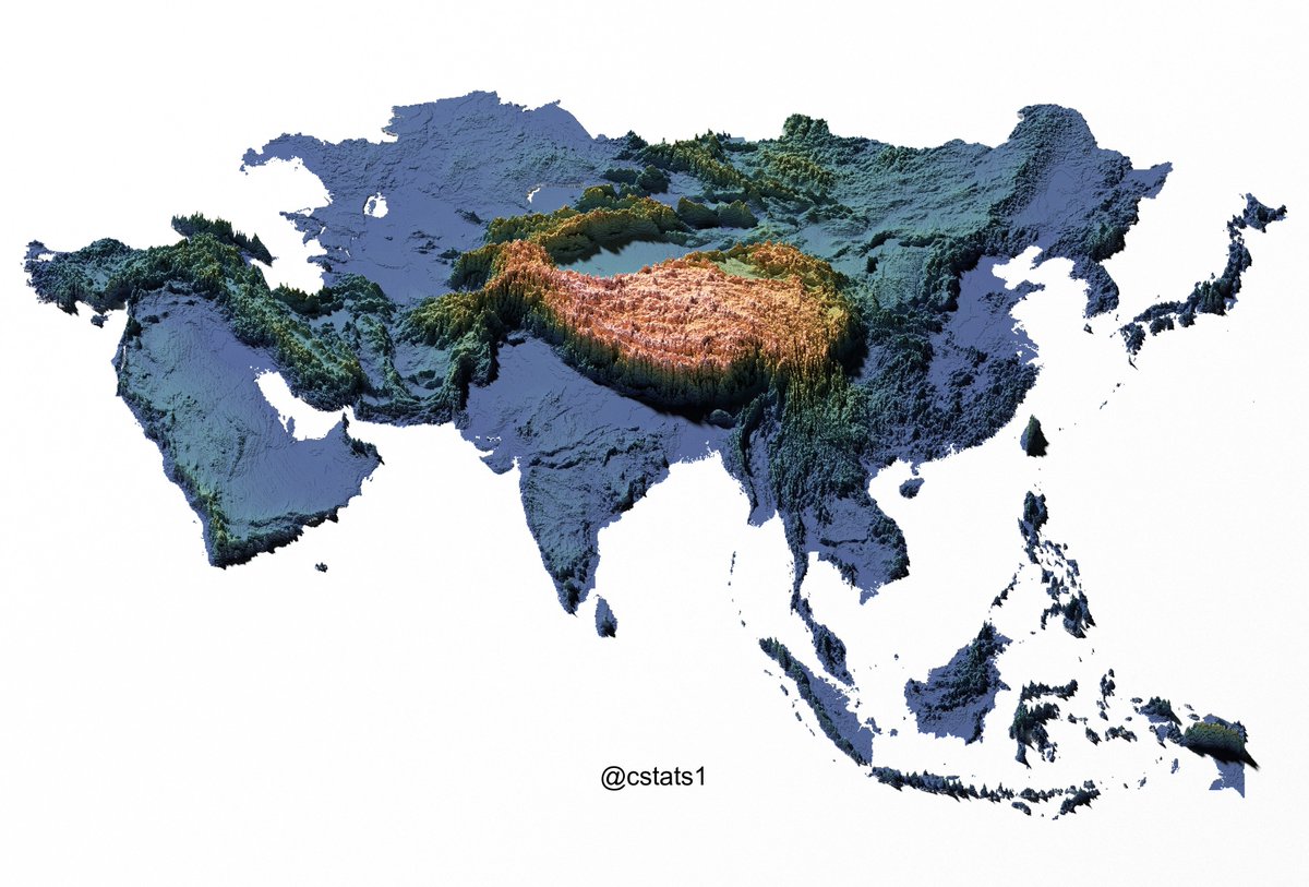
2. Tectonic plates.
The Indian Subcontinent Plate hits the Eurasian Plate, with the Indian Ocean just below.
2. Tectonic plates.
The Indian Subcontinent Plate hits the Eurasian Plate, with the Indian Ocean just below.

This causes 2 things:
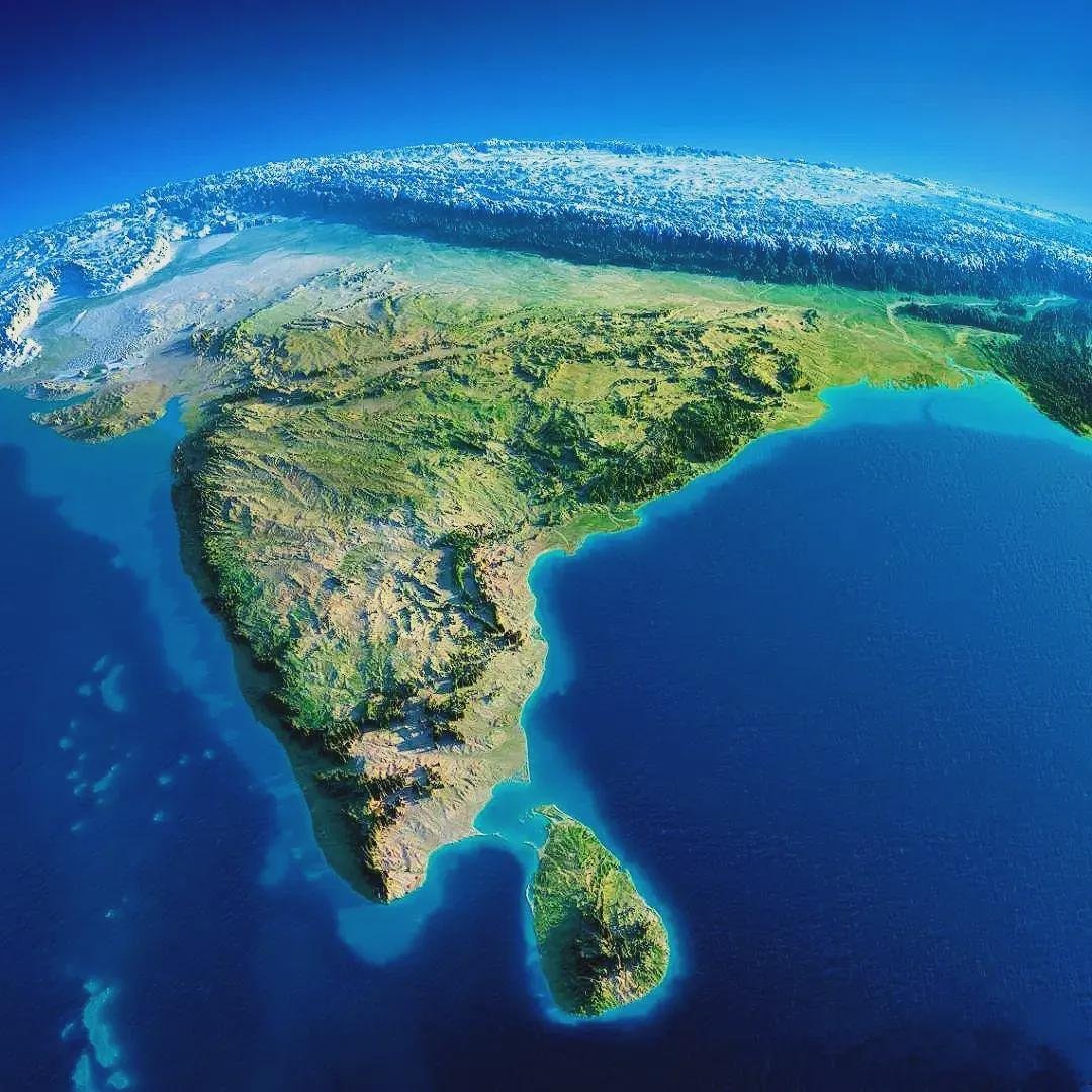
a. India's region is the only one in the world with a big ocean in the south and a big continental mass in the north.
a. India's region is the only one in the world with a big ocean in the south and a big continental mass in the north.

In summer, when it's hot, water evaporates and loads the sea air with humidity.
Meanwhile, the land air gets hotter faster (no evaporation to cool it). Hot air dilates, goes up, and sucks in the humid air from the sea.
This is the monsoon.
Meanwhile, the land air gets hotter faster (no evaporation to cool it). Hot air dilates, goes up, and sucks in the humid air from the sea.
This is the monsoon.

This happens at continental magnitudes in Eurasia
In summer, it goes from the southwest of the Indian Subcontinent to the northeast.
It hits Pakistan in August.
A historic heatwave causes a historic monsoon.
It hits Pakistan in August.
A historic heatwave causes a historic monsoon.

But the tectonic plates hit each other causing the Himalayas!
And the Himalayas stop the rains due to the rainshadow effect

That's why west of the Himalayas, on the Indian side, it's green (left).
But it's rather drier on China's Tibet side (right).
But it's rather drier on China's Tibet side (right).

So all that historic monsoon water stays on the Indian/Pakistani side.
China's water usually comes from its own monsoon, which comes from the Pacific and is earlier in the summer. So the heatwave has not caused floods there, but drought.
China's water usually comes from its own monsoon, which comes from the Pacific and is earlier in the summer. So the heatwave has not caused floods there, but drought.
https://twitter.com/ScottDuncanWX/status/1561040349535113217?s=20&t=qyO1uf4uEqdnV8O2RFY9Mg
There's one more factor for Pakistan's floods:
b. The glaciers.
Pakistan has thousands of them.
A historic heatwave means historic melting, which adds to the massive monsoon rains.
b. The glaciers.
Pakistan has thousands of them.
A historic heatwave means historic melting, which adds to the massive monsoon rains.

Here's the thing: India & Pakistan would be a desert if it weren't for the Monsoon because they're in the horse latitudes

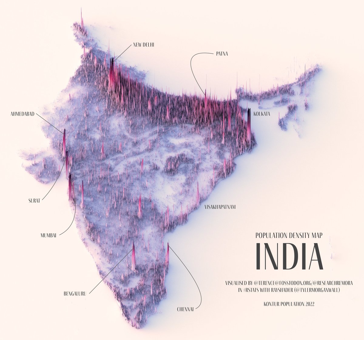
In fact, a big chunk of Pakistan is a desert. The only part that is habitable is the Indus Valley, which is the river that gathers *all* the water from the Himalayas/Hindu Kush, and makes its banks fertile.

You can see Pakistan's population through its nightlights: only visible in that valley
So when a heatwave melts glaciers and causes historic monsoons, all that water concentrates in that single Indus Valley, which hosts 220M Pakistanis.
30M of them are caught in these floods.
So when a heatwave melts glaciers and causes historic monsoons, all that water concentrates in that single Indus Valley, which hosts 220M Pakistanis.
30M of them are caught in these floods.

Summary:
• Summer heat causes imbalances in humid/dry air in the Indian Ocean vs Eurasia ➡️ monsoon
• Climate change ➡️ Historic heatwave ➡️ Historic monsoon
• Tectonic plates ➡️ Himalayas, which concentrates monsoon water on the Pakistani side
• Summer heat causes imbalances in humid/dry air in the Indian Ocean vs Eurasia ➡️ monsoon
• Climate change ➡️ Historic heatwave ➡️ Historic monsoon
• Tectonic plates ➡️ Himalayas, which concentrates monsoon water on the Pakistani side
• The plates also causes glaciers, which melt during a massive heatwave, adding to the monsoon
• All that water concentrates in the Indus Valley. That makes it fertile ➡️ 220M ppl
• They get flooded
• Himalayas stop the water ➡️ China only gets drought
• All that water concentrates in the Indus Valley. That makes it fertile ➡️ 220M ppl
• They get flooded
• Himalayas stop the water ➡️ China only gets drought
I'll publish my article on this today.
Subscribe to my newsletter for more
unchartedterritories.tomaspueyo.com/subscribe
Subscribe to my newsletter for more
unchartedterritories.tomaspueyo.com/subscribe
• • •
Missing some Tweet in this thread? You can try to
force a refresh