
Update 🧵September 11th.
Visit the interactive map for more details and explanations.
Russia now has a negative progress rate when looking at the time period since June 2nd.
We are talking about -1162km2 compared to last weeks +612 km2
Interactive map: scribblemaps.com/maps/view/Oper…
Visit the interactive map for more details and explanations.
Russia now has a negative progress rate when looking at the time period since June 2nd.
We are talking about -1162km2 compared to last weeks +612 km2
Interactive map: scribblemaps.com/maps/view/Oper…

Yesterdays thread:
https://twitter.com/DefMon3/status/1568750992568483840
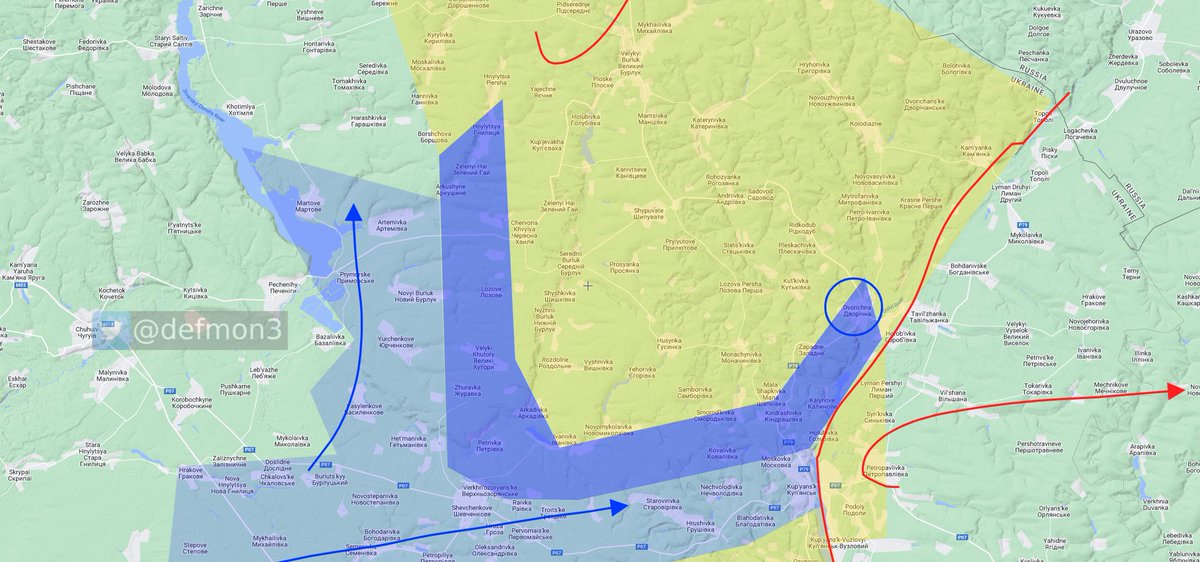
I now consider Kindrashivka and Khutory liberated based of photos. I have not geolocated them, but I see no reason they would not be authentic.
https://twitter.com/Militarylandnet/status/1568901714429747201
https://twitter.com/Militarylandnet/status/1568896095375302656
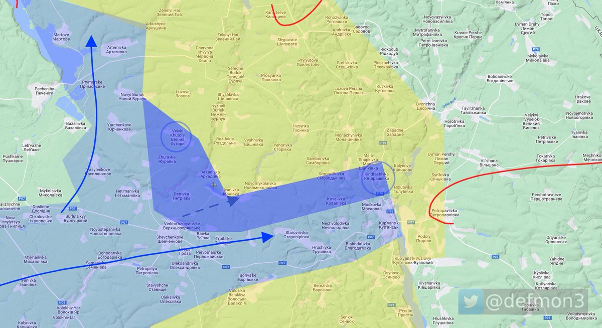
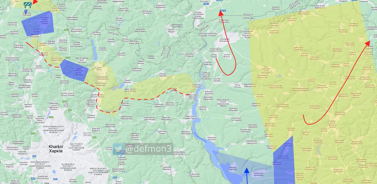
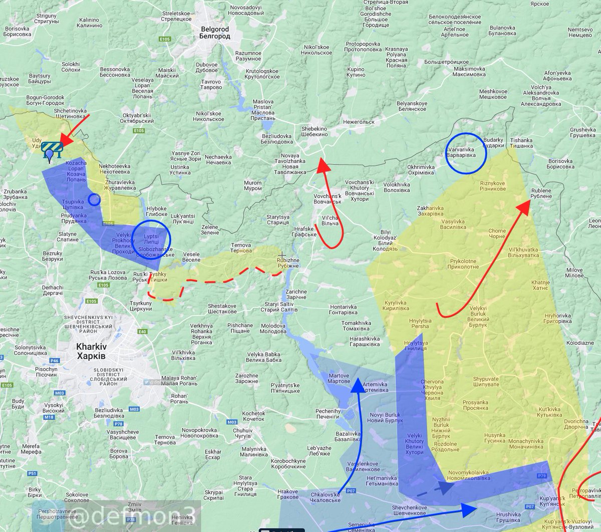
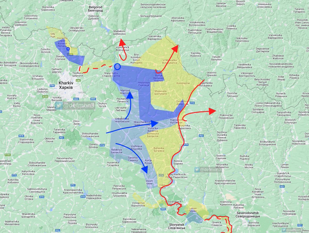
Kozacha Lopan' is possibly liberated.
The rumors says RuAF left. I think this is possible. I removed the contested yellow over it.
The rumors says RuAF left. I think this is possible. I removed the contested yellow over it.
https://twitter.com/ukraine_world/status/1568896415987908608

I also added the forest left of Izium to liberated, it's just a matter of the AFU making sure it's clear at this point. This was suggested by @emilkastehelmi and I agree.
According to Ukrainian general staff:
"The enemy continues to suffer losses. In the Kharkiv direction, enemy units from the 3rd Motorized Rifle Division of the 20th Combined Arms Army were left without means of support, and the personnel were in a panicked mood."
"The enemy continues to suffer losses. In the Kharkiv direction, enemy units from the 3rd Motorized Rifle Division of the 20th Combined Arms Army were left without means of support, and the personnel were in a panicked mood."
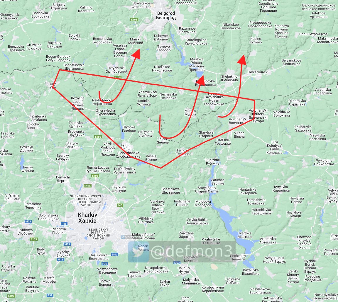
RuAF retreating from Izium over the Oskil river.
https://twitter.com/markito0171/status/1568910178556280835
This is the the crossing they are using
https://twitter.com/markito0171/status/1549079452205940736
I've mentioned this place a few times.
https://twitter.com/DefMon3/status/1545453265113989120
https://twitter.com/DefMon3/status/1549084257674563588
Changed Hnylytsya to liberated.
I have not geolocated the video but I think its likely its authentic.
I have not geolocated the video but I think its likely its authentic.
https://twitter.com/Militarylandnet/status/1568916167179513861

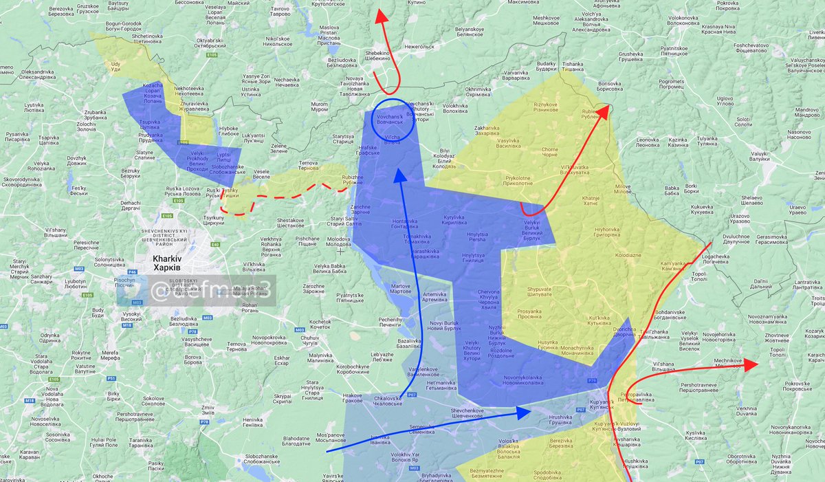
So far today I have changed 368 km2 to liberated, this is more than half of what RuAF managed to capture in 3 months.
And it's only 1 o'clock.
I did not count the Izium forest area.
And it's only 1 o'clock.
I did not count the Izium forest area.
According to pro russian map maker, RuAF have more or less evacuated the area north of Kharkiv city. Consider this unconfirmed.
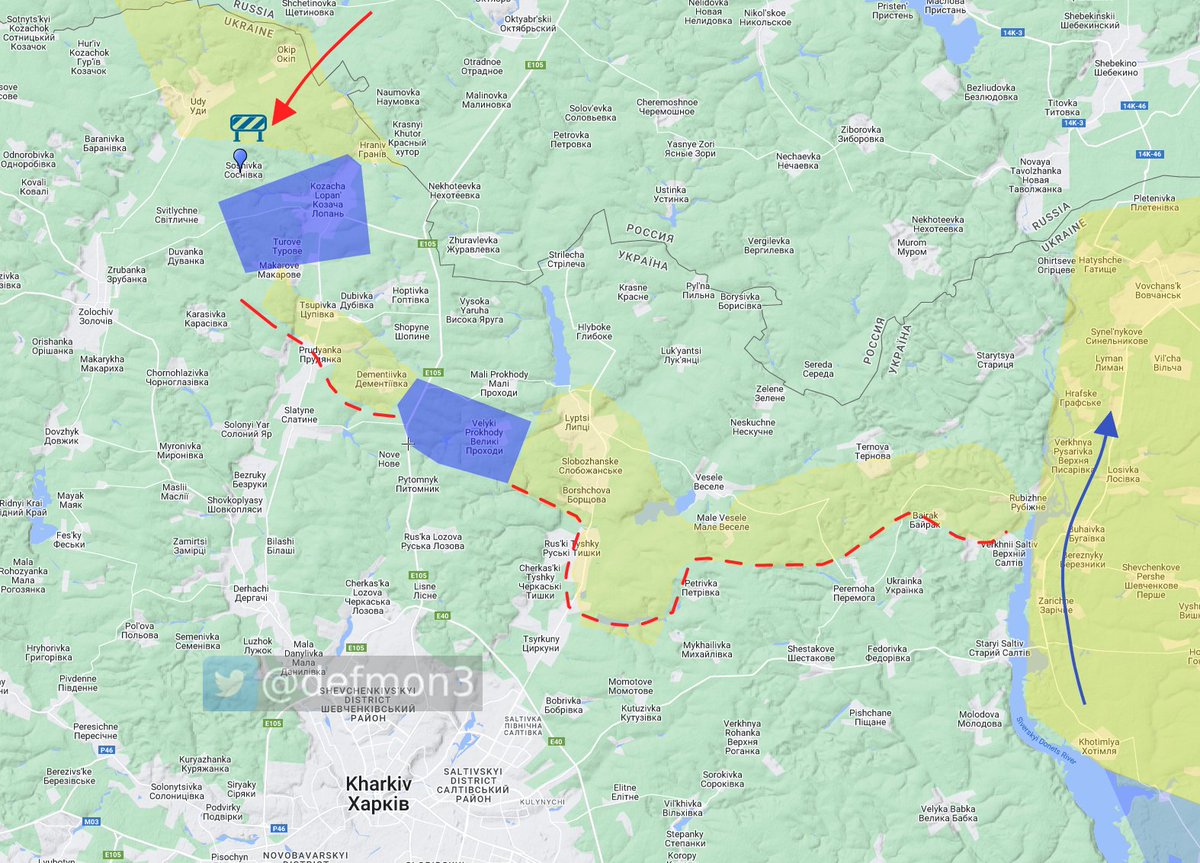
GSUA reported an attack in the area of Sosnivka today.
GSUA reported an attack in the area of Sosnivka today.
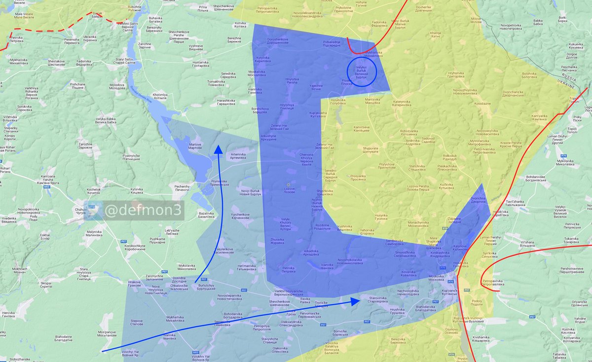
Changing Velyki Prokhody to liberated.
Non geolocated video. but it's obvious the Russians are on the run.
Non geolocated video. but it's obvious the Russians are on the run.
https://twitter.com/BarracudaVol1/status/1568920593428369408
RuAF have left Vovchans'k
I have not geolocated the video, but I believe the information is solid.
I have not geolocated the video, but I believe the information is solid.
https://twitter.com/tinso_ww/status/1568919678747115520
It seems the RuAF defenses has completely collapsed and they are running for the border, it will take time for the AFU to catch up and advance in a safe manner. This is why I have lowered the requirement a bit for what I report.
I now consider Tokarivka liberated with surrounding settlements.
No AFU visible, but I'm sure the Russians are gone.
No AFU visible, but I'm sure the Russians are gone.
https://twitter.com/tinso_ww/status/1568918904000348161
https://twitter.com/tinso_ww/status/1568918904000348161

According to this map by the Ru MoD, the RuAF have retreated to behind the Oskil river. This would mean Ukraine just liberated 8370 km2.

Good will gesture in Varvarivka
Lyptsi Liberated
Lyptsi Liberated
https://twitter.com/tinso_ww/status/1568934592027172865
https://twitter.com/Igor19840405/status/1568934128682434571
I'm sorry, I could not resist anymore.
Me about a month ago.
Me about a month ago.
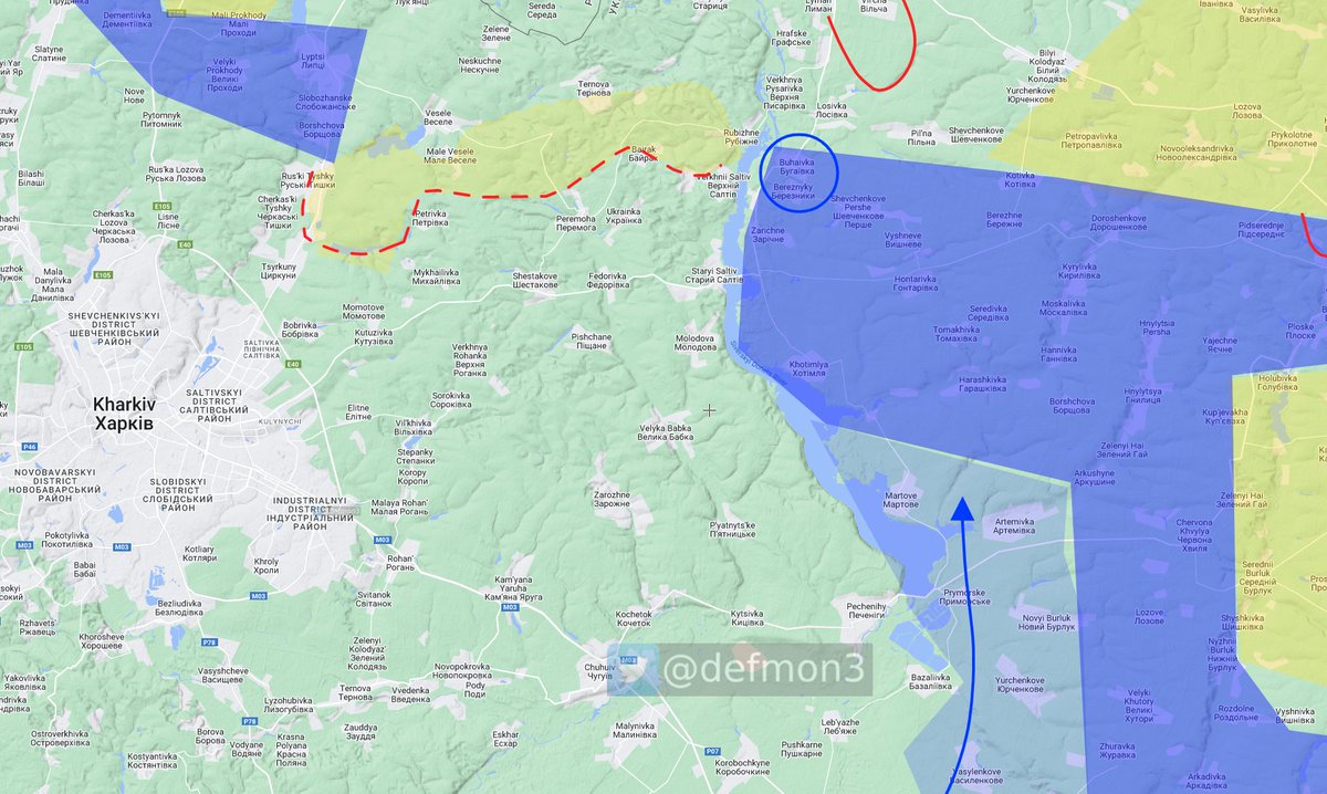
Buhaivka liberated
Along with that goes Zarichne and Khotimlya which were rumored to be liberated yesterday.
Along with that goes Zarichne and Khotimlya which were rumored to be liberated yesterday.
https://twitter.com/TpyxaNews/status/1568972199083606017
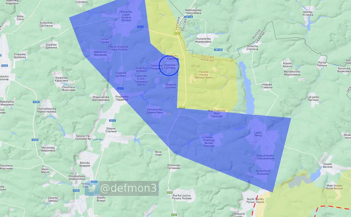
Hoptivka liberated
I'm sorry, I'm probably going to keep doing this for a few days.
I'm sorry, I'm probably going to keep doing this for a few days.
https://twitter.com/JimmySecUK/status/1568978406259277825
The size of the liberated area I've been able to confirm today amounts to 1509km2
This is colored in a darker blue.
This is colored in a darker blue.
GSUA reported 111 shelling locations todyay.

According to GSUA, the Russians attacked in two locations today, Velyki Prokhody and Sosnivka. Pretty strange considering the reports of them withdrawing, but it could also be reports lagging behind.

The usual crap along he Bakhmut - Donesk front. I'm not going to list them all as it's the same as usual.
Except for the attack around Ozeryanivka, I'm pretty sure i got the wrong one.
Except for the attack around Ozeryanivka, I'm pretty sure i got the wrong one.

GSUA stated:
The liberation of settlements from the Russian invaders continues. In the Kherson region, the occupiers also withdrew from their positions in some settlements.
The liberation of settlements from the Russian invaders continues. In the Kherson region, the occupiers also withdrew from their positions in some settlements.
There were two strange things in Kherson.
Sofiivka was shelled (there is one other possible location, but I think its this one)
and Zori was shelled, which I cant find.
Sofiivka was shelled (there is one other possible location, but I think its this one)
and Zori was shelled, which I cant find.
The AFU reached the RU border around Kudiivka north of Kharkiv, I expanded the liberated area all the way to the border.
https://twitter.com/tinso_ww/status/1569011686966714368

Seems I was wrong about Lyman, I see reports of Russians still in there. Back to contested.


Good night.
• • •
Missing some Tweet in this thread? You can try to
force a refresh


