Apropos current events, I thought it might be interesting, relevant or both to delve a little into the name of a certain street and dispel a few myths or misapprehensions about it. 🧵👇 
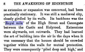
The Royal Mile of course is the ancient "high street" of Edinburgh's Old Town, marking the mile long route between Edinburgh Castle and the Palace of Holyroodhouse; long trodden by monarchs of Scotland, yes?
Well, no. Not really. Well, the bit about it being a mile long between the Castle and the Palace is correct, it almost exactly is. But that's a statute mile, not a Scots mile (which is ~200m longer) which should raise a slight suspicion as to how ancient it really is.
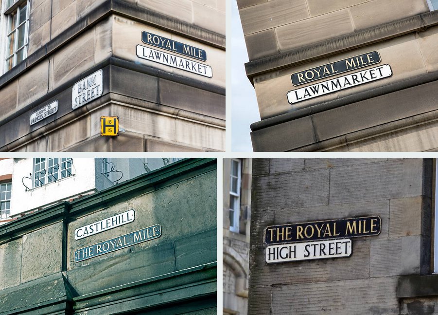
You also won't find any property with a street address on "The Royal Mile". You won't find it in any old Post Office directory listing.
No. The Royal Mile is a collective term for 4 distinct streets, which in days of yore were in 2 completely separate burghs. The Castle Hill, Lawnmarket and High Street were in Edinburgh and the Canongate was in the burgh of Canongate, shown in Kincaid's street map of 1784 (🗺️NLS)


Stuart Harris, who wrote the book on Edinburgh street names, takes particular exception to the term; "to use this label for the combined length of the separate historic market streets [Edinburgh and the Canongate] it is at cost of blurring the distinction between the two"
"it is not only meaningless historically, but unhappily gives an impression that this was a route created to link castle and palace, whereas the truth is that it came into being hundreds of years before the kings of Scots had anything to go with the fortress or the palace"
Harris notes that in medieval references it is given as "via Regia", the King's Way, but then that strictly was given to any public highway, with the adjoining streets and closes all being in private ownership in their respective burghs.
Using the "nickname" of Royal Mile he bemoaned was causing the erosion of the historic and distinct individual street names, "with a regrettable loss of civic dignity".
The route is undoubtedly ancient, a track will have existed along the spine of the Castle Rock since as long as people scratched out a living on its summit as a defensible place to survive. But how old are the streetnames and how old is the name "Royal Mile.?
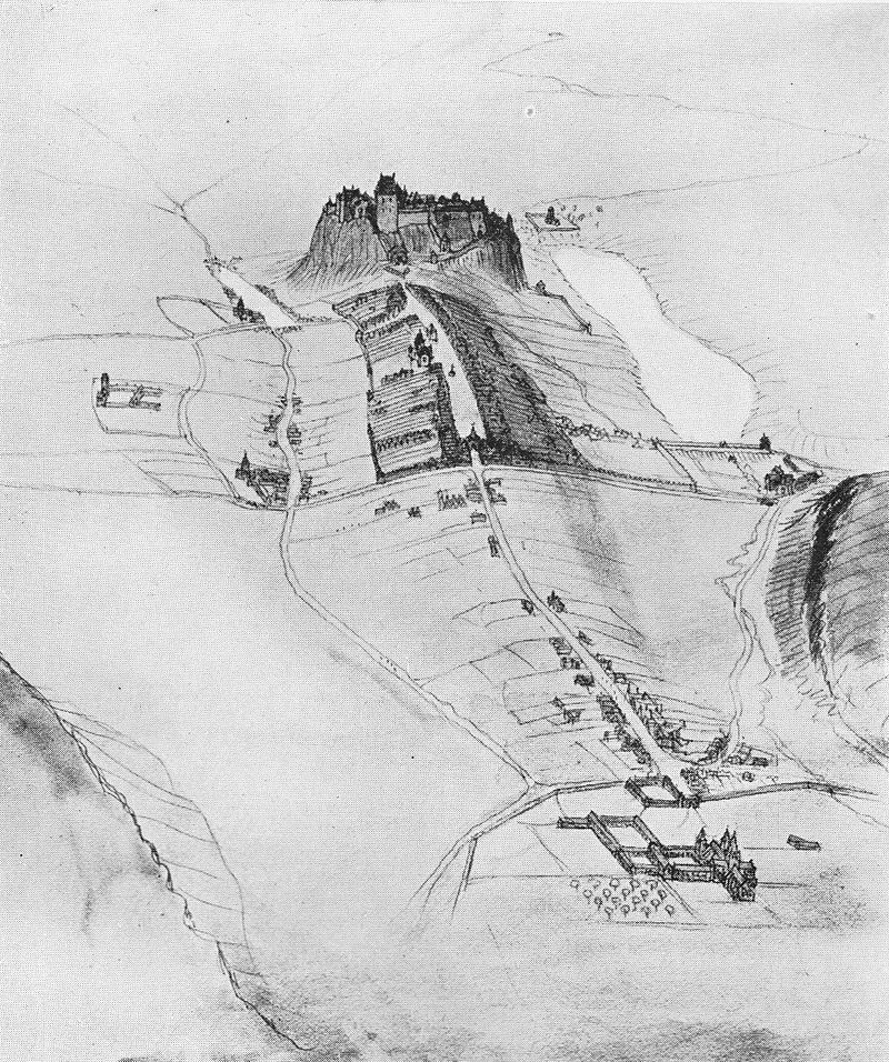
The earliest references to the High Street describe a "vicus foralis" or Market Street. By the 16th c. it's the "magnus vicus" or Great Street and by the start of the 17th it's the High Street or Hie Gate. This sketch reconstructs the 15th century birds eye view
The name Castle Hill, now partly buried beneath the 18th and 19th c. Esplanade, dates to at least 1484. It refers to the hill you climb to reach the Castle, the Castle itself sits on the Castle Rock. There's evidence to suggest that the Castle Hill predates the High Street.
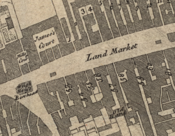
The Lawnmarket is nothing to do with lawns or selling fodder. Lawn is a corruption of Land; it was the Landmercatt, where people from the land outwith the burgh could trade, the main city market only being for traders of the burgh. Shown here in 1765 (🗺️NLS)
And the Canongate, the principle thoroughfare of the burgh of that name dates not long after the foundation of the Holyrood Abbey in 1128, first being recorded in 1363 as the "Vicus canonicorum" or "Canoungait", the way of the Canons (of the Abbey)
The burgh of Canongate, whose superiority was held by the Abbey until the Scottish Reformation, post-dated the street name and was established at some time in the 15th century.
And what of "The Royal Mile"?
Well, it's a term that first appears in the late 19th century. There are a couple of references to it in The Scotsman in the 1880 and 1890s, written in a manner that implies it was clearly understood locally.
Well, it's a term that first appears in the late 19th century. There are a couple of references to it in The Scotsman in the 1880 and 1890s, written in a manner that implies it was clearly understood locally.
But crucially, it's not given as a proper noun, it's the "royal mile", it's a descriptive nickname. It first appears in print probably in 1901, in "Edinburgh in the Nineteenth Century" by W. M. Gilbert. Again, with the quote marks and no capital on mile, it's clearly a nickname
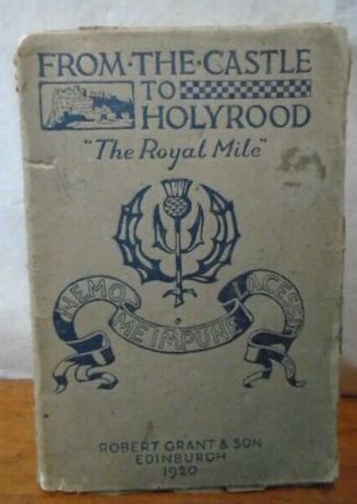
From here, use grows considerably. A burgh councillor, C. J. Mcarthy, gave a talk of that title to the Edinburgh Architectural Association in 1905, illustrated by magic lantern slides. By 1920, it's the title of a historical guidebook published locally, by Robert T. Skinner
And by the 1930s, the name and its mythical genesis is firmly embedded in the popular history books.

So there you have it. Yes, the Royal Mile or royal mile is a well accepted and established local name for the area between the Castle and the Palace, but as is often the case the accepted history is a relatively modern invention and divorced from reality. 🔚
Addendum - as it's been asked at least 4 times; "Is the Abbey Strand not included?"
Short answer, no. The Abbey Strand is formally within the "Girth" (boundary) of the Holyrood Abbey lands (the Royal lands after the Reformation), so it's where the Royal Mile starts/ends (🗺️NLS)
Short answer, no. The Abbey Strand is formally within the "Girth" (boundary) of the Holyrood Abbey lands (the Royal lands after the Reformation), so it's where the Royal Mile starts/ends (🗺️NLS)


The "Strand" (a Scots term) was a small stream/ditch/open sewer which ran across the open space at the foot of the Canongate, marked by the Girth Cross in its the centre. It gave its name to the municipal boundary gate here, the Water Yett.
The Abbey Strand marked the Holyrood sanctuary were debtors were free from persecution by their creditors. More than 1 well known Edinburgh personality in the 17th-19th century is recorded as fleeing to safety here. James Skene captured such a scene in 1820 (🖼️ECL)

You will still find brass "S" or "Scanctuary" (or Strand?) markers in the setts outside the Abbey Strand marking the boundary - the palace gates are more modern and set back from the boundary of its lands.

Even these are relatively modern, the actual boundary was probably defined by the Girth Cross. It is seen here in a 1585 illustration ("Edenburgum, Scotiae Metropolis", via NLS) Its position is marked by the circle of setts in the road these days.


Re-unrolled thread, including the bit about the Abbey Strand. threadreaderapp.com/thread/1569081…
Please check out my Soundcloud - by which I mean I do have c. 158 other Twitter threads on various interesting/ mundane/ obscure / unbelievable aspects of Edinburgh and Leith history if you are tickled by that sort of thing.
https://twitter.com/cocteautriplets/status/1561798261622640644?s=20&t=198FUpQKXiEOXuR4P6ItAg
• • •
Missing some Tweet in this thread? You can try to
force a refresh