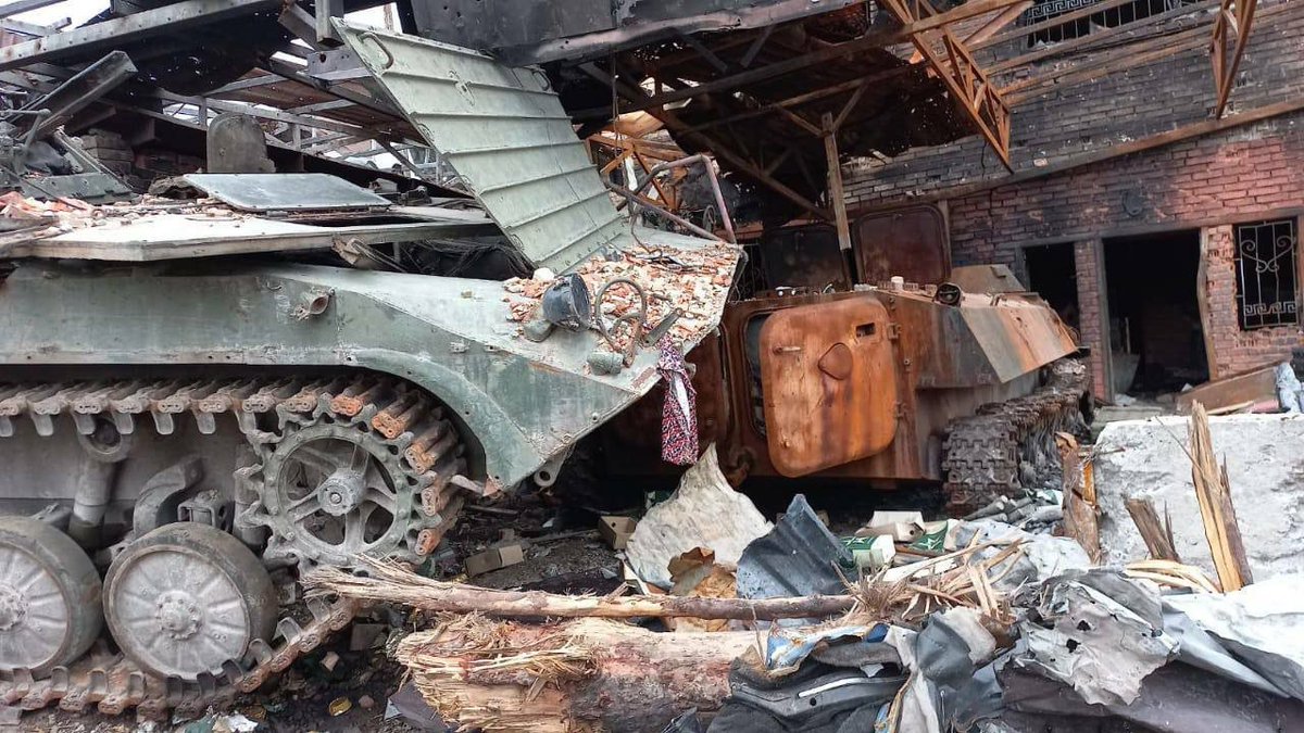
Appears that Ukrainian forces are back in control of Sviatohirsk. Images shared online show the Ukrainian flag at the city council building and soldiers in the city across the river from the Sviatohirsk Lavra.
There are also photos/videos from Bohorodychne nearby. This video shows what's left of the city's monastery buildings, one of which was destroyed on May 17 by an apparent Russian cruise missile strike.
Video showing the destroyed bridge in Sviatohirsk at which crosses the Siverskyi Donets River and connects the Lavra to the city. The city is back under Ukrainian control.
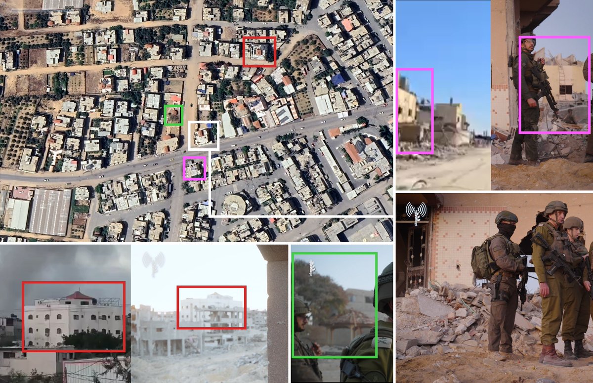
Geolocation for where Sinwar's body was found in Tal as-Sultan area. House is located at 31.3055, 34.2467. Gazebo (green) is visible with white tower (red) and house across the street (pink) visible in other reference imagery.
There's @planet PlanetScope imagery available for the area of UNP 6-52 from October 7 where, compared with September 30 PlanetScope imagery, we can see some changes in the area from possible military activity (new tracks, blackened fields, possible clearings).
There's limited SkySat imagery of Maroun El-Ras, but the most recent is unfortunately from September 29.
Compared with older imagery from June 5, can see there's some additional damage from airstrikes in the area, especially around the Iran-themed park at 33.09843, 35.45092.
Yesterday, RTÉ's @Mark_Coughlan reported on concerns by the UN over IDF tanks that were positioned near UNP 6-52: rte.ie/news/primetime…
Hard to say for sure without more reference imagery, but given the timeframe it's possible this is the New Al Bureij Cemetery which is one that the IDF carved a road through in early January.
Given the work from @NemoAnno geolocating the other videos shared by @ytirawi from the same Instagram account, it seems more likely that the above video was indeed filmed at the New Al Bureij Cemetery in early January.
Our new video investigation with @scrippsnews and @bellingcat documenting damage to important cultural heritage sites in Gaza is out.
Overall we looked at 150 sites, most of which are mosques, and which showed signs of being damaged or had been destroyed.
There were many archeological sites in our list, one of which is a 1,500 year old Byzantine mosaic found underneath an olive grove in 2022 near Bureij. At the time, it was hailed as one of the “greatest archaeological treasures ever found in Gaza”. bbc.com/news/world-mid…
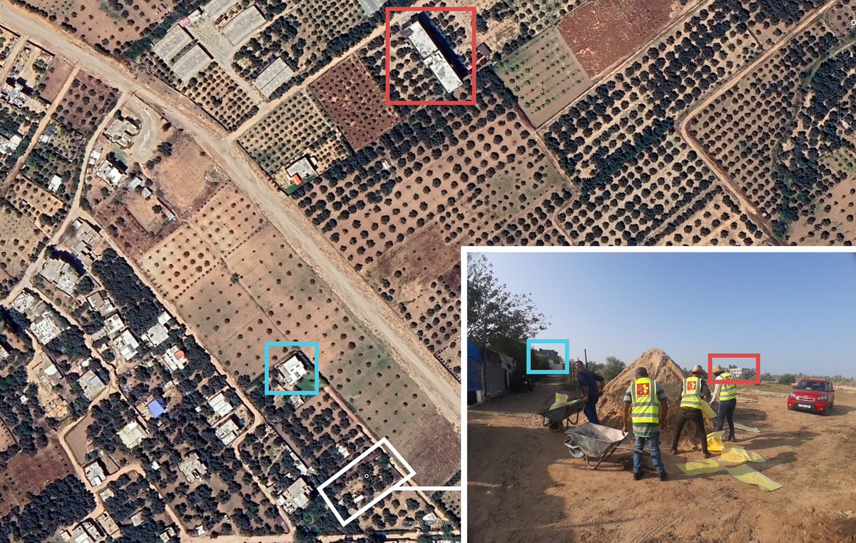
The location of the mosaic isn’t online, but we were able to geolocate it using photos from its excavation to an orchard east of Bureij about 1km from the border with Israel.
The excavation outline itself is actually visible in @Maxar imagery from October, as well, as seen here.
Area where reported IDF airstrike & fire took place in western Rafah tonight near the UNRWA facility still had a large amount of IDPs in it in May 24 @planet imagery.
Potential geolocation, possible image of large fire was at "Kuwaiti Peace Camp" just north of the warehouses.
Some additional reference imagery via Getty Images / Anadolu showing the site of the fire at the Kuwaiti IDP camp near the UNRWA logistics center during the daytime (CC: @TuiteroMartin).
Good spot by @Easybakeovensz of apparent munition remnants (US-made Small Diameter Bomb/GBU-39) visible in a video taken at the Kuwaiti Peace Camp shared on Telegram:
The same set of library shelves that are on fire in the background of the photo shared by Younis can be seen in an Instagram story saved by the IUG/Aqsa University Central Library in 2022.
Another note on this since there are people claiming it's AI-generated (?).
You can see matching visuals in other photos from the IUG Central Library's FB page, such as a matching "No Cell Phone" sign that appears to be in a different section.
And just further annotation for the 2022 Instagram video screenshot, in case people are missing what lines up...
While some of the tape on the shelves appears to have been removed over the years (bottom shelves in #37) one tape in particular has the same rip pattern on it.