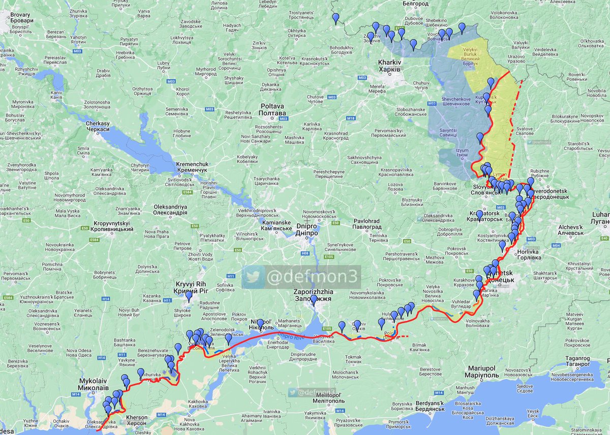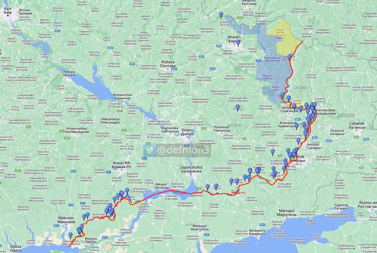
Update 🧵September 15th.
Visit the interactive map for more details and explanations.
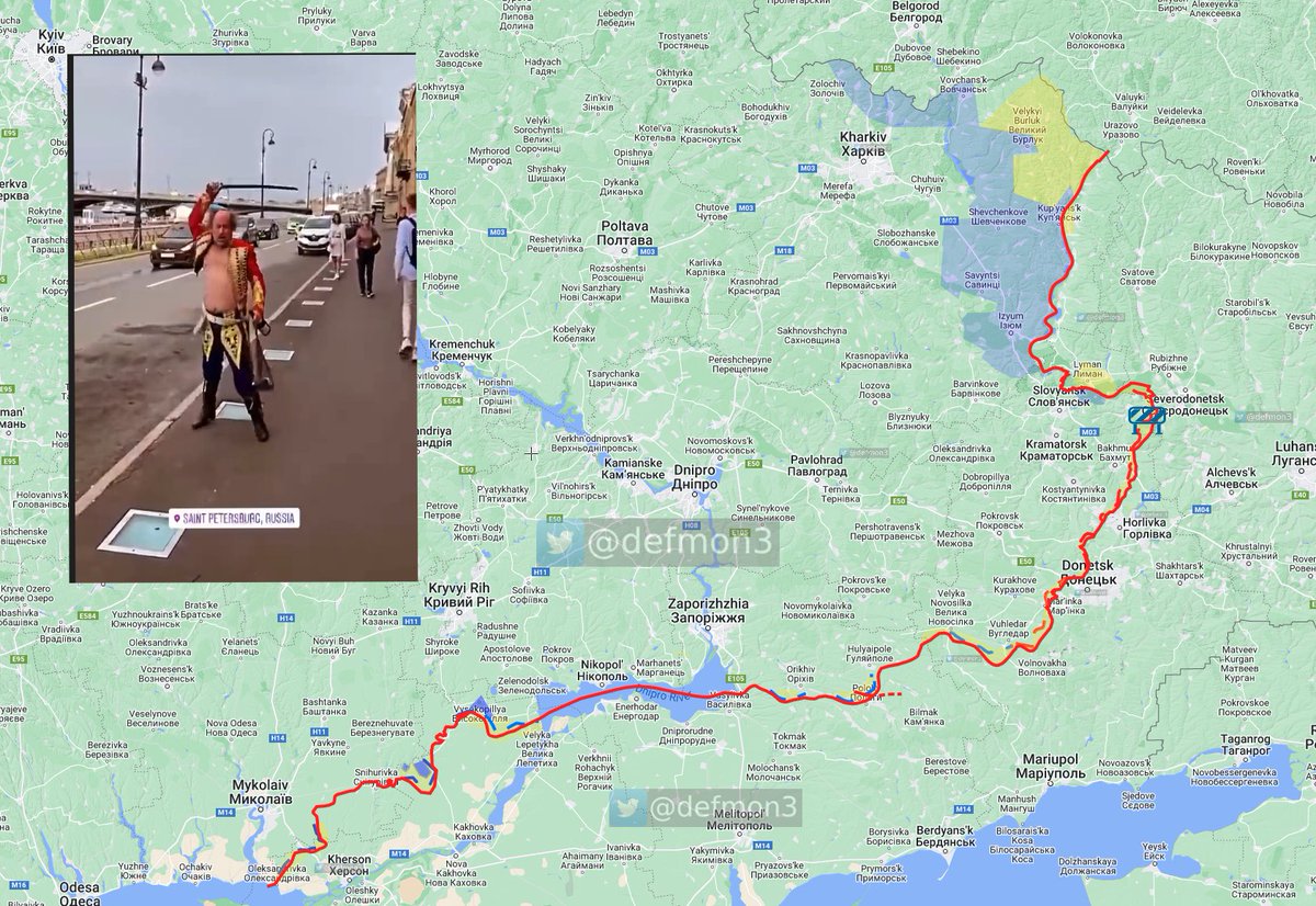
Todays presentation is brought to you by 2 Girls, 1 Drunk
Interactive map: scribblemaps.com/maps/view/Oper…
Visit the interactive map for more details and explanations.
Todays presentation is brought to you by 2 Girls, 1 Drunk
Interactive map: scribblemaps.com/maps/view/Oper…
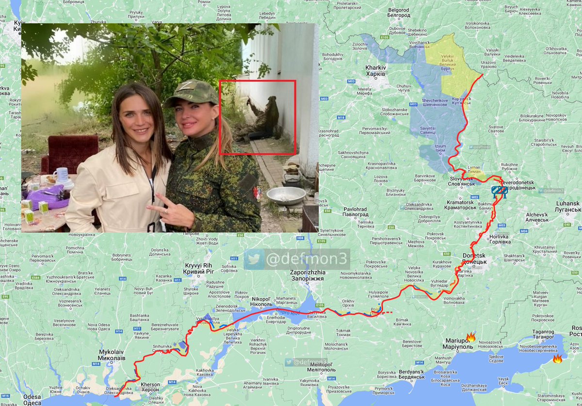
Nothing on FIRMS
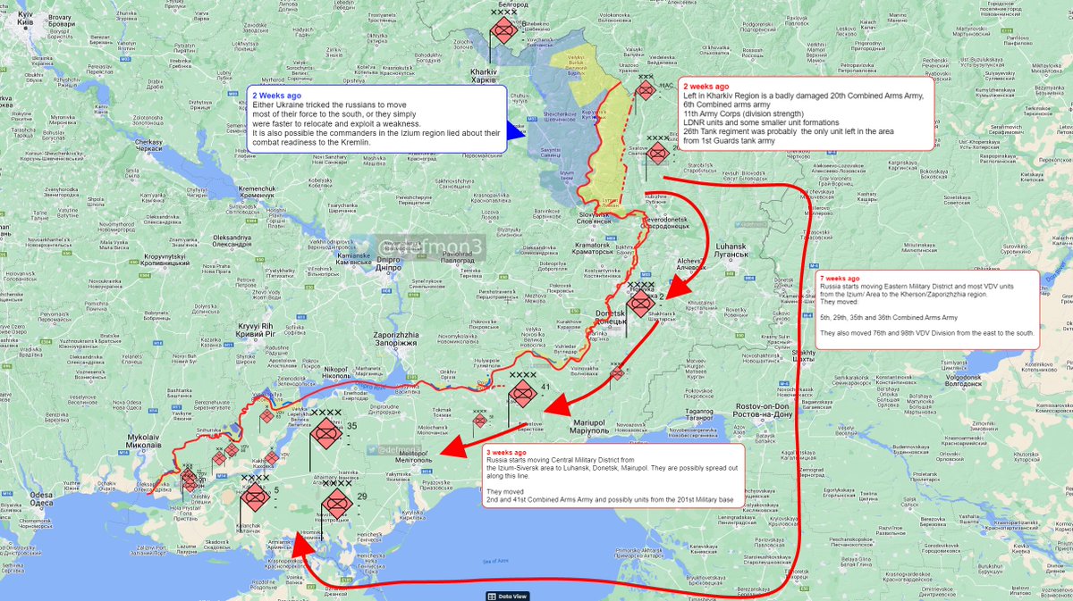
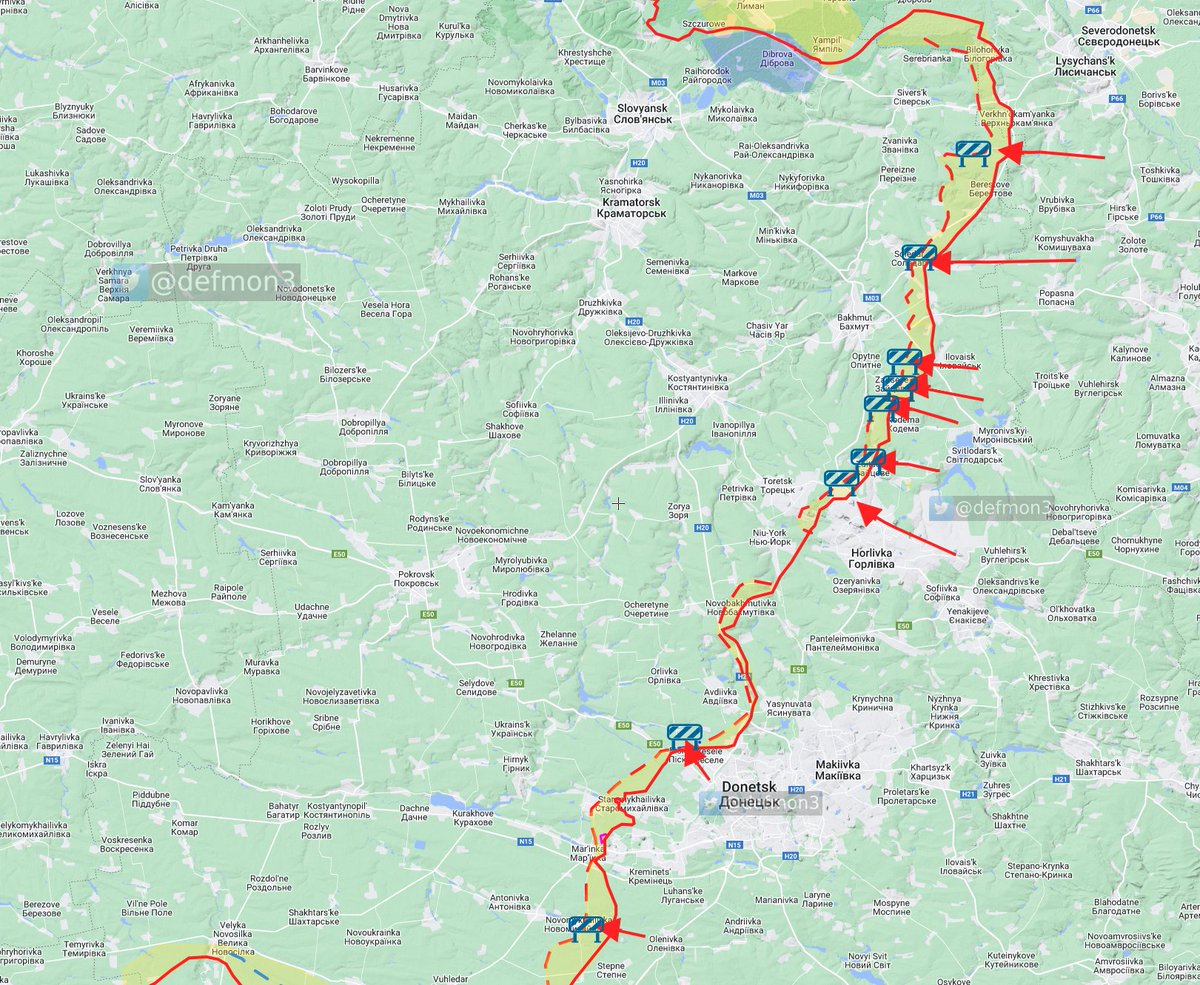
The total Russian maneuvering capability now fits in one image.
The AFU repulsed russian attacks in the area of:
Spirne, Soledar, Mayorsk, Zaitseve, Odradivka, Vesela Dolyna, Vodyane and Novomykhailivka.
The AFU repulsed russian attacks in the area of:
Spirne, Soledar, Mayorsk, Zaitseve, Odradivka, Vesela Dolyna, Vodyane and Novomykhailivka.
Kadyrovites on the Siversk front got an ass whopping recently and fled.
Bakhmut seems to be the main focus of the Russian offensive in the east, according to GSUA the 137th VDV regiment was moved from Izium to Bakhmut.
Bakhmut seems to be the main focus of the Russian offensive in the east, according to GSUA the 137th VDV regiment was moved from Izium to Bakhmut.
I find it unlikely the Russians will take Bakhmut in the foreseeable future.
GSUA stated the 202 rgt and the 204 rgt of the LDNR 2nd Army Corps has been withdrawn to Luhansk and will possibly be disbanded due to heavy losses.
They could be seen leaving Balakliya here.
They could be seen leaving Balakliya here.
https://twitter.com/GirkinGirkin/status/1568134122991718400
GSUA "stated In order to hold the temporarily captured territories, the enemy is trying to strengthen the first line of defense in the Donetsk and Zaporizhzhia regions..."
"...it is moving reserves from the units of the 3rd Army Corps, as well as the remnants of units that were withdrawn from the Kharkiv direction."
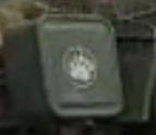
We have been seeing a lot of units with the inverted delta omega IFF markings moving in the direction of Luhansk->Donetsk->Mariupol
I think this marking is now the IFF of a new tactical group. Possibly formed by parts of the central military district and 3rd AC.
I think this marking is now the IFF of a new tactical group. Possibly formed by parts of the central military district and 3rd AC.
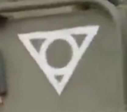
I am still a bit unsure about the 3rd AC, i have not really seen any of the equipment we saw them train with show up in ukraine.
Here are T-80s on transporters in Donetsk.
https://twitter.com/kr007t/status/1570175058810703872
This is another video of the paw formation showing T-80BVs and BMP-2Ms
t.me/milinfolive/90…
t.me/milinfolive/90…
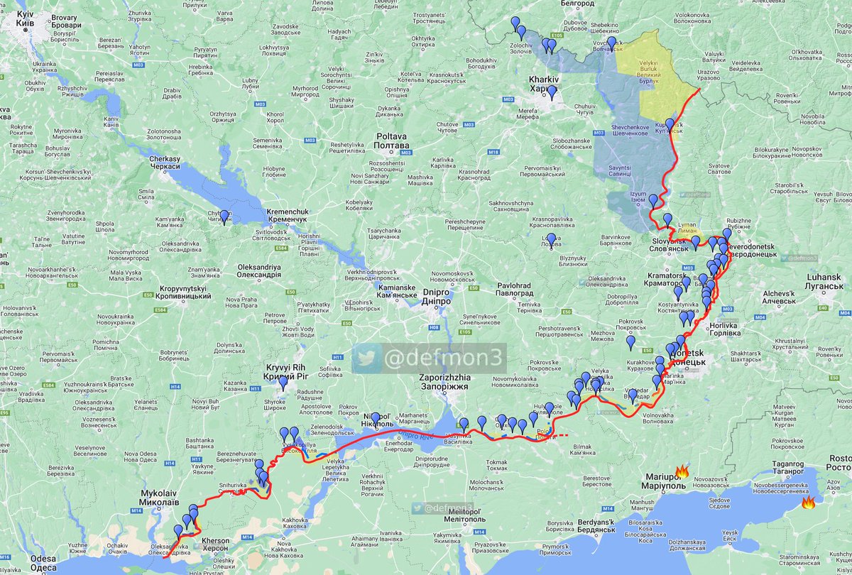
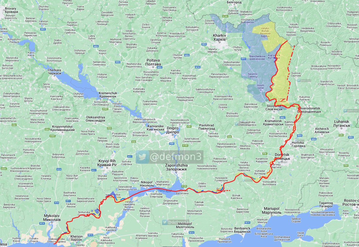
I think this is the current status in the Kharkiv region. I do not think the AFU has crossed the Oskil river from the west, but if they have, only to establish a bridge head. The bridge by Oskil is destroyed. 
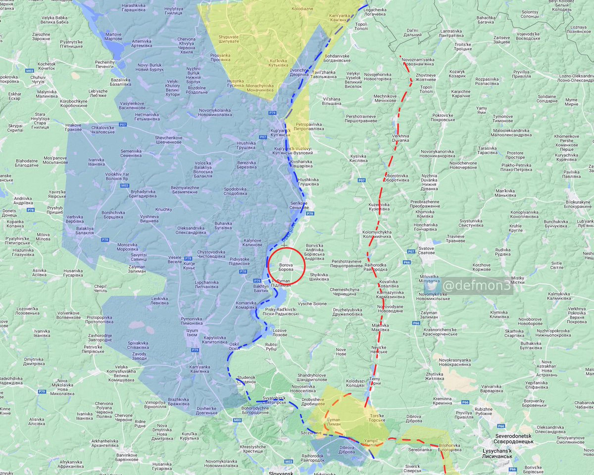
Russian forces seems to have set up along the Zherebets river, about 25km from the Oskil river. Just out of the "normal" 155mm artillery range.
I base this on report from the Borova administrative area council, rybars report of UA locations and places UA are asking for information about in various channels.
• • •
Missing some Tweet in this thread? You can try to
force a refresh

