Paul Blight Profile picture
Sep 25, 2022 6 tweets 4 min read Read on X
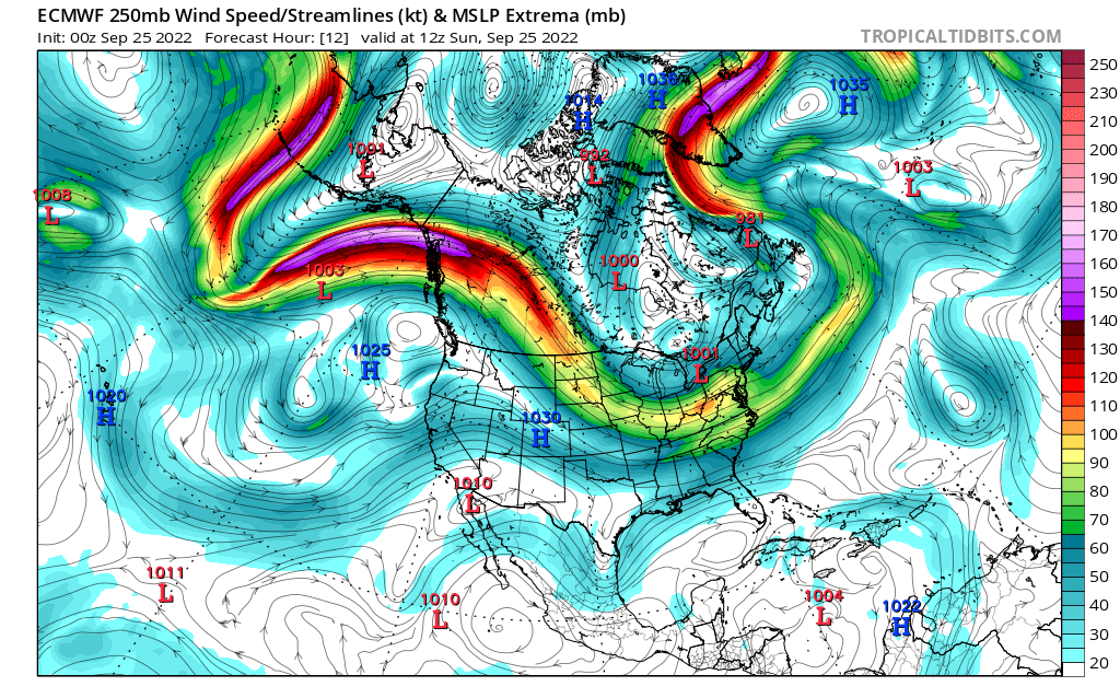
1/6 Despite a NOAA G-IV Dropsonde Mission & Multiple extra weather balloon launches over the Continental US overnight,there remains a clear split in the model guidance with the GFS & some of the GFS based Hurricane models further west than than the Euro Models (ICON, UKMET,ECMWF)
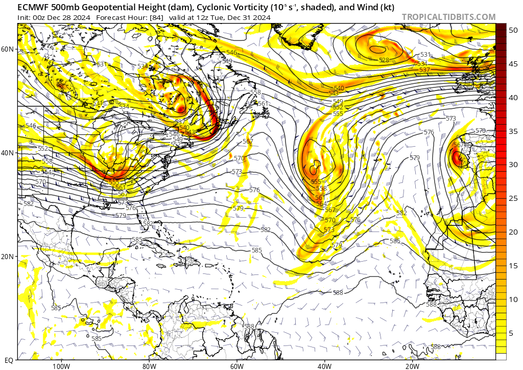
2/6 Studying the Upper Wind patter over N America over the next 3 days, a strong longwave trough over the Eastern US,extends south in both the GFS & ECMWF,but in the ECM the extension is stronger, this appears to be related to the strength of a Jet streak currently over NW Canada
3/6 which is forecast to dive into the rear of the trough over the next 48 hrs & extend it southwards. In the ECM this jet streak is stronger than in the GFS which serves to amplify & extend the base of the trough S/SW by a sig amount. This allows the trough to have a greater
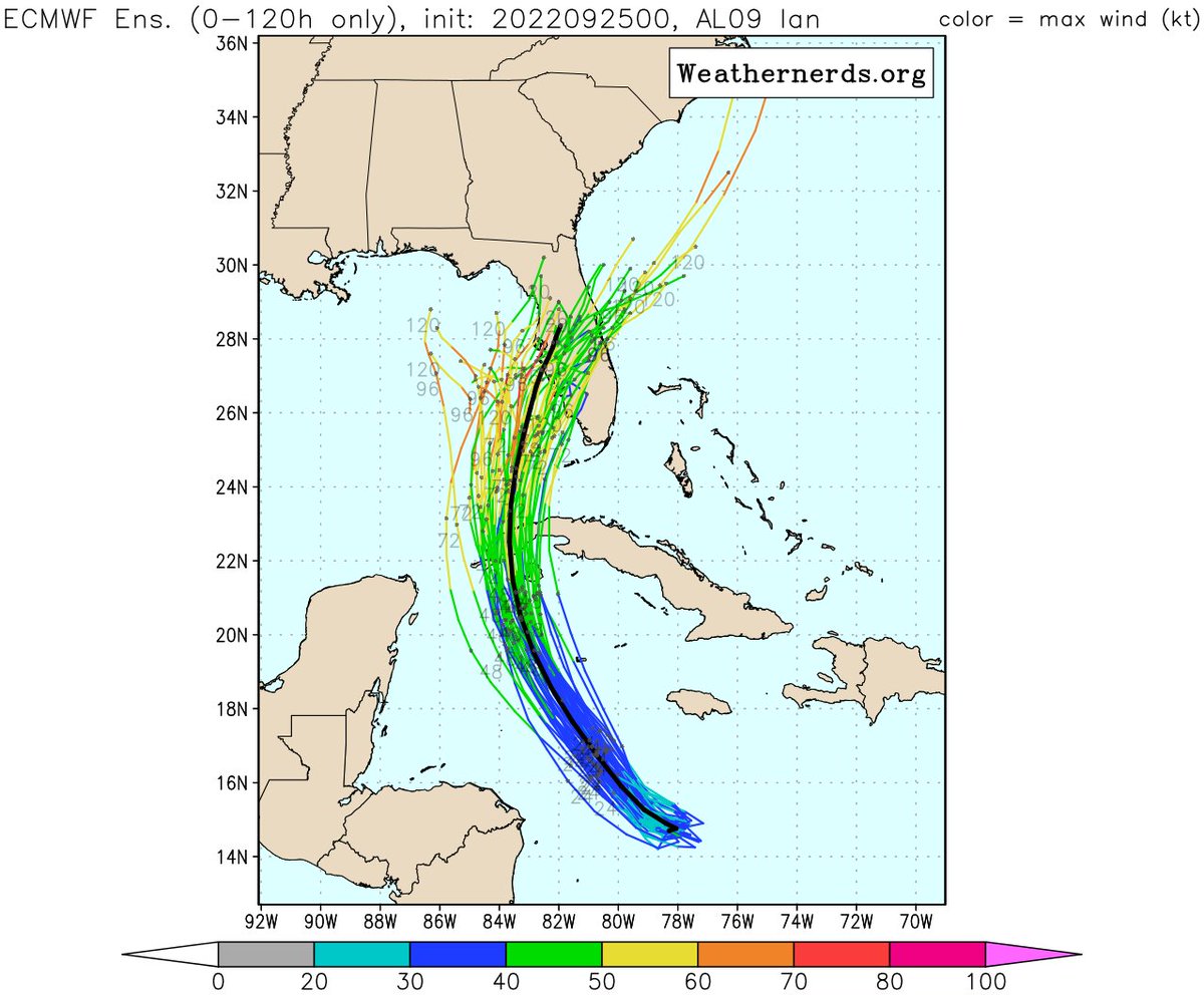
4/6 say over the steering influence it exerts over #Ian as it comes North near western Cuba. The Sharper trough can pick Ian up and steer it NE towards the Florida West Coast. Both the ICON & ECMWF pick up on a potential severe impact near #TampaBayFL
5/6 unfortunately this scenario if verified would allow #Ian to enter an area of strong Jet Right Entrance Divergence aloft & potentially intensify right up until landfall. If the GFS is correct & we get a less intense trough/Jet Streak moving south into the NE US then #IAn will
6/6 move further N towards US GulfCoast & feel the effects of v.dry air & hostile shear which will not be present if #Ian right hooks into W Florida. It appears the strength of the Jet stream currently over N Canada & exp to dive S into the US is crucial to getting models to agre

• • •

Missing some Tweet in this thread? You can try to force a refresh
 

Keep Current with Paul Blight

Paul Blight Profile picture

Stay in touch and get notified when new unrolls are available from this author!

Read all threads

This Thread may be Removed Anytime!

PDF

Twitter may remove this content at anytime! Save it as PDF for later use!

Try unrolling a thread yourself!

how to unroll video
  1. Follow @ThreadReaderApp to mention us!

  2. From a Twitter thread mention us with a keyword "unroll"
@threadreaderapp unroll

Practice here first or read more on our help page!

More from @PaulBlight6

Feb 21
Thursday's Wave Low is continuing to cause me some concern & is proving troublesome to the Model Guidance. The 00Z Runs of the ICON, ARPEGE & some ECMWF Ensemble members indicate the risk of a much deeper wave depression developing over CS/SE England during the afternoon. >>


Image
Image
Image
Image
this leads to a spell of potentially very strong winds in those models over parts of coastal S/SE England before clearing into the North Sea. A very active squally cold front is going to move east during Thursday. This ALL models agree on, however the shape & extent of the upper

Image
Image
Image
trough filament driving it is not agreed upon in the models. The upper trough then interacts with the frontal boundary over the Near Continent to form a wave low running NE. However in the ARPEGE & ICON this upper trough is sharper & more backed which allows for a deeper wave
Image
Image
Read 7 tweets
Nov 1, 2023
1/10) 1st November Morning Update #StormCiarán
The rapidly developing low is currently moving rapidly into the Eastern Atlantic around 987mbs, steady deepening occurring overnight, however it will soon move into the Left Exit region of the Powerful 200mph Jet. This will act like

Image
Image
Image
(2) a giant chimney & at 300mb (5 miles up) the air will rush outward rapidly, this means that air from the surface has to rapidly take its place which will cause the pressure to drop rapidly at the surface deepening the Storm. (That is called Divergence aloft) This causes the

Image
Image
Image
3) winds to begin to rapidly increase around the developing Storm. Unfortunately it now looks likely that the peak deepening phase will concur with the storm making its final approach towards NW Europe. Multiple Models now showing extremely strong gusts a probable over NW France
Read 10 tweets
Oct 31, 2023
(1) Tuesday Evening Update on #StormCiaran. Unfortunately we now have quite high confidence in a spell of potentially very damaging winds across NW France & the Channel Islands and preparations for #StormCiaran in #JerseyCI & #GuernseyCI should be completed as soon as possible.
(2) Ciaran could bring gusts over 90 & perhaps near to 100mph over the Channel Islands late on Wednesday Night & early on Thursday. Ciaran is currently SE of Newfoundland around 993mbs, currently sat under the Jet with only modest deepening. The 12Z St John's ascent analysed

Image
Image
Image
(3) a 165Knt Jet broadly in line with expectations. The Low will move rapidly across the Atlantic tonight & on Wednesday & approach the SW of Cornwall Weds Night. Models are now in good agreement on a track from Cornwall across SW then CS England & NE into East Anglia. Strongest


Image
Image
Image
Image
Read 7 tweets
Oct 31, 2023
(1/) 31st October AM Update on #StormCiaran. Increasingly confident about damaging winds affecting West Cornwall & Channel Islands, Coastal Sussex & Kent Kent. Remains on a knife Edge for other Southern Coastal Counties this morning.50-100Mile bounds will make a huge difference

Image
Image
Image
(2) #StormCiarán is currently located S of St Johns in Newfoundland, analysed at 997mbs at 07Z. The 00Z Ascent from Caribou Maine perfectly sampled the Powerful Jet across the far NE part of North America. This was at 180Knts or 207mph.This was under analysed by both the GFS &
(3) ECMWF. The ECM was expecting 163Knts & the GFS 168Knts. Therefore both of these models have underestimated the Jet at 00Z. The Jet 17Knts stronger than the models were anticipating. Given these starting errors one can only be moderately confident they have a good handle on
Read 10 tweets
Oct 29, 2023
(1/) The Embryonic Low which will highly likely become the next name storm is now developing along a developing frontal boundary over the Ohio Valley. This Low will move East across the Atlantic where it will come under the influence of the powerful 160-170Knt (nr 200mph) Jet Image
(2/) The low is set to deepen rapidly as it crosses the Atlantic, though there remains some uncertainty in the models with respect to when the most explosive phase of deepening will occur & how near this is to the UK. The 00Z Suite of models have backed off (thankfully) a little Image
3/) from the very concerning extreme solutions seen on Saturday evening. However there is still cause for serious concern with where this low tracks. There is 100-200m Spread in some of the solutions, which if the low is passing NW of the UK doesn't make that much difference

Image
Image
Image
Read 8 tweets
Oct 28, 2023
(1/) There is growing support this morning from the UKMET, ICON, JMA, Canadian, ECMWF Ens, for a track for Wed/Thurs Low (which will become Storm Ciaran) for a track across the Atlantic emanating from a developing embryonic Low on a very tight Baroclinic Zone (Thermal boundary) Image
(2/) over the NE USA. The Low moves rapidly east towards the SW Approaches, then turns NE across the UK. The ECWMF Operational is now somewhat on its own (with a few ensemble members) in turning the Low across Ireland, However the majority of the Ensemble + the UKMET, ICON, GFS Image
(3/)turn the storm NE across the Celtic Sea then NE Across Wales, Northern England towards Eastern Scotland. The Multi Model Consensus + The ECMWF Ensemble is now showing reasonably good support for this trajectory. The GFS Ensemble is still showing too much noise for my liking,
Read 8 tweets

Did Thread Reader help you today?

Support us! We are indie developers!


This site is made by just two indie developers on a laptop doing marketing, support and development! Read more about the story.

Become a Premium Member ($3/month or $30/year) and get exclusive features!

Become Premium

Don't want to be a Premium member but still want to support us?

Make a small donation by buying us coffee ($5) or help with server cost ($10)

Donate via Paypal

Or Donate anonymously using crypto!

Ethereum

0xfe58350B80634f60Fa6Dc149a72b4DFbc17D341E copy

Bitcoin

3ATGMxNzCUFzxpMCHL5sWSt4DVtS8UqXpi copy

Thank you for your support!

Follow Us!

:(