
34 Year Interest in Satellite/Tropical/Synoptic/Convective Meteorology -Writer of Weather Discussions & Nowcast Updates. I try to make the Technical Accessible


 this leads to a spell of potentially very strong winds in those models over parts of coastal S/SE England before clearing into the North Sea. A very active squally cold front is going to move east during Thursday. This ALL models agree on, however the shape & extent of the upper


 (2) a giant chimney & at 300mb (5 miles up) the air will rush outward rapidly, this means that air from the surface has to rapidly take its place which will cause the pressure to drop rapidly at the surface deepening the Storm. (That is called Divergence aloft) This causes the


 (2) #StormCiarán is currently located S of St Johns in Newfoundland, analysed at 997mbs at 07Z. The 00Z Ascent from Caribou Maine perfectly sampled the Powerful Jet across the far NE part of North America. This was at 180Knts or 207mph.This was under analysed by both the GFS &
 (2/) The low is set to deepen rapidly as it crosses the Atlantic, though there remains some uncertainty in the models with respect to when the most explosive phase of deepening will occur & how near this is to the UK. The 00Z Suite of models have backed off (thankfully) a little
 (2/) over the NE USA. The Low moves rapidly east towards the SW Approaches, then turns NE across the UK. The ECWMF Operational is now somewhat on its own (with a few ensemble members) in turning the Low across Ireland, However the majority of the Ensemble + the UKMET, ICON, GFS
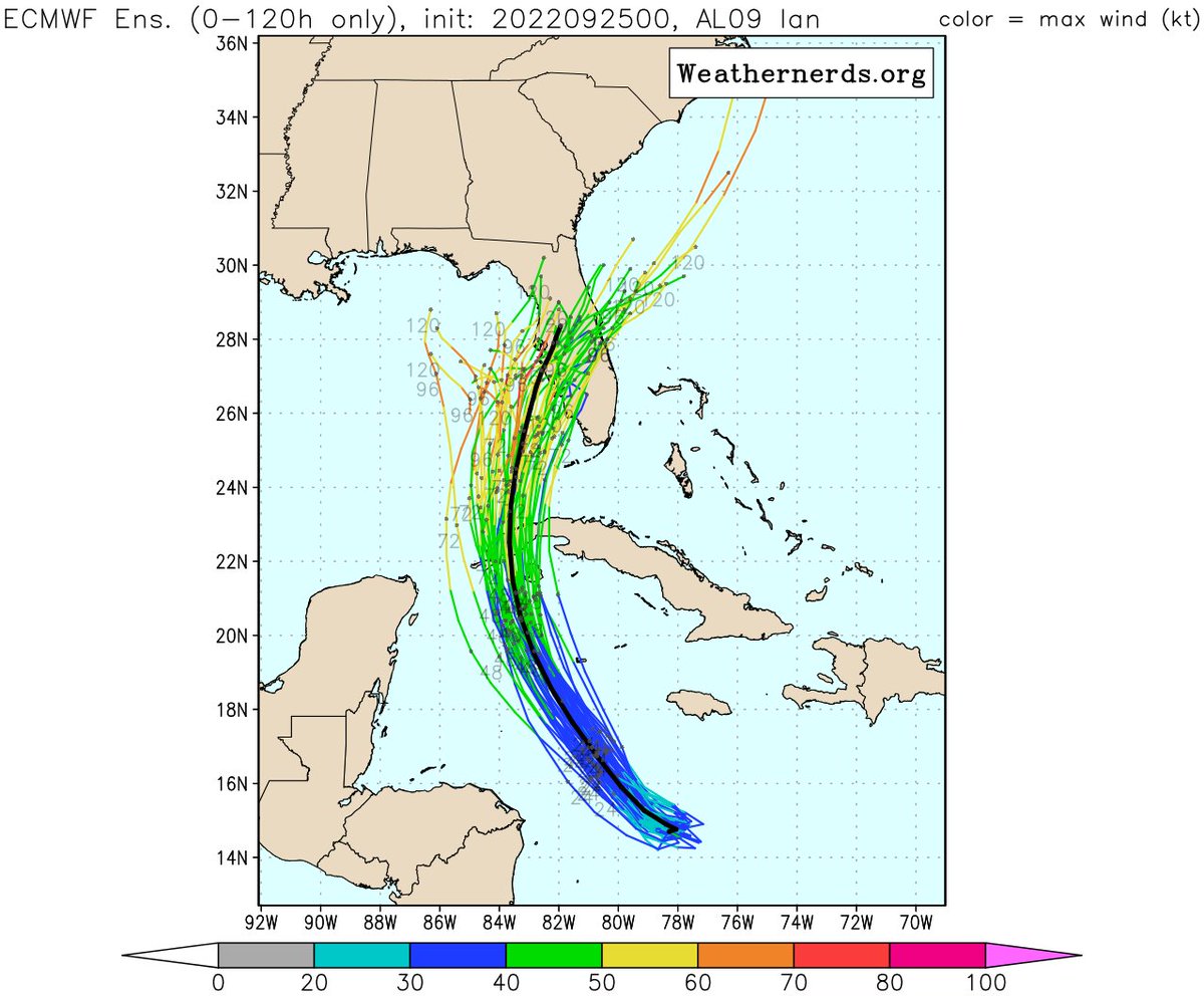
 2/6 Studying the Upper Wind patter over N America over the next 3 days, a strong longwave trough over the Eastern US,extends south in both the GFS & ECMWF,but in the ECM the extension is stronger, this appears to be related to the strength of a Jet streak currently over NW Canada
