Hurricane #Ian is starting to undergo extratropical transition tonight on its way to the Carolinas. Notice the big dry slot sneaking in from the SW and frontal boundary extending from #Ian's south into the Bahamas...
Fwiw, one of the simplest methods I use to discern b/t tropical & extratropical cyclones is to locate the subtropical jet & assume everything poleward/north of that is extratropical, while to the south = tropical. #Ian is in the middle rn => "hybrid" warm core/subtropical cyclone 

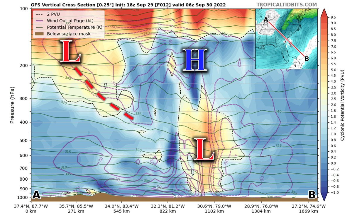
This method checks out here. PV x-sect for #Ian has elements of both tropical & subtropical cyclones atm. Low-mid lvl PV tower overlaid by an outflow high is characteristic of tropical cyclones but the intruding upper trough from the NW is the hallmark of an extratropical cyclone 

The TC phase space diagrams from the latest HWRF run also generally support both of these previous tweets showing that #Ian is a subtropical cyclone, perhaps w/ a warm core/tropical lean (if anything). 


The latter pt about #Ian still leaning tropical is dynamically consistent from a simpler subtropical jet (STJ) perspective too, b/c #Ian is near the middle of the STJ, but comes from the tropical/barotropic side; these warm cores tend to persist a bit during the initial ET phase
In any case, I'm just trying to provide some perspective/insight into these tricky extratropical transitions (ET) that go beyond subjectively discerning a cyclone's characteristics based on eye-catching satellite loops 😃
• • •
Missing some Tweet in this thread? You can try to
force a refresh


