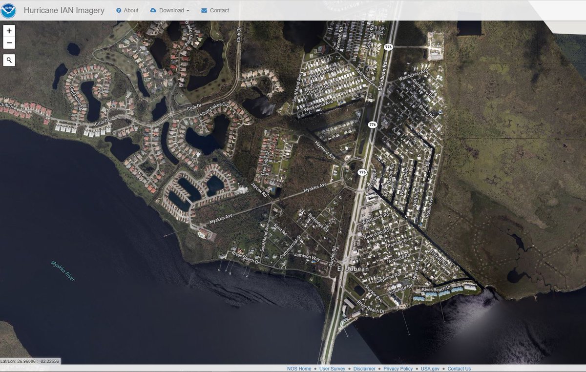
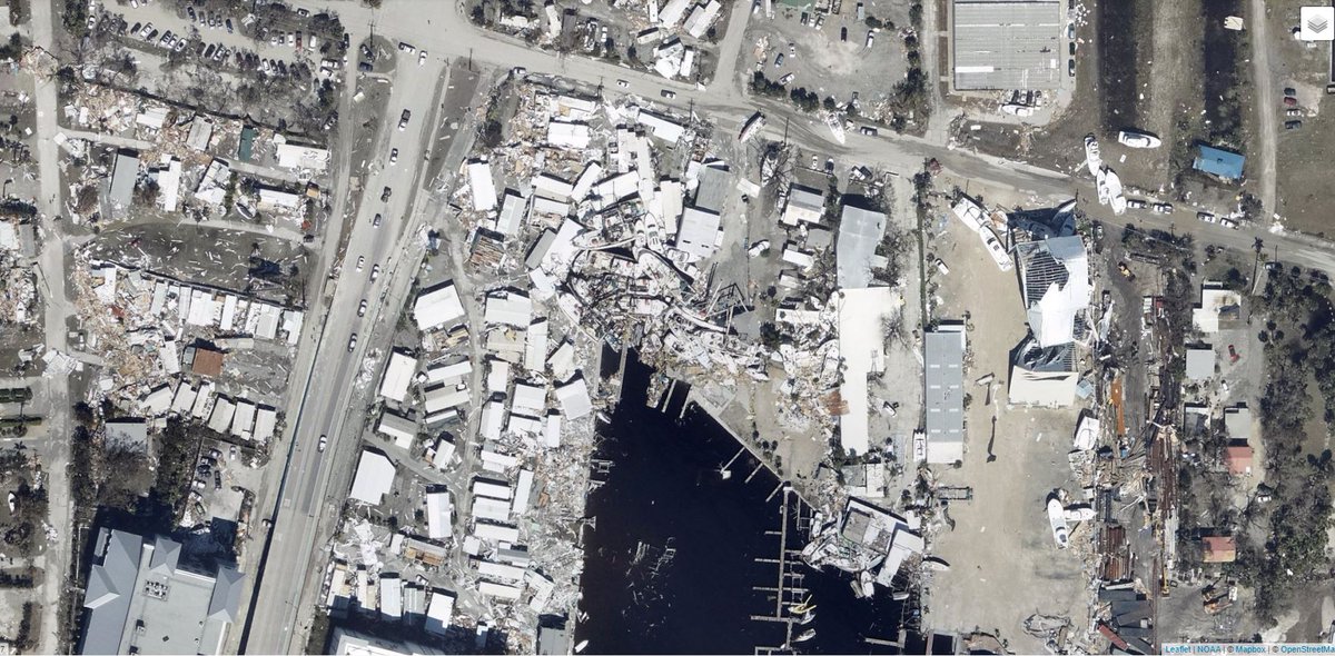
NOAA has published a remarkable tool to allow you to look at #HurricaneIAN damage in Florida and beyond.
This image shows the heart of the coverage of the satellite data - From Naples up to Venice. Imagery reveals how concentrated extreme damage is. oceanservice.noaa.gov/news/sep22/ngs…
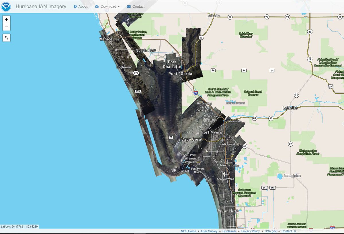
Fort Meyers Ground Zero
More...
Still Fort Meyers.
Sanibel Island.
Sanibel Causeway
Naples
Punta Gorda area including up Peace River
Port Charlotte
Further inland the wind damage is more random, and it is clear that the extent of damage depends on the construction of buildings. Trailer Parks are particularly badly effected. But not all.
This Trailer Park on the right is in Fort Meyers town, up river - and appears in ok shape. The image on the left is adjacent to it and shows extensive wind damage to trees.
Here's an area of mobile/moveable homes in Venice.
In the third image here it looks as if a tornado touched down -and completely smashed a handful of dwellings.
Also in Venice this area is by the sea - larger houses minimal sign of damage. Note that Venice is a quite a long way north of Fort Meyers.
This is from an area in between Venice and Fort Meyers and shows the conrtrast in damage between three areas of housing.
If @realDonaldTrump chooses to join Netanyahu’s genocidal campaign if he is not obeyed …. he WILL find himself indicted in the international criminal court in The Hague.
And he will then have to make a decision on whether he is willing to remain in the U.S.
@realDonaldTrump Should he proceed as he has intimated that he should now be pursued by protestors everywhere he goes.
There is a lot of concern about evacuations of civilians from Gaza in the flotilla as anyone leaving may not be able to return any time soon. /2
But the moral hazard here is palpable. There are thousands of injured and starving mostly women and children. And we saw the young babies dying in the hospitals in the early stages of this war. /3
More and more naval vessels from Europe and the Middle East are being deployed to protect the Global Samir Flotilla as it moves slowly but surely towards Gaza where it intends to deliver aid and global attention. /1
Attacks from drones on the flotilla have resumed and Israel is presumably responsible for this. It is because of this that naval vessels from Europe are now joining the flotilla to protect their citizens rights of travel in international waters. /2
The escalation appears fairly slow at present and the flotilla is still within Greek waters at present /3
The #Samud #GazaFlotilla is currently sailing across the Ionian Sea towards the island archipelago south east of Athens in the Western Mediterranean. Conditions appear good for this leg that departed from Sicily after leaving Tunisia. The Flotilla set off from Barcelona.
2/ this current leg is 860 kms roughly and lead boats in the 51 vessel flotilla are currently approaching south western Greece. You can follow the flotillas progress here >> flotilla-orpin.vercel.app
3/ After two drone attacks on flotilla boats in Tunisia the flotilla sailed first to Sicily where it was joined by several more boats. And this map shows the path of the flotilla so far. The numbers in the dots indicate more vessels joining #GazaFlotilla