
NOAA has published a remarkable tool to allow you to look at #HurricaneIAN damage in Florida and beyond.
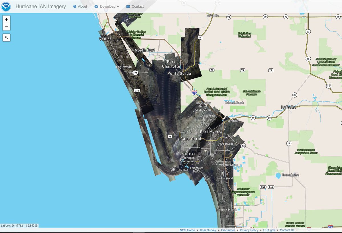
This image shows the heart of the coverage of the satellite data - From Naples up to Venice. Imagery reveals how concentrated extreme damage is.
oceanservice.noaa.gov/news/sep22/ngs…
This image shows the heart of the coverage of the satellite data - From Naples up to Venice. Imagery reveals how concentrated extreme damage is.
oceanservice.noaa.gov/news/sep22/ngs…
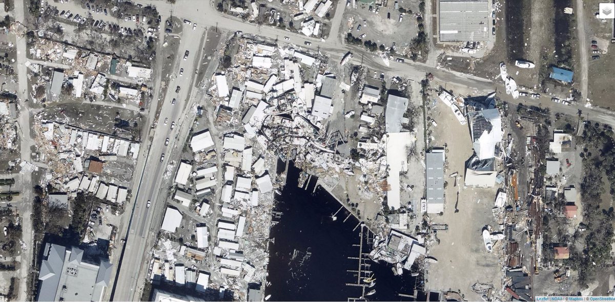
Fort Meyers Ground Zero


More...


Still Fort Meyers.

Sanibel Island.


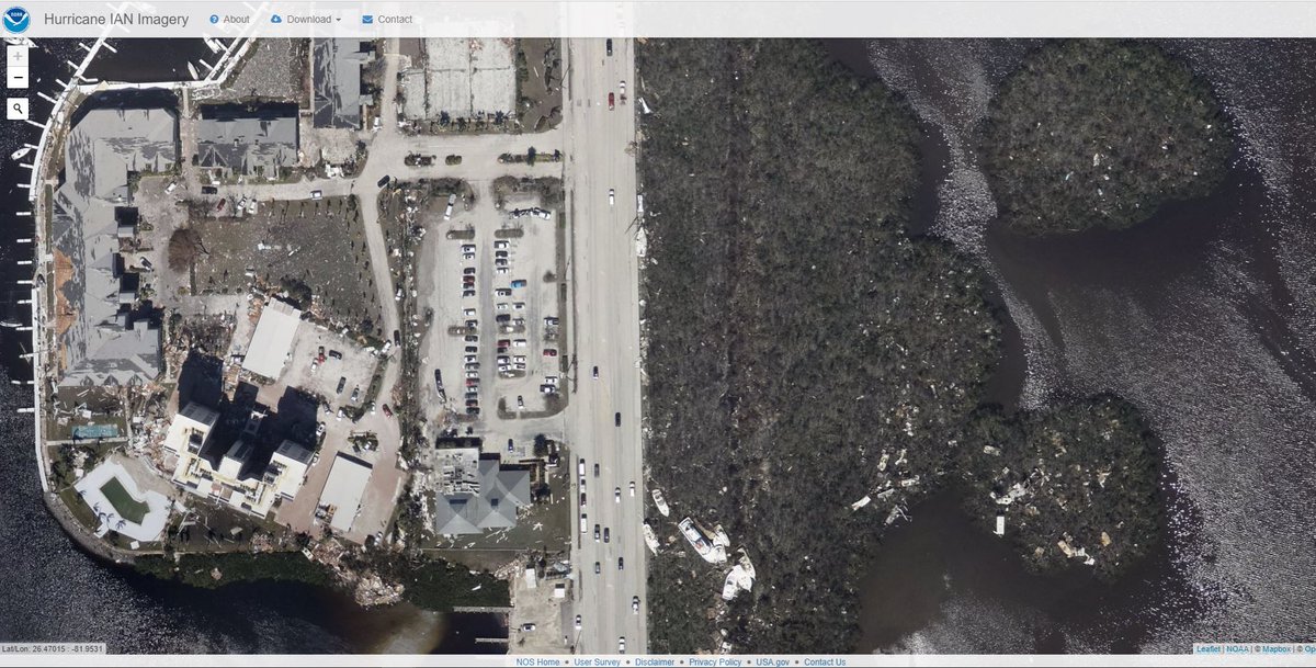
Sanibel Causeway


Naples


Punta Gorda area including up Peace River


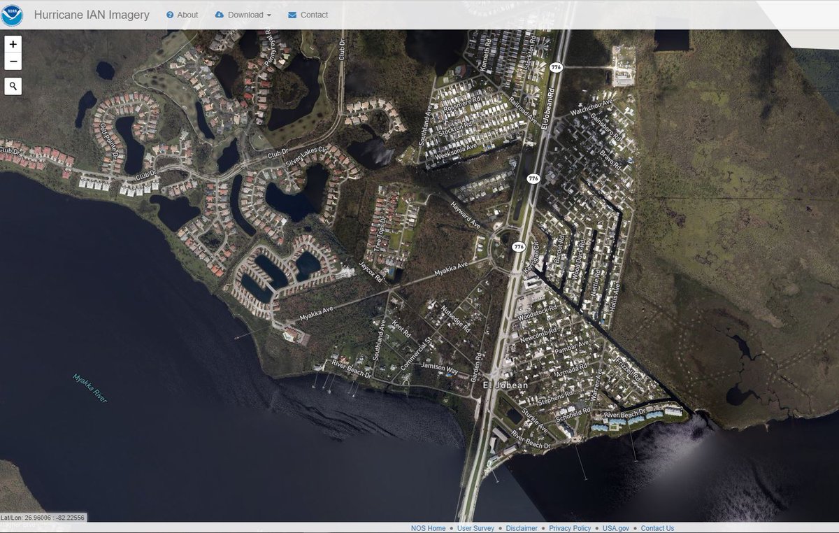
Port Charlotte


Further inland the wind damage is more random, and it is clear that the extent of damage depends on the construction of buildings. Trailer Parks are particularly badly effected. But not all.


This Trailer Park on the right is in Fort Meyers town, up river - and appears in ok shape. The image on the left is adjacent to it and shows extensive wind damage to trees.


Here's an area of mobile/moveable homes in Venice.

In the third image here it looks as if a tornado touched down -and completely smashed a handful of dwellings.


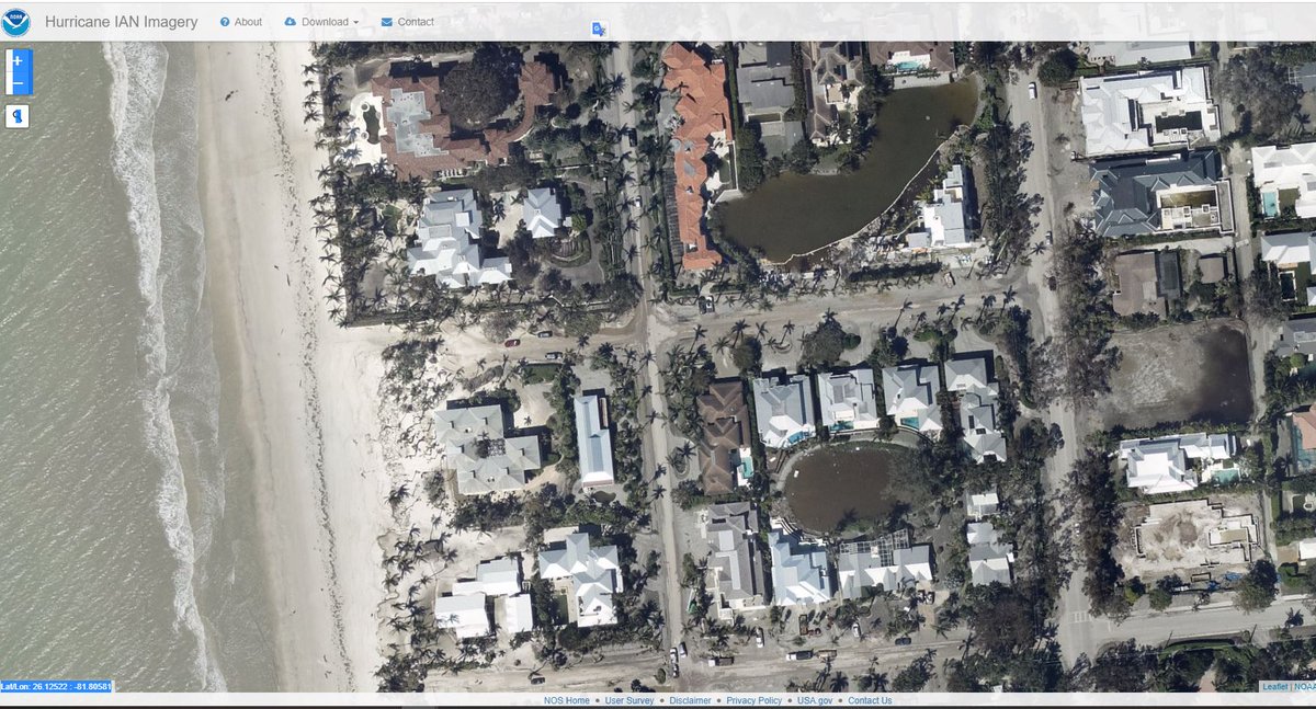
Also in Venice this area is by the sea - larger houses minimal sign of damage. Note that Venice is a quite a long way north of Fort Meyers.

This is from an area in between Venice and Fort Meyers and shows the conrtrast in damage between three areas of housing.

1. Least Damage
2. Lesser Damage
3. Most Damage
These areas are all in roughly the same place.
2. Lesser Damage
3. Most Damage
These areas are all in roughly the same place.


/ENDS
@ThreadreaderApp Unroll
@ThreadreaderApp Unroll
• • •
Missing some Tweet in this thread? You can try to
force a refresh


