
Cat 1 #HurricaneJulia is now making landfall over Nicaragua, its core covers 3/4 of the Eastern Seaboard and will extreme rainfall is underway over more than 50% of the country already. The scale of the storm is comparable to #HurricaneIAN was at Cat 5 on approach to Florida. 
https://twitter.com/althecat/status/1578909013349400576
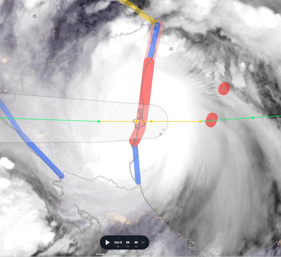


#HurricaneJulia's IR presentation on landfall. The colour gradation represents cloud top temperature with yellow representing the coldest and highest parts of the cyclones structure.
Forecasts expect #HurricaneJulia to decay rapidly, but as it is travelling over very warm rainforested areas with lots of recent rain, and it is dragging in moisture from a very wide area of convection it may maintain more integrity than expected.
Here is the current HRWF hurricane model foreast for Monday evening. A "Wind Gap Event" associated with the narrow isthmus between the Gulf of Mexico and the Pacific Ocean in southern Mexico is currently forecast to dissipate the storm shortly after this moment.

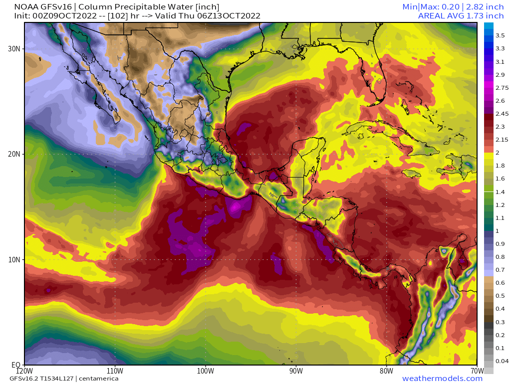
Rainfall however will continue for the next two weeks in the area, with the heaviest falls modelled for the Pacific Coast Colombia and Southern Mexico west of the Yucutan Peninsula.

The expected #extrremeWeather rainfall and wind events are exacerbated by a dry air blast coming south from the arctic over the United States arriving in the region 13th October.
This series of images shows how current models expect this interaction to look from an atmospheric water perspective between 12 and 17 October.


During this unusual warm dry air event over continental North America, minimal amounts of precipitation are expected across nearly the entire North American Continent.
The atmospherics physics explanation for the series of warm dry Acrtic air blasts in the weather model appears to be a burst of hot air originating over the northern Pacific and Siberia which persists over Canada throughout the forecast period.
This animation shows the atmospheric height anomaly (which correlates with high pressure) over the Continental US.
/ends
@Threadreaderapp unroll
@Threadreaderapp unroll
• • •
Missing some Tweet in this thread? You can try to
force a refresh


