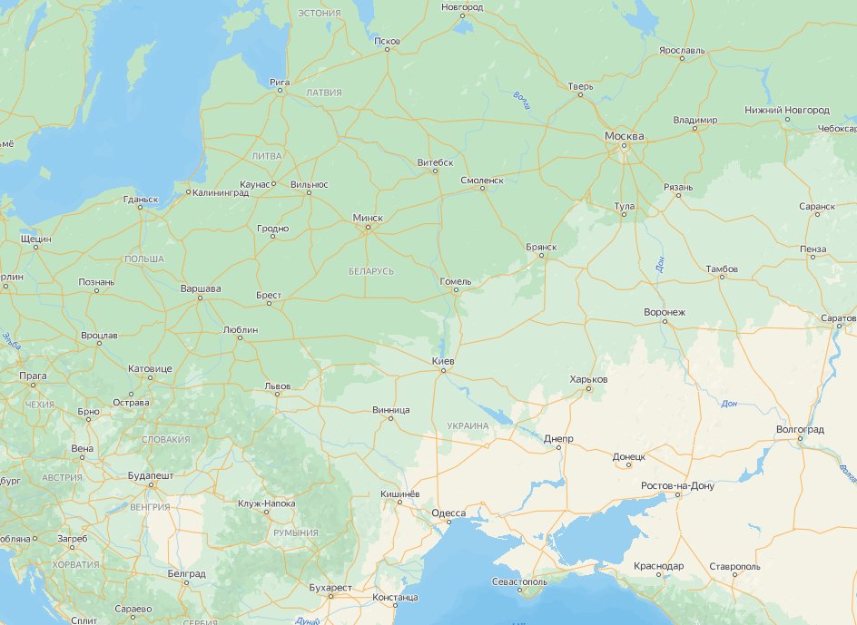
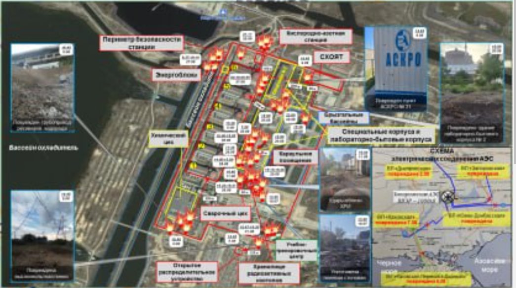
The "dirty bomb" map being posted today from the Russian MoD is literally the EXACT same one that was released on August 18th in regards to the potential false flag on Zaporizhzhia NPP 
https://twitter.com/OAlexanderDK/status/1560197502586028033
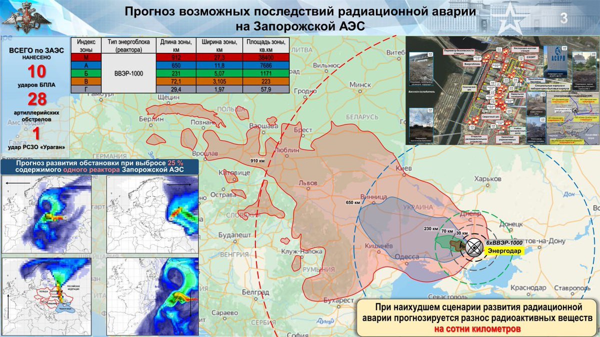
All they have done is switch the background map to Yandex maps and added some more explosion icons on their satellite image of the Zaporizhzhia NPP.
• • •
Missing some Tweet in this thread? You can try to
force a refresh