Erik Backstrom Profile picture
Nov 1 18 tweets 7 min read
There's a 120 year old house in Mill Woods?! Yes, there is. It's the Place place, and it's up for sale. #yeghistory #yegheritage realtor.ca/real-estate/25…
William Place was born in Ogdensburg, NY in 1843. After marrying Lucretia Hill of Morrisburg, ON, the couple moved to Edmonton, where Lucretia's brother lived. In 1902 they bought a farm south of town and promptly replaced its log house with the frame house still standing today.
Here's a picture of the Place children Elzetta and George at the time they lived in the house.
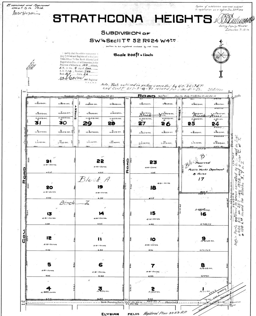
In 1912 at the height of the settlement boom, a real estate man convinced William to sell his farm for an acreage development called Strathcona Heights. The name was appropriate because the Place farm was on a knoll with views down to the newly-amalgamated city.
Here's the Strathcona Heights subdivision plan: an unimaginative grouping of 1 and 5 acre properties.
The Place family moved into town to start a business hauling freight with horse-drawn drays. Motorized vehicles were starting to take over so the business didn't take off. The Places bought a farm near Viking where William died in 1921 and Lucretia in 1935.
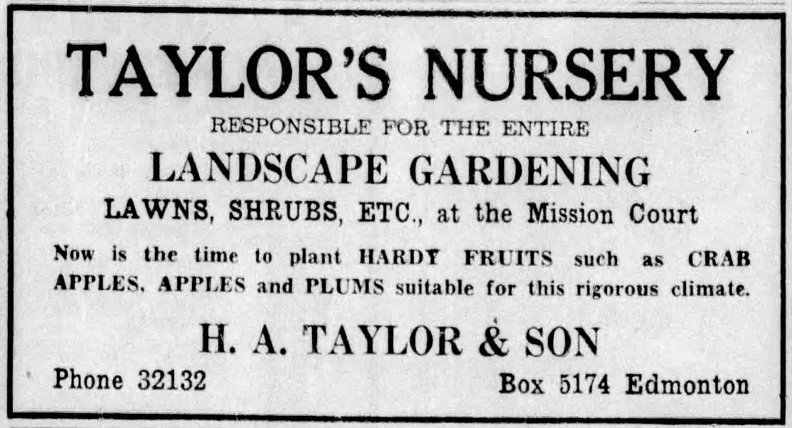
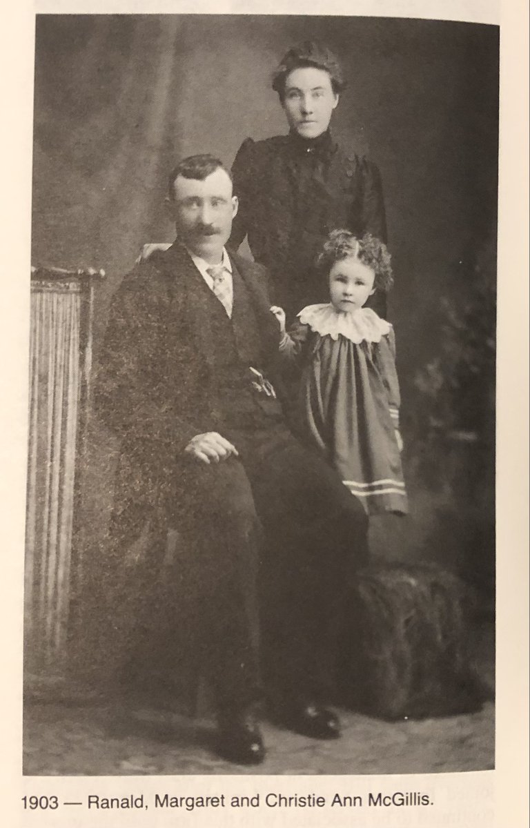
Like most pre-WWI subdivisions, Strathcona Heights didn't do well. A tree nursery was established on part of the Place farm after World War I, and a farmer named Ranald McGillis picked up the acreages as they came up for sale and eventually built up a 100 acre farm.
In 1944 at the age of 77, McGillis sold the farm to the Department of Veteran's Affairs, which resubdivided it four market-garden sized plots (34 - 46 acres). The Place house was on Lot 1, the largest of the four.
Oil was discovered in 1947 & the city began growing rapidly. In 1953 Stan Melton of Melcor fame & an associate named George Sillman subdivided Lot 1 back into smaller (3 - 6 acre) lots akin to the ones in the original Strathcona Heights subdivision.
In 1961, a group of Strathcona Heights residents successfully fought off being annexed by the City of Edmonton because it feared "higher assessment and taxes without the corresponding benefits."
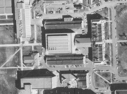
Here's a 1965 air photo showing the acreages, with the Place residence on the east side of a rural road called 75 Street. It looks like it would have been a peaceful retreat.
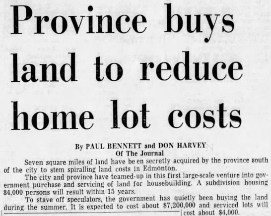
But housing affordability was becoming a political issue as land supply struggled to keep up with demand. In 1969 the City convinced the province to secretly buy up farmland for a major new urban development -- the largest in Edmonton's history with space for 120,000 people.
The Strathcona Heights subdivision wasn't part of the original acquisition...
... but as planning for what would become Mill Woods got underway, the property owners no doubt saw the writing on the wall and eventually sold their land for development.
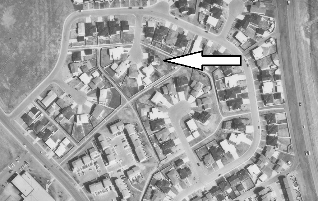
How many of the pre-Mill Woods Strathcona Heights homes were retained I don't know, but at very least the oldest one, the Place place, was. Here's its new configuration on a cul-de-sac in the 1973 Millbourne subdivision.
This 1978 air photo shows the realized development in the Lee Ridge neighbourhood,
and this 1982 photo looks a lot like (though not entirely the same as) ...
... a picture in the current real estate listing. Having been extensively modernized, the house probably wouldn't qualify for designation as a Municipal Historic Resource, but if you buy it you'll get a lot more history than normally found in a post-war suburb.

• • •

Missing some Tweet in this thread? You can try to force a refresh
 

Keep Current with Erik Backstrom

Erik Backstrom Profile picture

Stay in touch and get notified when new unrolls are available from this author!

Read all threads

This Thread may be Removed Anytime!

PDF

Twitter may remove this content at anytime! Save it as PDF for later use!

Try unrolling a thread yourself!

how to unroll video
  1. Follow @ThreadReaderApp to mention us!

  2. From a Twitter thread mention us with a keyword "unroll"
@threadreaderapp unroll

Practice here first or read more on our help page!

More from @e_backstrom

Oct 15
Century Park timeline
2022: a couple of early risers walking their dogs in a grassy area surrounded by apartments, construction materials & equipment and an empty parking lot next to an LRT station just out of view. Image
2005: architect James Cheng's concept for a walkable, mixed-use, high-density, transit-oriented urban village that wowed planners and helped #yegcc decide to fund extension of the LRT to the site. Image
1981: Heritage Mall opening day with thousands of cars and at least two boys on bicycles. Image
Read 8 tweets
Oct 13
Thanks for asking! The history of Alexander Circle is more interesting than I imagined.
The circle was part of the original design of the 1911 Glenora subdivision, planned as a focal amenity at the intersection of 33 (later 133) Street & Peace Avenue in an area where the other avenues (Athabasca, Mackenzie) were also named after rivers. Image
Sixteen lots surrounded a park with a diameter of 140 feet. The design is unique in Edmonton and while there are residential circles elsewhere (e.g. The Crescent in Vancouver's Shaughnessy neighbourhood), I can't think of a more formally intimate one. Image
Read 18 tweets
Jul 27
What a ring road has to do with the papal visit. Photo of white Fiat containing Pope Francis passing through
The Oliver neighbourhood has been a focus for Roman Catholics in Edmonton for 140 years. In addition to Saint-Joachim Church and St. Joseph's Basilica, there's the Archbishop's Palace and the General Hospital, which was founded and run by the Grey Nuns.
Another long-time Catholic institution in the area was the St. Joseph Seminary. Just north of Saint-Joachim, it was founded in 1927 when the Catholic Archdiocese took over priest training from the Missionary Oblates of Mary Immaculate. Its history is here: stjoseph-seminary.com/About/Our-Hist…
Read 21 tweets
Apr 5
How the @UAlberta's Cameron Library became a two-skinned building. ImageImage
Cameron Library, opened in 1964 and named after former University Librarian Donald Cameron, was designed to be expanded after its bracketing North and South Labs, shown in this 1965 air photo, were demolished. Image
The North Lab was taken down in 1968 to accommodate Cameron's north expansion. Image
Read 6 tweets
Jan 16
The Tawatinâ Bridge artwork by @GarneauDavid is a dazzling fusion of contemporary and historical Indigenous themes and perspectives. The map-related pieces particularly caught my planning historian eye so here’s a thread about them.
The pixelated bison is a map connecting Edmonton with St. Paul. Each pixel is a surveyor’s township. The blue line is the North Saskatchewan and the red line is the former @CNRailway Coronado subdivision.
When I was growing up, all I knew about St. Paul was that it was home to a UFO landing pad. The space age whimsy helped mask the community’s origins as a Métis settlement called St. Paul des Métis metismuseum.ca/resource.php/0…
Read 14 tweets
May 29, 2021
How an Edmonton neighbourhood didn't end up being called Grossdale, and got the city's dirtiest name instead.
Before World War I there was a real estate boom in Edmonton. Land owners and investors were bringing dozens of speculative subdivisions to market. One on the south side of the river was Grossdale.
The High Level Bridge, then under construction, was seen as dramatically improving access to the south side. In the marketer's parlance, Grossdale was where the bridge "will take the population."
Read 46 tweets

Did Thread Reader help you today?

Support us! We are indie developers!


This site is made by just two indie developers on a laptop doing marketing, support and development! Read more about the story.

Become a Premium Member ($3/month or $30/year) and get exclusive features!

Become Premium

Don't want to be a Premium member but still want to support us?

Make a small donation by buying us coffee ($5) or help with server cost ($10)

Donate via Paypal

Or Donate anonymously using crypto!

Ethereum

0xfe58350B80634f60Fa6Dc149a72b4DFbc17D341E copy

Bitcoin

3ATGMxNzCUFzxpMCHL5sWSt4DVtS8UqXpi copy

Thank you for your support!

Follow Us on Twitter!

:(