A thread🧵on Luhansk oblast mammoth 🇷🇺 trench project.
The start of this project was issued at the same time as the withdrawal from Kherson (end of oct).
I'll go through some of the data available and point the obvious *without going in too deep*.
1/20(n)
The start of this project was issued at the same time as the withdrawal from Kherson (end of oct).
I'll go through some of the data available and point the obvious *without going in too deep*.
1/20(n)

The project has been going on already for over a month now and mostly all AT-trenches are now ready. Placement of dragon's teeth is still taking place and almost no infantry trenches have yet been completed in the most important strategic chokepoints.
2/n
2/n
As winter approaches and the ground starts to freeze the hurry is valid. Digging frozen ground is a way more labor intensive task than warm loose soil.
With this said and out of the way let's take a closer look into what is going on. Breakdown by numbers in this map.
3/n
With this said and out of the way let's take a closer look into what is going on. Breakdown by numbers in this map.
3/n

North (1.) is the segment that is lagging the most behind in the construction work, if the objective is to have one single defensive line.
This can be partly explained by weather. Comparing southern Luhansk with northern gives an average difference of roughly two degrees.
4/n
This can be partly explained by weather. Comparing southern Luhansk with northern gives an average difference of roughly two degrees.
4/n

During a season when temperatures round the freezing point of water this can be a major issue when terramorphing. As of today (4.12.) some progress has been made to close the gap (red square) but there is still a lot to do. At least they have priorized the high ground.
5/n
5/n
With OSINT in mind the current weather is perfect for satellite tracking of movement tho. With wet ground which is slightly frozen from the top vehicles still leave deep tracks which are quite visible from satellite images and when the snowcover comes things get even easier.
6/n
6/n
As an example let's use the village of Novonikanorovka south of Pokrovske. We can see the building process of the trenches, as well as placing of teeth (underway).
Tracks are quite highly visible (dark brown).
By the power of deduction one can spot passageways as well...
7/n
Tracks are quite highly visible (dark brown).
By the power of deduction one can spot passageways as well...
7/n
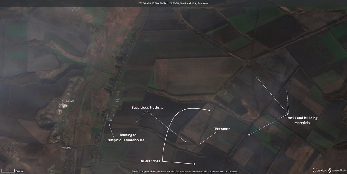
as suspicious buildings. For example, from the building supply area tracks lead to a "gate" thru the trenches and all the way to the village with P-66 running thru it.
A warehouse stands out, so satellite image comparison can be conducted.
Bingo. More dragons teeth.
8/n
A warehouse stands out, so satellite image comparison can be conducted.
Bingo. More dragons teeth.
8/n
As the importance of the weather and tracks left behind to observe what's going on is just my sub-point, I shalln't be going through them all.
Jumping to (2.) second view of how the building process is going east from Poltava.
9/n
Jumping to (2.) second view of how the building process is going east from Poltava.
9/n

This zone is like the previous one: AT-trenches mostly dug, dragons teeth partially placed, no infantry trenches yet. The rest of the trenching project is pretty much the same as this.
Here's a closeup south-east of Nyz. Duvanka.
10/n
Here's a closeup south-east of Nyz. Duvanka.
10/n

Going further south (3.) the situation is mostly similar, slightly lagging behind, but AT-trenches already complete.
11/n
11/n

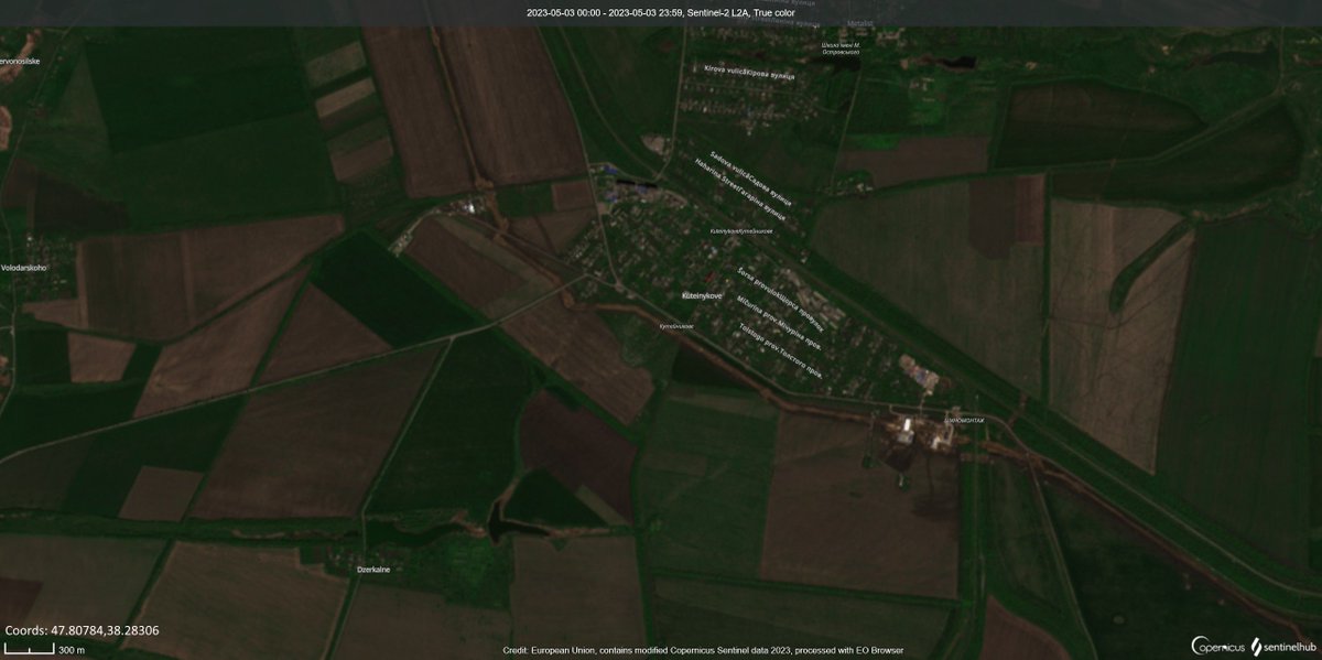
An example of what this segment looks like looking closer is like this. Next to Svatove. The highway is likely used to transport supplies and personel to work. Assuming they're not staying in Svatove, again, following the tracks we get to Korzhove where the tracks end.
12/n
12/n

A verification can be done quickly with a timelapse once more. (49.372463,38.361724)
13/n
13/n
When moving to the last segment (4.) south which ends before Novokrasnyanka north of Severodonetsk we can see many more tracks to follow.
14/n
14/n

As a closeup to this segment I chose west of Baranykivka. Lot of traffic, an old factory in the background, highest ground looking west from the east bank.
This zone will be worth following whether additional hints of presence will pop up here.
* 4.12. images, not these
15/n
This zone will be worth following whether additional hints of presence will pop up here.
* 4.12. images, not these
15/n

To wrap up what has been said:
- As it is a race against time vs ease of digging, AT-trenches have been priorized over other defenses
- Tracks are easy to follow from now on
- The trench system is almost continuous, 85km long
- Protects railwayline to the east
16/n
- As it is a race against time vs ease of digging, AT-trenches have been priorized over other defenses
- Tracks are easy to follow from now on
- The trench system is almost continuous, 85km long
- Protects railwayline to the east
16/n
- This strench strategy varies from the one seen in the south where little fortifications are built on strategic points.
- Here we have a thin line of defenses for a long way, which has its advantages and disadvantages.
- The work is yet far from complete, so lets see.
17/n
- Here we have a thin line of defenses for a long way, which has its advantages and disadvantages.
- The work is yet far from complete, so lets see.
17/n
This is all for now.
My point was to raise awareness of this mammoth in the north as it's still in progress.
I didn't go into detailed investigation for the reason it is a huge rabbit hole with A LOT to find out. There is so much material visible from space.
18/n
My point was to raise awareness of this mammoth in the north as it's still in progress.
I didn't go into detailed investigation for the reason it is a huge rabbit hole with A LOT to find out. There is so much material visible from space.
18/n
This area consists mainly of 🇷🇺 troops that suffered heavy losses during the UA Kharkiv offensive.
19/n
19/n
https://twitter.com/Martinnkaaaa/status/1595326895436038145
I hope someone got interested in this and I inspired someone to look deeper into this. To see where the tracks lead ;)
My thanks for reading.
________________________
For more information and on-ground images about the segment east of Svatove:
mil.in.ua/en/news/russia…
20/END
My thanks for reading.
________________________
For more information and on-ground images about the segment east of Svatove:
mil.in.ua/en/news/russia…
20/END
There might be some errors and just a reminder that opinions and observations are my own. I strongly encourage to do your own research before claims.
Sources:
topographic-map.com
weatherspark.com
sentinel-hub.com
mil.in.ua
deepsatatmap.live
Sources:
topographic-map.com
weatherspark.com
sentinel-hub.com
mil.in.ua
deepsatatmap.live
• • •
Missing some Tweet in this thread? You can try to
force a refresh