India just passed China as the most populous country in the world. Why?
Because of the biggest accident in history
Look at where people live in India. What's that band up north?
Because of the biggest accident in history
Look at where people live in India. What's that band up north?
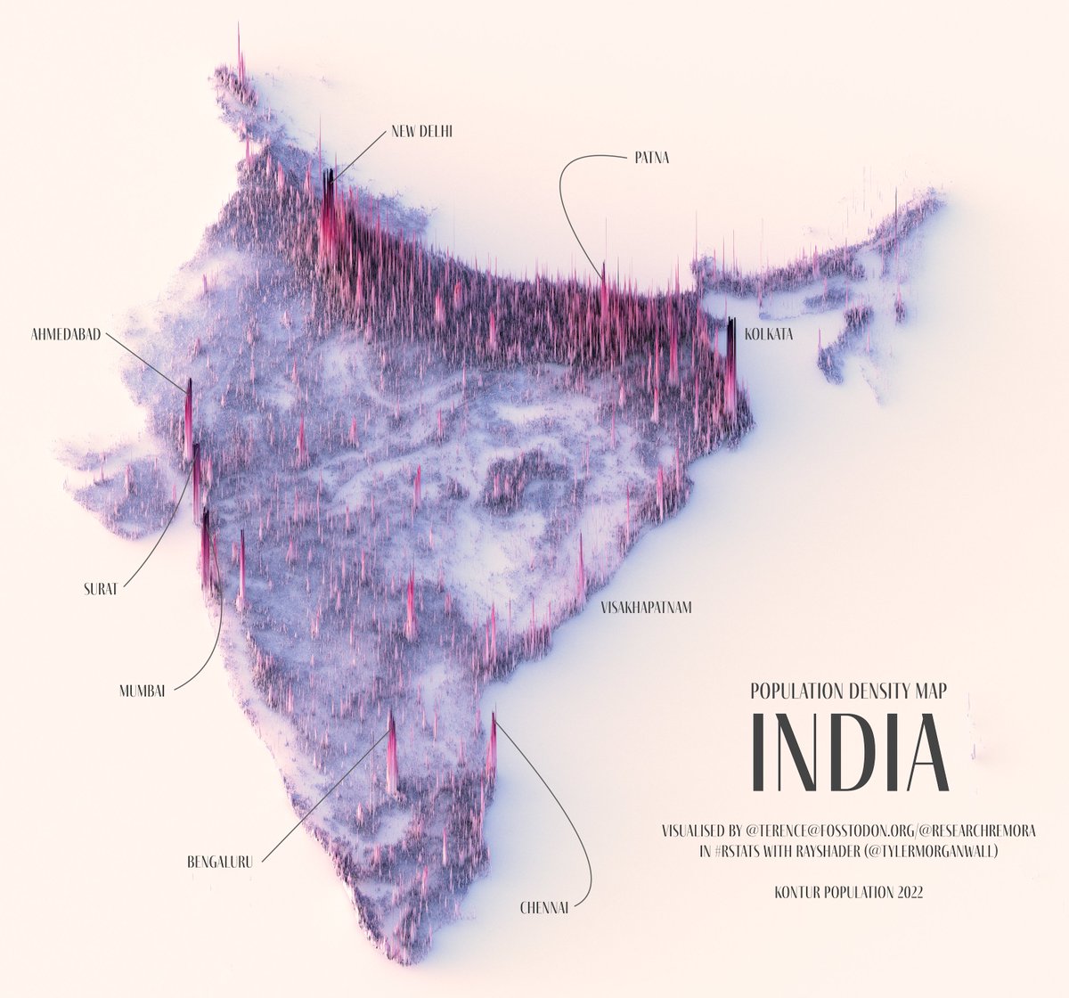
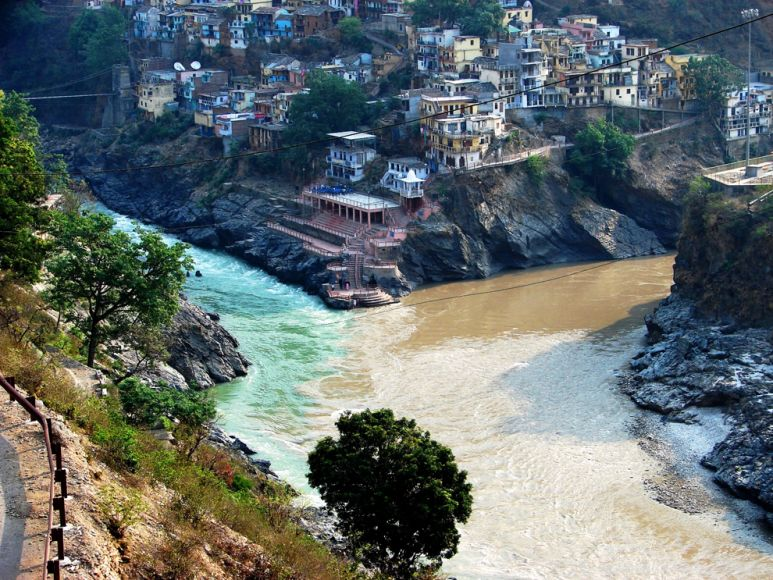
It's the Ganges river basin. It hosts ~half the country's population. It's one of the densest places on Earth. Why?
Because it's one of the most fertile places on Earth.
It's one of the main producers of wheat, peas, potatoes, rice, lentils, eggplant...
And why is it so fertile?
It's one of the main producers of wheat, peas, potatoes, rice, lentils, eggplant...
And why is it so fertile?

• It's hot (tropical)
• It rains a lot
• It has a many rivers bringing water and irrigation
• The rivers also bring fertilizing silts
Why so much water?
• It rains a lot
• It has a many rivers bringing water and irrigation
• The rivers also bring fertilizing silts
Why so much water?
The mountains.
Wind comes from the ocean full of water
It hits the Himalayas
Climbs up
Gets colder
The water condensates and rains down
Wind comes from the ocean full of water
It hits the Himalayas
Climbs up
Gets colder
The water condensates and rains down
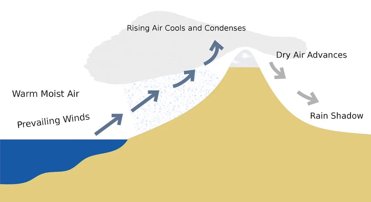
This is a good depiction of clouds (and their humidity) being stopped by mountains:
https://twitter.com/AvatarDomy2/status/1562045094412312577
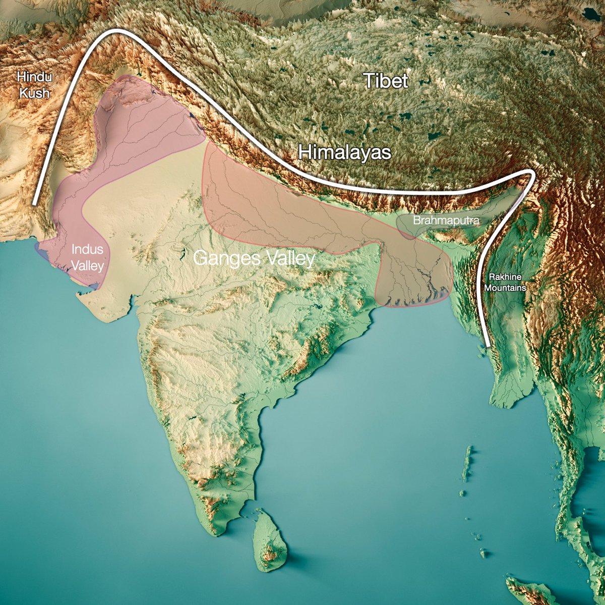
Here you can see how India (to the left) is much greener than Tibet (right).
You can tell where the mountains stop the water from the wind
You can tell where the mountains stop the water from the wind
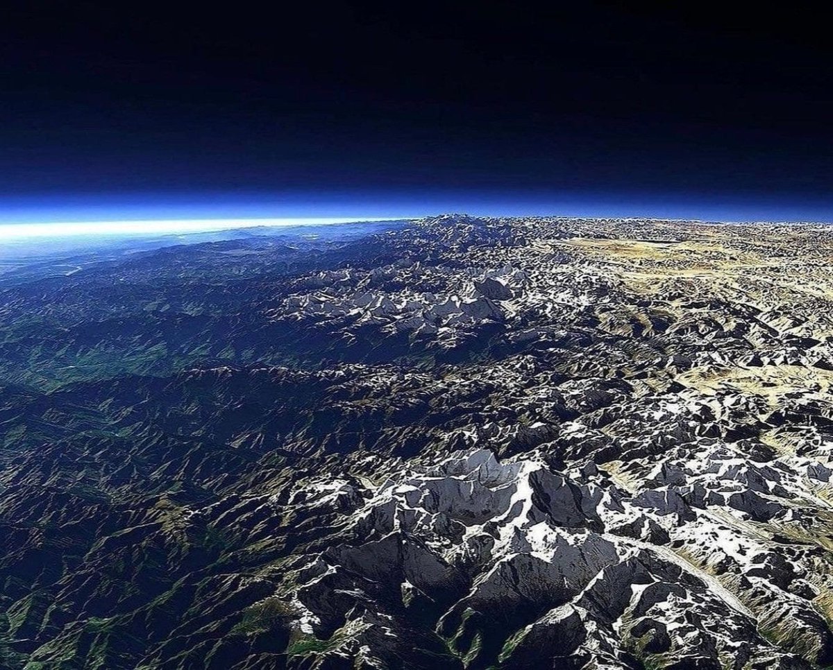
In India, this happens across hundreds of kms
And what causes the mountains? The Indo-Australian Tectonic Plate hitting the Eurasian Plate
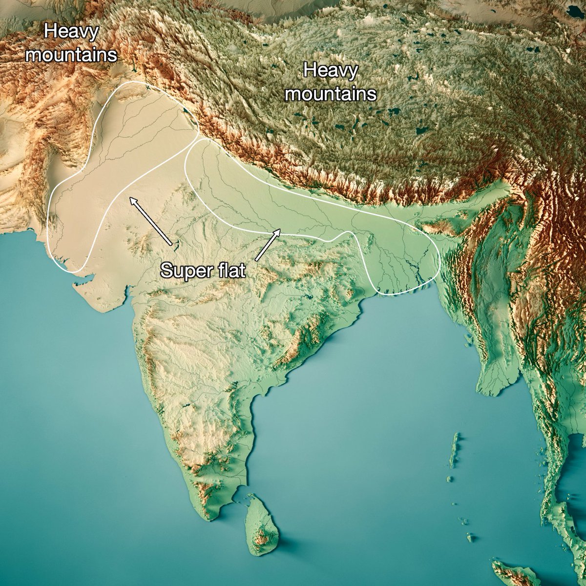
But why is the Ganges valley so flat when it's just next to the Himalayas, the tallest mountain range in the world?
It's *because* of the Himalayas: They're so heavy that gravity crushes down the region around it! The same thing happens in the Indus valley nearby
It's *because* of the Himalayas: They're so heavy that gravity crushes down the region around it! The same thing happens in the Indus valley nearby
Now we know why:
• It's flat
• Humid winds discharge their water there
But hold on, why are there humid winds to begin with?
They're not supposed to be there! Every other part of the world at the same latitude is a desert!
Why is the Sahara a desert but India a garden?
• It's flat
• Humid winds discharge their water there
But hold on, why are there humid winds to begin with?
They're not supposed to be there! Every other part of the world at the same latitude is a desert!
Why is the Sahara a desert but India a garden?
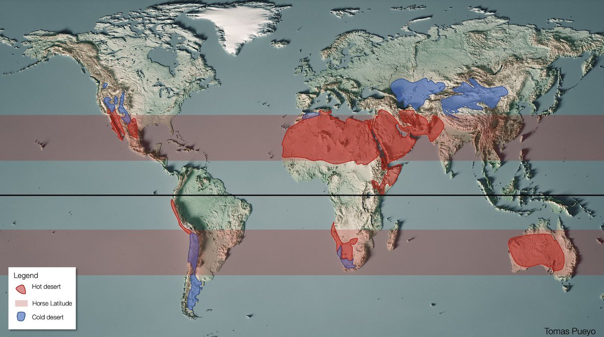
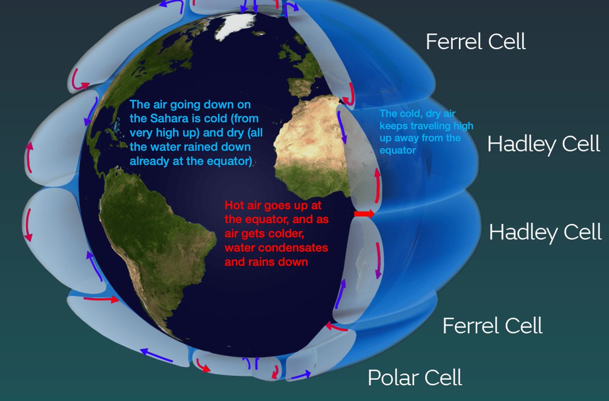
The equator is the warmest part of the world, hit directly by the Sun
Hot air, full of humidity, goes up, hits colder air, water condensates, and rains down.
But air keeps going, and falls down farther north, completely dry. Hence the Sahara.
So why not India?
Hot air, full of humidity, goes up, hits colder air, water condensates, and rains down.
But air keeps going, and falls down farther north, completely dry. Hence the Sahara.
So why not India?
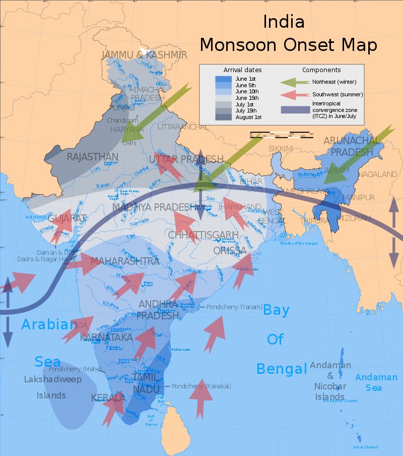
The monsoon
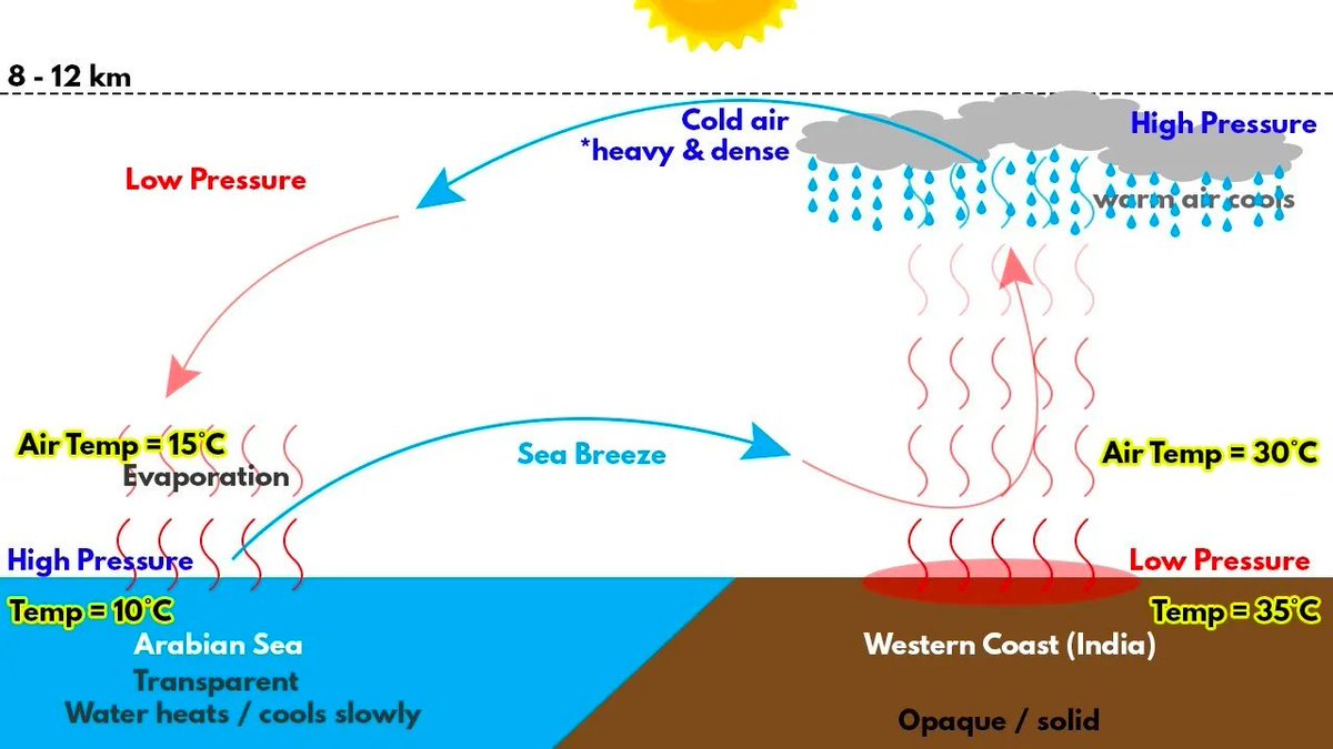
In Indian summers, winds come from the sea, full of water.
What force pushing the monsoon is so huge that it predominates over the normal circulation of wind on Earth?
In Indian summers, winds come from the sea, full of water.
What force pushing the monsoon is so huge that it predominates over the normal circulation of wind on Earth?
The sheer size of the Eurasian Plate being north of the only southern ocean on Earth

In summer, the air above the Indian ocean gets hot and fills with water.
But lands warms up faster than water
Eurasia gets much hotter
Air goes up above it
It creates a vacuum
And the hot, humid water from the Indian ocean invades India
And rains down at the Himalayas
But lands warms up faster than water
Eurasia gets much hotter
Air goes up above it
It creates a vacuum
And the hot, humid water from the Indian ocean invades India
And rains down at the Himalayas
This brings water across all of India, not just the Himalayas, making all of it fertile—even if the Ganges river basin is the most fertile.
In summary, in India:
Fertile soil ➡️ Population
Why?
• Hot (tropical)
• Lots of rain
➡️Rivers➡️irrigation & fertilizer
But ALL these conditions exist thanks to an ancient accident: The Indo-Australian Plate hitting the Eurasian one!
Fertile soil ➡️ Population
Why?
• Hot (tropical)
• Lots of rain
➡️Rivers➡️irrigation & fertilizer
But ALL these conditions exist thanks to an ancient accident: The Indo-Australian Plate hitting the Eurasian one!
1. In summer, the Eurasian plate heats up north of the Indo-Australian plate (Indian ocean)➡️monsoon
2. These plates hit and create the Himalayas➡️stop the waters and rain it down to the Ganges valley
3. The weight of the Himalayas flattens the Ganges basin➡️best for crops
2. These plates hit and create the Himalayas➡️stop the waters and rain it down to the Ganges valley
3. The weight of the Himalayas flattens the Ganges basin➡️best for crops
I hope you enjoyed this thread. If you did, follow for more. I write one of these every week or so.
You can also subscribe to my newsletter. It's free: unchartedterritories.tomaspueyo.com/subscribe
You can also subscribe to my newsletter. It's free: unchartedterritories.tomaspueyo.com/subscribe
The 1st map is from @researchremora
I learned from @lewis_dartnell about the flattening of the Ganges due to the weight of the Himalayas
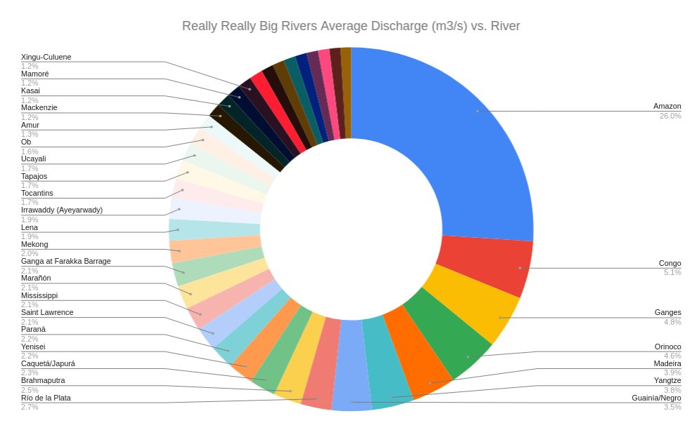
Another crazy river thread if you missed it:
I learned from @lewis_dartnell about the flattening of the Ganges due to the weight of the Himalayas
Another crazy river thread if you missed it:
https://twitter.com/tomaspueyo/status/1621927288613883904
I go into much more detail in this articles on India, Pakistan, and Bangladesh:
unchartedterritories.tomaspueyo.com/p/a-brief-hist…
unchartedterritories.tomaspueyo.com/p/a-brief-hist…
• • •
Missing some Tweet in this thread? You can try to
force a refresh