[PART TWO] THE CASE OF OPEN-AIR SETTLEMENT OF MAROULAS IN KYTHNOS AND ITS IMPORTANCE FOR THE INTERPRETATION OF THE AEGEAN MESOLITHIC. 

1/ As a result of the intense climatic and environmental changes after the end of the Younger Dryas, the Mesolithic cave sites in Franchthi and Youra demonstrated the differentiation of the survival strategies of some Aegean hunters-gatherers groups ➡️

➡️ with the adoption of a semi-sedentary lifeway through the appropriation of living places, the intensification of fishing activities and the pre-domestication of wild animals and plants, taking a step towards the Neolithic revolution.

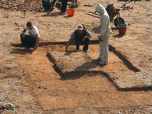
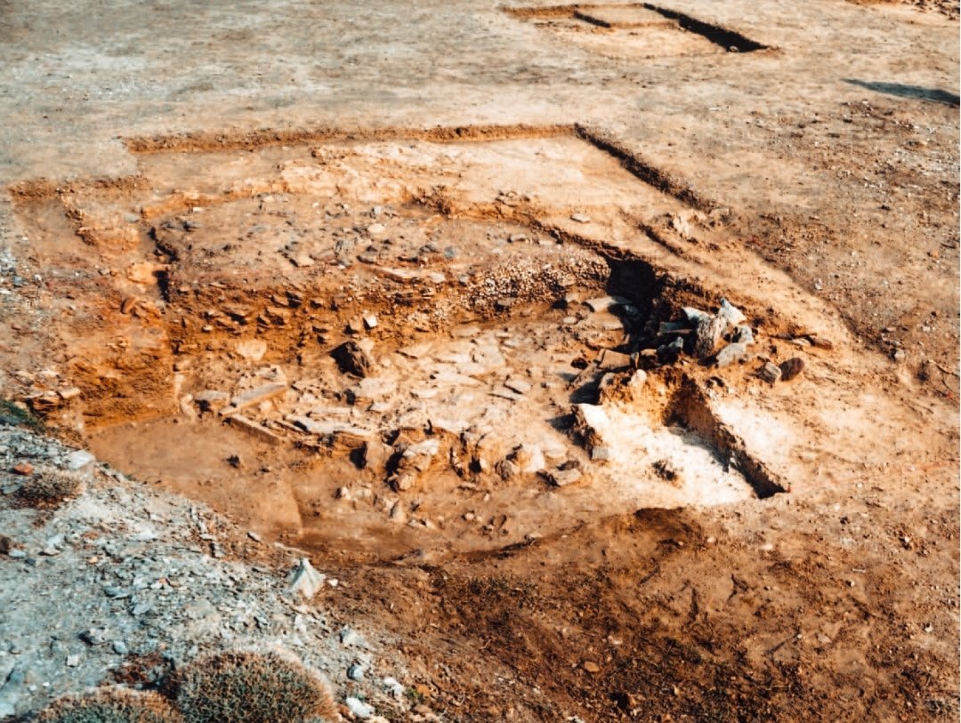
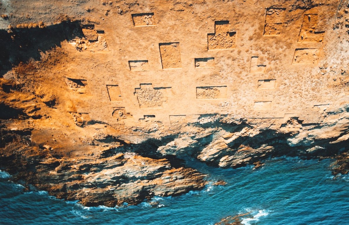
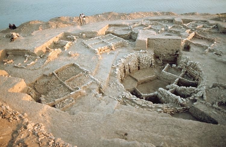
2/However,the major breakthrough in the Aegean Mesolithic took place with the discovery of an open-air settlement at the site of Maroulas on the island of Kythnos,during an excavation activity that run between 1996-2005. The surviving remains were found within a surface 1500 sqm
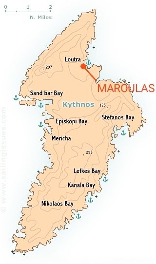
3/ The settlement was located on the NE side of the island, next to the sea and on a rather eroded promontory, with its beginnings going back to the early Mesolithic, ie the first half of the 9th millennium BC. The extent erosion is due to sea level rise of at least 50-60 meters.
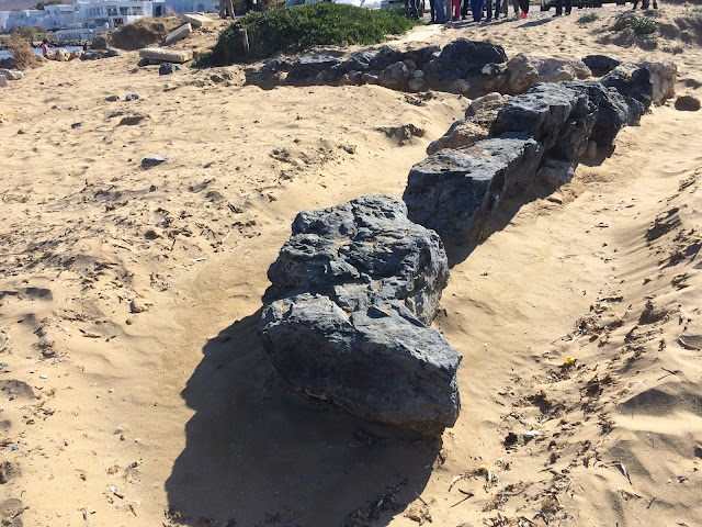
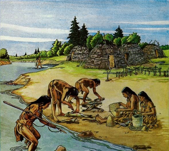
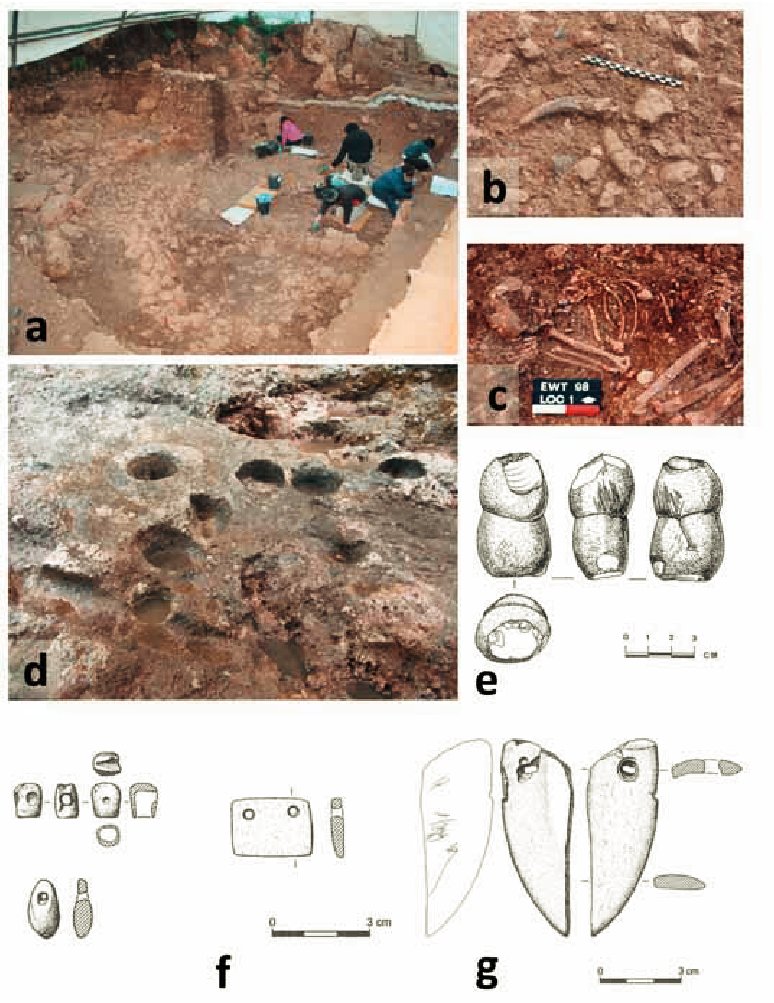
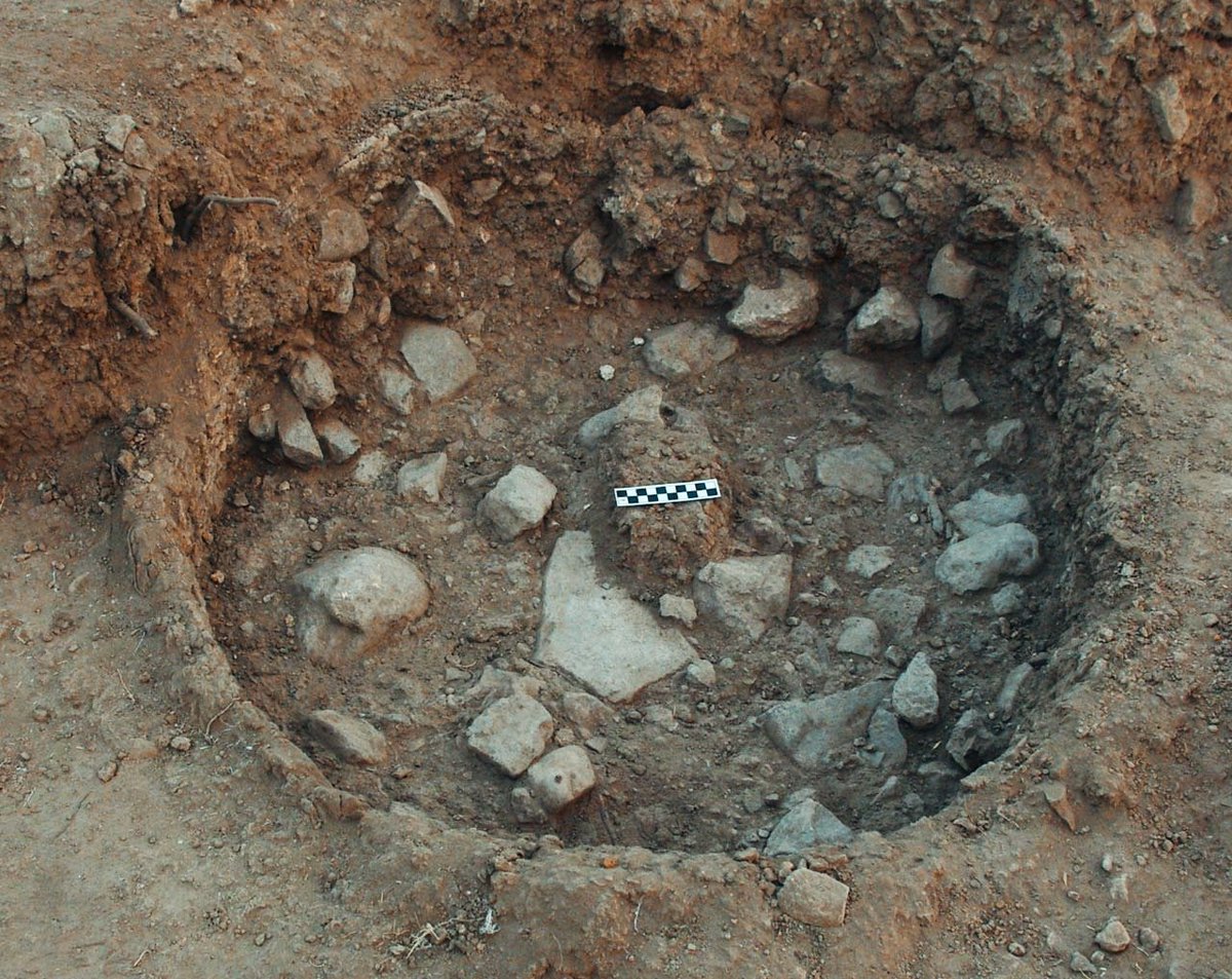
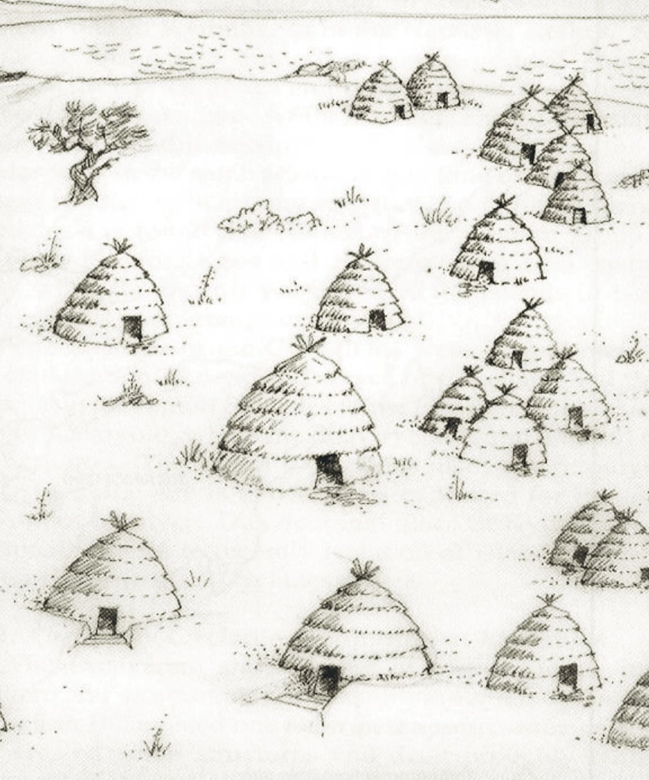
4/ The most important discovery was the finding of the earliest architectural remains in the helladic area through the existence of 15 circular or ellipsoidal structures that functioned as hut floors. ➡️
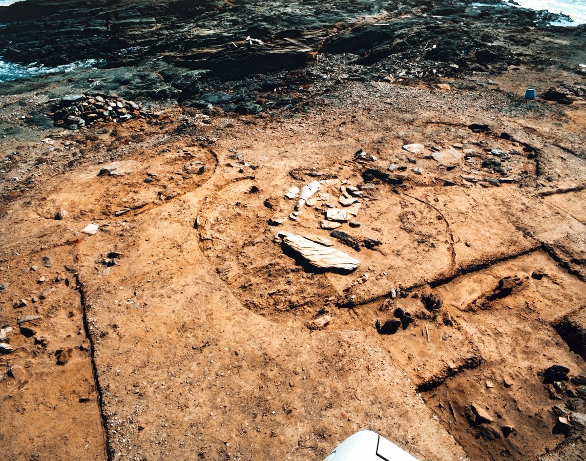
➡️ Their circular form has been thought to have been a conical structure with a stone foundation and superstructure of perishable materials, i.e. piles covered by some insulating material on the outside.
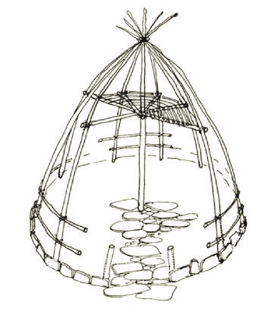
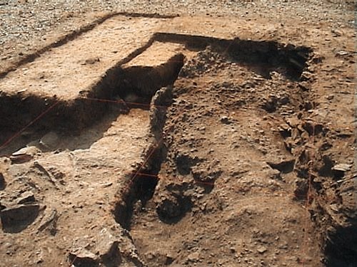
5/ The most of the huts are founded on the natural ground, while in one of them, a cavity has been opened before the construction took place. ➡️
➡️ This cavity was probably used as a storage space, a feature that becomes even more interesting if one takes into account the existence of successive floors indicating a long-term use.
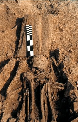
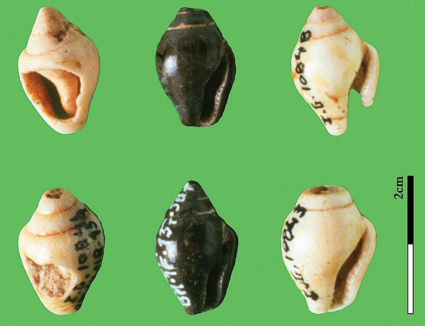
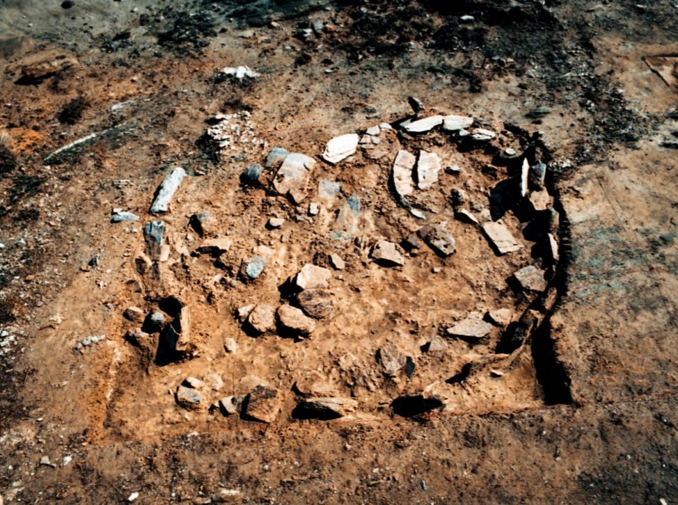
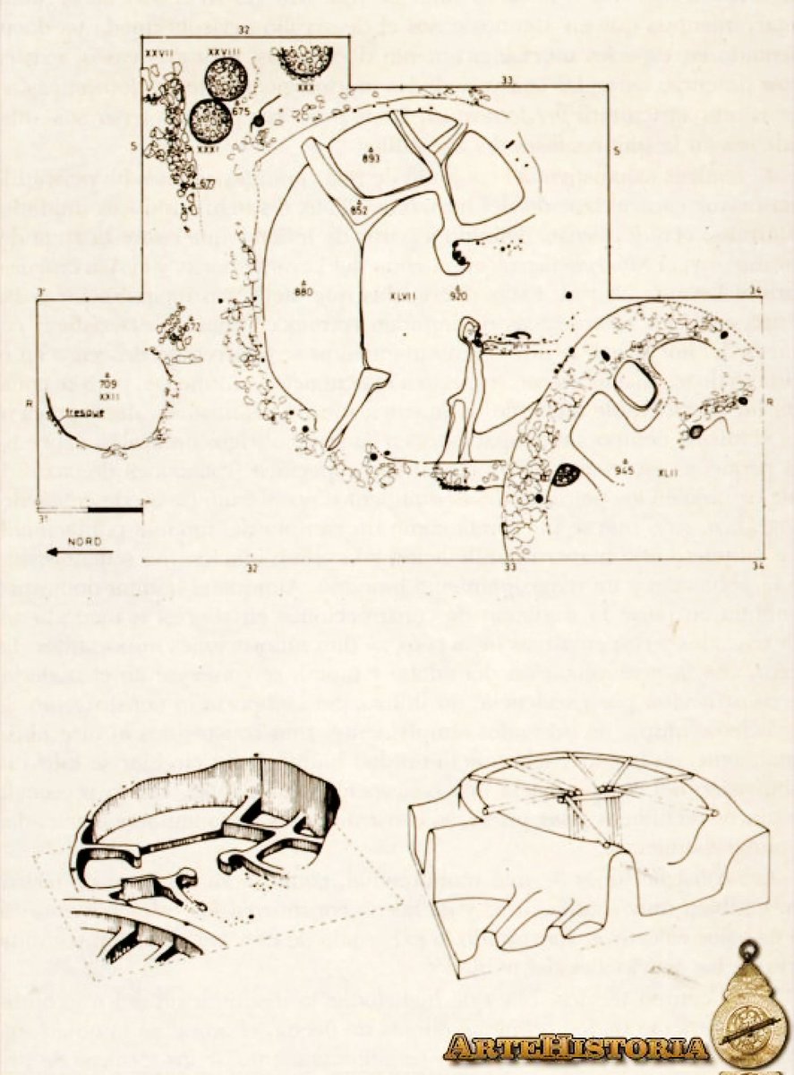
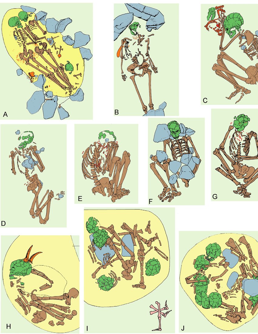
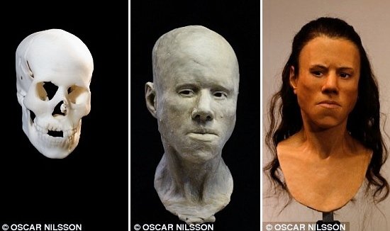
6/ Burials were found under the stone floors of the habitation structures, including an intact human skeleton of a young adult with offerings of obsidian and helixes-seashells. ➡️
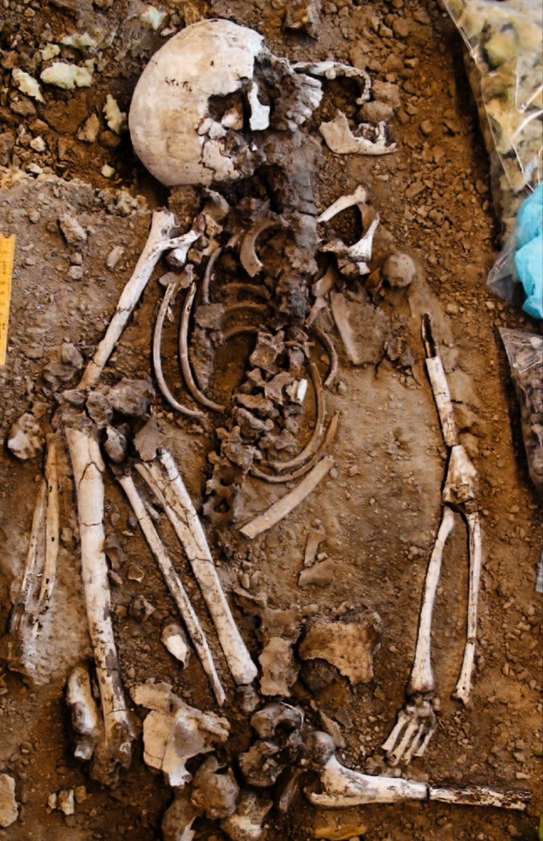
➡️ In particular, the burials at Maroulas are divided into those found in a carving within the rock and others recovered in pits that peripherally bore slabs or stones, covered by large slabs, with the dead placed in a contracted or partially contracted position.
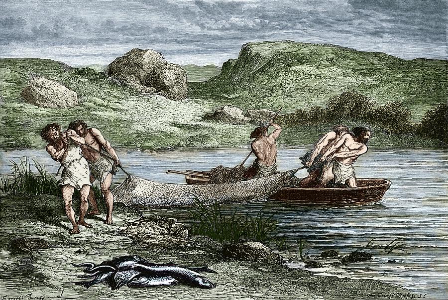
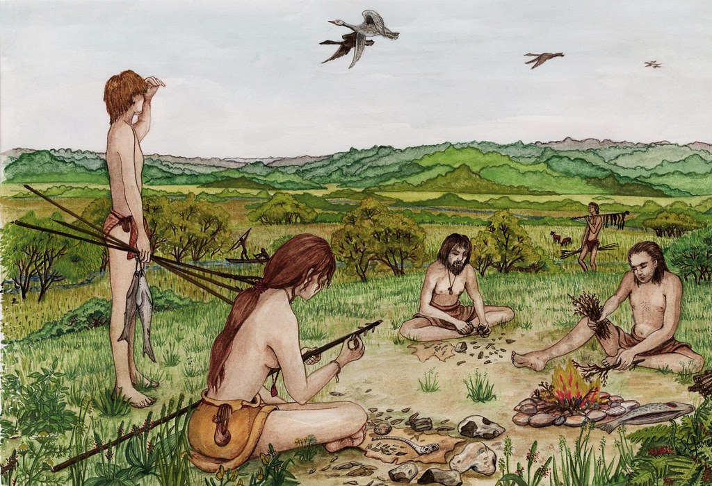
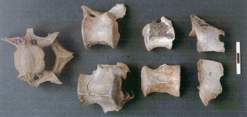
7/ The research showed that it was a fishing settlement with its inhabitants applying a highly selective fishing strategy, targeting a limited range of fish of a certain size range, as well as a fish preservation technique. ➡️

➡️ The users of Maroulas mainly fished for scorpionfishes and Sparidae, as well as schools of bluefin tuna, fish that lived in the shallows or close to the shore, i.e. at distances that could be reached by small boats without having to pull out to the high sea.
8/ They supplemented their diet with gathering (wild fruits - molluscs) and hunting small mammals (wild boars - hares) or birds, with the character of the settlement tending towards a semi-permanent settlement. ➡️
➡️ In fact, the hunting of different species of birds shows us a long period of stay in the area that reached almost the entire year.

9/ The small mammals and wild boar are animals which did not thrive on the island until the end of the Pleistocene, so they were probably introduced to Kythnos by the early Mesolithic users of Maroulas, as a supplement to their diet. ➡️

➡️ The finding of sanded tools, mainly mortars, perforators and millstones, probably indicates an occupation with grinding wild plants and cereals.
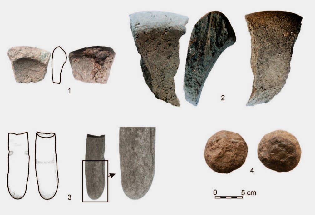
10/ Of particular interest are the chipped stone assemblages, which demonstrate to us their in situ manufacturing, being adapted to a different range of functions from the stereotypes, concerning an isolated local economy, with the presence of microlithics being minimal.
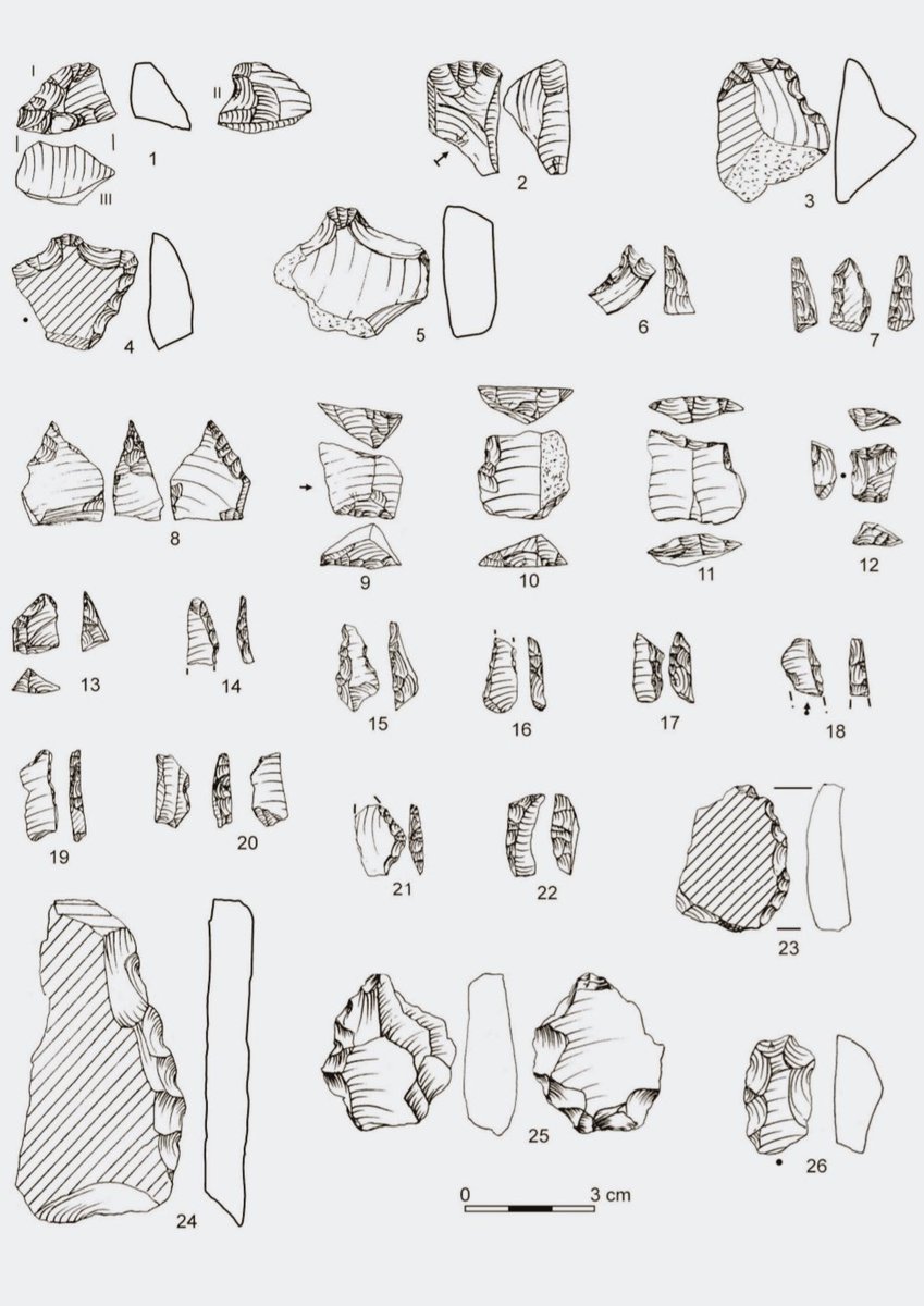
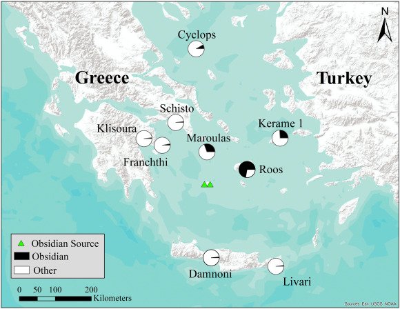
11/ Most of the stone tools are made from local sources of quartz. However, 1/3 of the chipped stone assemblage comes from Melian obsidian. The settlement was located on the sea route between Melos and the mainland, giving its inhabitants easy access to obsidian reserves.
12/ Another important element is the presence of sporadic remains of similar stone industry in other sites of the island. ➡️
➡️ The fact demonstrates the strategy followed by the Mesolithic groups of Kythnos: a central settlement in Maroulas and scattered ephemeral camps in various parts of the island, where they provided seasonal foraging prospects.
13/ The settlement of Maroulas, although it shares many characteristics with that of Cyclops Cave on the islet of Youra, such as the settlement in a prominent coastal place, the development of a foraging economy oriented towards the sea ➡️
➡️ and evidence of early domestication of wild animals, nevertheless bears witness to new typological and cultural information, which is unmatched for the Aegean region.
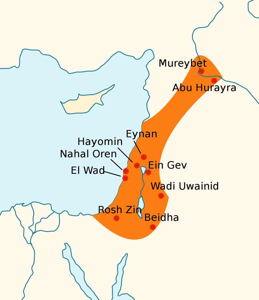
14/ The presence of circular or ellipsoidal structures, the way of burial and especially the burials under the floors of the huts are elements that refer to the lifeway of the Natufians, a culture of Syro-Palestine that flourished between 13000-9500 BC, ➡️
➡️ as well as the Pre-Pottery Neolithic settlements of Mesopotamia, Anatolia and Cyprus, which reveals the existence of a network of contacts between these regions and the Aegean region through which ideas and innovations were spread.

15/ More specifically, in the open settlements of Ain Mallaha and El-Wad in Palestine, dating to the 11th and 10th millennia BC, the dead are buried with a slab on the chest, while similar practices are reported in Epipaleolithic cave sites, such as Hayonim, Kebara and Shuqba.
16/ Primary and secondary burials are found in these places, which take place between the houses or under the floors. Examples of circular structures come from the PPNA Palestine, such as the Netiv Hagdud site, where millstones and perforators for grinding food were also found.
17/ However, the Natufian settlement of Mureybet is very similar, although it is located in the interior of Syria (Raqqa): its first phases of habitation appear in the 9th millennium BC, a duration of habitation is observed almost for the entire year, ➡️
➡️ there is a preference for eating fish, various birds, sea shells and wild plants, circular stilt structures are used with a clay superstructure, and some of the local stone industry is made of imported obsidian from Cappadocia.
18/ All of the above are chronologically and typologically related to the cultural package of the Mesolithic groups in Maroulas. ➡️
➡️ This raises the question of their origin and their identification with Natufian groups of Syro-Palestine who arrived in the Aegean in search of the same sources of nutrition as those they had in their ancestral lands.
19/ However, paleoanthropological studies on the skeletal remains found showed that the Mesolithic groups in Maroulas came from the mainland, suffering strongly from mediterranean anemia due to their continuous living within a marshy coastal environment.
20/ All of the above gives the picture of an extensive maritime activity through the development of navigation beyond the northern corridor (Thessaly-NW Asia Minor) and of the existence of many southern sea routes that were used for the interaction of Aegean and Oriental groups.
21/ It's likely that Kythnos was inhabited by Mesolithic groups who sailed from mainland Greece (Argolis or Attica) and who developed a specialized local economy,different from that of the mainland,that required an adapted set of tools to face with a diverse range of activities.
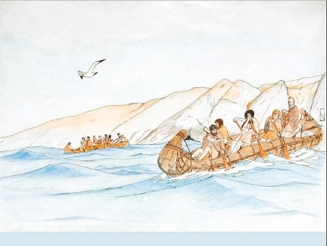
22/ The similarities in stone industry between Maroulas and the other coastal sites in Youra and Franchthi testify to the existence in the Aegean region of a widespread and well-established maritime and fishing tradition and a special communication network of these groups.

• • •
Missing some Tweet in this thread? You can try to
force a refresh