Hi! Want to get caught up on some of my past threads about the 2023 #TurkeySyriaEarthquake?
Here are some links.
1) A summary of the tectonic setting, published just after the first earthquake.
Here are some links.
1) A summary of the tectonic setting, published just after the first earthquake.
https://twitter.com/JudithGeology/status/1622475625633050624
2) A discussion of why the shaking that people feel is different in different places...
https://twitter.com/JudithGeology/status/1625858606565572609
3) ...and a great visual highlighting the importance of basin amplification.
https://twitter.com/JudithGeology/status/1631790271032709121
4) A visual comparing aftershocks in Turkey to other seismic sequences around the world.
https://twitter.com/JudithGeology/status/1631069691459383297
5) An overall assessment of what happened in the earthquakes and what that means for continued hazard in different areas.
https://twitter.com/JudithGeology/status/1631021938930774016
6) An assessment of the current seismic situation in Adana.
https://twitter.com/JudithGeology/status/1630199118235672576
7) An assessment of the current and historical seismic situation along the Dead Sea Fault.
https://twitter.com/JudithGeology/status/1629337682550697984
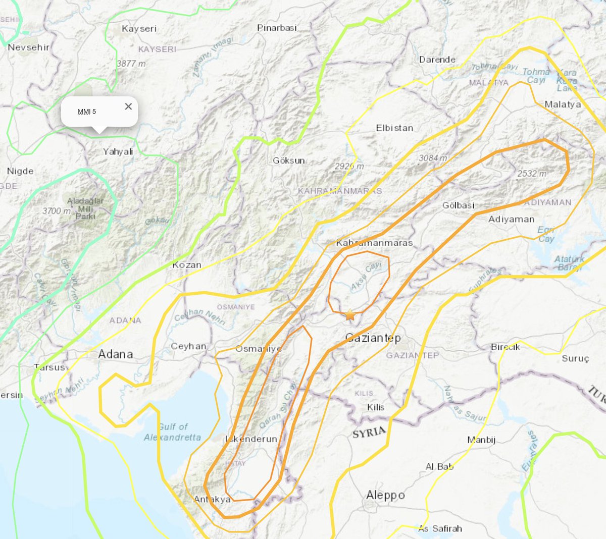
8) An assessment of the current seismic situation around Gaziantep.
https://twitter.com/JudithGeology/status/1631665064120926210
9) An assessment of the current seismic situation near Kayseri.
https://twitter.com/JudithGeology/status/1631406864977084421
10) An assessment of what the earthquakes in Turkey mean for Cyprus.
https://twitter.com/JudithGeology/status/1628109541928730665
11) Information about possible lower hazard along the eastern East Anatolian Fault.
https://twitter.com/JudithGeology/status/1631656255872802823
12) A discussion of seismic hazard near Istanbul (part 1).
https://twitter.com/JudithGeology/status/1624152485991440386?lang=en
13) And more discussion of the seismic hazard near Istanbul (part 2).
https://twitter.com/JudithGeology/status/1629873157682151424
14) Some maps and resources for Syria, which has been less studied that Turkey.
https://twitter.com/JudithGeology/status/1631702393489326105
15) An explanation about how we think about seismic hazard around the world.
https://twitter.com/JudithGeology/status/1630558132467367937
16) A summary of what data earthquake scientists use to study earthquakes after they happen.
https://twitter.com/JudithGeology/status/1426722808181100549
17) An explanation of why we can't predict earthquakes in general, and...
https://twitter.com/JudithGeology/status/1485813279653908480
18) An explanation for why we couldn't have specifically forecast the earthquakes in Turkey either.
https://twitter.com/JudithGeology/status/1632016559324397568
19) A visual highlighting how buildings in nearby areas may have different responses to earthquakes, highlighting the importance of building safety.
https://twitter.com/JudithGeology/status/1630045379243790337
20) A thorough report describing building and infrastructure damage in the earthquakes.
https://twitter.com/JudithGeology/status/1629548612748181504
21) Links to handbooks about earthquake preparedness, in both Turkish and English.
https://twitter.com/JudithGeology/status/1624500702591520769
22) An explanation for how to access recent satellite imagery and real-time earthquake data in Google Earth for free.
https://twitter.com/JudithGeology/status/1629969415688134656
23) An analysis of a landslide that was triggered by the earthquakes.
https://twitter.com/JudithGeology/status/1624524445325950978
24) The importance and challenges of seismic networks.
https://twitter.com/JudithGeology/status/1626933248973582336
25) A discussion that includes triggered cascades of earthquakes on the North Anatolian Fault.
https://twitter.com/JudithGeology/status/1623002261478690817
• • •
Missing some Tweet in this thread? You can try to
force a refresh