
Plate tectonics to earthquakes & everything in between • Vstng Asst Prof @CornellEAS • Prev @EOS_SG, Caltech, Harvard • Mom/3 • Read my earthquake newsletter:
 The 2002 Molise earthquakes occurred within ~1 day of each other (Oct 31 and Nov 1). The first quake collapsed a school, killing half the children inside (26 of 51). At the time, the area was considered to have no seismic hazard.
 Yesterday's earthquake was just the latest in a long series of earthquakes - and not the largest, either; there was a M6 in 2020 to the south.
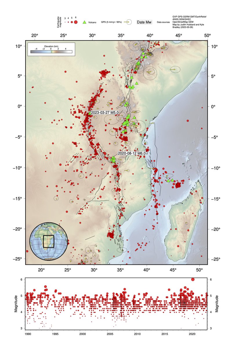
 This is a subduction zone: the Pacific Plate is subducting below the Okhotsk Plate at a rate of ~9 cm/yr. The Okhotsk Plate used to be considered part of the North American Plate (even though it's in Japan!) but it actually moves slightly differently.
 It started on Feb. 23, with a M3.8. Then, a few days later, a little microseismicity.

 This is how earthquake early warning works.

 There are occasional spikes in the data - in the monthly data, the March 2011 Tohoku-Oki M9.1 earthquake creates a spike because of its many aftershocks.
 The two earthquakes in areas with subucting slabs oriented in opposite directions. The rainbow lines above represent the depth to the plate interface (red = shallow, blue = deep).

 This aspect of the seismicity has been known for some time - the deeper earthquakes here are not on that shallow fault system, but rather an inferred boundary between two parts of the subducting slab.
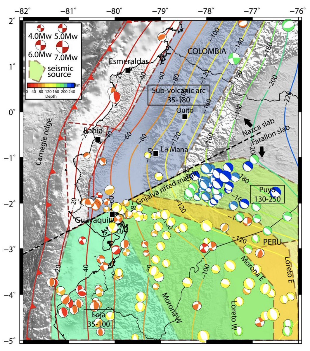
 In the map above, I've excluded the primary area of the recent rupture; what you're seeing is earthquakes recorded since 1900. Before ~1975, only large (M>5) earthquakes were recorded. Since then, seismic detection has been progressively improved.
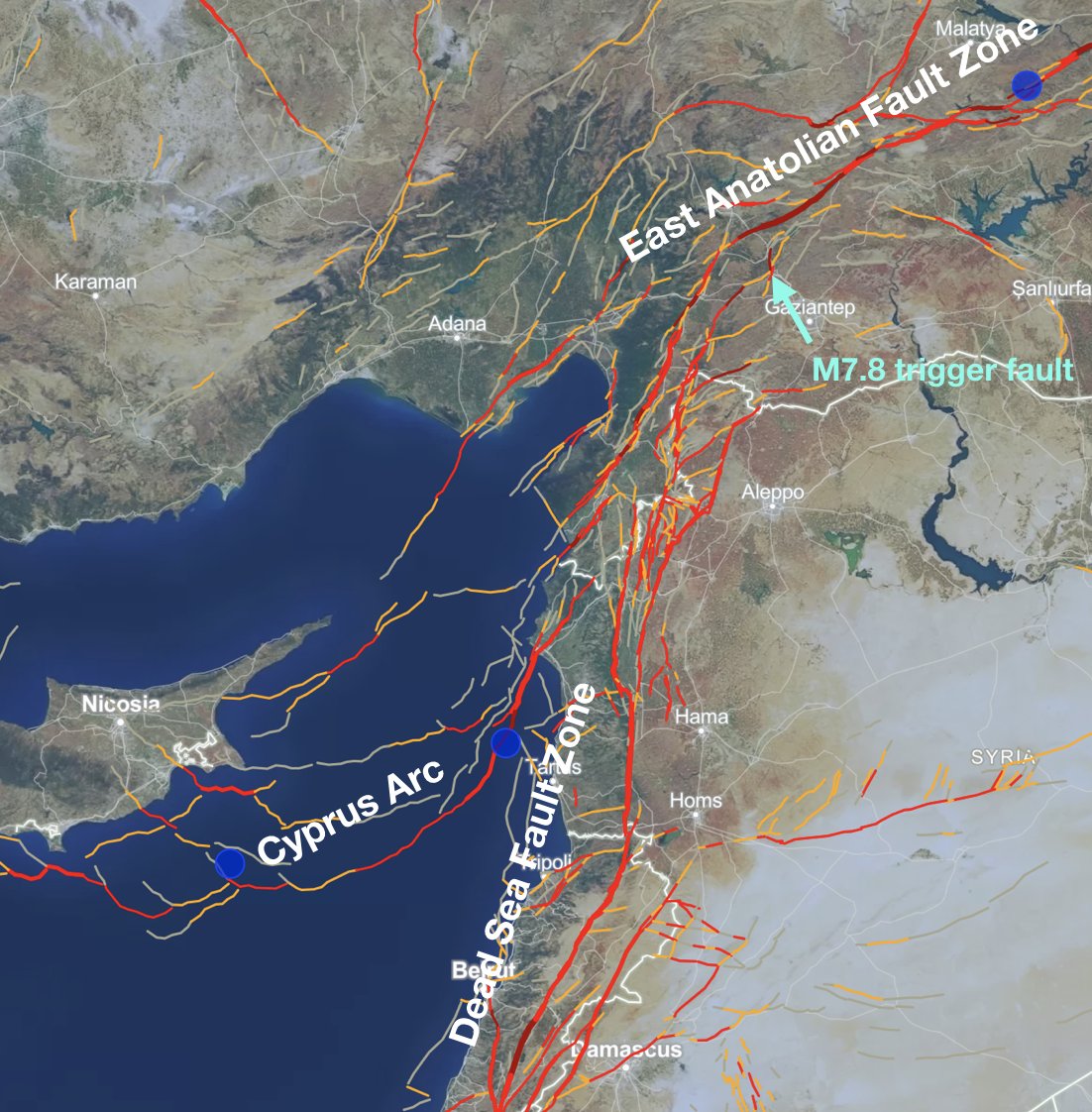 It is true that this area has complex faults across a wide area. Personally, I am not so concerned about the labels - the important thing is which faults slipped, and how much.
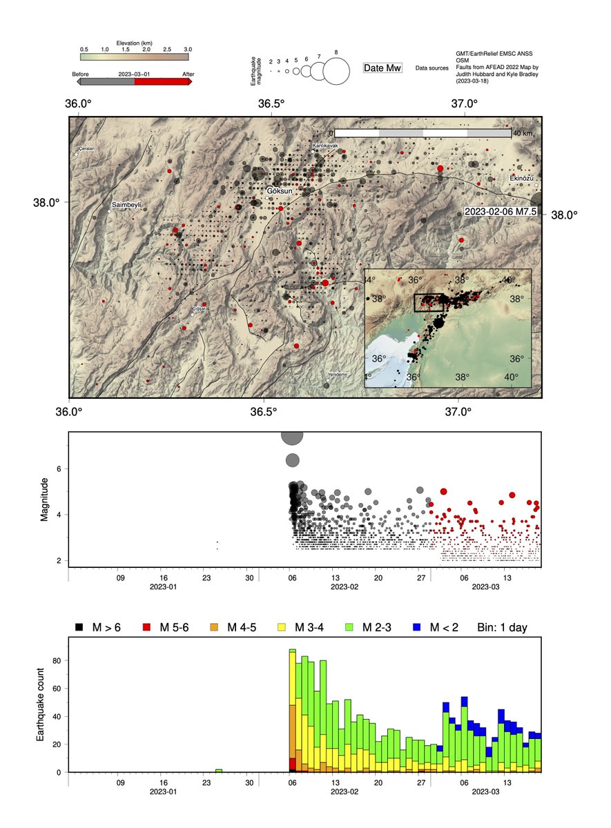 Aftershocks here are distributed across an area ~40 km x 50 km - we're not just looking at the main E-W fault, but at least two extra faults extending NW-SE and N-S down from the tip of the rupture. All of these faults have produced aftershocks.
 There have been many other earthquakes of M6.8+ in the broad area, but not so many at this depth - they are generally either shallower or deeper - and none specifically recorded near the latest epicenter.

 The aftershocks are largely located within the fault zone, not near Gaziantep, Kilis, or other cities to the east.
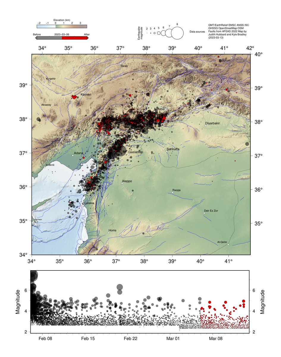 The central part of the M7.8 (~Gaziantep) is pretty quiet now, and Hatay has only moderate seismicity.
 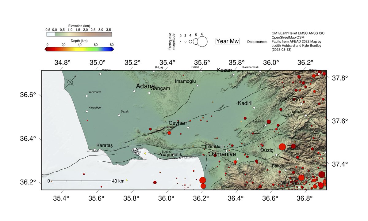 This is the earthquake record near Adana. I had to scale down the aftershocks to show it - they are small compared to to the recorded events!