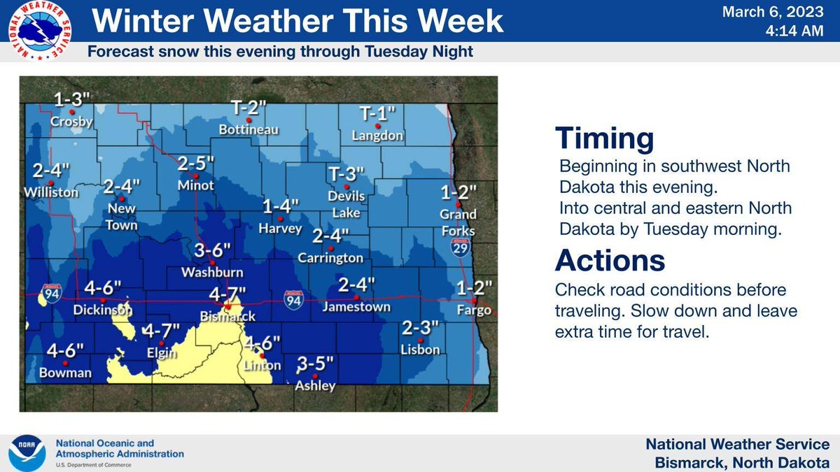
The parade of winter weather continues this week. Another round of accumulating snow arrives this evening in southwest North Dakota and then spreads through the central and east on Tuesday. #ndwx
After just light snow on Wednesday, a more significant system should develop Thursday and Friday across the region. Accumulating snow is likely for much of the region, with the highest potential for most significant impacts in eastern and southern areas of the region. #ndwx
Keep up to date with the forecast over the coming week, especially if you have travel plans. #ndwx
• • •
Missing some Tweet in this thread? You can try to
force a refresh
You may have seen in the news that a Sudden Stratospheric Warming (SSW) event is occurring - what does that mean, and what are the potential impacts for North Dakota? A thread (1/9):
The stratosphere is the layer of the atmosphere extending from ~6 miles to ~31 miles above the Earth’s surface. The stratospheric polar vortex (we bet you've heard of the polar vortex!) resides in this area, and can significantly influence weather in the mid-latitudes. (2/9)
Note: the stratospheric polar vortex and tropospheric vortex are two different things. The tropospheric polar vortex is a normal atmospheric feature that affects our weather every winter. For the remainder of the thread, we'll focus on the stratospheric one. (3/9)