It is #FrancophonieMonth and this is the story of the Acadian Expulsion!
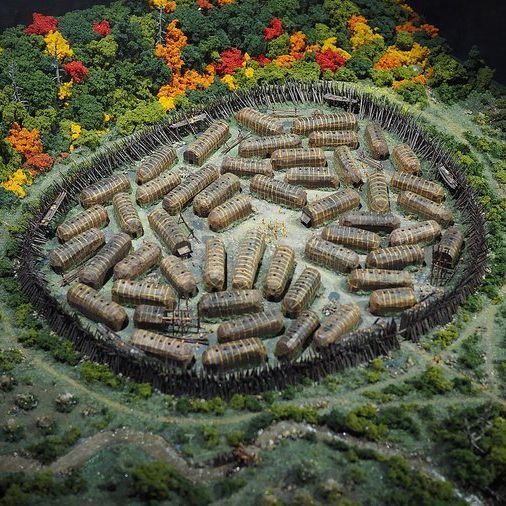
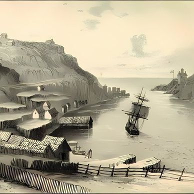
The French began settling in Acadia (Nova Scotia & New Brunswick) in the early-1600s.
In 1713, the British took over Acadia & at first left the Acadians in peace but it was not to last.
🧵1/5
In 1730, the Acadians took an oath of neutrality, promising not to get involved in a war between France and England.
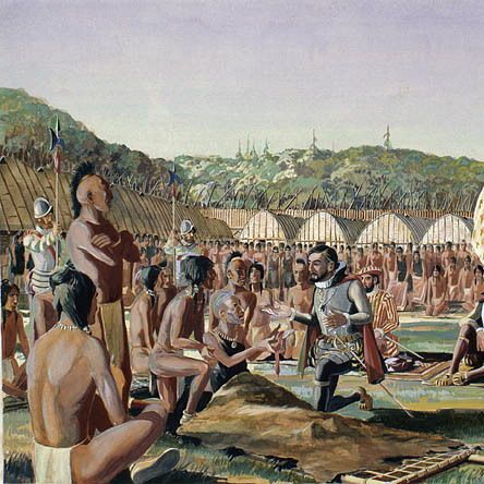
Throughout the 1740s, the French & British built fortresses in the area.
Charles Lawrence, Lt. Gov. of Nova Scotia, soon became suspicious of the Acadians
🧵2/5
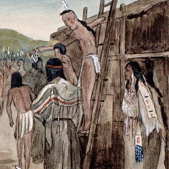
Believing they were not neutral, he demanded an oath of allegiance in 1755 but the Acadians, who wanted to be left in peace, refused.
Lawrence threw the leaders of the Acadians in jail, then ordered the Acadians to leave.
This began the Acadian Expulsion.
🧵3/5
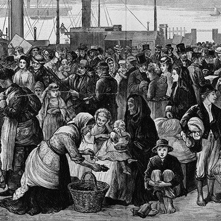
From 1755-1764, 14,000 Acadians were forced to leave. Thousands were sent to the Thirteen Colonies, others were sent to the Caribbean & a few were sent to France.
Many Acadians went to Louisiana, becoming the Cajuns
At least 5,000 died from disease, starvation & shipwrecks
🧵4/5
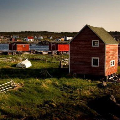
Some Acadians returned back to their lands, finding it now occupied by British settlers.
The Acadians were also allies of the Mi'kmaq, and the expulsion allowed for Indigenous lands to be taken by the British.
Today, the expulsion is considered a crime against humanity.
🧵5/5
• • •
Missing some Tweet in this thread? You can try to
force a refresh
A few days ago, I looked at how the international border through The Great Lakes was determined.
But what about the border west of Lake Superior?
It took decades to determine and wasn't just "drawn with a ruler by some guy".
Let's learn more!
🧵1/13
The 49th parallel border begins west of the Northwest Angle, a blip on the border that gives Minnesota part of the Lake of the Woods.
That 197 sq-km area came about due to treaties and a limited understanding of the geography west of Lake Superior.
🧵2/13
The 49th parallel border runs from the Strait of Georgia in the west to the Lake of the Woods.
It extends for 2,030 kilometres.
Having this as a border was first proposed before the United States even existed, back in 1714 by the Hudson's Bay Company.
From 1973 to 2022, Canada and Denmark were at war.
Over the course of the war, several soldiers on both sides were wounded....by hangovers. And it was all fought over a tiny island the size of a city block.
Let's learn about The Whisky War!
🧵1/16
Hans Island is a tiny island, 1.3 square kilometres in size, located between Ellesmere Island and Greenland.
It has no trees, no grass and is not inhabited.
The island is in the territory of the Inuit, who have visited it periodically over the centuries.
🧵2/16
The first-known Europeans reached the island in 1853 when a Danish expedition arrived. The island was named for an Inuk man on the expedition Hans Hendrik. He saved several men on the expedition when they journeyed too far from the ship on the ice.
The Great Lakes hold 23 quadrillion litres of water and 20% of the world's fresh surface water supply.
But how did Canada and the USA determine the border between the Great Lakes and also agree on the use of the lakes?
Let's learn about the treaties!
🧵1/10
When the Treaty of Paris of 1783 ended the American Revolutionary War, the treaty set out the boundary between the USA and British North America.
That border went through the Great Lakes but it was not officially surveyed.
🧵2/10
The Rush-Bagot Treaty of 1818 limited naval armaments on the Great Lakes. This treaty was significant as it laid the groundwork for a demilitarized border between the USA and Canada and the longest demilitarized border in the world (8,891 km).
On this day in 1919, Bob Homme was born.
While he was born in the United States, he adopted Canada as his home. To generations of Canadians, he was The Friendly Giant.
Let's look up...waaaaay up...and learn about his life!
🧵1/12
Bob Homme was born in Stoughton, Wisconsin where his parents were teachers at the high school.
After he graduated from school, he attended the University of Wisconsin and graduated with a degree in economics.
He joined the Air National Guard in 1939.
🧵2/12
When Japan attacked Pearl Harbor, his unit was activated. He was promoted to Staff Sergeant and was assigned to study psychology at Cornell. He ended his time in the Second World War classifying and discharging servicemen who were returning home.
In 1890, the Tariff Act came into place in the United States. It placed tariffs on imports of up to 50%.
While touted as a way to build American industry, there was also the hope it would force an annexation of Canada. It backfired.
Let's learn more.
🧵1/10
Put forward by William McKinley, who was a Congressman at that point, the Tariff Act put duties across imports ranging from 38% to 49.5%.
McKinley was called the Napoleon of Protection. While some items had tariffs eliminated, most had tariffs increased.
🧵2/10
One reason for the tariffs was to force the annexation of Canada. The McKinley Tariff declined to make an exception for Canadian products.
It was hoped this would make Canada more reliant on the US market, and push Canadians to become the 45th state.
On this day in 1920, James Doohan was born in Vancouver.
He became famous for playing Scotty on Star Trek, but before he was chief engineer on a starship he was fighting for Canada in the Second World War.
Let's learn more about that time of his life!
🧵1/12
Doohan was the youngest of four children born to Irish immigrants.
Early in Doohan's life, the family moved to Sarnia where he attended the Sarnia Collegiate Institute and Technical School. He enlisted with the 102nd Royal Canadian Army Cadet Corps in 1938.
🧵2/12
At the outbreak of the Second World War, Doohan was posted with the 14th (Midland) Field Battery of the Second Canadian Infantry Division. He then transferred to the 13th Field Regiment of the Canadian Third Infantry Division in their 22nd Field Battery.