Hermahai Profile picture
Apr 17, 2023 22 tweets 8 min read Read on X
1/ The main factor of the prosperity of the Mycenaean palatial elite was the existence of a successful commercial model, in which both the creation of an internal road network between the Mycenaean provinces and the presence of a powerful trade fleet played a catalytic role. Image
2/ The bulk of goods were transported via sea routes, but the diverse topography of the mainland, the discontinuous coastline and the numerous islands near to inland led to the creation of a road network by which goods and military forces were transported. Image
3/ The highly centralized administration facilitated the passage of trade caravans by placing military outposts (mainly watchtowers) and probably tolls along the land routes. Remains of this network have been found in Argolis and Messinia. Image
4/ However, a corresponding land network for foreign trade did not exist, although it is certain that very specific routes were followed that crossed Europe, with caravans transporting amber and metal objects to the Aegean from every corner of continental Europe. Image
5/ The difficulties of land transport were placing serious restrictions on trade, and thus there was a preference only for objects of light weight and great value, which could be more easily promoted inland. ➡️ Image
➡️ Thus the Mycenaeans were limiting to conducting trade on the coasts without penetrating the interior of the countries with which they had commercial transactions. Image
6/ On the contrary, ships allowed the cheap transport of bulky objects, absorbing the most important part of the Mycenaean trade. ➡️ Image
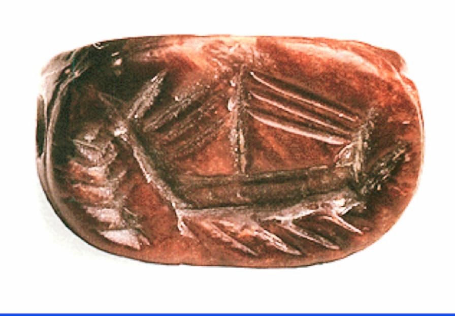
➡️ The shipwrecks of Gelidonya, Uluburun and Iria give us a clear picture of the kind of goods carried by the Mycenaean and Levantine / Cypriot trade ships of the time: ingots of copper and tin, pottery, precious artefacts. Image
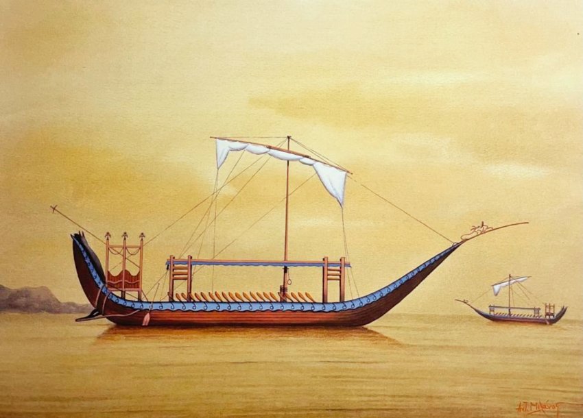
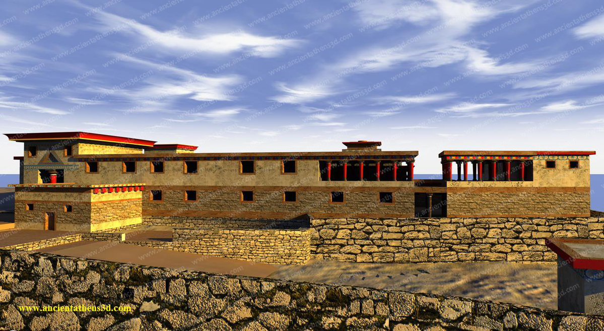
7/ The Mycenaean trade ships had a flat keel,which allowed them to enter shallow harbors and pull them ashore, a raised bow,a piston in the stern as a lever, to steer them ashore,a large stern oar as a rudder, rowers arranged in a row,a cabin for the passengers and only one sail. Image
8/ With these ships, the Mycenaeans managed to spread throughout the Mediterranean, perhaps even further. However, the difficulties were not disappearing. ➡️ Image
➡️ These ships were relatively fragile in the frequent and intense rough waters of the Mediterranean, while at the same time the sailing direction was done by observing the sun and stars and flying pigeons that were releasing at sea. Image
9/ Thus a ship rarely risked to be reopened in the open sea, but followed coastal routes, taking advantage of the favorable winds or resorting sometimes to the human power of the oarsmen, but mostly letting itself be carried away by the winds and sea currents. Image
10/ If we observe a map of the surface sea currents of the Mediterranean we will be able to understand and chart the natural two-way course of an LBA trade ship, ➡️ Image
➡️ which starts from Rhodes, embraces Crete, follows the west coast of the Peloponnese, heads north, with Corfu as an important intermediate port, to the strait of Otranto, which it crosses, to then sail around the Italian Peninsula to Sicily. Image
11/ The success of the Mycenaean palaces lies in the production of low-cost and at the same time high-quality products, with Mycenaean pottery (stirrup jars and amphorae) flooding the major commercial ports of the Eastern Mediterranean and becoming a model for local imitations. Image
12/ The Mycenaean potters had as a raw material excellent quality clay, they possessed the know-how to bake it at very high temperatures and had the high artistic skill to present products in wonderful shapes, which were decorated with tasteful patterns. Image
13/ The Mycenaean pottery was either exported as is, or contained the main Mycenaean export products: wine, aromatic oils, ointments. Another great Mycenaean export product was the textiles, continuing the textile tradition of the Minoan Cretans. Image
14/ But the Mycenaeans were not only successful exporters of agricultural and handicraft products, they also functioned as intermediaries. ➡️ Image
➡️ For example Egyptian glass beads for necklaces from the 15th century BC were found in the Aeolian Islands, the Iberian Peninsula, Northern France, Brittany, England and Central Europe, attesting to Mycenaean participation in the transport of these objects. Image
15/ In return for their highly exportable products, but also for their role as intermediaries, they received ores (copper, tin and gold), ivory, amber and exotic objects. It is impressive that the Mycenaeans of Crete imported Cypriot dyed wool, despite the large local production. Image
16/ Of great interest are two texts from Pylos which show the word o-no (load) in combination with some goods, indicating the existence of an exchange system of values: ➡️ Image
➡️ a load of Cypriot alum in exchange for 30 kg of wool and 10 pieces of linen cloth (PY Un 443) and a piece of fine cloth in exchange for 480 liters of wheat (PY Un 1322). Image

• • •

Missing some Tweet in this thread? You can try to force a refresh
 

Keep Current with Hermahai

Hermahai Profile picture

Stay in touch and get notified when new unrolls are available from this author!

Read all threads

This Thread may be Removed Anytime!

PDF

Twitter may remove this content at anytime! Save it as PDF for later use!

Try unrolling a thread yourself!

how to unroll video
  1. Follow @ThreadReaderApp to mention us!

  2. From a Twitter thread mention us with a keyword "unroll"
@threadreaderapp unroll

Practice here first or read more on our help page!

More from @hermahai

Mar 8
1/ Around 1900 BC, the old Minoan palaces were founded in Crete and the foundation stone of the first European civilization was laid, which was based on a pioneering model of political and economic organization whose main axes were maritime dominance and economic penetration. Image
2/ The Minoans,having realized the strategic geographical position of their island in the middle of important maritime trade routes that connected the western lands with the Near East, transformed Crete into the main commercial hub of the Mediterranean, building a powerful fleet. Image
3/ The Minoan ships brought important innovations for the time in order to cross the open sea: They were made of cypress trunks, had a keel for stability and a narrow, aerodynamic shape to develop speed, had large square sails and multiple rows of oars, and were waterproofed 👉 Image
Read 12 tweets
Mar 3
1/ The Hittite texts demonstrate that the Hittite Empire was in a long-standing conflict with the Mycenaean Aegean, mainly due to the constant Achaean involvement in the affairs of the Hittite vassal kingdoms of Western Anatolia. Often the Hittite kings were forced to send 👉 Image
👉 expeditionary forces to the region to defend Hittite strategic interests, suppressing instigated rebellions or stopping the penetration of Achaean military forces (Attarsiya, Wiluša). However, it does not appear that the Hittites ever attacked the Mycenaean Aegean itself. Image
2/In answering the question of why they never did this, we must first focus on the high strategy of the Hittite Empire and what its main strategic goals were. The Hittites had as the central cradle of their Empire their capital Hattusa and the surrounding areas of the highlands👉 Image
Read 20 tweets
Dec 5, 2025
1/Sicily has been a major trade crossroads since the Neolithic era,through which sea routes passed, connecting the peoples of the Eastern Mediterranean with the West and vice versa. The result of this event was the long-term habitation of the Sicilian land by a mosaic of peoples. Image
2/ Thus, when the Greek colonists arrived on the island after the mid-8th century BC, they found three population groups: the Sicilians in the E, the Sicanians in the C-W, and the Elymians in the NW. The origin of these peoples has been a subject of controversy since antiquity. Image
3/ The literary tradition has handed down to us several contradictory narratives, referring to mass migrations, often in the form of mythical tales. The best-known mythological tale is Minos' pursuit of the fugitive Daedalus in Sicily and the founding of Cretan cities there. Image
Read 16 tweets
Nov 25, 2025
1/ Athens has been associated since antiquity with the city's patron goddess, Athena. However, although most people believe that the city was named after the goddess, perhaps the opposite was actually the case. The two words have a common root that is likely of pre-Greek origin. Image
2/ But let's start from the beginning. Long before the city of Athens became the dominant center of the region, its name was Actaea and it belonged to a wider community, Att(h)is < Attica. The inhabitants of Attica at that time were not Greek-speaking (pre-Greek substrate). Image
3/ Several scholars argue that both the word Actaea and Attica, and the word Athéne (Ἀθήνη), derive from the word Atthis through corruption. Athéne is the common root from which the word Ἀθῆναι and the word Ἀθηνᾶ came. So both the city and the goddess have pre-Greek origins. Image
Read 8 tweets
Nov 23, 2025
1/ During the same period (1250/40 BC) that the major fortification works were taking place in Mycenae and Tiryns, and the hill of Midea was being rebuilt with new palatial buildings and Cyclopean fortifications, a new fortified palatial settlement was founded on the Acropolis. Image
2/ But who were the ones who built the new Mycenaean citadel Athens? The answer lies in the question of what purpose its building served. In my opinion, the Athenian elites had neither the financial means nor the know-how to construct such a project. Image
3/ So the project was designed and financed by a powerful Mycenaean actor outside Attica and he - according to the available evidence - was in Mycenae. The stakes were the limitation of Thebes' influence in Attica and in particular the exploitation of the mines of Lavrion. Image
Read 11 tweets
Oct 20, 2025
1/ The Citadel of Dymaean Wall at the NW end of the Peloponnese has a special place in Aegean prehistoric studies, as it was previously believed to be proof (along with the Isthmus Wall) of the existence of a northern threat (Dorians) to the core of the Mycenaean palatial world. Image
2/ Recent field study has placed its presence on a more realistic basis. First of all, the human presence on the Hill of Kalogria where the Citadel is built bears evidence of human presence, residential remains and pottery, dating back to the end of the 4th millennium BC. Image
3/ The choice of location is due to its great strategic importance, at the intersection of the land and the sea, constituting a significant defensive stronghold and an ideal point of surveillance of the sea routes of the Ionian Sea, already since the end of the 3rd millennium BC. Image
Read 16 tweets

Did Thread Reader help you today?

Support us! We are indie developers!


This site is made by just two indie developers on a laptop doing marketing, support and development! Read more about the story.

Become a Premium Member ($3/month or $30/year) and get exclusive features!

Become Premium

Don't want to be a Premium member but still want to support us?

Make a small donation by buying us coffee ($5) or help with server cost ($10)

Donate via Paypal

Or Donate anonymously using crypto!

Ethereum

0xfe58350B80634f60Fa6Dc149a72b4DFbc17D341E copy

Bitcoin

3ATGMxNzCUFzxpMCHL5sWSt4DVtS8UqXpi copy

Thank you for your support!

Follow Us!

:(