Unpacking this assessment in our change of control of terrain around the Dnipro River delta.
This assessment uses a combination of multi-sourced Russian-provided textual reports about Ukrainian activity in this area as well as available geolocated combat footage.
This assessment uses a combination of multi-sourced Russian-provided textual reports about Ukrainian activity in this area as well as available geolocated combat footage.
https://twitter.com/TheStudyofWar/status/1649957134233157641

Russian milbloggers Rybar and "Thirteenth" claimed on April 20 and 22 that Ukrainian forces have maintained positions in left (east) bank Kherson Oblast for weeks, established stable supply lines to these positions, and regularly conduct sorties in the area.


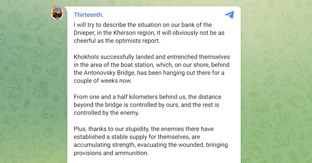
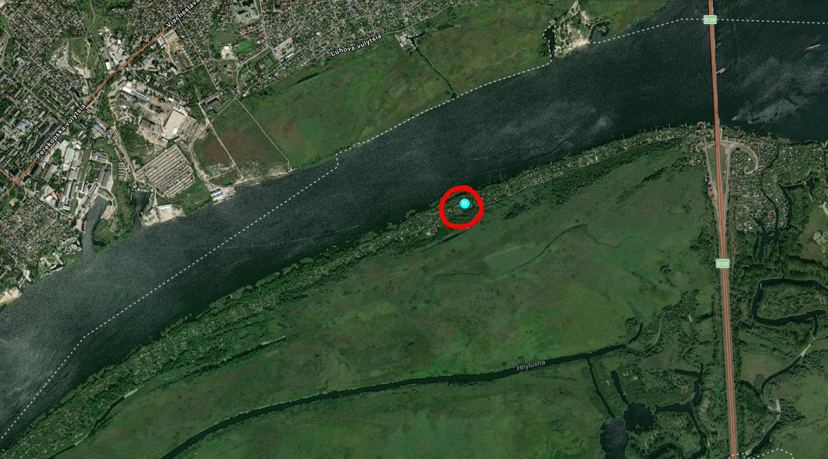
Thirteenth explicitly states that Ukrainian forces control everything beyond an unspecified portion of the Antonivsky bridge.
It's not clear what his point of reference on the bridge is, but he explicitly claims Ukrainians control the costal housing in the the red area circled.
It's not clear what his point of reference on the bridge is, but he explicitly claims Ukrainians control the costal housing in the the red area circled.

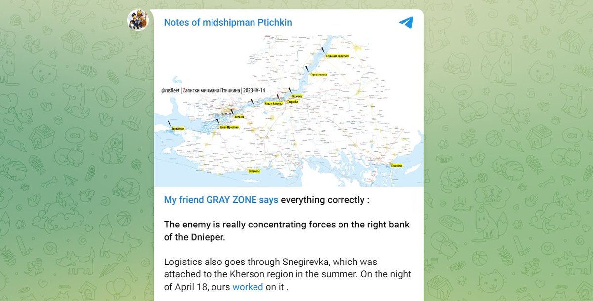
Russian milblogger Rusfleet claimed on April 18 that the Wagner-affiliated Grey Zone Telegram channel is right and that Ukrainian forces are concentrating in left bank Kherson Oblast and that Ukrainian forces are capable of crossing the Dnipro River near Kakhovka.

Kherson Occupation Head Vladimir Saldo claimed on April 18 that Ukrainian forces have massed in right bank Kherson Oblast and have demonstrated a willingness to cross the Dnipro River t.me/readovkanews/5…
Prominent milblogger Yury Kotyenok reported on April 22 that Ukrainians remains active on Velyki Potemkin Island and near Oleshky, constantly sending reconnaissance via boat and “making their presence known” on the shore.


Igor Girkin claimed on April 20 that Ukrainian forces have a small bridgehead on the left bank of the Dnipro River on an island in the Dnipro River delta. Girkin claimed that Ukrainians established a garrison and supplied boats on the island.


Girkin also notably stated that this bridgehead makes little sense as it only allows Ukrainian forces access to a floodplain swamp.
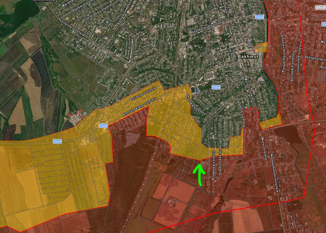
The critical mass of current Russian reporting characterizes Russian forces' presence in the delta areas as fundamentally degraded from where it was six months ago.
These reports indicate that Russian forces no longer fully control this area.
It should not be discounted.
These reports indicate that Russian forces no longer fully control this area.
It should not be discounted.
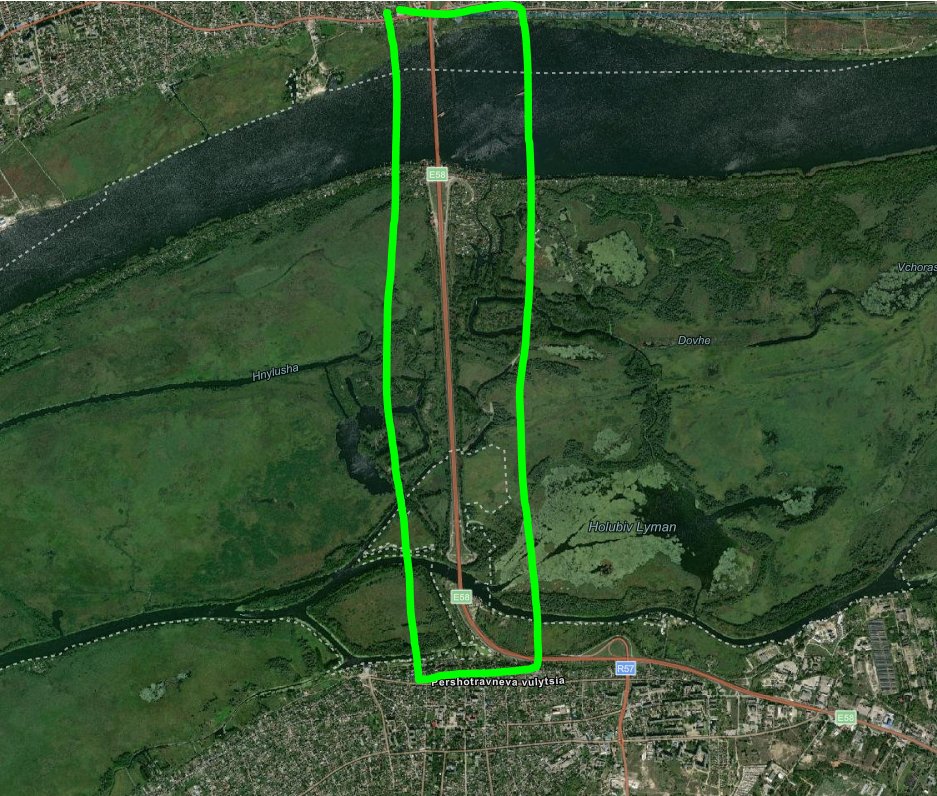
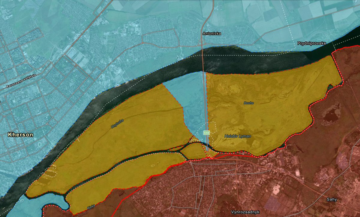
At first we were not prepared to make a major map change based solely on textual sources, but then new combat footage released on April 22to provide some more context.
On April 22 Russian Milblogger Za Front posted geolocated combat footage with a visible smoke plume - likely impact from Russian forces shelling Ukrainian forces (likely reconnaissance) - within 500 meters of Oleshky.


The footage also shows Russian forces striking likely Ukrainian reconnaissance in Dachi west of the bridge (as described by several Russian sources).
The terrain in this area - particularly south of the Dachi area - is terrible. It's wetlands & marshes unsuitable for sustaining large forces. It's unclear if Russian forces are sustaining any forces north of the Kinka & Hnylusha rivers given geographic challenges operating here

We therefore downgraded much of the delta area from Russian advance to Russian claims since not all Russian sources fully acknowledge a Ukrainian presence there and we coded where the visual evidence and textual sources suggest a Ukrainian presence.
Furthermore, the extent and intent of these Ukrainian positions remain unclear, as does Ukraine’s ability and willingness to maintain sustained positions in this area.
We're adjusting our assessment only now because this is the first time we have observed reliable geolocated imagery of Ukrainian forces on the delta's east bank along with multi-sourced Russian reports of an enduring Ukrainian presence there.
Russian reports should not be categorically excluded.
Some critics attacked previous ISW's assessments in September / October 2022 when we coded the reported Ukrainian bridgehead for the Ukrainian crossing at the Inhulets River near Bilohirka as part of the Kherson...
Some critics attacked previous ISW's assessments in September / October 2022 when we coded the reported Ukrainian bridgehead for the Ukrainian crossing at the Inhulets River near Bilohirka as part of the Kherson...
counteroffensive. That assessment was also based on Russian reports, combat footage, and remote sensing. It turned out that the Russian reports about the Ukrainian activity there was more accurate than what Ukrainian units and officials were letting on to.
We will of course update our assessment as promptly as soon as we receive more information that can enable a more precise assessment.
Sources for those interested: t.me/ZA_FROHT/16128; t.me/rybar/46079; t.me/Separ13_13/109…; t.me/RSaponkov/4860; t.me/DonbassYasinov…; t.me/rusfleet/7820; t.me/grey_zone/18319;
Sources continued: t.me/readovkanews/5…; t.me/voenkorKotenok…; t.me/strelkovii/4597; t.me/SALDO_VGA/683; t.me/hueviyherson/3…
• • •
Missing some Tweet in this thread? You can try to
force a refresh