It is #SikhHeritageMonth and this is the story of Sikhs gaining the vote!

The first Sikh immigrants to British Columbia were permitted to vote in civic elections. This right to vote would not last long as the province began to strip rights away from the Sikh people.

🧵1/5 Image
In March 1907, BC Premier William Bowser introduced legislation to deny the provincial vote to any immigrant from India who was not of Anglo-Saxon descent.
Vancouver took the vote away from Sikhs the following month.
The Sikh people couldn't vote federally either.

🧵2/5 Image
At the 1921 Imperial Conference in England, a resolution was passed to grant South Asians in the British Empire the right to vote.
Canada simply ignored the resolution.
Some MPs, like Samuel Jacobs, Canada's 1st Jewish MP, supported giving Sikhs the vote.

🧵3/5 Image
In 1924, BC passed the Provincial Elections Act to deny the vote to all Asians except Japanese veterans of WW1.
Men such as Dr. D.P. Pandia (pictured), Kapoor Singh Siddoo, Mayo Singh & Kartar Singh Hundal campaigned to get the vote for Sikhs and others.

🧵4/5 Image
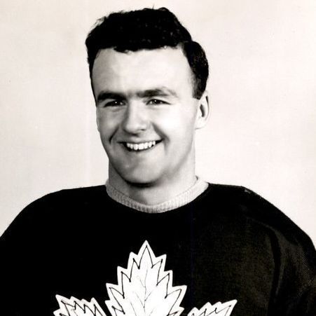
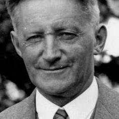
In the 1940s, Sikhs, such as Naginder S. Gill (pictured) continued to pressure the government to grant the vote to South Asians.
India PM Jawaharial Nehru joined the cause of gaining the vote.
On April 2, 1947, South Asians gained the provincial & federal vote.

🧵5/5 Image

• • •

Missing some Tweet in this thread? You can try to force a refresh
 

Keep Current with Craig Baird - Canadian History Ehx

Craig Baird - Canadian History Ehx Profile picture

Stay in touch and get notified when new unrolls are available from this author!

Read all threads

This Thread may be Removed Anytime!

PDF

Twitter may remove this content at anytime! Save it as PDF for later use!

Try unrolling a thread yourself!

how to unroll video
  1. Follow @ThreadReaderApp to mention us!

  2. From a Twitter thread mention us with a keyword "unroll"
@threadreaderapp unroll

Practice here first or read more on our help page!

More from @CraigBaird

Mar 15
A few days ago, I looked at how the international border through The Great Lakes was determined.
But what about the border west of Lake Superior?
It took decades to determine and wasn't just "drawn with a ruler by some guy".
Let's learn more!

🧵1/13 The photo shows a grassy, open landscape with a clear blue sky dotted with a few wispy clouds. The terrain appears to be a mix of tall, dry grass and patches of dirt, suggesting a rural or prairie setting. A narrow dirt path or road stretches across the scene from left to right, dividing the landscape. In the foreground, there is a vertical marker or signpost standing in the grass. The sign has text on it, with the most prominent words being "UNITED STATES AND CANADA" written vertically in large, bold letters. Below this, there is smaller text, likely providing additional informat...
The 49th parallel border begins west of the Northwest Angle, a blip on the border that gives Minnesota part of the Lake of the Woods.
That 197 sq-km area came about due to treaties and a limited understanding of the geography west of Lake Superior.

🧵2/13 The image is a map highlighting a specific geographical area near the border between the United States and Canada. The map shows parts of Minnesota in the United States and Manitoba and Ontario in Canada. Key locations are labeled, including: Northwest Angle, which is situated in the northern part of Minnesota, extending into a body of water.  Elm Point, located slightly to the southwest of Northwest Angle, near the border.  Muskeg Bay, positioned near Elm Point.  Lake of the Woods, a large lake that dominates the central part of the map, with Northwest Angle protruding into it.
The 49th parallel border runs from the Strait of Georgia in the west to the Lake of the Woods.
It extends for 2,030 kilometres.
Having this as a border was first proposed before the United States even existed, back in 1714 by the Hudson's Bay Company.

🧵3/13 The image is a map of a portion of North America, focusing on the border region between the United States and Canada. The map highlights the 49th parallel, which is marked with a red dashed line running horizontally across the map. This parallel serves as a significant portion of the border between the two countries. Key features on the map include: Point Roberts, located on the far western side of the map, just south of the 49th parallel. It is a small exclave of the United States, surrounded by water and Canadian territory, accessible by land only through Canada.  Lake of the Woods, situa...
Read 14 tweets
Mar 12
From 1973 to 2022, Canada and Denmark were at war.
Over the course of the war, several soldiers on both sides were wounded....by hangovers. And it was all fought over a tiny island the size of a city block.
Let's learn about The Whisky War!

🧵1/16 The photo shows two side-by-side images. The left image depicts a group of people in military-style camouflage uniforms raising a Canadian flag on a pole surrounded by rocks, with a helicopter in the background. The right image shows a group of individuals, some in red uniforms and one in a dark coat, standing in front of a Danish flag on a pole, with a frozen landscape and mountains in the background.
Hans Island is a tiny island, 1.3 square kilometres in size, located between Ellesmere Island and Greenland.
It has no trees, no grass and is not inhabited.
The island is in the territory of the Inuit, who have visited it periodically over the centuries.

🧵2/16 The image is a map showing a portion of the Arctic region, specifically focusing on the area between Canada and Greenland. The map highlights two islands: Ellesmere Island, which is part of Canada, and Hans Island, located between Ellesmere Island and Greenland. Ellesmere Island is labeled and marked with a black dot, while Hans Island is marked with a small circle and labeled in blue. The map also includes a small inset in the top right corner showing the broader Arctic region, with a dot indicating the location of this area within the Arctic Circle. The map is sourced from the BBC, as ind...
The first-known Europeans reached the island in 1853 when a Danish expedition arrived. The island was named for an Inuk man on the expedition Hans Hendrik. He saved several men on the expedition when they journeyed too far from the ship on the ice.

🧵3/16 The image is a black-and-white illustration of a person wearing a fur hat and a heavy coat with a high collar, suitable for cold weather. The style suggests an older, possibly historical depiction, with detailed cross-hatching for shading.
Read 17 tweets
Mar 11
The Great Lakes hold 23 quadrillion litres of water and 20% of the world's fresh surface water supply.
But how did Canada and the USA determine the border between the Great Lakes and also agree on the use of the lakes?
Let's learn about the treaties!

🧵1/10 The photo is a satellite image of the Great Lakes region in North America. It prominently features the five Great Lakes—Superior, Michigan, Huron, Erie, and Ontario—surrounded by lush green landmasses, including parts of the United States and Canada. The image shows varying shades of blue in the lakes, with some cloud cover scattered across the land.
When the Treaty of Paris of 1783 ended the American Revolutionary War, the treaty set out the boundary between the USA and British North America.
That border went through the Great Lakes but it was not officially surveyed.

🧵2/10 The photo shows a historical document, specifically a page from the Treaty of Paris. The text is written in an elegant, cursive script typical of the 18th century. The document states that it was "Done at Paris the third day of September in the year of our Lord one thousand seven hundred and eighty-three" and is signed by notable figures, including "John Adams," "B Franklin" (Benjamin Franklin), and "John Jay." The page is adorned with several red wax seals attached with ribbons, signifying its official nature and authenticity. The parchment appears a...
The Rush-Bagot Treaty of 1818 limited naval armaments on the Great Lakes. This treaty was significant as it laid the groundwork for a demilitarized border between the USA and Canada and the longest demilitarized border in the world (8,891 km).

🧵3/10 The photo depicts an old map titled "A Map of the Frontier Lakes with part of Pennsylvania, New York, Canada, and the Hudson Bay Territories." The map appears to be historical, likely from the 18th century, given its style and the date "1783" printed in the bottom right corner. It focuses on the Great Lakes region, showing Lake Huron, Lake Erie, Lake Ontario, and parts of Lake Michigan and Lake Superior, labeled as they were known at the time (e.g., "Lake Hurons"). Surrounding areas are labeled as "Canada," "Ohio," "Pennsylvania," ...
Read 11 tweets
Mar 8
On this day in 1919, Bob Homme was born.
While he was born in the United States, he adopted Canada as his home. To generations of Canadians, he was The Friendly Giant.
Let's look up...waaaaay up...and learn about his life!

🧵1/12 The photo features an older man with white hair, smiling at the camera. He is dressed in a rustic, medieval-style outfit, including a tan tunic with a brown collar and black pants. In his hands, he holds a violin and a small stringed instrument, possibly a dulcimer or zither, placed on his lap. Over his shoulder, he carries a bagpipe.  Accompanying him are two puppet-like figures: one is a colorful giraffe with blue spots and a harmonica in its mouth, positioned to his left, and the other is a chicken puppet perched on his right shoulder, dressed in a polka-dotted outfit. The background is ...
Bob Homme was born in Stoughton, Wisconsin where his parents were teachers at the high school.
After he graduated from school, he attended the University of Wisconsin and graduated with a degree in economics.
He joined the Air National Guard in 1939.

🧵2/12 This black-and-white photo depicts a man with short hair, smiling at the camera. He is dressed in a medieval or folk-style outfit, featuring a loose-fitting tunic with a belt around his waist. He appears to be playing a set of bagpipes, with one hand on the chanter and the other supporting the bag, which is decorated with a polka-dot pattern.  Behind him stands a puppet resembling a giraffe with large spots, holding a violin and bow, as if playing along. The background consists of a stone wall with a rounded, textured pattern, giving the scene a rustic or historical ambiance. The overall co...
When Japan attacked Pearl Harbor, his unit was activated. He was promoted to Staff Sergeant and was assigned to study psychology at Cornell. He ended his time in the Second World War classifying and discharging servicemen who were returning home.

🧵3/12 This black-and-white photo shows a man kneeling or crouching on a wooden platform. He is dressed in a rustic, medieval-style outfit, featuring a loose-fitting tunic with frayed edges and dark pants. His hands are positioned as if he is adjusting or placing a small object, possibly a miniature accessory, onto a detailed model of a barn with a pitched roof and a small cupola. The background includes a painted scene depicting a rural landscape with a windmill, trees, and rolling hills, suggesting a farm setting. The indoor setting is hinted at by the visible pipes and conical structures above,...
Read 13 tweets
Mar 4
In 1890, the Tariff Act came into place in the United States. It placed tariffs on imports of up to 50%.
While touted as a way to build American industry, there was also the hope it would force an annexation of Canada. It backfired.
Let's learn more.

🧵1/10 The image is a black-and-white political cartoon depicting a man in a suit standing behind a counter labeled "Republican Platform." He is holding a bottle labeled "Untaxed Whiskey, 20¢ Gal." in one hand and a piece of cloth labeled "War-Taxed Common Cloth, Tariff 84%" in the other. Above the counter, a sign reads, "If you don’t see what you want, ask for it." The cartoon, signed by W.A. Rogers, appears to satirize the Republican Party's economic policies, highlighting the disparity in taxation between luxury items like whiskey and essential goods like...
Put forward by William McKinley, who was a Congressman at that point, the Tariff Act put duties across imports ranging from 38% to 49.5%.
McKinley was called the Napoleon of Protection. While some items had tariffs eliminated, most had tariffs increased.

🧵2/10 The photo is a black-and-white portrait of a man wearing a formal dark suit, white shirt, and bow tie. His hair is neatly combed and parted to the side. He has a serious expression and is seated, with one hand resting on his lap. The background is plain and dark, keeping the focus on his attire and expression, suggesting a historical or official photograph, likely from the late 19th or early 20th century.
One reason for the tariffs was to force the annexation of Canada. The McKinley Tariff declined to make an exception for Canadian products.
It was hoped this would make Canada more reliant on the US market, and push Canadians to become the 45th state.

🧵3/10 The image is a black-and-white scan of a newspaper article or editorial excerpt. The headline reads, "A TRIUMPH FOR CANADIAN BARLEY." The text discusses the McKinley tariff bill, describing it as an example of "protectionism run mad," and notes that it has failed to achieve its goal of affecting Canadian farmers. Specifically, it mentions that the bill increases the import tax on barley from 10¢ to 30¢ per bushel, but this has not reduced the importation of eight to twelve million bushels of barley yearly from Ontario, benefiting the western farmer. The text is formatted...
Read 11 tweets
Mar 3
On this day in 1920, James Doohan was born in Vancouver.
He became famous for playing Scotty on Star Trek, but before he was chief engineer on a starship he was fighting for Canada in the Second World War.
Let's learn more about that time of his life!

🧵1/12 The photo shows two images side by side. On the left, a man wearing a red Starfleet uniform with a delta shield insignia, associated with the character Scotty from "Star Trek," is depicted in a futuristic setting. On the right, a young man in a military uniform, including a beret with an insignia, is shown outdoors, smiling, with trees in the background.
Doohan was the youngest of four children born to Irish immigrants.
Early in Doohan's life, the family moved to Sarnia where he attended the Sarnia Collegiate Institute and Technical School. He enlisted with the 102nd Royal Canadian Army Cadet Corps in 1938.

🧵2/12 The black-and-white photo shows a young man in a military uniform and an older woman in a floral dress sitting side by side on deck chairs in a garden. The man is smiling, and the woman has a calm expression. The background features greenery and a wooden fence.
At the outbreak of the Second World War, Doohan was posted with the 14th (Midland) Field Battery of the Second Canadian Infantry Division. He then transferred to the 13th Field Regiment of the Canadian Third Infantry Division in their 22nd Field Battery.

🧵3/12 The black-and-white photograph depicts a young man standing outdoors in a military uniform. He is wearing a peaked cap with an insignia, a belted jacket with epaulets, and trousers. His hands are on his hips, exuding a confident posture. The background features a rural landscape with bare trees and open ground, suggesting it was taken in late autumn or winter. The overall tone of the image is historical, likely from the mid-20th century, given the style of the uniform and the photographic quality.
Read 13 tweets

Did Thread Reader help you today?

Support us! We are indie developers!


This site is made by just two indie developers on a laptop doing marketing, support and development! Read more about the story.

Become a Premium Member ($3/month or $30/year) and get exclusive features!

Become Premium

Don't want to be a Premium member but still want to support us?

Make a small donation by buying us coffee ($5) or help with server cost ($10)

Donate via Paypal

Or Donate anonymously using crypto!

Ethereum

0xfe58350B80634f60Fa6Dc149a72b4DFbc17D341E copy

Bitcoin

3ATGMxNzCUFzxpMCHL5sWSt4DVtS8UqXpi copy

Thank you for your support!

Follow Us!

:(