
The Saivite savant Manickavasagar of the 9th century used money meant for buying horses to construct this temple at Avudaiyarkoil, known as Thiruperunthurai, in Pudukottai district.
#Archaeology
thehindu.com/news/national/…
1/8
#Archaeology
thehindu.com/news/national/…
1/8

Queen with all her robes and Jewels sculpted in Aathmanathaswamy temple, Aavudayar Kovil 'Avudaiyarkoil', Tamilnadu.
9th century ce
What is the name of this Queen? 👑
#Archaeology
upload.wikimedia.org/wikipedia/comm…
2/8
9th century ce
What is the name of this Queen? 👑
#Archaeology
upload.wikimedia.org/wikipedia/comm…
2/8


Possibly, the King and the Queen in Aathmanathaswamy temple. Look at the hairdress. Is this ritualistic depiction?
#Archaeology
travel.bhushavali.com/2012/02/avudai…
3/8
#Archaeology
travel.bhushavali.com/2012/02/avudai…
3/8

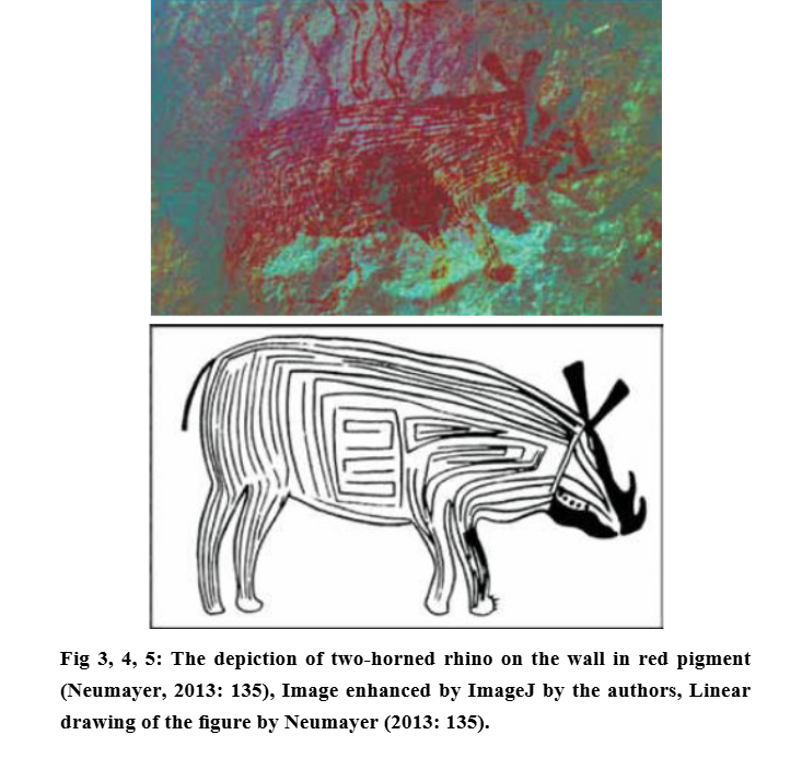
What is this Animal ?
You must cover this temple
@TheGopalan #Archaeology
travel.bhushavali.com/2012/02/avudai…
4/8
You must cover this temple
@TheGopalan #Archaeology
travel.bhushavali.com/2012/02/avudai…
4/8


Some more devotees carved on the pillars of the temple
#Archaeology
tripadvisor.com/LocationPhotoD…
7/8
#Archaeology
tripadvisor.com/LocationPhotoD…
7/8


There are snake sculptures surrounding a pond in the temple.
Can anyone count the number of snakes ?
destimap.com/index.php?act=…
8/8
Can anyone count the number of snakes ?
destimap.com/index.php?act=…
8/8

• • •
Missing some Tweet in this thread? You can try to
force a refresh


