For anyone interested in Central/Eastern European history, maps, history in general, or all of the above, if you don’t know about this book you are missing out.
It is free to download as a pdf and has some of the most detailed and interesting maps you’ll ever see.
Short🧵
It is free to download as a pdf and has some of the most detailed and interesting maps you’ll ever see.
Short🧵
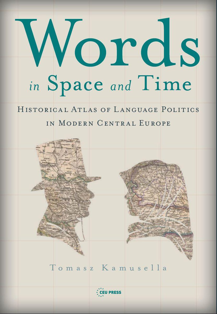
To say it’s just a book doesn’t do it justice. It is a beautiful historical atlas covering over 1000 years of Central and Eastern European (CEE) linguistic history.
It goes far beyond just dialect continua, covering writing systems, holy languages, minority languages, etc. etc.
It goes far beyond just dialect continua, covering writing systems, holy languages, minority languages, etc. etc.


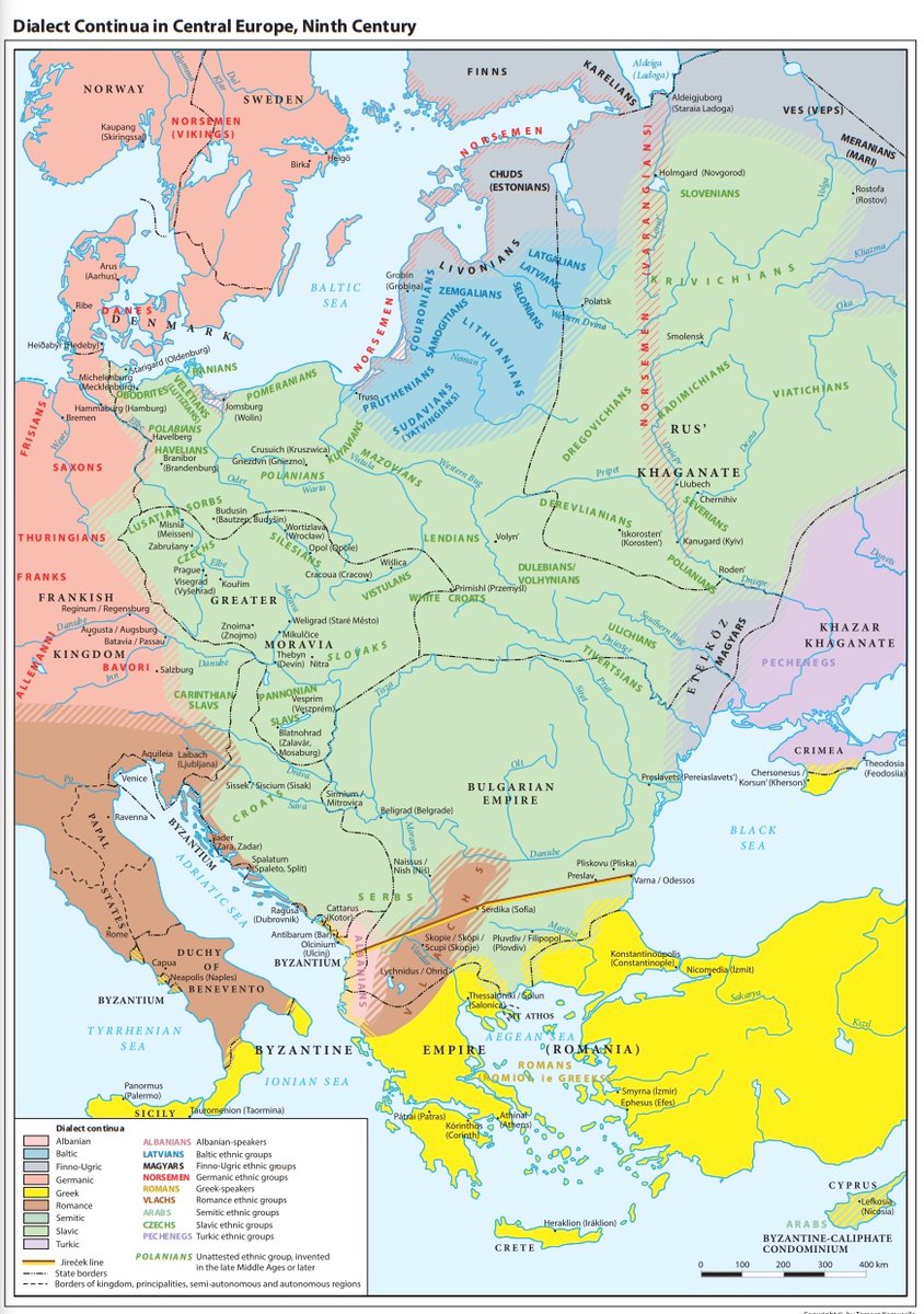
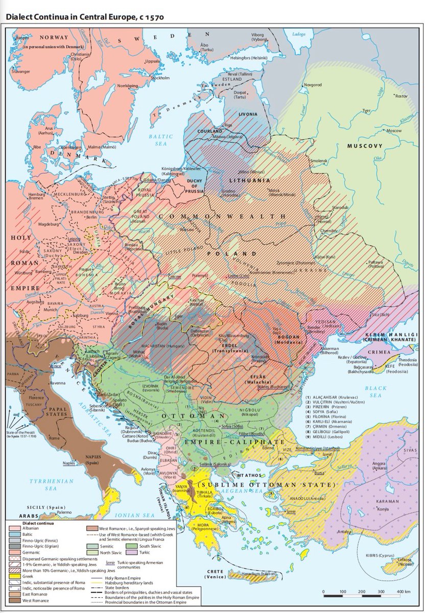
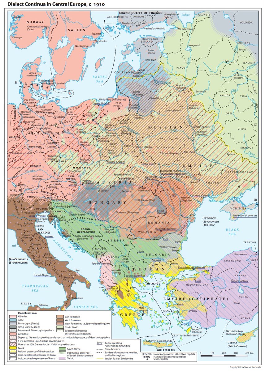
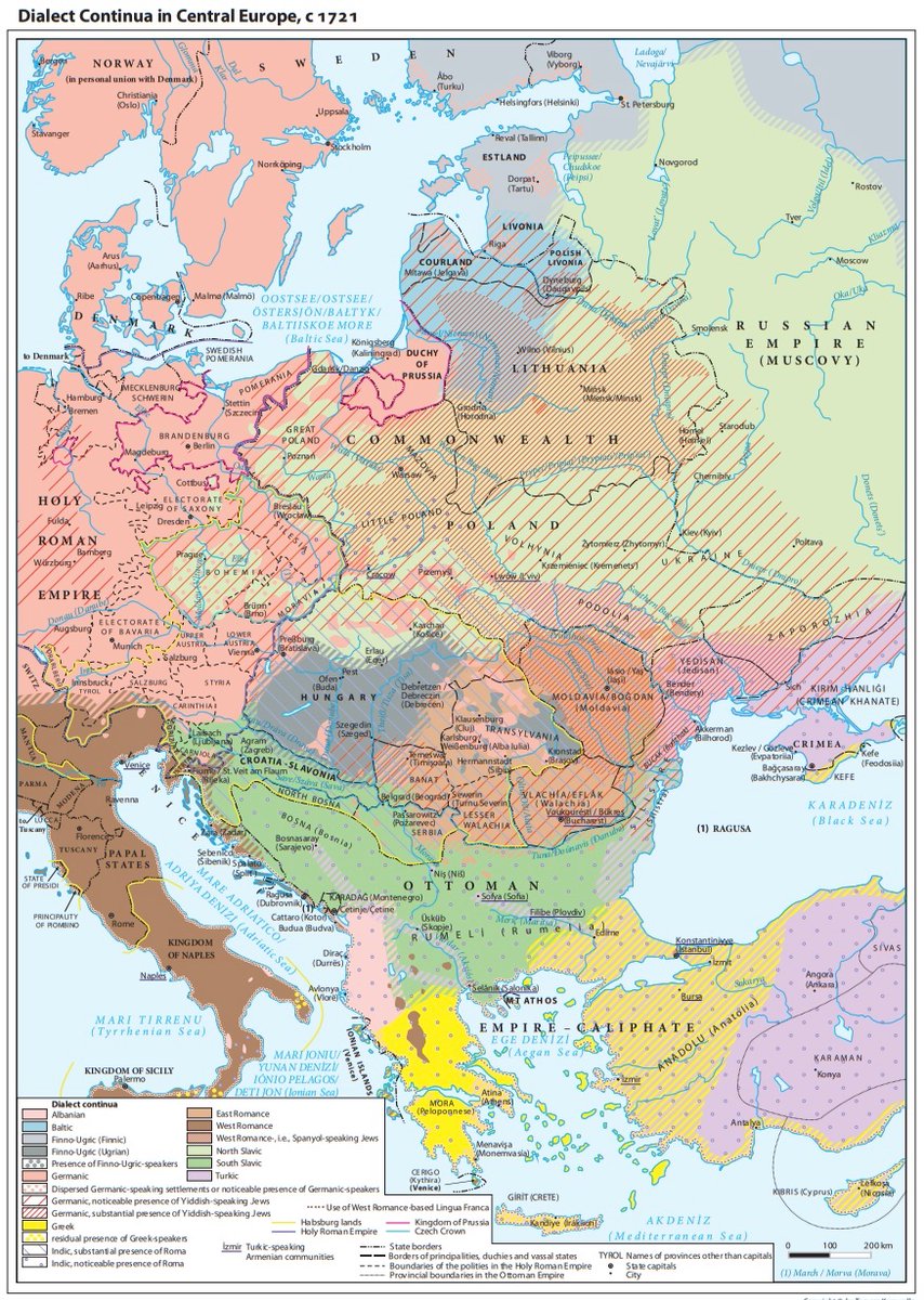
Here are, for example, the beautiful maps of dialect continua showing how radically the languages spoken across CEE from the 9th century to 1910.

But dialect continua are only half the story.
Writing systems in use present a far more complicated picture of how religious and political uses of varying scripts and languages influenced and interacted with those local languages.
Writing systems in use present a far more complicated picture of how religious and political uses of varying scripts and languages influenced and interacted with those local languages.
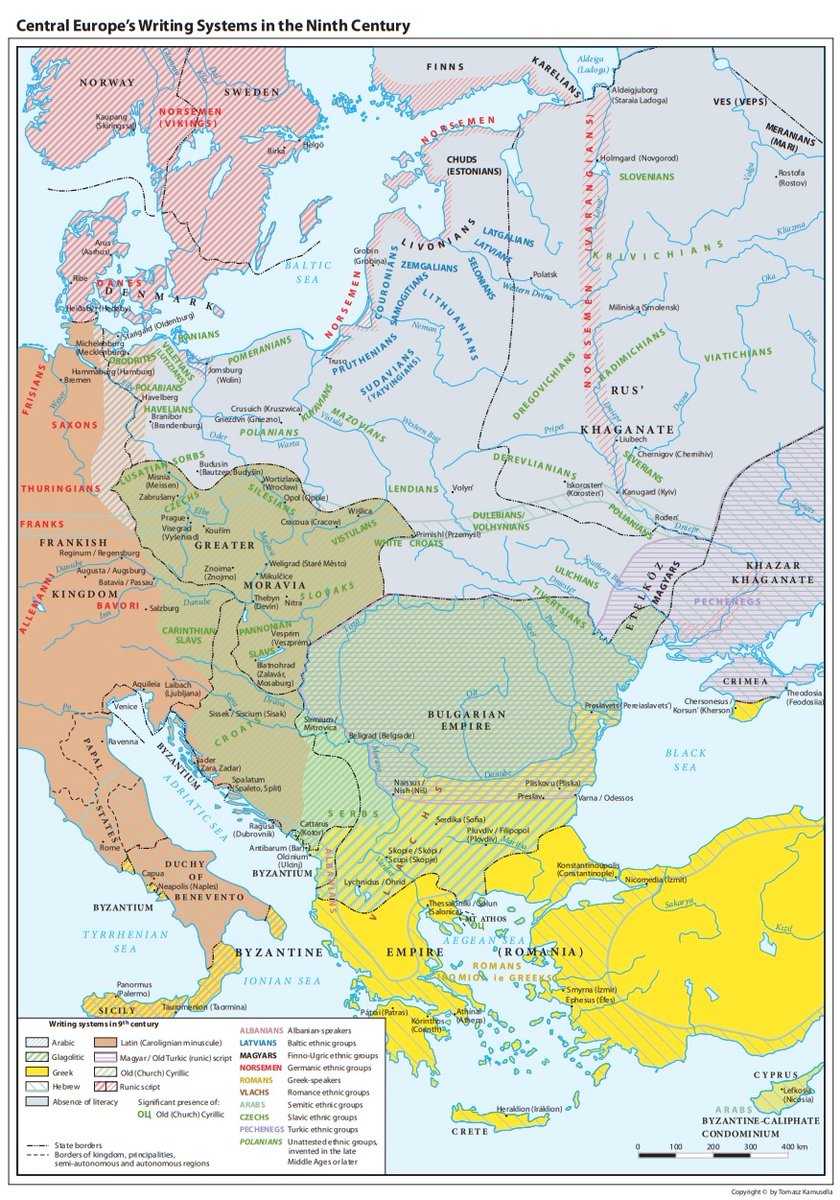
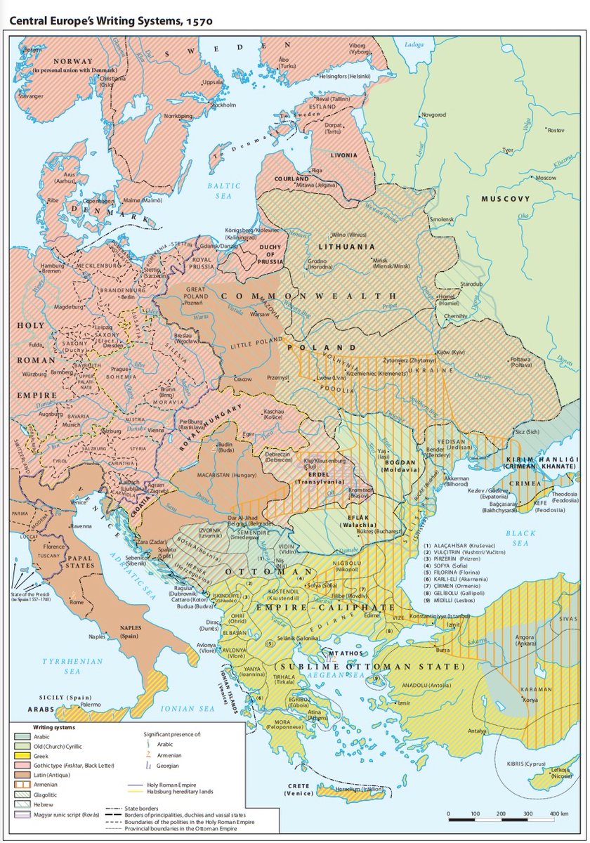
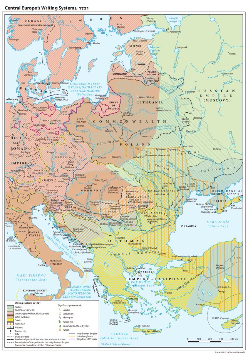
Perhaps most interesting here is the use of Latin. Latin continued to be used in Central Europe (specifically in the Kingdom of Hungary) into the mid-19th c., later than anywhere else in Europe.
This great map shows the status of Latin across CEE in 1721 (in Latin!)
This great map shows the status of Latin across CEE in 1721 (in Latin!)
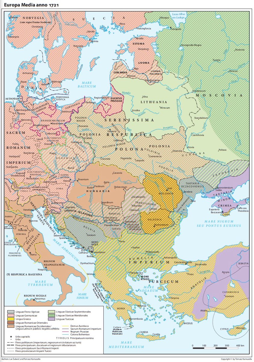
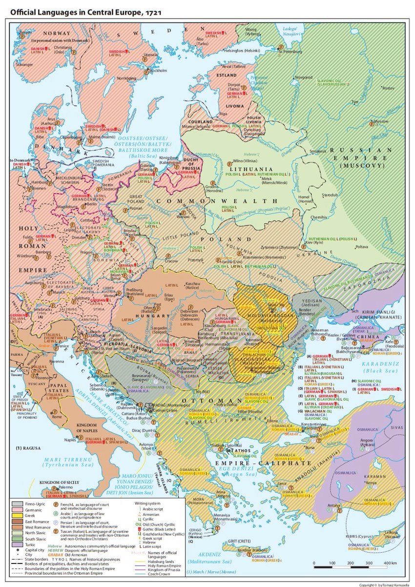
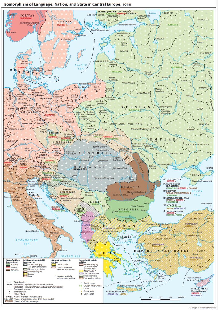
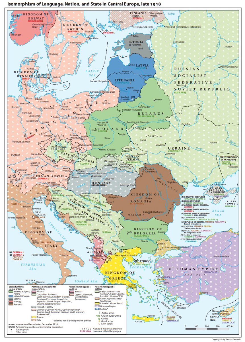
And, my personal favourite, this map shows official languages across CEE in 1721, showing dialect continua, scripts, and pockets of French, Persian, Arabic, Tuscan use in various different urban environments
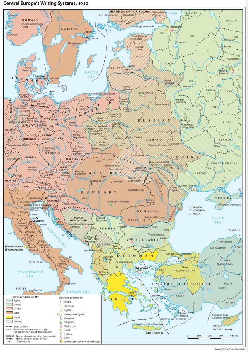
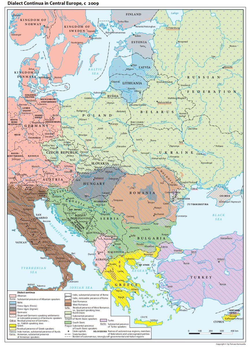
That linguistic complexity has not survived to the present day, however, as these maps of modern CEE show.
Just look at this contrast between 1721 and 2009!
Just look at this contrast between 1721 and 2009!
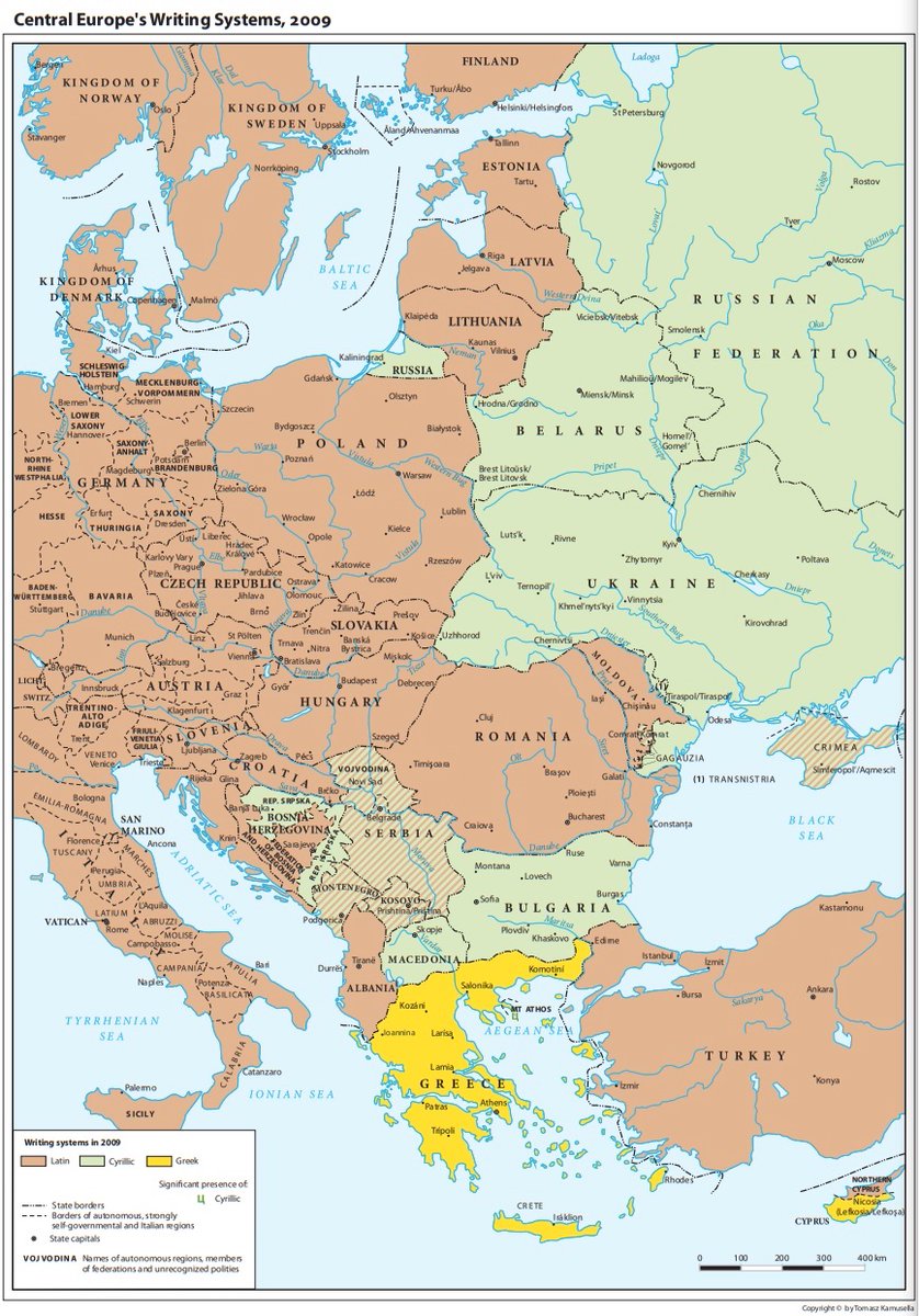
This is even more pronounced with writing systems.
But how did that happen?
But how did that happen?

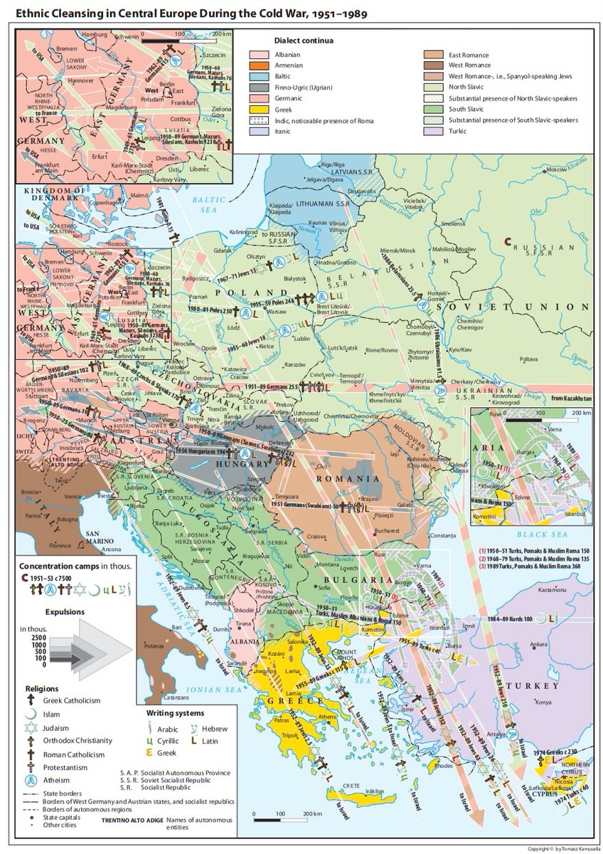
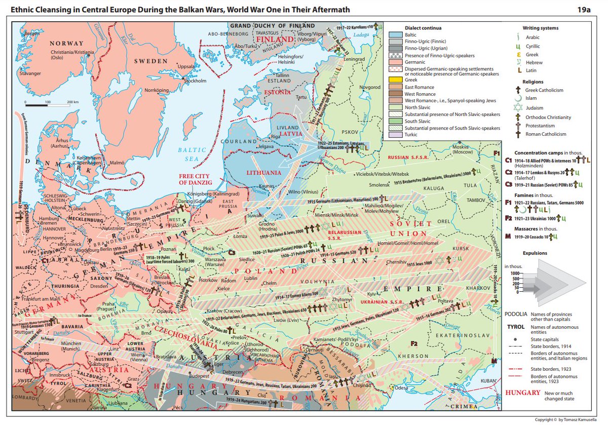
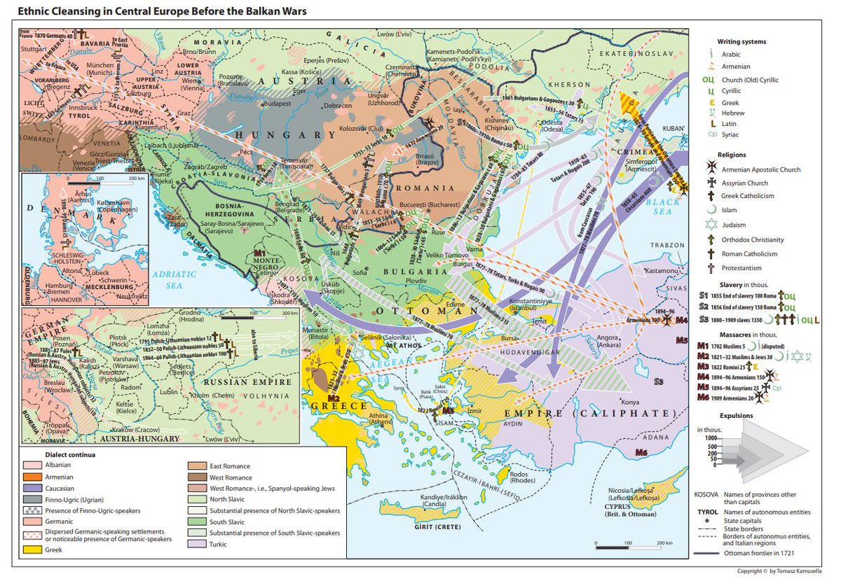
Here the atlas does not let us down, helping us visualise how centuries of linguistic nationalism and ethnic cleansing reshaped the linguistic map of Central and Eastern Europe.
All of this is just a little taste of what’s in the atlas.
Highly recommend everyone make use of this, download it, buy it even. The work that Tomasz Kamusella and others have done here is remarkable.
Pdf can be found here 👇
ceupress.com/book/words-spa…
Highly recommend everyone make use of this, download it, buy it even. The work that Tomasz Kamusella and others have done here is remarkable.
Pdf can be found here 👇
ceupress.com/book/words-spa…
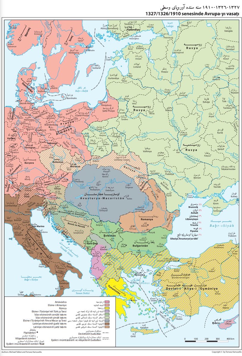
Bonus map: CEE in 1910 in Ottoman Turkish viewed through the lens of Ottoman geography.
@llisjak provides an important reminder that these maps should not be taken as 100% accurate in their boundaries. Best as a general visual guide, but the boundaries (esp. premodern) are not necessarily accurate or reflective of recent scholarship.
https://twitter.com/llisjak/status/1653733371917344775?s=20
• • •
Missing some Tweet in this thread? You can try to
force a refresh