Why is Africa the way it is? Part 2
Today, a story about religions, bugs, mountains, deserts, trade, wars, slaves & more
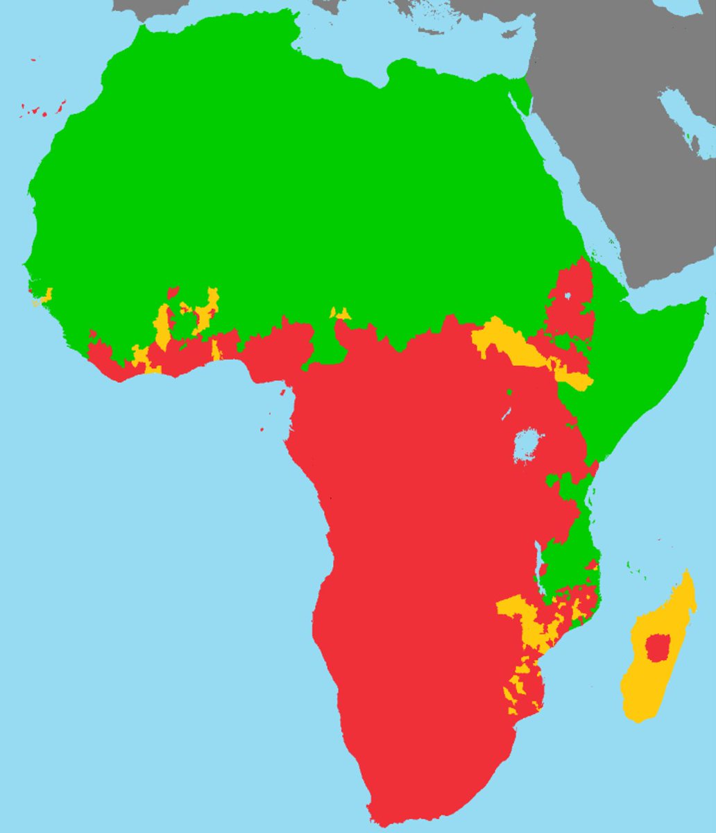
Here's a challenge. Look at this map and make a guess: what do the red/green/yellow colors represent?
Today, a story about religions, bugs, mountains, deserts, trade, wars, slaves & more
Here's a challenge. Look at this map and make a guess: what do the red/green/yellow colors represent?
If you thought religions, congrats! These are the *majority* religions in Africa
Green is Islam
Red is Christianism
Yellow is other
But have you ever wondered *why* it's like this?
Hint: who brought these religions here?
Green is Islam
Red is Christianism
Yellow is other
But have you ever wondered *why* it's like this?
Hint: who brought these religions here?

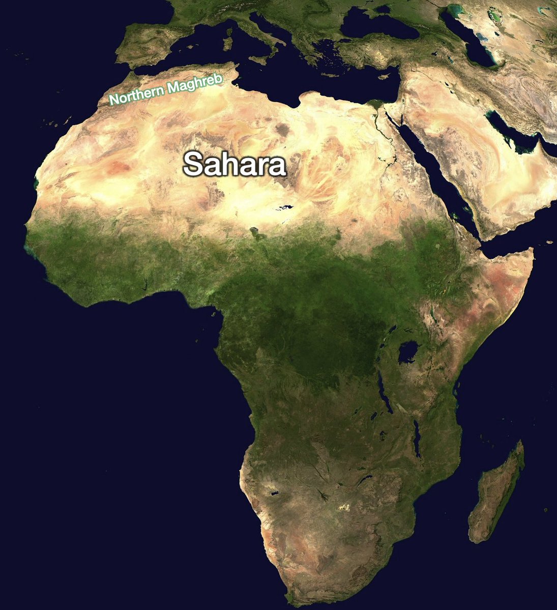
Look at Islam in North Africa, the big green blob. Where does it stop? It reaches the Sahara and stops in its south, when forests start, close to the Gulf of Guinea (the big gulf that narrows Africa in the middle)
Why does Islam stop there?
Why does Islam stop there?
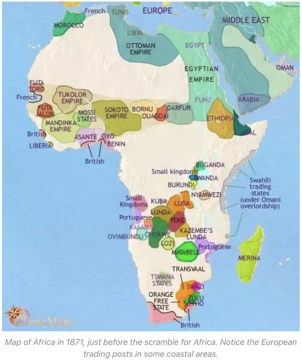
For that, we need to understand first how Islam got there. Look at this historic political map of Africa. For thousands of years there's just Egypt, somewhat connected to the Middle East. Then, the Roman Empire for centuries. And then, in less than 100 years, it becomes Muslim
During all that time, North Africa was connected to Europe and the Middle East.
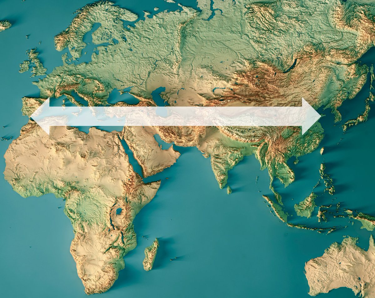
Because North Africa is closer geographically to Eurasia than to sub-Saharan Africa.
Same latitude, same climate, no impassable barriers
But the Sahara was impenetrable
Because North Africa is closer geographically to Eurasia than to sub-Saharan Africa.
Same latitude, same climate, no impassable barriers
But the Sahara was impenetrable
Until the Muslim Arabs brought the domesticated camel with their conquests in the 7th century.
With it, they could start venturing south, to do what everybody did at the time: trade, including slavery
With it, they could start venturing south, to do what everybody did at the time: trade, including slavery
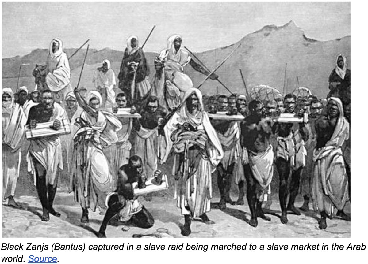
Over centuries of trade and slavery, Islam slowly progressed south
But these were desert people. It was much harder to adapt to the savanna, and then the jungle, and then the coast
But these were desert people. It was much harder to adapt to the savanna, and then the jungle, and then the coast
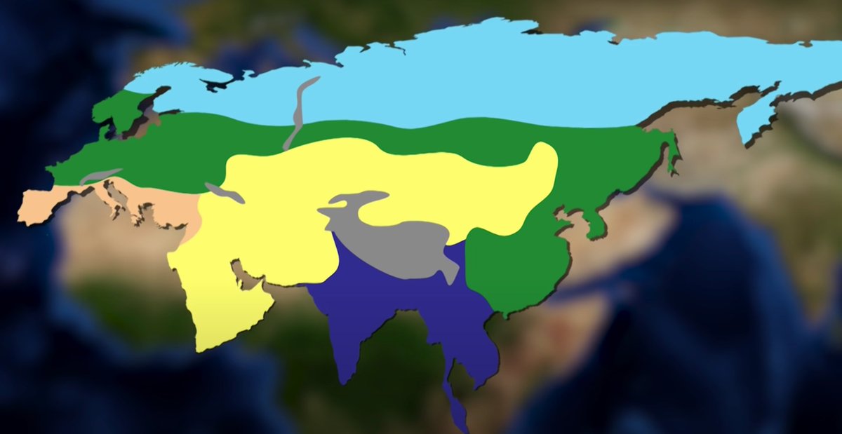
This shows an inescapable fact of Africa's geography: its north-south axis slowed down any transmission, be it of technology, animals, plants, or kingdoms.
Look at all the climate changes!
Compare them to Eurasia (North Africa should be included in the Eurasia map)
Look at all the climate changes!
Compare them to Eurasia (North Africa should be included in the Eurasia map)
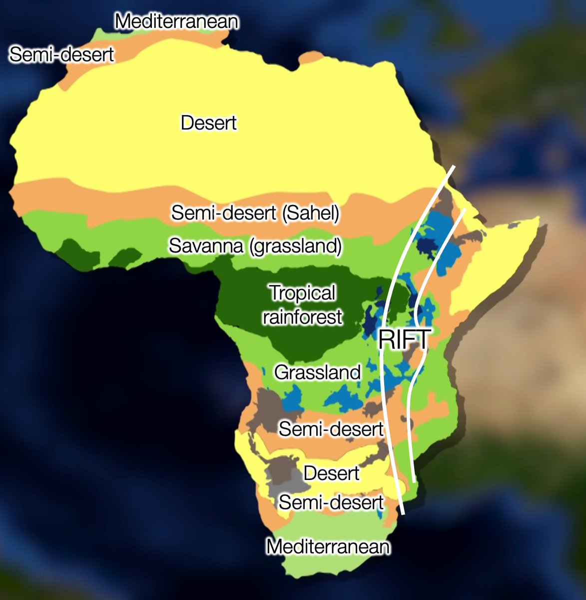
These barriers are huge. Arab empires couldn't span across the Sahara for example. Slavery came from raids... and trade with local kingdoms.
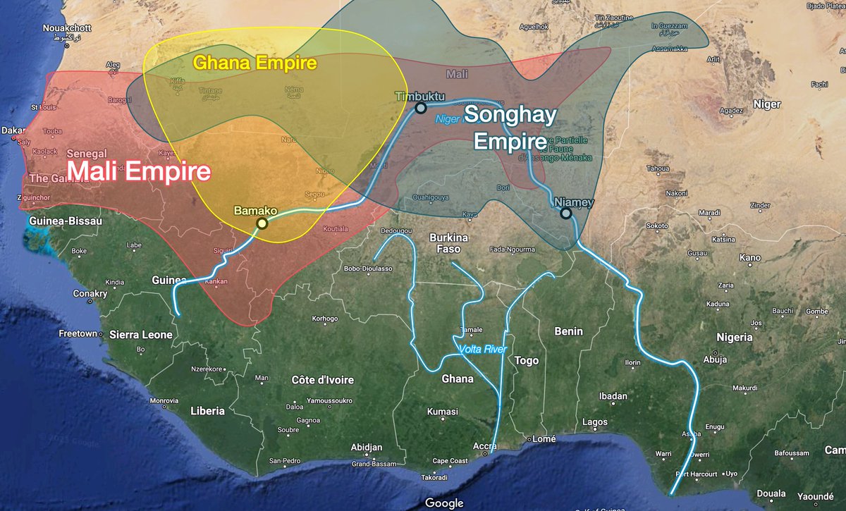
And empires, which arose in the only place that could host them—the shores of the Niger River, around what's today ~Mali and Niger
And empires, which arose in the only place that could host them—the shores of the Niger River, around what's today ~Mali and Niger
These empires, of course, participated in the slave trade too
Slavery was common across the world for the longest time, from America to Europe, Africa, Asia...
You beat an enemy? You enslave it.
Slavery was common across the world for the longest time, from America to Europe, Africa, Asia...
You beat an enemy? You enslave it.

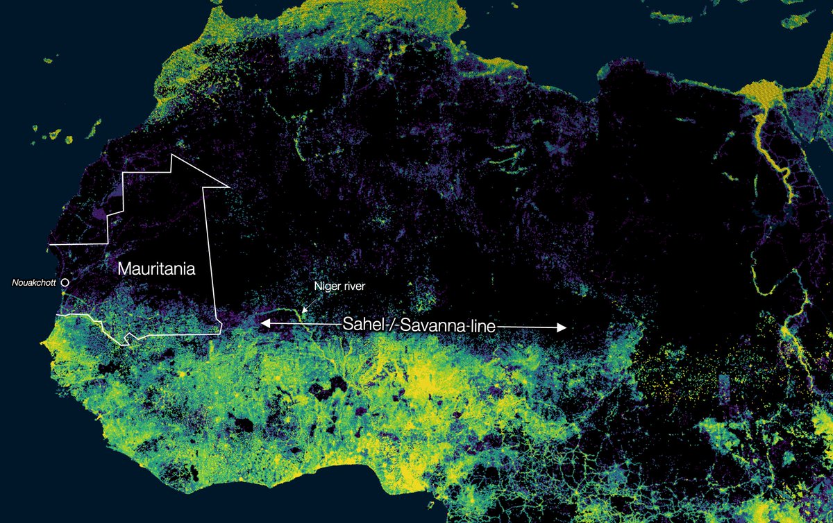
Look at this population density map
Empty desert. Humans appear as soon as the climate makes regions habitable
The populations just south of the desert hosted these empires
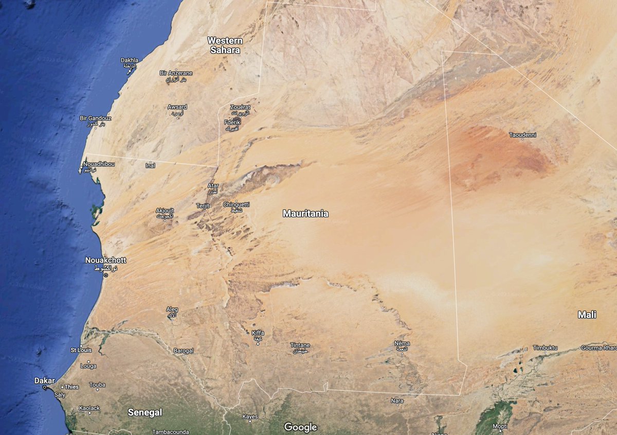
Mauritania also illustrates this north-south border, like Mali and Niger
Why is the capital Nouakchott?
Empty desert. Humans appear as soon as the climate makes regions habitable
The populations just south of the desert hosted these empires
Mauritania also illustrates this north-south border, like Mali and Niger
Why is the capital Nouakchott?
• A village when chosen capital in 1958
• Had to be on the coast (most trade potential, most ppl)
• The 2 most powerful cities were Nouadhibou in the north coast and St Louis, near the Senegal River, in the south coast
• Nouakchott was a compromise between the 2 groups
• Had to be on the coast (most trade potential, most ppl)
• The 2 most powerful cities were Nouadhibou in the north coast and St Louis, near the Senegal River, in the south coast
• Nouakchott was a compromise between the 2 groups
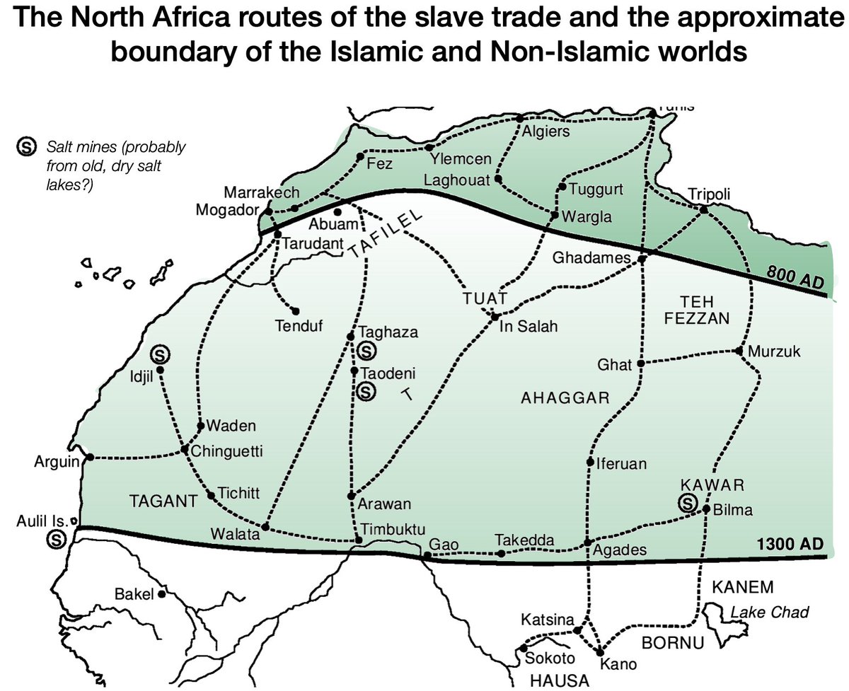
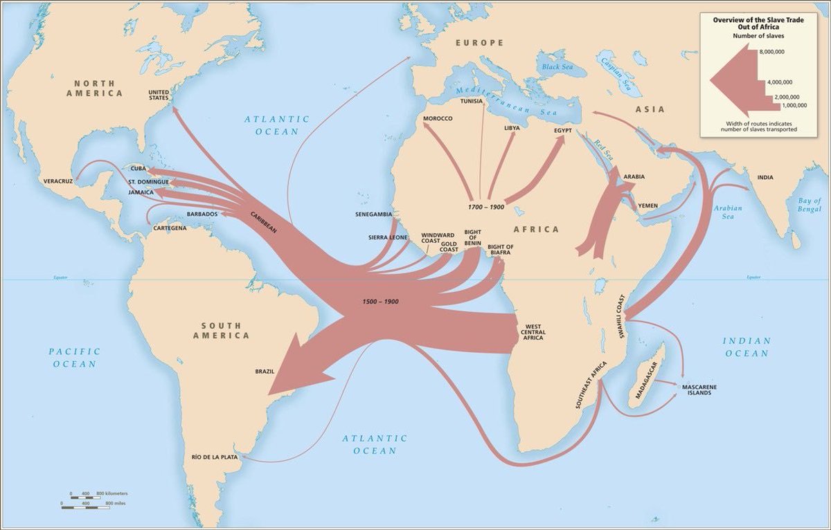
If you're paying attention, you saw that the map above showed slave trade in northern Africa... but also on the east.
Do you see the overlap with Islam?
Africa's majority Muslim populations are those that traded with the Muslim world for centuries
Do you see the overlap with Islam?
Africa's majority Muslim populations are those that traded with the Muslim world for centuries
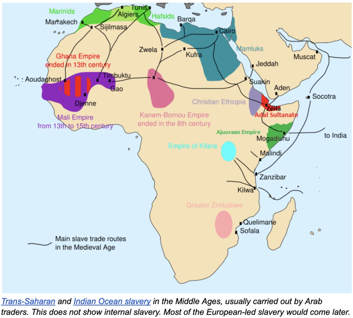
This is not a unique feature of Africa: Muslims traded in the Indian Ocean for centuries (and sometimes conquered), and brought Islam with them. Compare the maps of trade and Islam
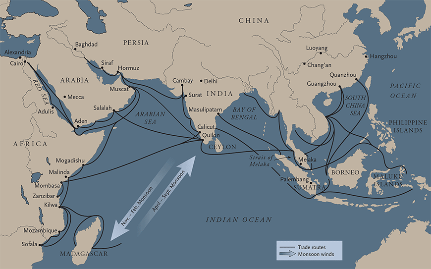
It's not just slave trade though, it's any type of trade. The most long-lasting in Africa was slaves, but also gold and ivory (we'll talk another day about why, and why it matters). Some others include salts, woods, animals, resins..
But the influence of Islam on the east coast doesn't go as far inland as in the north. Why (aside from climate)?
Mountains and bugs
1st, mountains: the Rift is a huge range crossing East Africa. An impassable natural barrier. See how altitude compares with religion
Mountains and bugs
1st, mountains: the Rift is a huge range crossing East Africa. An impassable natural barrier. See how altitude compares with religion
2, Bugs: Malaria
Notice how Malaria follows a north-south gradient too
It stops Muslim traders in the north, but also in the east
The transition zone between Islam & Christianity also has strong local beliefs.
And the maximum level of malaria on the east coast
Notice how Malaria follows a north-south gradient too
It stops Muslim traders in the north, but also in the east
The transition zone between Islam & Christianity also has strong local beliefs.
And the maximum level of malaria on the east coast
Where Muslim traders (and raiders) could reach, they did.
There, they traded—mainly gold, ivory, slaves.
Who did they trade with or raid? The local kingdoms and chiefdoms, who also traded the same things
There, they traded—mainly gold, ivory, slaves.
Who did they trade with or raid? The local kingdoms and chiefdoms, who also traded the same things
OK so that's why Islam is in the green area in Africa:
• Sahara-based trade/raids in the north
• Indian Ocean-based trade/raids in the east
There, Muslims couldn't penetrate far inland, so their presence is more coastal
What about Christianity?
It's the same principle
• Sahara-based trade/raids in the north
• Indian Ocean-based trade/raids in the east
There, Muslims couldn't penetrate far inland, so their presence is more coastal
What about Christianity?
It's the same principle
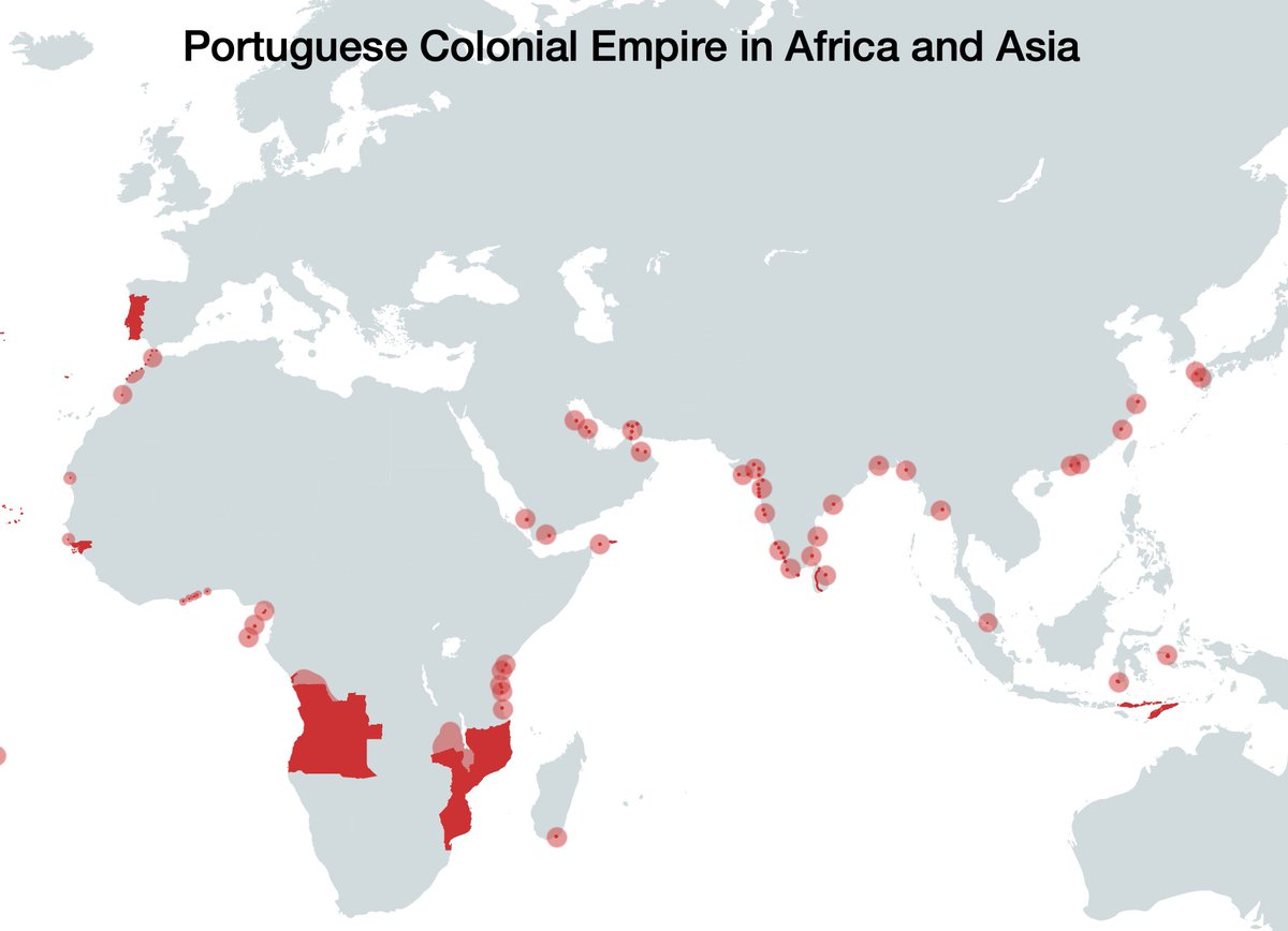
Except Europeans came much later to sub-Saharan Africa
The 1st ones were the Portuguese in the late 1400s.
They spent centuries unbothered by other Europeans
They didn't conquer inland because they couldn't. And only wanted trade—including slaves
So they established trading posts
The 1st ones were the Portuguese in the late 1400s.
They spent centuries unbothered by other Europeans
They didn't conquer inland because they couldn't. And only wanted trade—including slaves
So they established trading posts
Over the centuries, as other European powers on the Atlantic caught up, they did the same thing:
• Stay on African coasts because of malaria & power of local kingdoms
• Fight for access to trade
• Stay on African coasts because of malaria & power of local kingdoms
• Fight for access to trade
This is the period during which most of the slave trade happens: when foreigners are in control of the coasts, and trade with African kingdoms
European demand for slaves, along with the weapons they brought, instigated conflict—and hence death & destruction—in Africa
European demand for slaves, along with the weapons they brought, instigated conflict—and hence death & destruction—in Africa
And then, in the 19th century, during Europe's industrial revolution and max power, it discovers quinine. European death rates from malaria drop from 90% to 17%
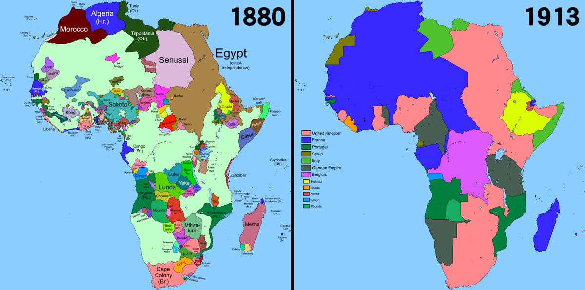
This is the result: the Scramble for Africa. A matter of decades.
(Details in the link)
unchartedterritories.tomaspueyo.com/p/why-european…
This is the result: the Scramble for Africa. A matter of decades.
(Details in the link)
unchartedterritories.tomaspueyo.com/p/why-european…
So this is why the south and west of Africa is more Christian:
• Little Muslim influence
• European (Christian) influence for 500 years
• They reached farther inland after quinine & Scramble for Africa
• The Sahel & Rift mountain range mark the border of their influence
• Little Muslim influence
• European (Christian) influence for 500 years
• They reached farther inland after quinine & Scramble for Africa
• The Sahel & Rift mountain range mark the border of their influence
OK running out of tweets again
If this is still interesting, LMK.
Anything I forgot?
Next up, West Africa.
Anything I should include?
Follow & sign up for the free newsletter if you don't want to miss anything
unchartedterritories.tomaspueyo.com/subscribe
If this is still interesting, LMK.
Anything I forgot?
Next up, West Africa.
Anything I should include?
Follow & sign up for the free newsletter if you don't want to miss anything
unchartedterritories.tomaspueyo.com/subscribe
• • •
Missing some Tweet in this thread? You can try to
force a refresh