
A brief clarification regarding the defensive lines. @KofmanMichael addressed this in a recent war on the rocks podcast.
On a daily basis I see questions like:
"Where are the defensive lines"
"Which is the first line"
I'll try to address this here.
On a daily basis I see questions like:
"Where are the defensive lines"
"Which is the first line"
I'll try to address this here.

The blue dashed line represent the most forward observed UA positions while the red represent RU the same for RU.
Orange is trench systems observed via satellite imagery.
Orange is trench systems observed via satellite imagery.
Looking at the Robotyne axis, the layered defense looks like this.
The first part of the defenses is the combat zone, almost every tree line here is fortified. It's heavily mined and it consists of mostly smaller trenches and fox holes sometimes just big.
The first part of the defenses is the combat zone, almost every tree line here is fortified. It's heavily mined and it consists of mostly smaller trenches and fox holes sometimes just big.
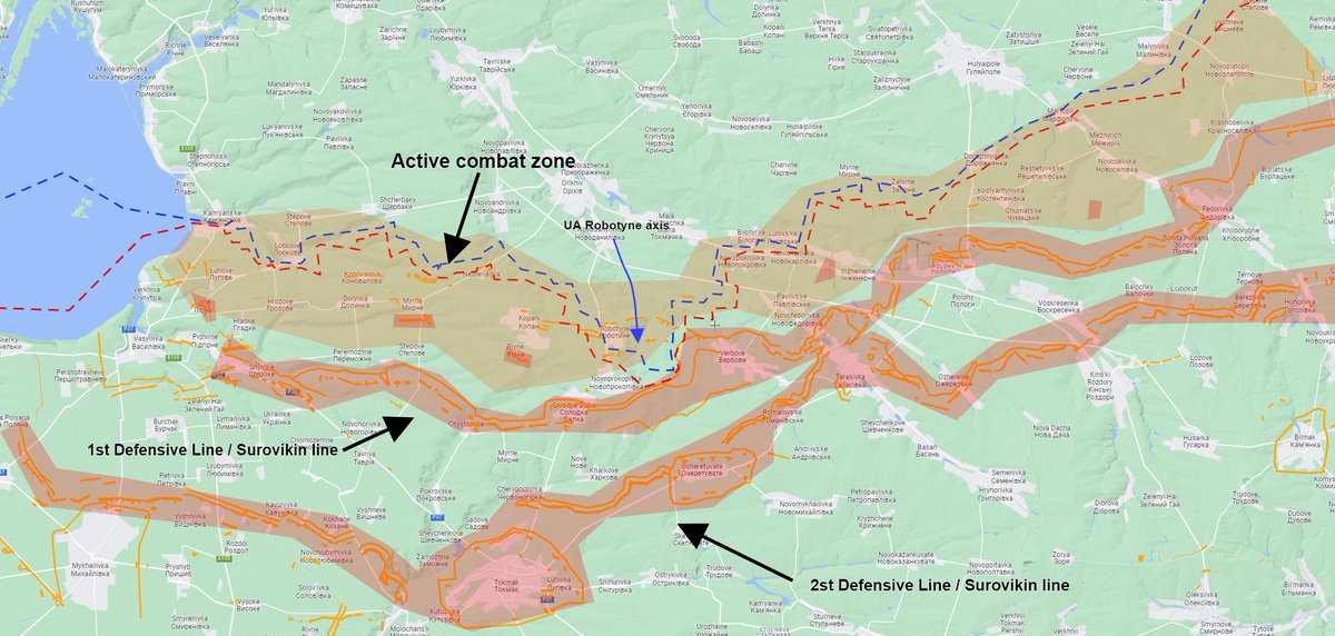
Sometimes when people talk about the first line of defense they mean the defenses along the active frontline and some other mean the prepared Surovikin line. That is why you hear some people talk about Ukraine already broke the 1st line of defense and some say they haven't.
The lines which are usually called 1st/2nd line of defense or Surovikin lines.
They have been machine made and consist of a anti tank ditch, a triple row of concrete pyramids and a system of infantry trenches. The area is heavily mined.
They have been machine made and consist of a anti tank ditch, a triple row of concrete pyramids and a system of infantry trenches. The area is heavily mined.

Video of pyramids and trench system.
Early images of the trench systems.

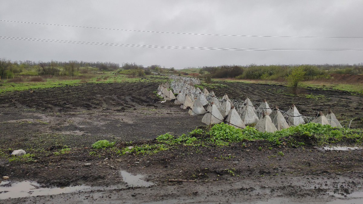


The concrete bunkers have been covered with dirt at this point. So have parts of the trenches.

If you feel unsure about these these lines you can go to my map and look. Link pinned in my profile.
h/t @AS_22ws and @bradyafr for providing the trench systems as KML.
The most easily accessible map out there with trenches is probably deepstatemap.live
h/t @AS_22ws and @bradyafr for providing the trench systems as KML.
The most easily accessible map out there with trenches is probably deepstatemap.live
This is the podcast I was talking about
warontherocks.com/2023/08/a-cont…
warontherocks.com/2023/08/a-cont…
• • •
Missing some Tweet in this thread? You can try to
force a refresh


