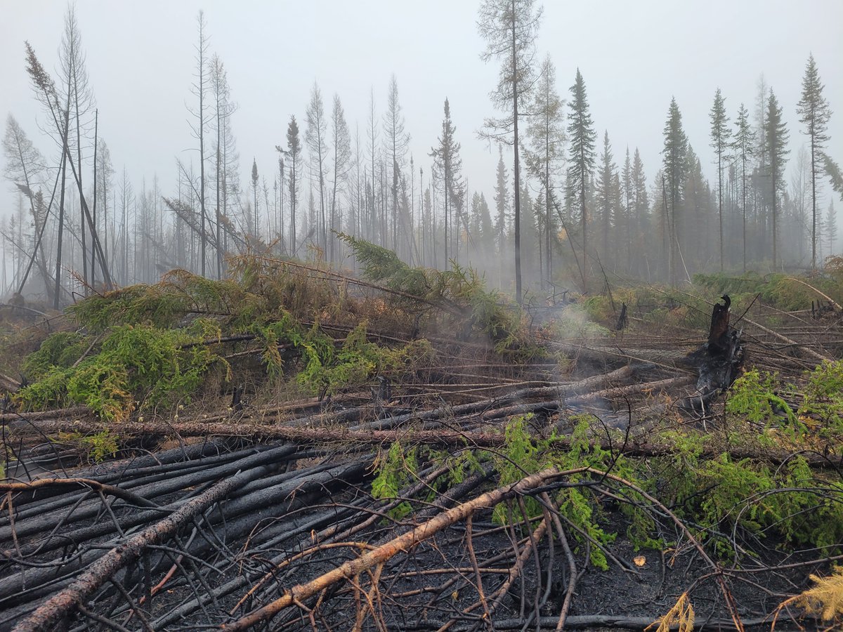
Today we finally made it to the NWT after having postponed twice our #drone fuel mapping due to the #wildfires. Took the risk to cross an active fire in BC Hwy77 only to learn the state of emergency had been extended again...luckily not in the Dehcho where we will be working 😌

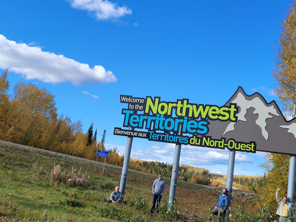
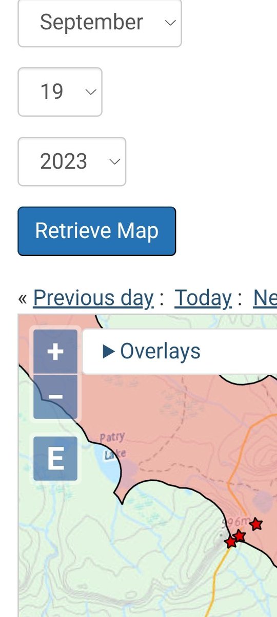


Just came back from NWT. Hwy 77, our only way back, was closed due to wildfire for a time while we were there, but cold weather and rain allowed us to go through once more. It was a successful field trip, we did 4000 km to get ~50 plots. More details (+
photos/videos) below 2/11
photos/videos) below 2/11
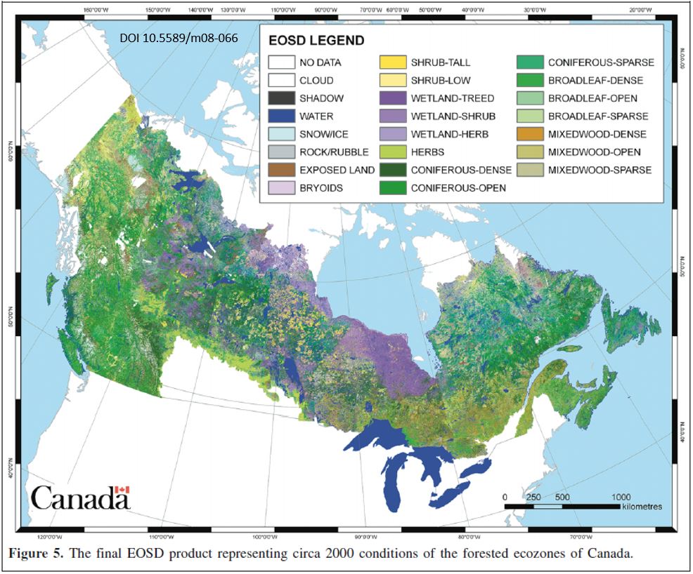
We are leveraging the Northern Forest fuels Mapping (NorthForM), a 5 yr, 30 MCAD CFS program that will provide Canadian fire agencies with enhanced 30m raster maps of fuel attributes for use within fire behavior prediction models, which are also been upgraded 3/11

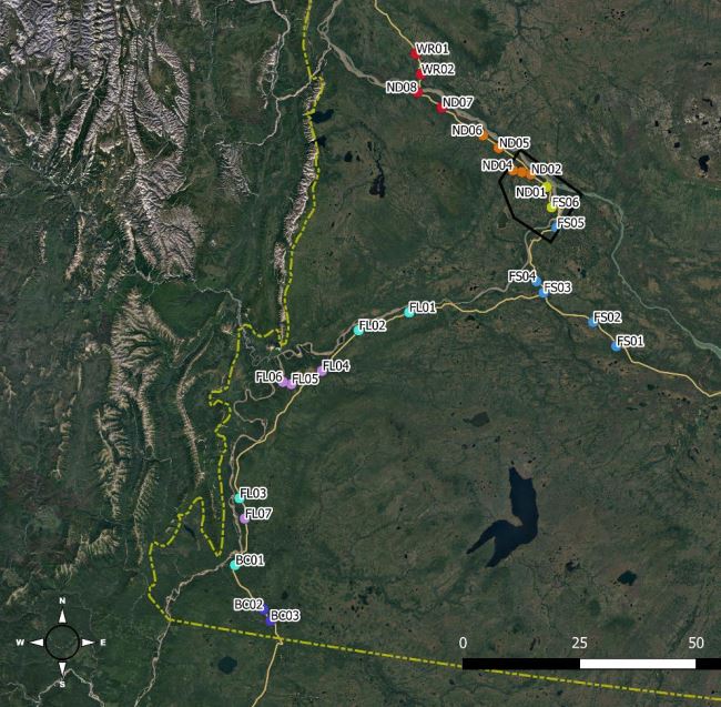
NorthForM measured 156 plots in NWT this summer, following the field protocol (link below). Because the focus is plot level attributes, no stem maps (XY of each large tree) were done, which would add 1h/plot to the long list of tasks the crews had 4/11 ca.nfis.org/fss/fss?comman…
Because NorthForM is also aimed at informing community firesmarting efforts, we got 25kCAD for @artemis_lab to acquire ALS over ~50k ha around Łíídlıı Kųę (Fort Simpson), a village of 1200, mostly Dene, whose only escape route is a gravel road interrupted by a ferry crossing 5/11
@artemis_lab We will use the NorthForm plots as the reference dataset to calibrate to the Simpson area ALS models of canopy fuel attributes developed by @artemis_lab. However, for surface fuels, we may need higher point density, which is where our M300RTK drones come into action 6/11
@artemis_lab Main goals of our field campaign:
Acquire drone lidar (L1) and photogrammetric (P1) data over ~50 NorthForM plots in the NWT
Assess to what degree can drone data complement or replace ground measurements
Get additional trees for a separate study on drone-based DBH estimation 7/11
Acquire drone lidar (L1) and photogrammetric (P1) data over ~50 NorthForM plots in the NWT
Assess to what degree can drone data complement or replace ground measurements
Get additional trees for a separate study on drone-based DBH estimation 7/11
@artemis_lab For the L1 we flew 75 m above ground level at 4 m/s, with a pulse repetition frequency of 160 kHz, triple return and non repetitive pattern (sort of a rotating 8 figure), for a expected men density of over 2000 points/m2. Here is how the L1 missions look like 8/11
@artemis_lab For the P1 we use a 50mm lens, same alt (75 magl), 75% sidelap (more is better, but increases flight time a lot) and 85% forwardlap, and 20° off nadir smart oblique (see P1 in action below), for a target GSD of 0.6 cm, which should yield point clouds denser than 10k pt/m2 9/11
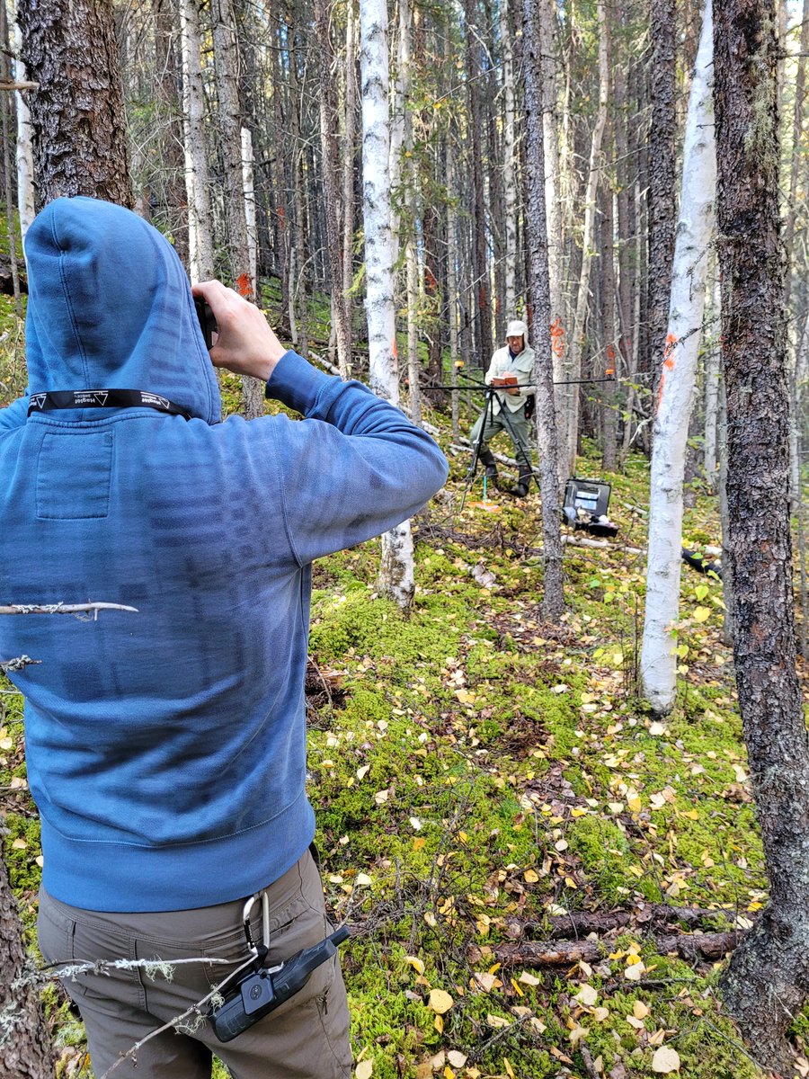
@artemis_lab Normally we would not need to visit the plot for this work (plot centers had been RTKed with centimetric accuracy), but in those that were not too far from the road, we would place a GCP (pail lid with a reflective cross) and map stems (e.g., with a Haglof Postex, below) 10/11
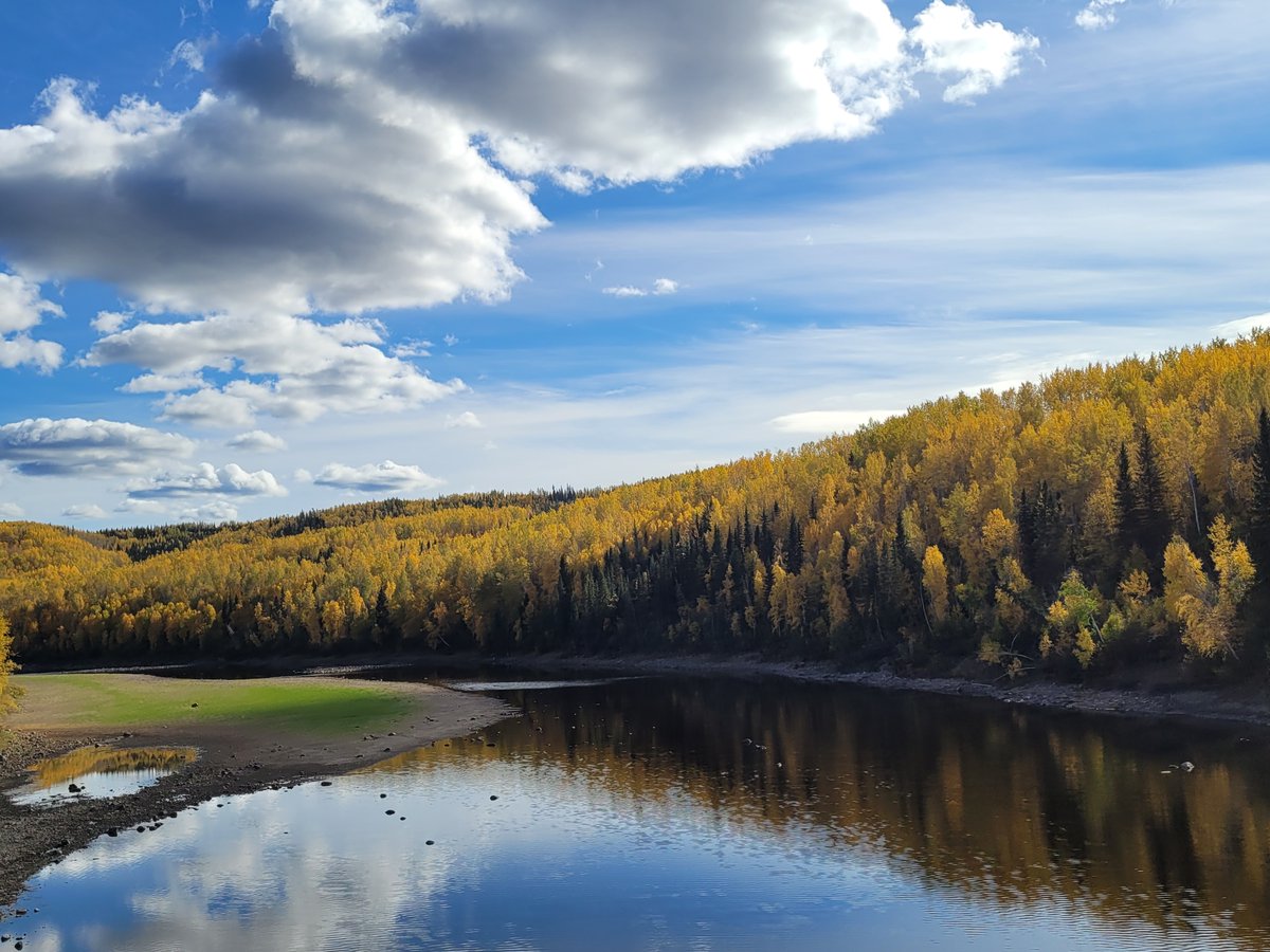
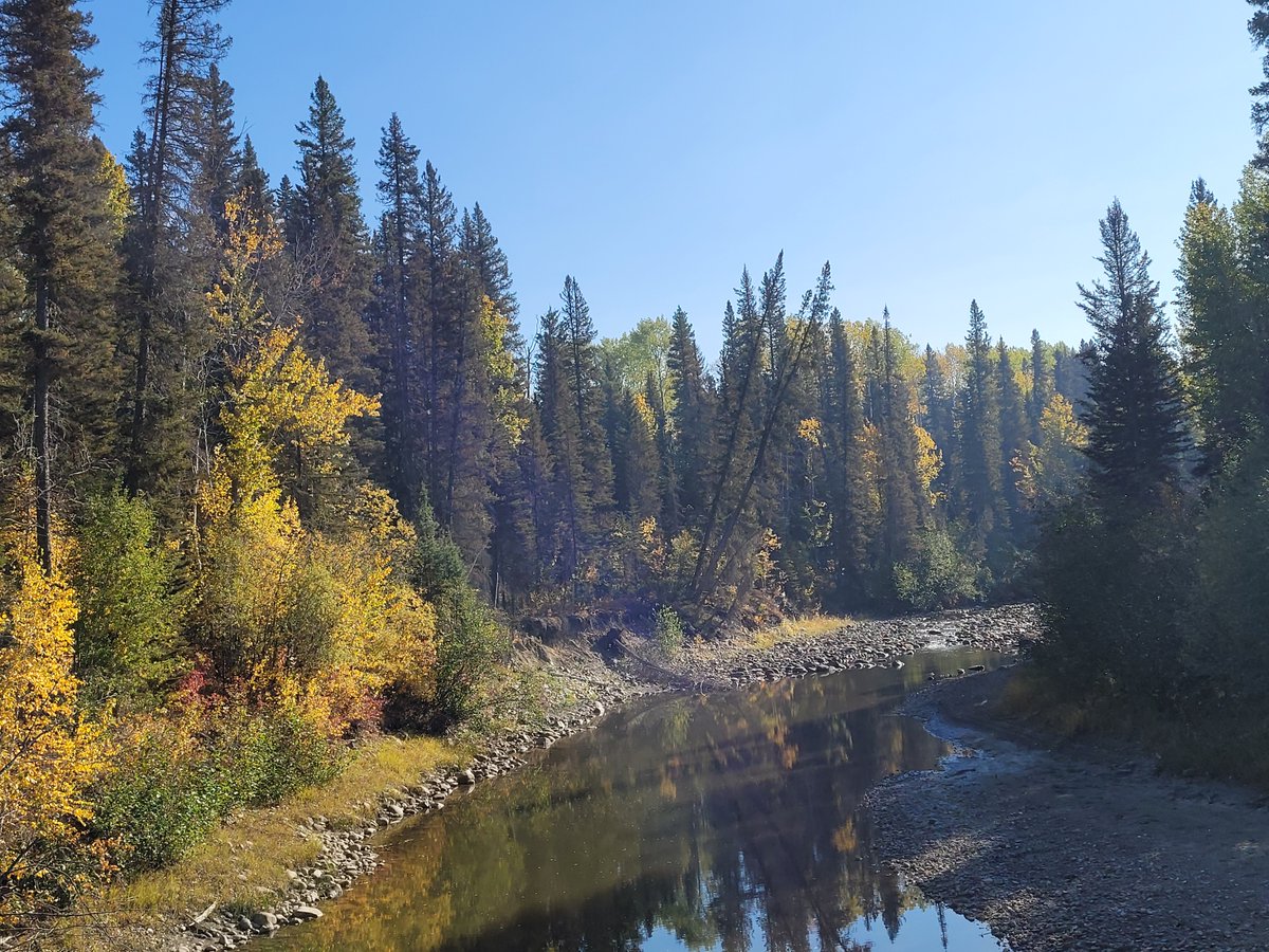
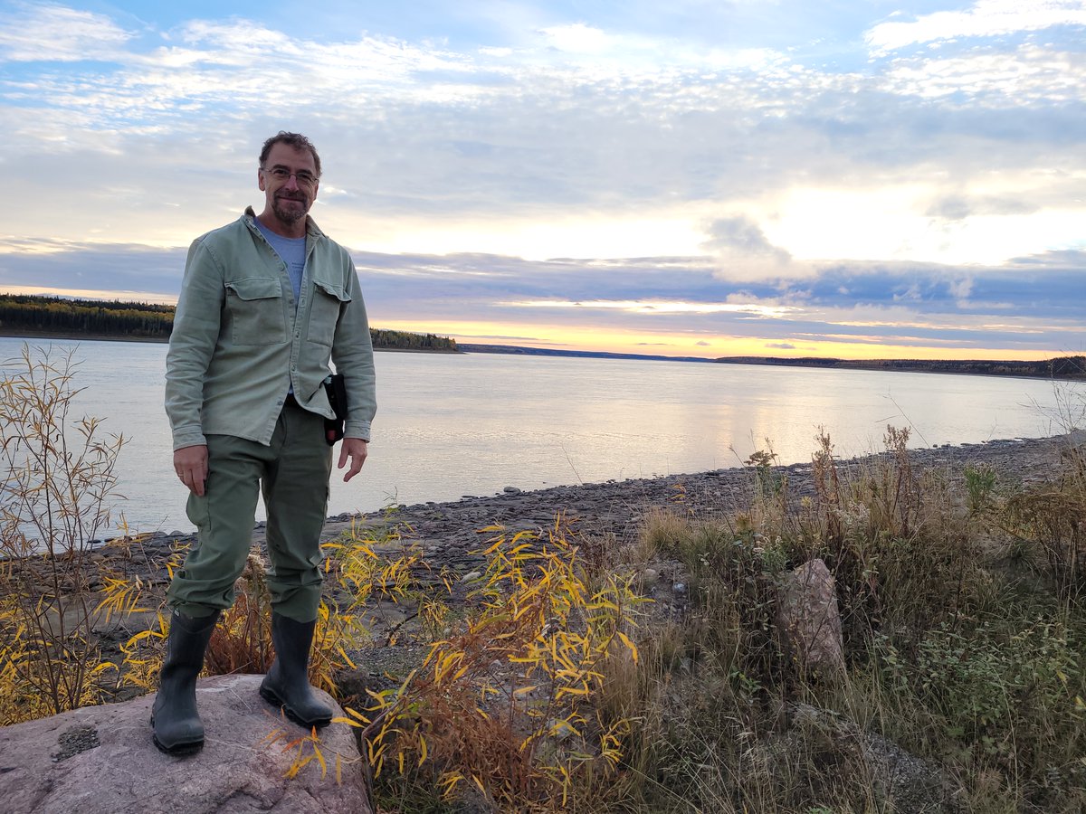
@artemis_lab Great trip and work with my dedicated teammates Michael, Sebastien and Steven s. It’s a privilege to visit this remote wilderness and get a glimpse of its life. We crossed beautiful autumn landscapes and rivers, including Canada’s largest, the Dehcho. A la prochaine! 11/11

@artemis_lab @threadreaderapp unroll
• • •
Missing some Tweet in this thread? You can try to
force a refresh