Guillermo Castilla Profile picture
Remote Sensing scientist serving the Canadian forest sector
Oct 23, 2023 10 tweets 4 min read
DYK that the national equations used in Canada to estimate the aboveground biomass of individual trees are biased in the case of small black spruce from peatlands, by far the most common trees in Canada? In this new paper we fix that. See this thread 1/9 cdnsciencepub.com/doi/full/10.11… Our equations are based on ~500 small black spruce trees from 56 plots across peatlands from the taiga and boreal plains ecozones. They were cut into pieces, put into sacks, brought to the lab, oven dried, and painstakingly separated into components (stem, branches, needles) 2/9 Image
Sep 20, 2023 12 tweets 6 min read
Today we finally made it to the NWT after having postponed twice our #drone fuel mapping due to the #wildfires. Took the risk to cross an active fire in BC Hwy77 only to learn the state of emergency had been extended again...luckily not in the Dehcho where we will be working 😌


Image
Image
Image
Image
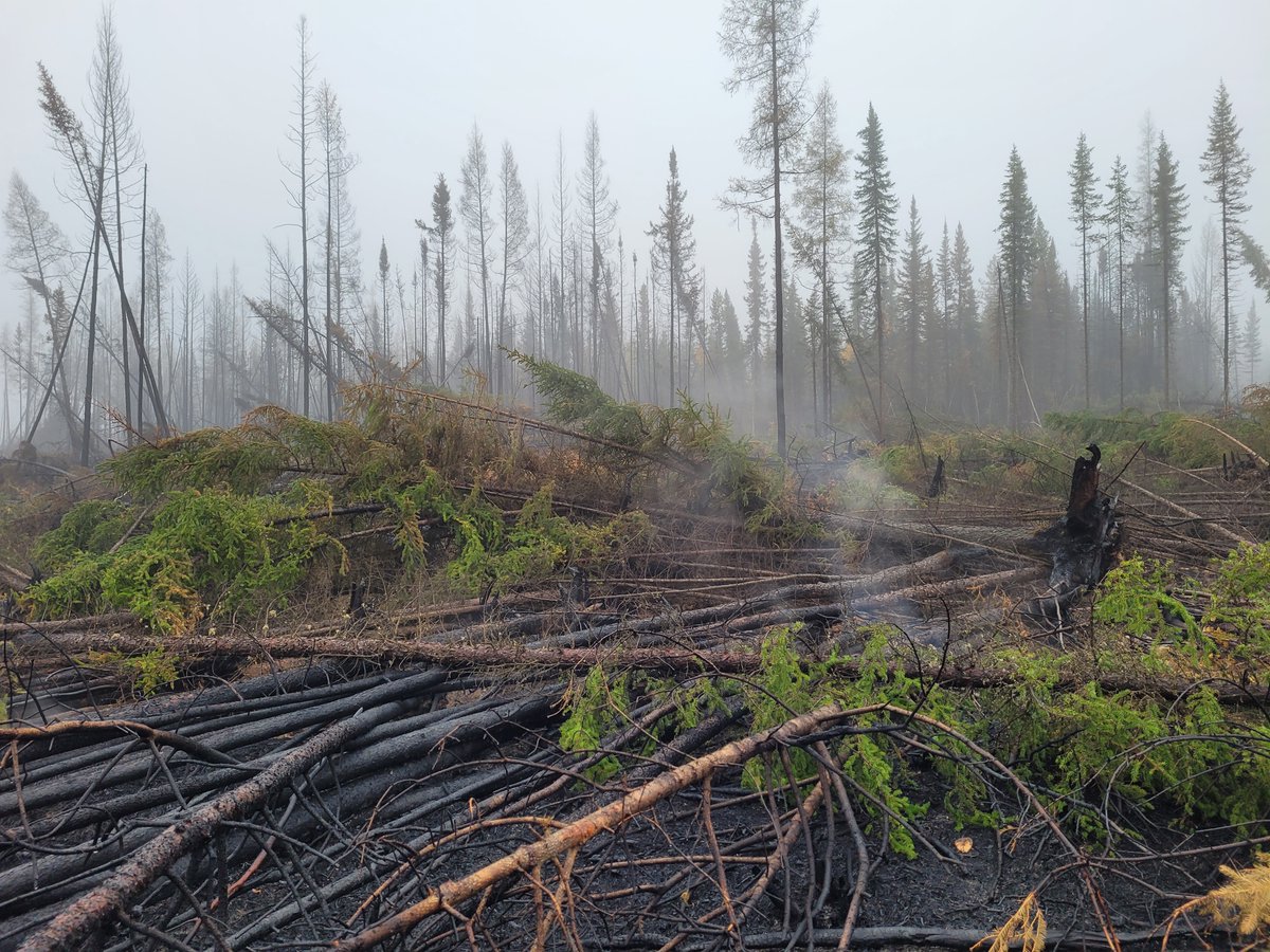
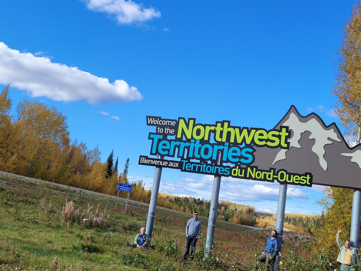
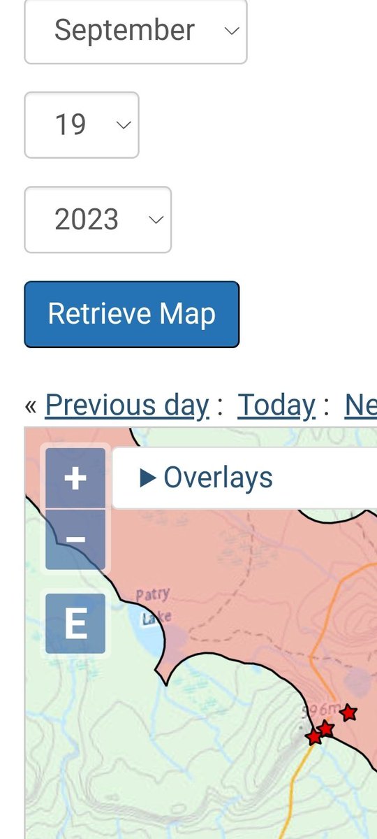
Just came back from NWT. Hwy 77, our only way back, was closed due to wildfire for a time while we were there, but cold weather and rain allowed us to go through once more. It was a successful field trip, we did 4000 km to get ~50 plots. More details (+
photos/videos) below 2/11 Image
Mar 2, 2022 18 tweets 8 min read
It is finally out! Our paper summarizing the Multi-source Vegetation Inventory (MVI), a herculean collaborative project with @GNWT_ENR and @artemis_lab that created a ~400,000 km2 forest inventory (FI) for the Taiga Plains. More info in the next 16 tweets mdpi.com/2072-4292/14/5… 1. Project started in 2005 by my predecessor Dr. Ron Hall. At that time the only wall-to-wall information available there was the c.2000 EOSD landcover map. GNWT wanted to update the EOSD map and upgrade it to a strategic-level FI including forest attributes beyond forest type. Image