Nathan Ruser Profile picture
Sep 22 11 tweets 6 min read Twitter logo Read on Twitter
A 🧵of military defeats of the Burmese junta, who have faced 2 two years of concerted, nationwide revolt against the Sit-Tat and their coup.
Starting with the Daru H'ka bridge outpost. The first major outpost S of Sumprabum, fell to the KIA on Wednesday (2023-09-20) morning.

Image
Image
Image
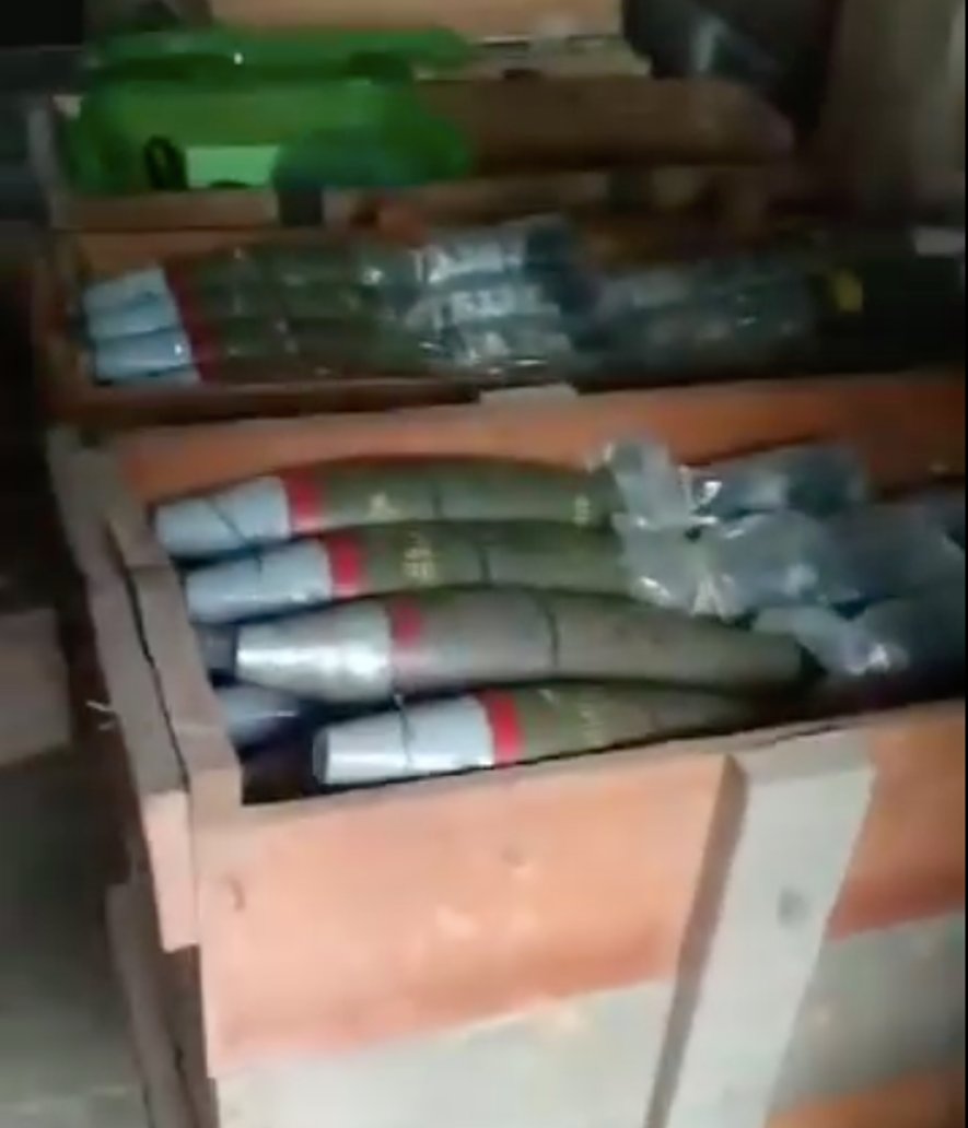
On Monday (2023-09-18), PDF/CDF fighters overran a Pyu Saw Htee checkpoint near Kant Thet at the entrance to Ka-Pa-Sa (Defence Manufacturing Plant) 23. This attack highlights junta's dwindling manpower, relying on civilian militias to protect a missile-manufacturing facility. Image
On Sunday (2023-09-17), the Sit-Tat launched a military raid from their bases in Indaw towards the Maw Lu town around 30km North. They made it around 3-5km before being attacked by a combined force of KIA and PDF troops before being entirely blocked by the KIA/PDF 6km from town. Image
On Saturday (2023-09-16), the junta lost a key base near Nam San Yang, a gold-mining area on a key supply road they had been battling for 3-months to capture, see this thread for details.
On Sept 14th, the KNLA captured the Yay Ta Shaut outpost on the border with Thailand, after troops stationed there attempted to resupply a nearby besieged outpost via Thai territory, read this thread for details.
On September 15th, resistance groups working on fixed-wing drone bomblets attacked Aye Lar Airbase (near the capital Naypyidaw International Airport) with small bomblets despite jammers around the area. Damage was likely minor, but the capability to launch attacks here is major.

Image
Image
Image
On Sept 7th, KNLA troops captured the Hsa Law Kyo outpost near Kay Pu village, which the Sit-Tat constructed during a 2007 road-building push into northern Hpapun township.
Image
Image
On the night of Sept 15th, joint TNLA/PDF forces launched an offensive in Kyat Pyin town, attacking the town's police station and capturing part of it before a junta counter-offensive. Photos show PDF fighters walking through Kyat Pyin town.
myanmar-now.org/en/news/ethnic…


Image
Image
Image
On Sept 9th, PDF fighters overran and captured the Khar Chin Taung Checkpoint along the Bago Yoma range road. Sit-Tat troops have tried four times since (most recently on Thursday) to recapture the checkpoint without success (and loosing 10+ troops). mpapress.com/en/news/30161/
Image
The Bago Yoma range has been under pretty clear Govt control for the last 50 years (since Communist Party of Burma control over the range from the 40s-70s). Even in these firmly controlled territories, the Sit-Tat is struggling to maintain their positions.
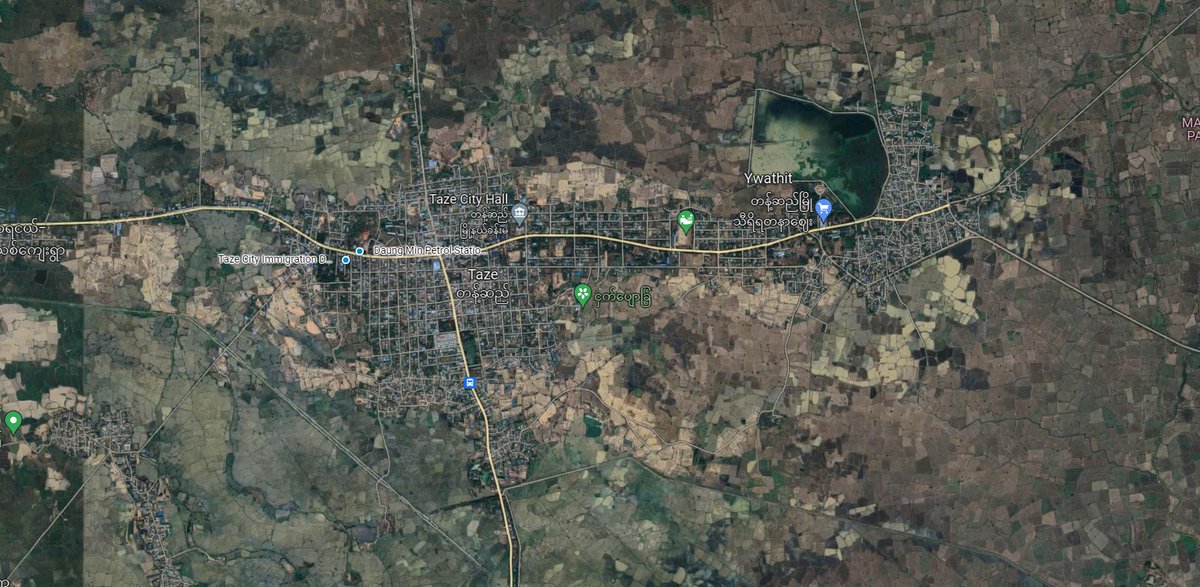
On Friday morning, resistance PDF fighters attacked and overran two junta checkpoints on the Western edge of Taze city, killing around 20 soldiers and siezing 14 guns before retreating. irrawaddy.com/news/war-again…
Image

• • •

Missing some Tweet in this thread? You can try to force a refresh
 

Keep Current with Nathan Ruser

Nathan Ruser Profile picture

Stay in touch and get notified when new unrolls are available from this author!

Read all threads

This Thread may be Removed Anytime!

PDF

Twitter may remove this content at anytime! Save it as PDF for later use!

Try unrolling a thread yourself!

how to unroll video
  1. Follow @ThreadReaderApp to mention us!

  2. From a Twitter thread mention us with a keyword "unroll"
@threadreaderapp unroll

Practice here first or read more on our help page!

More from @Nrg8000

Jun 13
🧵I've updated this fortifications data to include all Southern occupied Ukraine (Donetsk city - Crimea - Kinburn) with 2,389 fortifications traced from new satellite imagery. A download link is included.
nrg800.users.earthengine.app/view/russianfo…
So what does this mean for the Ukrainian offensive? ImageImageImage
Obviously, the purpose of this data is to provide insight to people far more knowledgable in the military tactics and strategy than me, so I won't focus too much on my armchair general takes, but I do want to share a few quick things that mapping this mas made me realise.
These fortifications look formidable. Russia has clearly invested SIGNIFICANT time and manpower into building a robust and comprehensive main-defensive line behind the front, and these provide challenges to Ukraine that it has not faced before in its offensive operations.
Read 7 tweets
Jun 9
While Ukraine's offensive in Zaporizhia is starting to ramp up, Russia has spent the last 2 months fortifying defensive lines across the entire oblast.
Ive made an interactive map that shows the most recent satellite imagery and these lines.
nrg800.users.earthengine.app/view/russianfo…
Download below ImageImageImage
The satellite imagery shows land over the past two months (since April 15th). Overall, around 1,000 fortification lines have been mapped in the area. These certainly present a challenge to Ukrainian forces trying to move through the landscape and attack in depth.
The fortification data can be freely downloaded (incl for Google Earth) here:
mega.nz/file/LVZnQJoA#…
Anyone is free to use it in any map or publication with attribution to Nathan Ruser/ASPI.
I have tried to be comprehensive, but don't consider this a complete survey. Image
Read 8 tweets
Jun 9
This is incredible, since the collapse of Kakhovka Dam, you can actually see (in @PlanetImagery) the baymetry reflected in the surface currents and flow along with the old path of the river before it was dammed in 1956!
If anyone knows why this is happening, super fascinated. Image
@PlanetImagery It is also evident in Sentinel-2 imagery, though less clearly.
I'm sure it must be some form of how old stagnant water is mixing with the surface flow? but very interested in getting a better idea. Image
@PlanetImagery Here's Harel talking about some of the possibilities on an early post of mine (that I deleted because it was worded as though you actually were seeing the bathymetry not just it reflected in the currents)

Read 4 tweets
Jun 8
Using satellite imagery to gauge the flood-level along the Dnipro River on June 7th, this map shows an estimate of the flood depth on the 7th.
The satellite imagery used to estimate the flood was centred on Kherson, and uncertainty grows as you get further away from there. ImageImageImageImage
To make this, I used RFERL extracts of @planet imagery (huge thanks to @Mike_Eckel and @kromark)
, georeferenced the images, plotted points at the edge of the floodwaters to create a flood-elevation surface and compared that to FABDEM elevation models.
@planet @Mike_Eckel @kromark As the water is rapidly flowing down the channel, the flood-level elevation wont be consistant down the river, especially as it spreads out closer to the sea, because of this areas far away from the towns mapped shouldn't be considered at all exact. I'll try and get more imagery.
Read 4 tweets
May 4
OK, ISW is becoming a major problem in the media ecosystem. This assessment is just a hunch from their mapping team (one that I disagree with), and yet their role in providing maps will see this (bad) opinion laundered as fact by many journalists who print what they say verbatim.
You can have reasonable theories that this was a false flag, I disagree for the simple fact that it makes the Kremlin look inept and weak as hell. But the point is, it's irresponsible to throw these largely baseless theories out there knowing how they'll be consumed.
And the other point is (and this is coming from someone who has mapped Ukraine in meticulous detail), the people you don't want making this assessment and putting it out there are the people who's only job is to map the situation in meticulous detail.
Read 21 tweets
May 3
If you need a reminder that by 2023 we're living in the future, here's a video of Burmese resistance fighters dropping bombs from drones on fascist coupist military cronies to high-vibe electro music (specifically @1N1KO).

Don't worry Iniko, these are the good guys.
@1N1KO Fighting against a genocidal and murderous occupying coup force in the Myanmar Ricefields, but still keeping up with your spotify New Releases playlist (this song came out less than a month ago). Very based.
As someone who spent years having to listen to nasheeds (don't jump on me nasheed lovers) in videos like this, often coming from ISIS, Myanmar and Ukraine have really shaken it up, both in soundtrack, and in coming from groups you can actually support.
Read 4 tweets

Did Thread Reader help you today?

Support us! We are indie developers!


This site is made by just two indie developers on a laptop doing marketing, support and development! Read more about the story.

Become a Premium Member ($3/month or $30/year) and get exclusive features!

Become Premium

Don't want to be a Premium member but still want to support us?

Make a small donation by buying us coffee ($5) or help with server cost ($10)

Donate via Paypal

Or Donate anonymously using crypto!

Ethereum

0xfe58350B80634f60Fa6Dc149a72b4DFbc17D341E copy

Bitcoin

3ATGMxNzCUFzxpMCHL5sWSt4DVtS8UqXpi copy

Thank you for your support!

Follow Us on Twitter!

:(