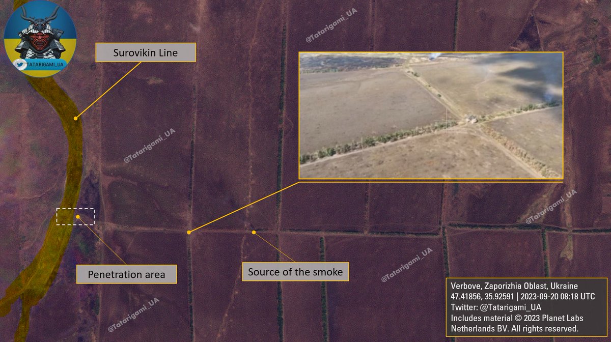
From recent video geoconfirmations, it's clear that the UAF are actively operating near Verbove and Novoprokopivka. Satellite analysis, based on observable landscape changes, supports it and shows fire shifting toward both Verbove and the southern part of Novoprokopivka🧵Thread:
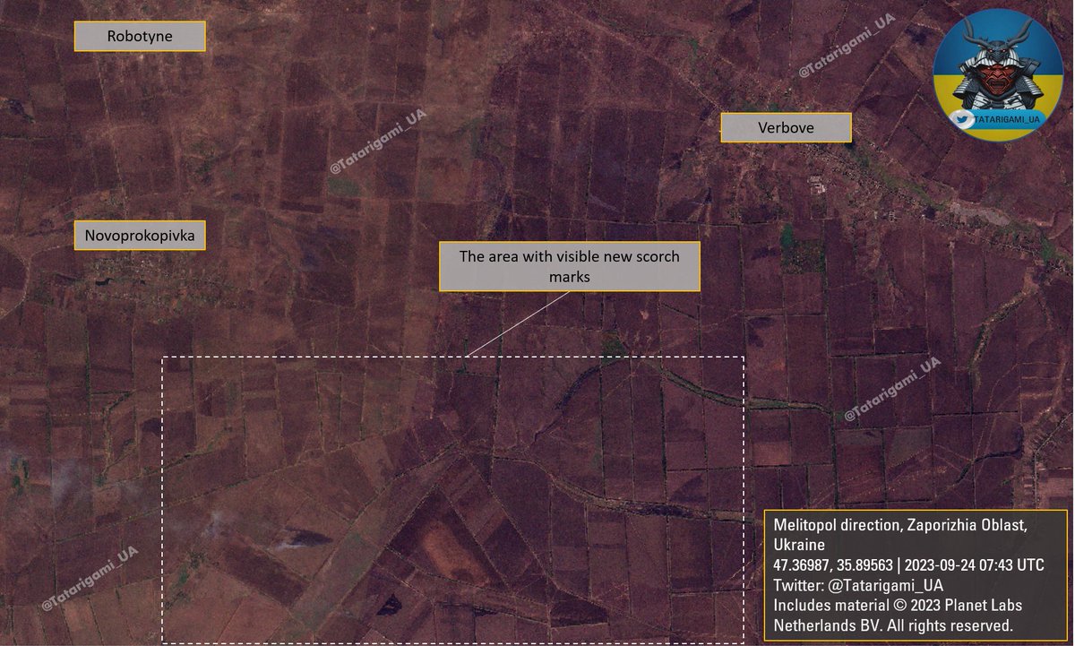
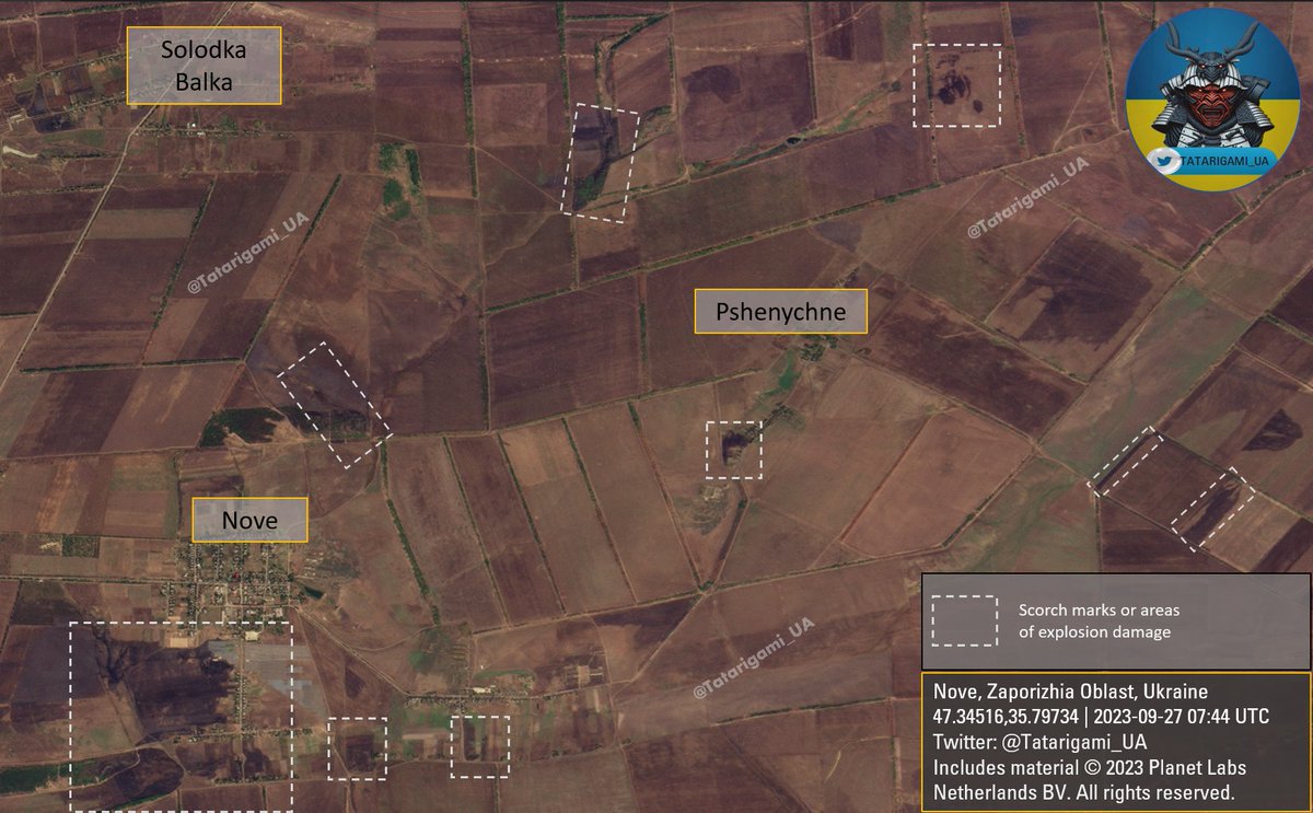
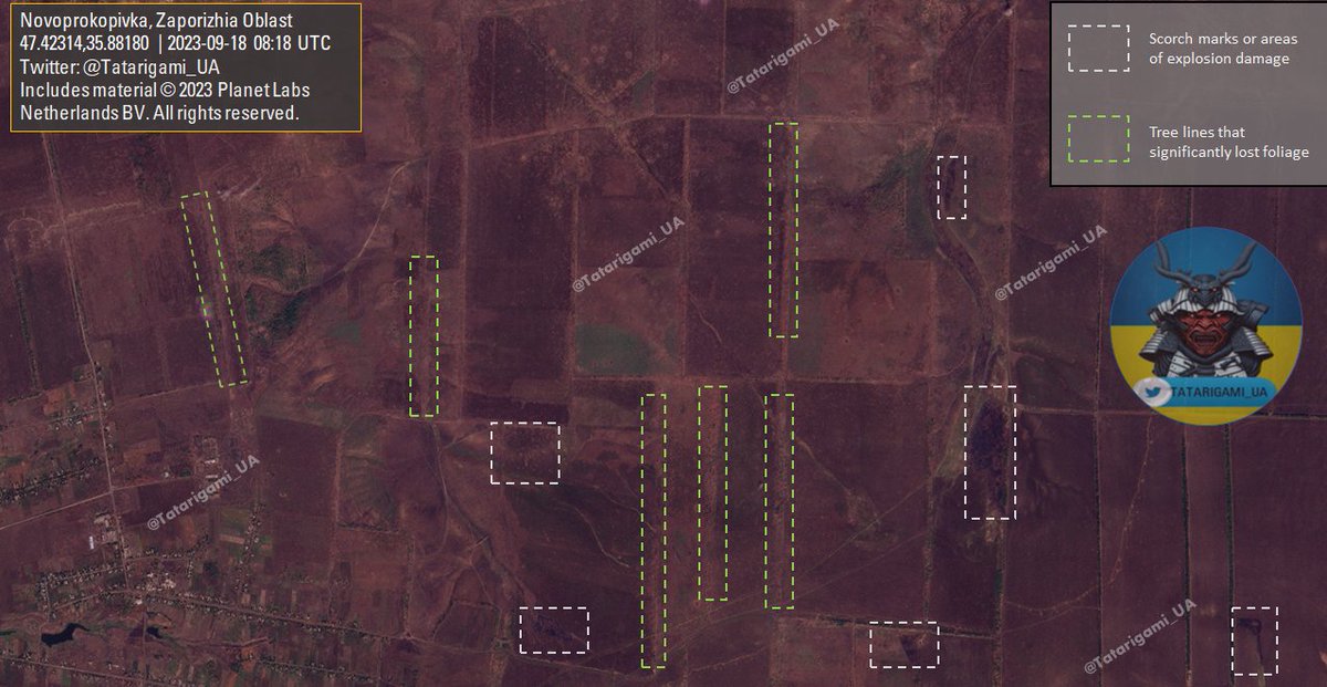
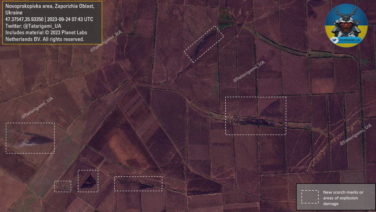
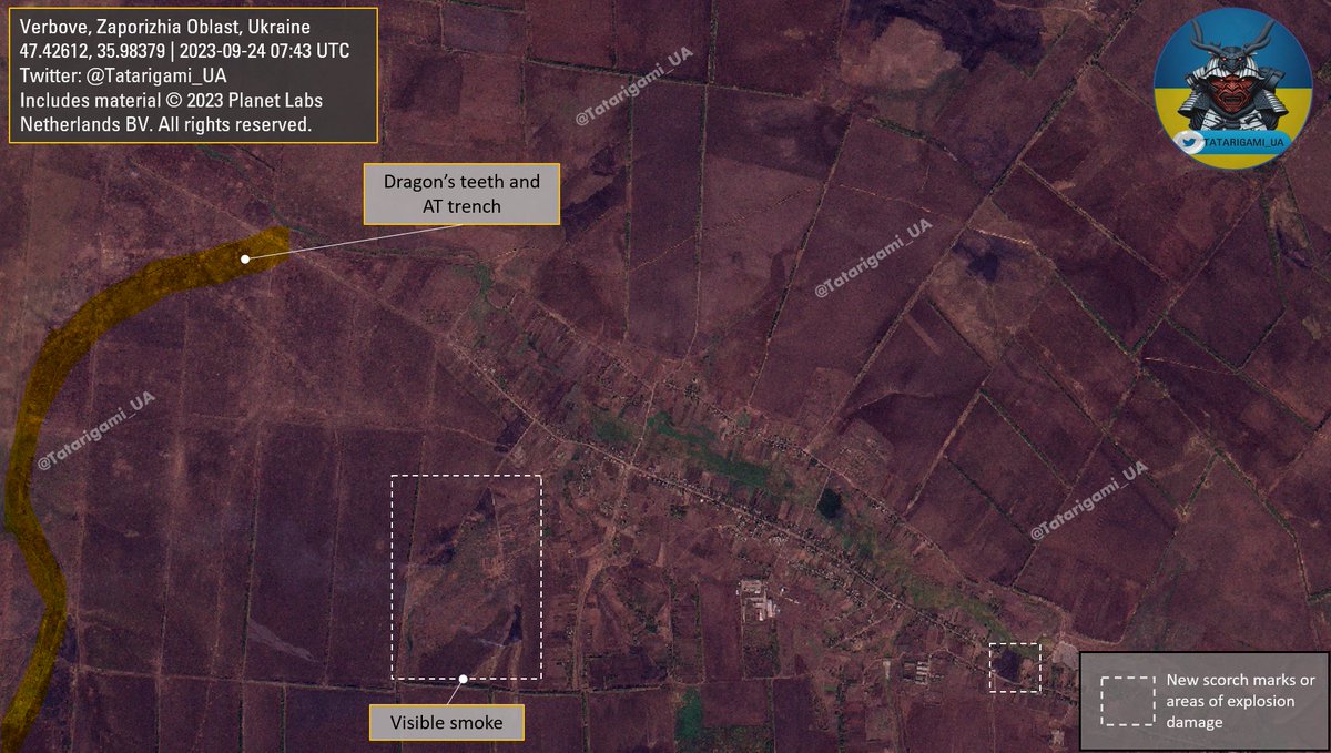
2/ This image displays scorch marks and shelling marks, showing recent combat activity. Given the ongoing southward progression of the fire toward Ocheretuvate, it is very likely the AFU pushed russian forces from their positions in the vicinity of Verbove and Novoprokopivka.
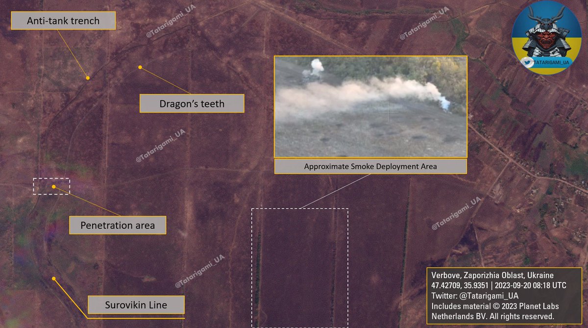
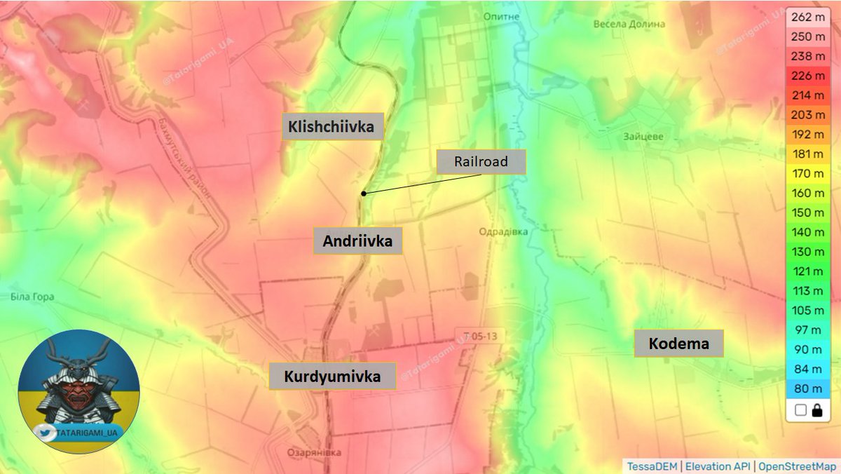
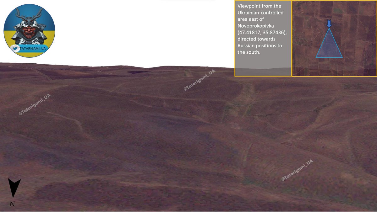
3/ For a clearer grasp of the tactical situation, terrain understanding is key. The landscape is primarily flat with slight elevations shown on this map. Remember, these elevations are relative to the overall flat terrain, and the red color doesn't always show dominant hills.
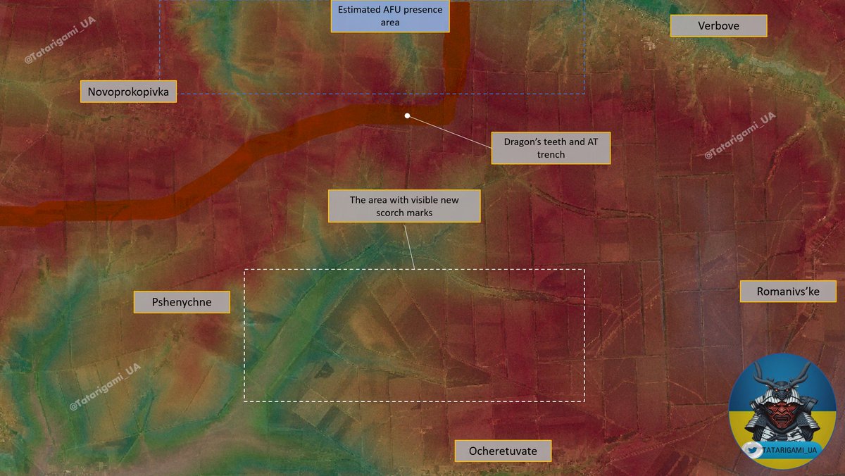
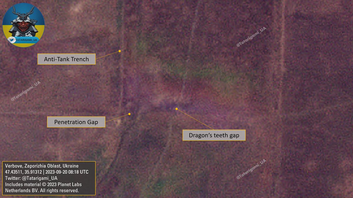
4/ The presence of visible scorch marks within Verbove itself, as well as on its western outskirts, corroborates previously identified photo and video evidence indicating engagement of the AFU and russian occupational forces in the vicinity of Verbove.
5/ I want to emphasize that russian defense has not collapsed. Despite enduring substantial losses and being compelled to retreat, they still maintained control over their forces and afforded organized retreat, continuing to present a formidable challenge to our forces.
6/ In this 3D terrain simulation, you can observe that minor elevations can provide certain tactical advantages. This simulation combines the current satellite image with terrain data. Although it is far from perfect, it will be integrated into all future analyses.
7/ I kindly request your support through likes, follows, and shares of the first message in the thread. Recent satellite imagery and the integration of new elevation and 3D tools depend on your generous contributions via the Buy Me a Coffee account linked to my profile. Thank you
• • •
Missing some Tweet in this thread? You can try to
force a refresh
Given recent talks in russian Telegram groups about supposed increased pressure from Ukrainian forces, I conducted a visual comparison of images taken on the 24th and 27th of September. Here, I noted distinctions and identified clear patterns. Thread: 1/
2/ As you can see, a number of fresh scorch marks have emerged in recent days. It appears that new visible alterations have occurred to the east and southeast of Novoprokopivka. This aligns with recent reports of Ukrainian Forces activity in the vicinity of Novoprokopivka.
3/ Another important development is taking place in the Nove-Solodka Balka-Pshenychne triangle. Numerous recent marks in the region suggest that the Ukrainian Armed Forces have substantially intensified their pressure on more remote defenses.
Russian railroads are a critical component of their logistics, allowing the rapid and cost-efficient movement of substantial quantities of ammunition, vehicles, fuel, construction materials, and personnel. Here's a brief 🧵thread with an update on their logistical operations:
2/ For a better understanding, let's examine Kantemirovka, a train station in Voronezh Oblast, right across the northern part of Luhansk Oblast, situated out of the range of artillery and HIMARS. It's located only a few hours from critical logistical hubs like Starobilsk
3/ In this case, the satellite has recorded the unloading of equipment and vehicles from the train. This typically starts either late at night or early in the morning and finishes by dawn or noon, respectively. Here, many trucks with ammo and equipment had already left.
Based on a recently uploaded video by russians, it's evident that Ukrainian forces successfully penetrated the Surovikin Line and disembarked infantry beyond it. Satellite imagery substantiates these developments, hinting at Ukrainian vehicles crossing Surovikin's Line.🧵Thread:
2/ A bit further south from the first image, the video captures a crossroad that was shelled by russians. In the background, you can see the burned area near the Surovikin Line, and the presence of black smoke in the image suggests that some object caught on fire.
3/ Utilizing geolocation data from the video, it's evident that our forces executed maneuvers effectively, driving back the enemy and exploiting the gap. They have advanced close to Verbove, overcoming AT trenches, minefields, and dragon's teeth. A notable milestone
With our forces achieving success in Klishchiivka and Andriivka, a new "natural" frontline has emerged along the railroad, effectively separating the opposing sides. In this brief 🧵thread, I'll elaborate on the importance of this phase and provide additional context:
2/ As evident in the image created by @DefMon3, the current frontline aligns closely with the railroad, flanked by tree lines on both sides, followed by open fields.
3/ The altitude image shows that controlling Andriivka opens up crucial avenues for further advances in the east, south, and north. However, it remains essential to cross the railroad, which the russians use as an obstacle, and focus their defensive efforts there.
A brief 🧵thread on the Novoprokopivka-Robotyne-Verbove area updates: Through a comparative analysis of images captured on September 18th and those taken nearly two weeks ago, the landscape changes confirm the combat area and direction of current advances by the Ukrainian army
2/ Observing the emergence of new scorch marks, signs of shelling, and the defoliation of tree lines provides a rough estimate of combat engagements and active fire exchange areas. This aligns closely with the map provided by @DefMon3
3/ This is a reference map that can be used independently to verify the data. Not all changes are marked, especially those discussed in the previous thread about Novoprokopivka. Today's map primarily focuses on the eastern and northeastern parts of Novoprokopivka
While many experts have provided valuable assessments on the potential submarine damage in Sevastopol, I'd like to add some additional context. After further analyzing and comparing the latest images, I've identified a few noteworthy details. 🧵Thread
2/When comparing @BlackSky_Inc 's imagery from September 13th with Planet's from September 15th, I've noticed a green tarp on the submarine's rear section. While its exact purpose is unclear, its presence is unusual, hinting at alleged efforts to conceal something.
3/ A quite interesting detail is the appearance of objects resembling water cannons spraying water. Due to image quality limitations, I'll avoid speculations, as image quality prevents me from definitive conclusions, but it's worth noting as another unusual element in the imagery