Mapping and timing the atrocities at the Nova Festival near Rei’m on Saturday morning (long thread).
Working with new drone footage, multiple sets of satellite imagery, and videos, it was possible to assemble a small idea of what happened in a small area.
Note- content warning
Working with new drone footage, multiple sets of satellite imagery, and videos, it was possible to assemble a small idea of what happened in a small area.
Note- content warning
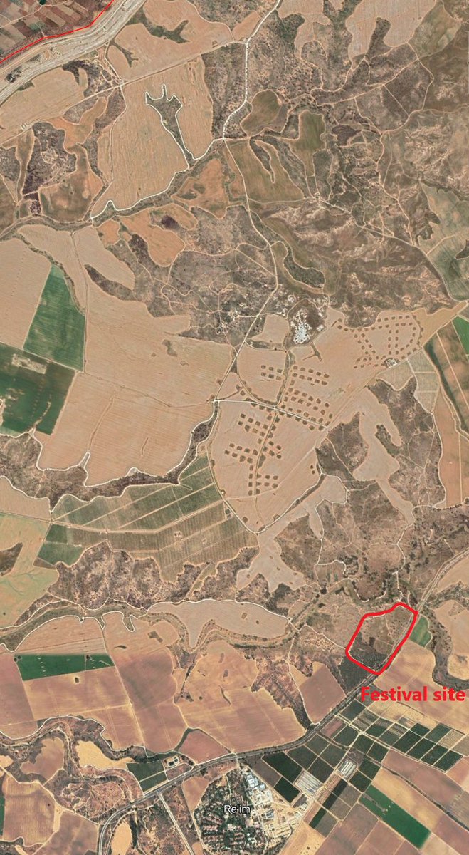
Baseline imagery with notation here. The Festival was held 1.3 km from Re'im and 5.2 km from the Gaza border.
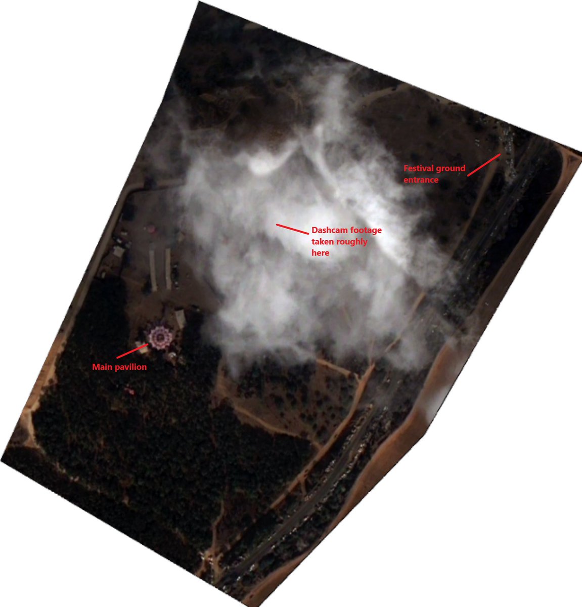
Imagery here is 0.5m Pleades from yesterday, 10/8. Excuse the large cloud, this is actually a composite of multiple cloudy images.

Imagery here is 0.5m Pleades from yesterday, 10/8. Excuse the large cloud, this is actually a composite of multiple cloudy images.
First footage seen is early in the morning on the 7th. Sunrise was around 6:40 AM local.
This shot was taken right in front of the central pavilion, people are confused and unsure of where to go while security works to evacuate people east.
This shot was taken right in front of the central pavilion, people are confused and unsure of where to go while security works to evacuate people east.
Second clear shot appears to be a bit later, in one of the fields to the east of the event venue.
Not 100% sure but this may have been taken at the edge of the treeline a few hundred meters east of the venue.
Not 100% sure but this may have been taken at the edge of the treeline a few hundred meters east of the venue.


This video was likely filmed in the same field as the last photo, as the same group of abandoned/stopped vehicles can be seen.
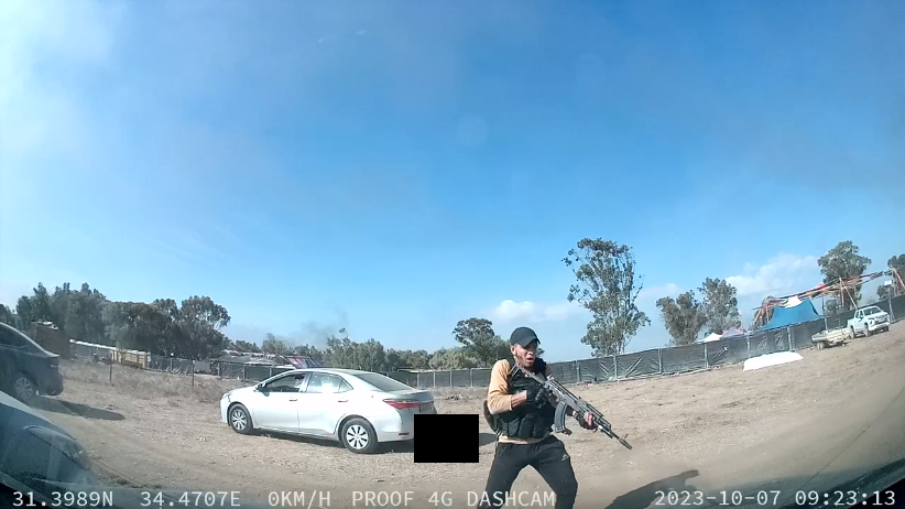
As rescuers were going through vehicles, one group found a working dashcam and pulled the footage with GPS location and timestamps. The footage was filmed at 31.3989, 34.4707, north of the central pavilion.
🚨Warning: the following images are censored but highly disturbing.
🚨Warning: the following images are censored but highly disturbing.

At 9:23:14 (clock not verified) a Hamas militant can be seen dragging away a civilian.
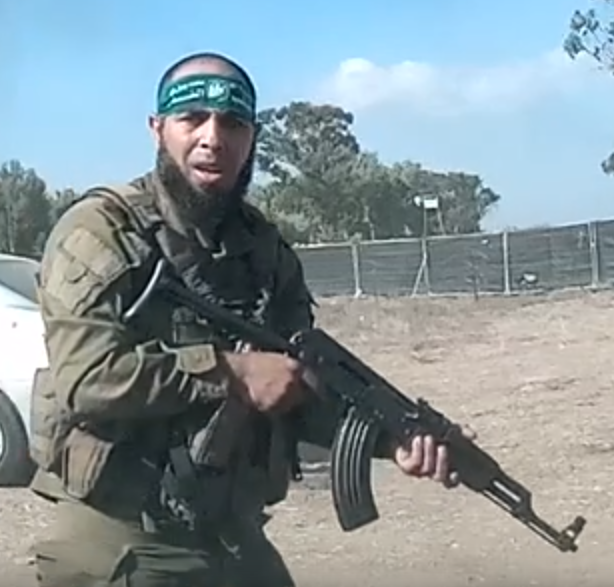
At 9:23:41, this militant executes a wounded civilian behind the silver sedan.

This militant can be seen looking for additional civilians at 9:24:11
Next dashcam clip is from nearly 3 hours later
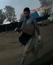
At 12:09, another loose group of individuals arrive. They appear slightly different; only one is armed, and the unarmed individuals carry stolen items.
Two of the unarmed individuals rifle through the executed civilian's pockets.
At 12:09, another loose group of individuals arrive. They appear slightly different; only one is armed, and the unarmed individuals carry stolen items.
Two of the unarmed individuals rifle through the executed civilian's pockets.
This one is carrying several items.
3 minutes later, another group arrives. They begin to go through the abandoned vehicle, taking out a suitcase and going through it.
At this point, Sentinel-2 low-resolution imagery was acquired around noon. Multiple areas of the festival ground can be seen burning.

Most civilians who were not caught in the western part of the venue had fled to the east at this point.
From the drone footage alone, I was able to discern at least 35 destroyed or severely damaged vehicles (red) and 89 abandoned vehicles (yellow).
Additional vehicles were present in the event area, but I could not tell if they were first responders.
Additional vehicles were present in the event area, but I could not tell if they were first responders.

Israeli authorities recovered 260 bodies from the site, mostly civilians.
Full caveat, this is a limited view constrained by both time and resources.
If you wish to build off of the work I have done, feel free to reach out to me.
Full caveat, this is a limited view constrained by both time and resources.
If you wish to build off of the work I have done, feel free to reach out to me.
• • •
Missing some Tweet in this thread? You can try to
force a refresh