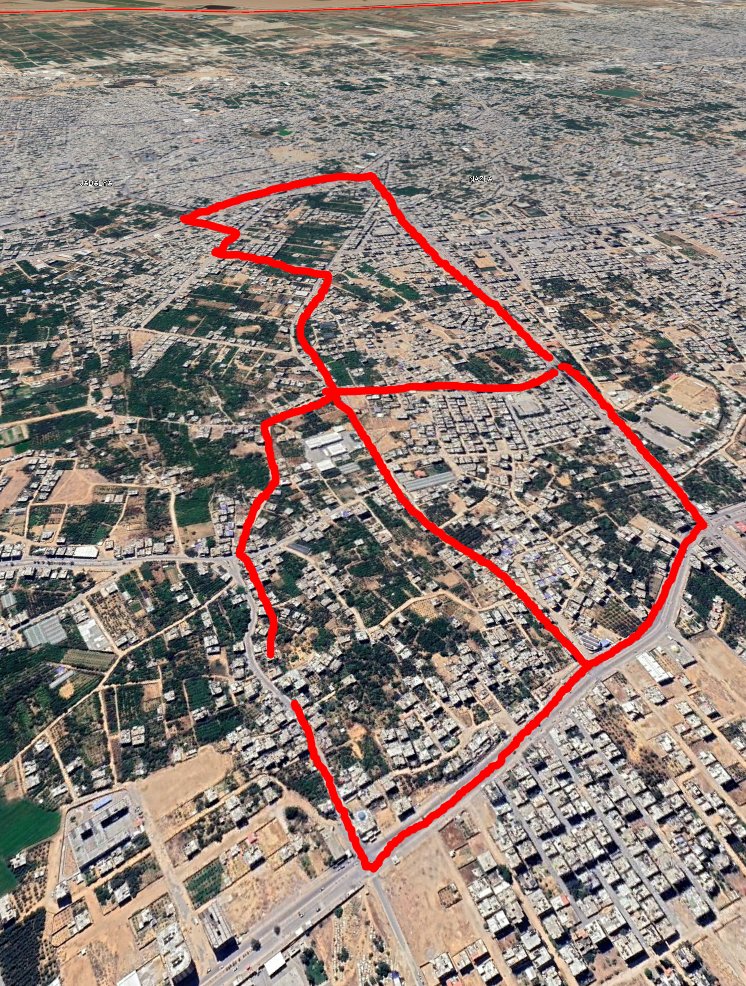
I have been able to acquire new open high-resolution (50cm) satellite imagery from yesterday around noon showing the central IDF advance into the Gaza Strip.
IDF mechanized forces had nearly reached the coast road, and heavy fighting was ongoing in the Wahsh area. (Thread)
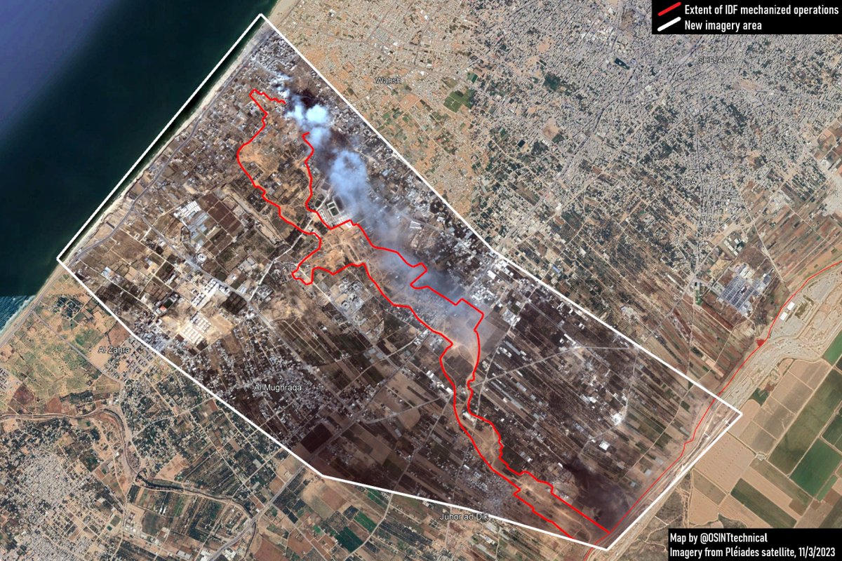
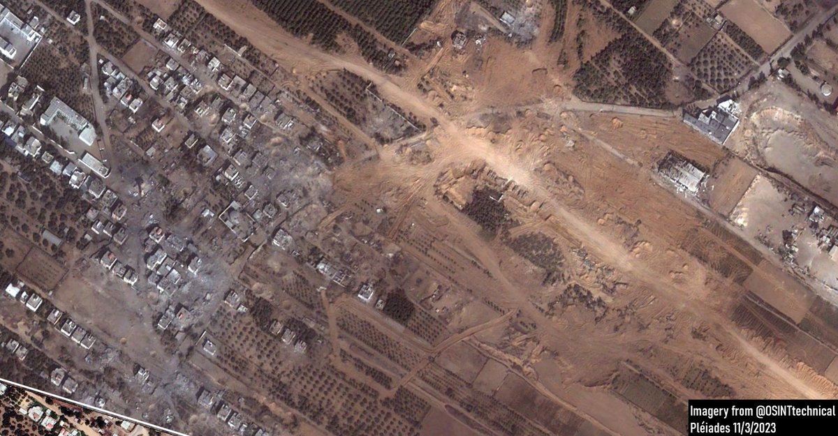
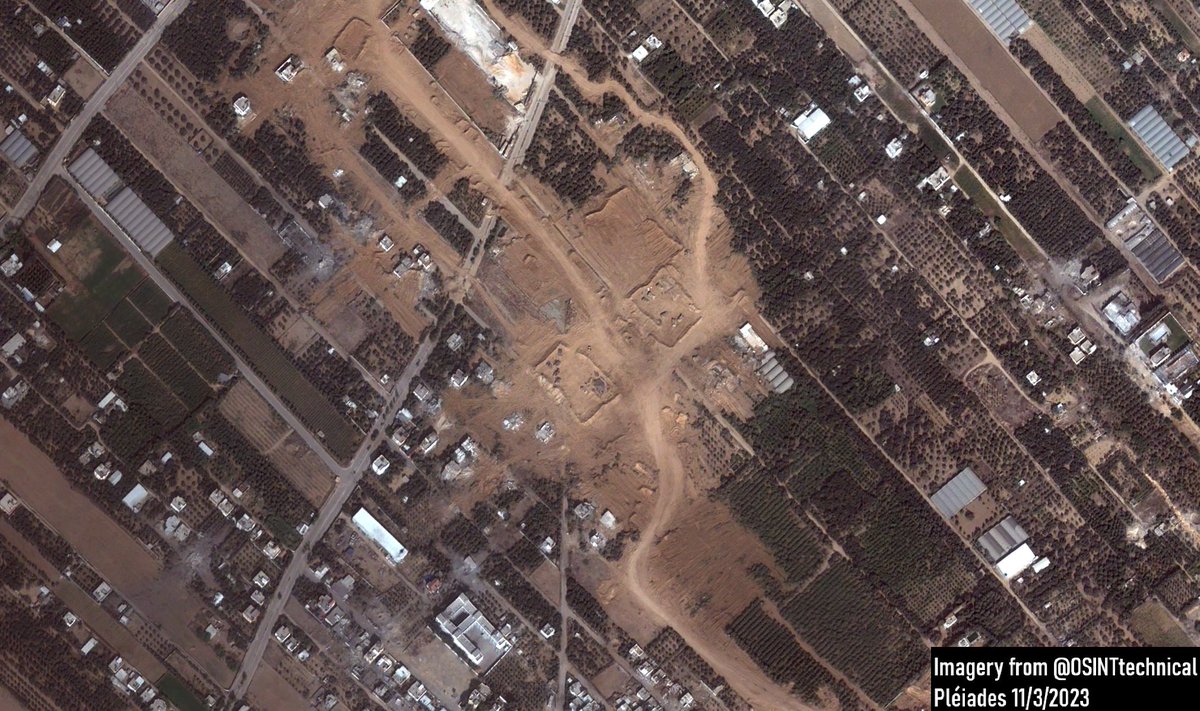
The general IDF mechanized strategy in the area seems to be that D-9 bulldozers lead the way, clearing any potential mines or IEDs, and roughly every half mile, build a large laager with dirt berms.
The tip of the advance can be seen here, led by D-9 bulldozers, armored vehicles, and backed by a Puma AEV with a carpet mine clearing system.
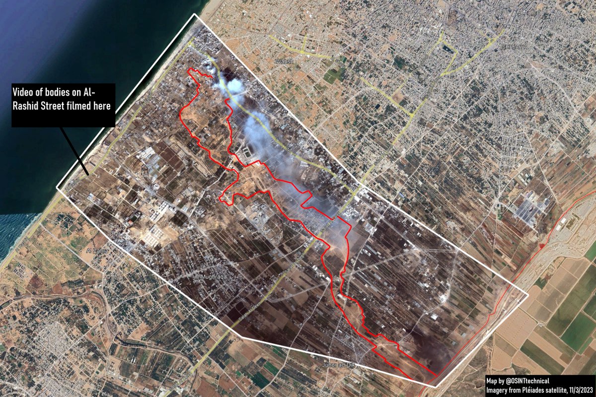
Yesterday, footage emerged of civilians killed by what appeared to be gunfire on the Al-Rashid Street.
The footage was geolocated roughly 2 kilometers from the nearest clear Israeli mechanized advance.
Another quick look at the IDF's armor-driven strategy for its advance into the central Gaza Strip.
On 11/3, six distinct strongpoints anchored a thin push into the Gaza Strip. Each was effectively a series of large dirt berms and revetments built by D-9 bulldozers.
(thread)
The first IDF strongpoint is only about 1km from the initial entry point east of Juhor ad Dik.
Hamas released at least one video of an engagement in the area, and the town was heavily damaged, receiving what appears to be the most severe damage from the entire push so far.
The next strongpoint was built roughly a half kilometer further on, anchoring the northern side of Juhor ad Dik.
The IDF released an image reportedly showing Hamas's defensive plans for the northwest side of Jabalya.
I went and roughly mapped them out over available satellite imagery of the city, bottom right corner is bounded on the Al Toam/Al Bahr intersection at (31.547512, 34.475085)
In the eastern Mediterranean, sailors assigned to the weapons department of USS Gerald R. Ford maneuver live AIM-120D AMRAAMs from the weapons elevator onto the flight deck.
Brown band and yellow band, live rocket motor, live warhead.
Additional photo dump of flight ops on CVN 78 from last week
Just spent more time than I care to admit trying to find a source for a picture I wanted to post, only to realize that it was two years old.
This photo shows an Israeli M109A5 firing into the Gaza Strip- in 2021.
An extremely basic primer on how I verify an image:
Easiest is to go to the direct source, if there’s a watermark, I usually think Telegram.
Telegram has a great search function that allows you to chase down a channel fairly easily, combine with Translate to pull text, and any (watermarked) telegram channel can be found.
Additionally, the Google search mobile app has an immensely powerful reverse image search function through Google lens, that’s how I figured out the artillery image was actually from 2021.
President Biden has sent a war powers notification to Congress explaining the US targeted strikes against facilities in eastern Syria used by the IRGC and IRGC-affiliated groups on the night of October 26, 202.
"I directed the strikes in order to protect and defend our personnel, to degrade and disrupt the ongoing series of attacks against the United States and our partners, and to deter Iran and Iran-backed militia groups from conducting or supporting further attacks"
"The United States stands ready to take further action, as necessary and appropriate, to address further threats or attacks."