Did you know St Louis has an ABANDONED BUSWAY?
Operating from 1966 to 2009, the #15 Hodiamont bus served north St Louis and was ahead of it’s time in many ways and could be though of as an early BRT, similar to the services operated on Pittsburgh’s famed busways.
Short 🧵

Operating from 1966 to 2009, the #15 Hodiamont bus served north St Louis and was ahead of it’s time in many ways and could be though of as an early BRT, similar to the services operated on Pittsburgh’s famed busways.
Short 🧵


As with many US cities, St Louis was never really the same after the great recession of 2008. The #15 Hodiamont bus’s closure in 2009 was just one of the many victims of corporate America’s greed. But even though it’s gone, it’s legacy lives on through it’s unique infrastructure.
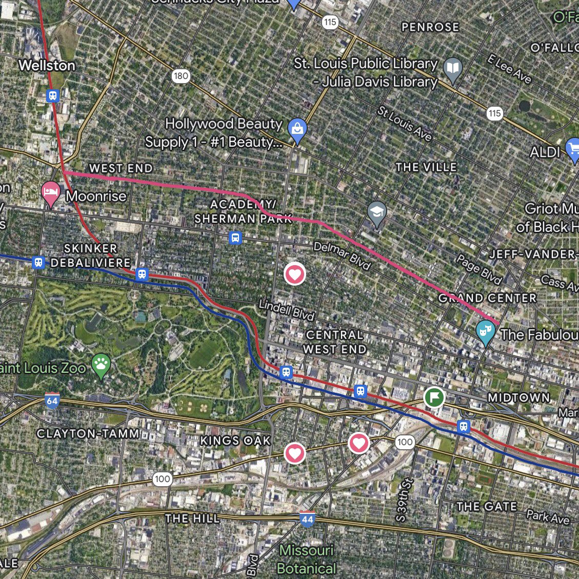
The #15 Hodiamont’s busway, as highlighted in magenta on the map, ran from north Delmar to Grand Center, and then on normal streets into downtown.
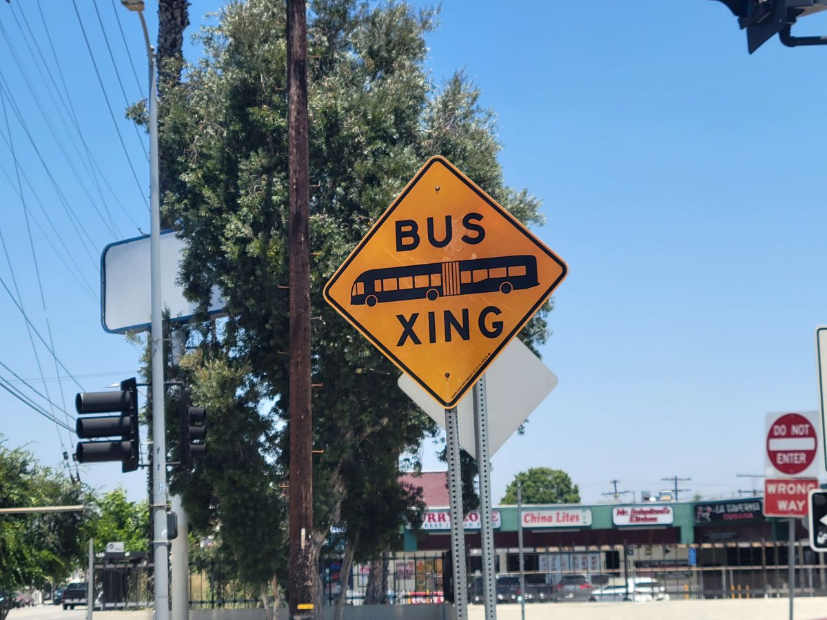
A busway is the ultimate form of bus lanes; a road dedicated to buses only. This allows for greater speeds and higher capacity.
A busway is the ultimate form of bus lanes; a road dedicated to buses only. This allows for greater speeds and higher capacity.
Before this ROW (right of way) was a busway, it was part of the streetcar network.
Originally opened in 1875 by the St. Louis & Suburban Railway as a horse drawn route, a cable car in 1886, and an electric streetcar in 1891. It was one of the last streetcars routes to close.
Originally opened in 1875 by the St. Louis & Suburban Railway as a horse drawn route, a cable car in 1886, and an electric streetcar in 1891. It was one of the last streetcars routes to close.
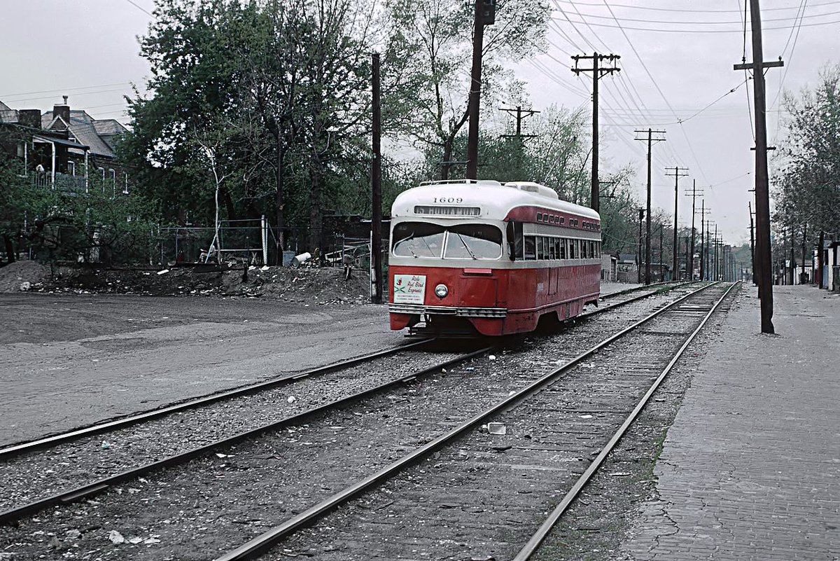
The #15 was unique among streetcars due to it’s infrastructure, and can be thought of as a proto-light rail because it largely ran off-street and away from traffic before it’s conversion to busway in 1966.
The conversion to busway was popular at first. Streetcars were seen as old and antiquated, buses were the future.
The #15 bus was well used, there was even a burger restaurant installed in the old trolley depot at the end of the busway that proved popular with passengers.
The #15 bus was well used, there was even a burger restaurant installed in the old trolley depot at the end of the busway that proved popular with passengers.
But as the years wore on the population of St. Louis declined and personal automobile ownership increased. Transit ridership in the city declined and so did funding.
When the budget cuts associated with the 2008 recession hit, St Louis Metro could no longer afford to keep many routes, and on March 30th, 2009, the last transit vehicle would run along the Hodiamont alignment ending 134 years of continuous service.
So, what of this ROW today?
Well, there are no plans to reactivate this alignment for transit, though the north desperately needs it.
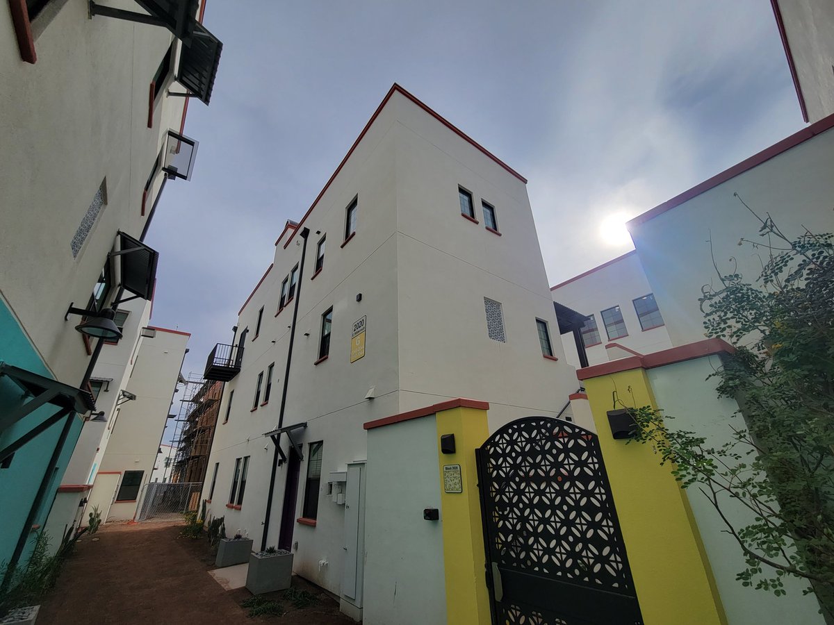
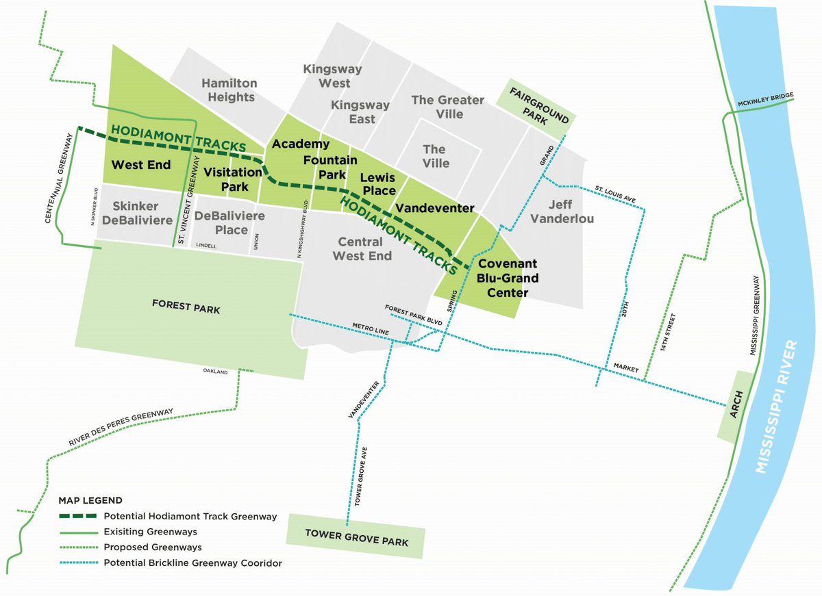
It is being turned into a bike path, part of the Greater Rivers Greenway network.
Well, there are no plans to reactivate this alignment for transit, though the north desperately needs it.
It is being turned into a bike path, part of the Greater Rivers Greenway network.
My thoughts on this conversion are complex. I am happy the alignment is being used for something, biking is good, but I would have rather it have been used for public transport again.
Biking isn't for everyone, rapid transit is. I really believe we should have a universalist approach to transportation in our cities, biking should be complimentary to reliable fixed to public, transportation links, never supplanting them.
Last summer I had the opportunity to experience the LA, Metro’s G line. The G is a bus transit line that operates 24 hours a day with 6min peak headways, all in it’s own busway.
This is possible in St Louis, we have the busway. We just need to start running buses on it again.
This is possible in St Louis, we have the busway. We just need to start running buses on it again.

Still today St Louis has no #15 bus, and the busway sits abandoned. We need to get serious with our leaders about reactivating it, especially as North/South Metrolink gains momentum. To convert it to a bike path feels like a waste of infrastructure..
Miscellaneous things I couldn’t really find a spot for in the thread; it’s pronounced HO-DE-A-MONT.
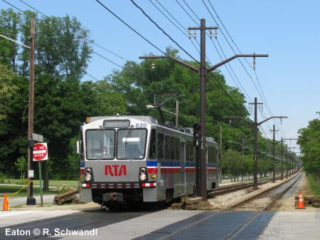
If the #15 still existed as rail, I believe it would have looked very similar to Cleveland’s light rail lines, which have similar origin stories.
If the #15 still existed as rail, I believe it would have looked very similar to Cleveland’s light rail lines, which have similar origin stories.
Also Hodiamont maybe isn’t the best name for the ROW going forward, Baron DiHodiamont was a slave owner and all around problematic dude, so we should probably change the name.
There are plenty of rails to trails conversions, but I'm not aware of any other busway to trail conversions. I think that is unfortunately unique to St Louis, if you know of any others sound off.
Also I am of the belief that if the #15 was in South St Louis it would still exist today, we need to bring it back. North St Louis desperately needs more transportation options.
Biking isn't for everyone, rapid transit is. I really believe we should have a universalist approach to transportation in our cities, biking should be complimentary to reliable fixed public transportation links, never supplanting them.
Reposted that because of a typo, sorry for all those lol 😬
• • •
Missing some Tweet in this thread? You can try to
force a refresh