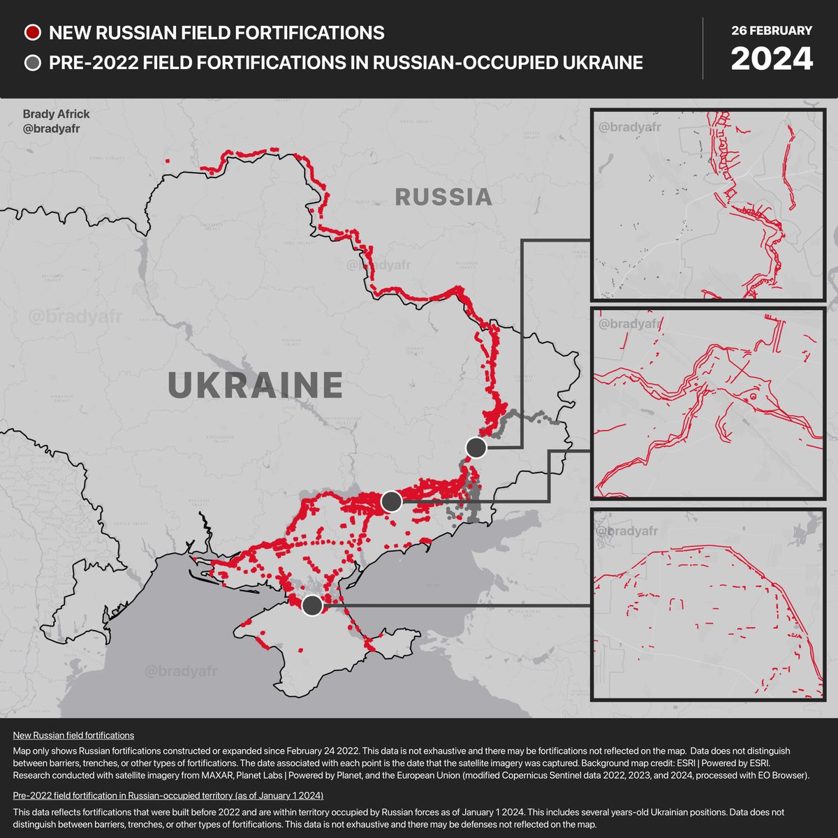
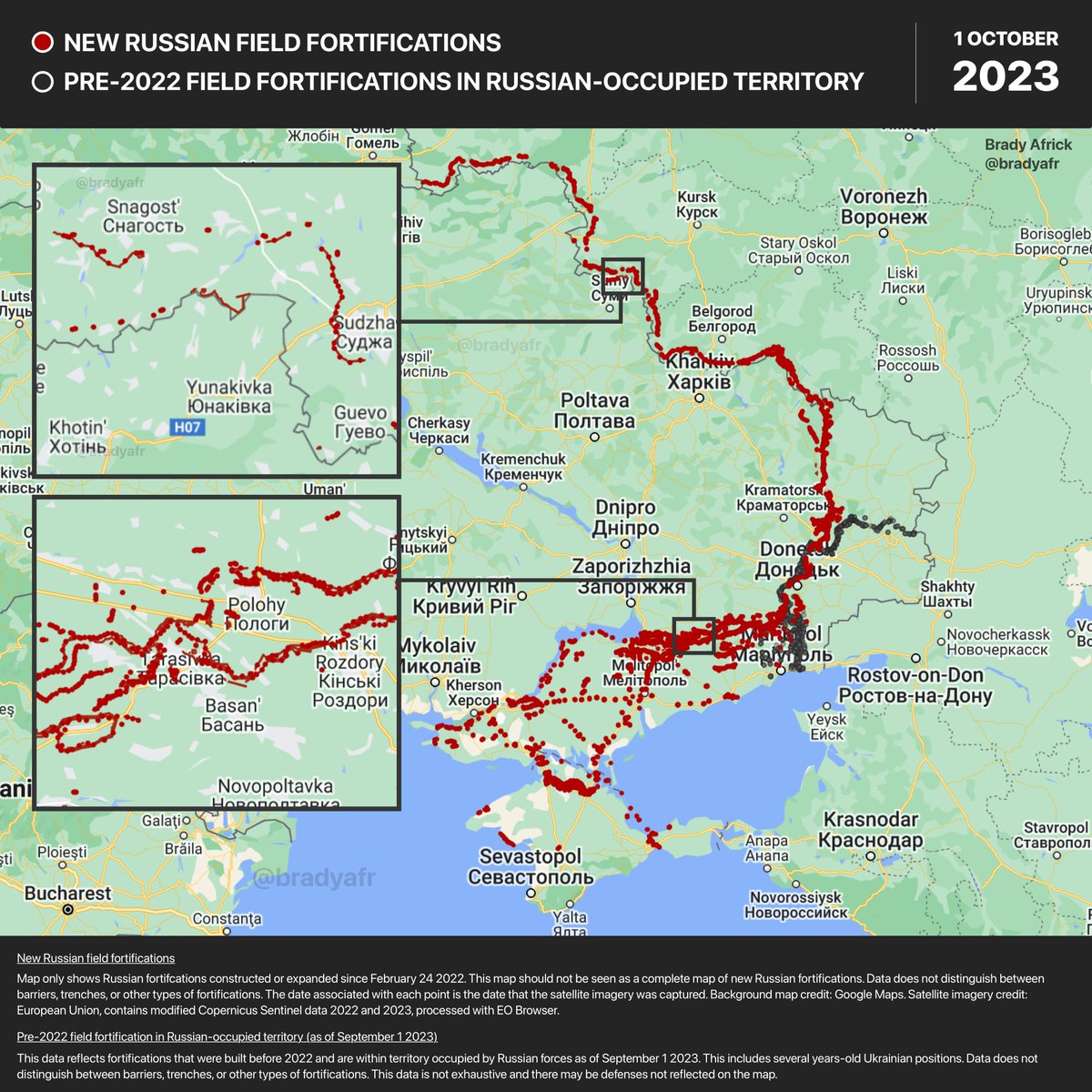
Russia's fortifications in Ukraine will scar Ukrainian land for generations.
These defenses slice through neighborhoods, farmlands, and forests across occupied territory. This map update includes previously unmapped Russian positions found in high resolution satellite imagery.
These defenses slice through neighborhoods, farmlands, and forests across occupied territory. This map update includes previously unmapped Russian positions found in high resolution satellite imagery.

Check out the full interactive map and satellite imagery of Russia's defenses in and around Ukraine at the link below.
read.bradyafrick.com/p/russian-fiel…
read.bradyafrick.com/p/russian-fiel…
• • •
Missing some Tweet in this thread? You can try to
force a refresh


