Ukraine🇺🇦 facing difficulties on the frontline is digging huge fortifications across Donbass and Zaporijia oblasts.
I already talked about the "Donbass line" facing the Surovikin system. There is now a Syrsky line similar to Russian🇷🇺one.
🧵THREAD🧵⬇️1/10
I already talked about the "Donbass line" facing the Surovikin system. There is now a Syrsky line similar to Russian🇷🇺one.
🧵THREAD🧵⬇️1/10

This is Avdiivka map, my own work with the help of "playfra" on discord.
After the Ukrainian defenses west of Avdiivka collapsed, the Russian army is now facing the first line of defense.
After the Ukrainian defenses west of Avdiivka collapsed, the Russian army is now facing the first line of defense.

This line is not optimal for defense but it is still good since there are lakes and water bodies supporting it.
I think the Russian army is going to take Orlivka and it will advance in the hole of the defensive line west of it.
I think the Russian army is going to take Orlivka and it will advance in the hole of the defensive line west of it.

Since the end of december, the Ukrainian army has been impoving its defensive lines. The secondth one is the best one, helped with lakes and a river. The approch to Niu York, Oukrainsk and Selydove won't be easy.
(defenses being improved everyday)
(defenses being improved everyday)

I won't talk much about Bakhmout since i havn't updated the map. You can undestrand that the village of Ivanivske was well defended, but the main line is on the canal in front of Tchasiv Yar.

This is the news of the day: the Ukrainian army is building a big line all along Zaporijia oblast, with anti-tank ditches and trenches just as Russian did a few kilometers south.
I can't share satellite pictures for now, but you have to understand it is really impresive.
I can't share satellite pictures for now, but you have to understand it is really impresive.

Finally, after Russian advance in Novomykhailivka, the Ukrainian armed forces began to dig new defenses east and south of Kourakhove, including this big anti-tank ditch.
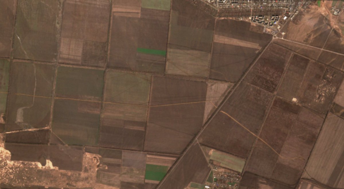
This is how it looks like ⬇️

And to conclude, a vision of the entire frontline.

This is my first work about it.
You can support me by subscribing to @atummundi
(I also have a buy me a coffee on my linktree)
10/10
https://twitter.com/clement_molin/status/1745033008938102852
https://twitter.com/clement_molin/status/1745033008938102852
Tomorow i'll take a look at Kharkiv and northern regions to see if they are building some defenses.
• • •
Missing some Tweet in this thread? You can try to
force a refresh